
|

Mt. Mitchell seen from Mt. Craig |
Introduction
These mountains reside on a high ridge north of the Blue Ridge Parkway and south of the Pisgah National Forest.
Mt. Mitchell and Mt. Craig are the two highest peaks in Eastern U.S (east of Mississippi). Clingman's Dome in Tennessee comes in third. Note that some sources will state that Clingman's Dome is the second highest, and this is probably due to the marginal 300ft primary factor between Mt. Mitchell and Mt. Craig. Depending on how you do/see the calculation, Mt. Craig may be considered a spur.
A number of trails, with varying elevation are accessible from the Blue Ridge Parkway. Additional trail can be found at the Mt. Mitchell State Park Visitor Center. One may also drive all the way up to Mt. Mitchell.
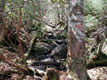
As in the Smoky Mountains, the timberline run all the way to the top of the mountains. One may question if these mountains should be referred to as "high forest hills", instead. As such, good views are rare. Best views are found on the Mt. Mitchell Lookout Tower, but you will also get views from Mt. Craig.
The Deep Gap Trail takes you from Mt. Mitchell to Cattail Peak. Along the way you will get Mt. Craig, Big Tom (a spur of Mt. Craig) and Balsam Cone. Near Cattail Peak you can also do Potato Hill, and near the Mt. Mitchell Visitor Center, you can do Mt. Gibbes (Clingman Peak).
Trail descriptions:
The most popular (and recommended) trailhead is the Black Mountains Campground. Several trails will take you up to Mt. Mitchell. This page will describe the Old Mitchell Trail from the Visitor Center to Mt. Mitchell, and the Deep Gap Trail from Mt. Mitchell to Cattail Peak.
|
Mt. Mitchell - Cattail Peak (summer)
|
Trip report Apr 23 2002:
|
The plan was to scale Mt. Mitchell with several thousand feet
of vertical gain. But I had been unable to get hold of the map,
so I finally ended up at the Mt. Mitchell State Park visitor center.
When I inquired about the trails, a friendly lady said the Mt. Mitchell
trail trail began just outside the visitor center.
I was confused, as I head read on the internet that one could hike
from a campground, gaining thousands of feet. The lady said the
campground was further up the road, so I just stopped pursuing the matter.
As I was eager to get going, I traded vertical gain for a longer hike. My feet was starting to get sore after the past days of hiking in the Smokies, so I would just play it by the ear. The hike was interesting, as I never knew what mountain as I was on, before I got there. Thanks to summit plates left from early surveys, I was able to tell where I was. I met one person on the whole hike. He carried a book about hiking in North Carolina, and finally I could reveal the campground mystery. If I had continued on the Parkway, instead of driving up to the Mt. Mitchell State Park, I would have been able to get to the Black Mountain Campground. From this campground, several trails would run up the mountain to Mt. Mitchell. Oh well. Next time around.. |
Pictures:
Move cursor to read notes, and click on the images to see full version.
Some of the thumbnails may have been cropped to fit the format


 Other hordaland mountains
westcoastpeaks.com
Other hordaland mountains
westcoastpeaks.com

