
Norwegian Mountains, Møre og RomsdalÅsefjellet, 141m
|
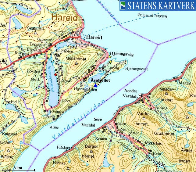
| Fylke/Kommune : | Møre og Romsdal/Hareid | ||||||
| Maps : | 1119-I Ålesund (Statens Kartverk, Norge 1:50 000) | ||||||
| Primary factor : | 83m | ||||||
| Hiked : | Apr 2009 | ||||||
| See also : |
| ||||||
| See also : | Other Hareid and Ulstein mountains |
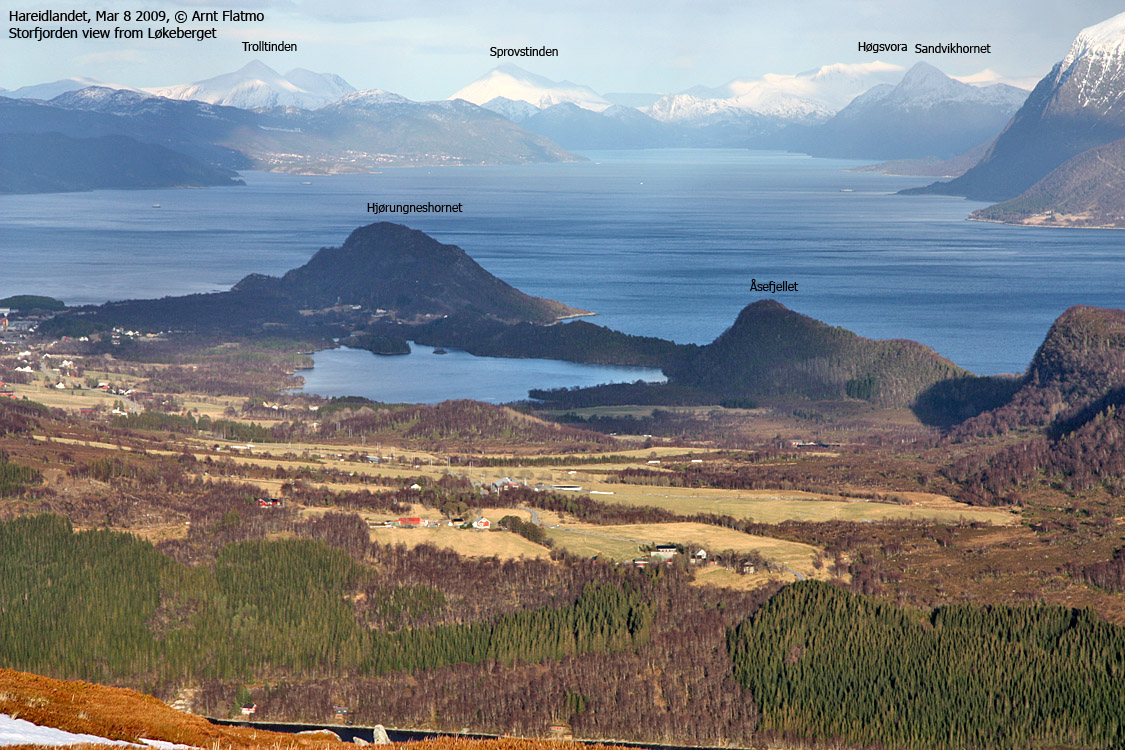
Åsefjellet seen from Løkeberget
(Click for larger image)
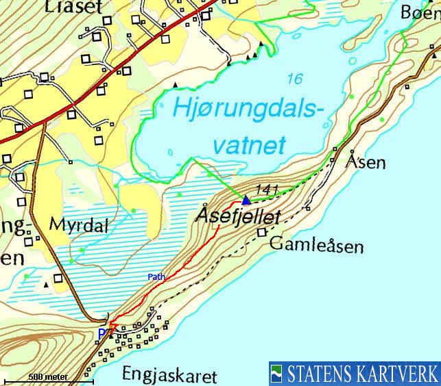
Åsefjellet is a forest ridge located between Hjørungneshornet and Ulsettua. A vague path runs across the ridge, so you can either start from Åsen or Engjaskaret. This page describes the route from Engjaskaret. Lake Hjørungdalsvatnet, which is located north of Åsefjellet is a nature preserve.
The vague path reveals that Åsefjellet is not frequently visited. But you should not have any problems following the path all the way up to the high point. If you follow the path from Engjaskaret, you will see another point 100m east of the high point, which is 1m lower than the high point (according to Økonomisk Kartverk).

View in the direction of Engjaskaret
(Click for larger image)
Åsefjellet (Norge 1:50,000: 141m, Økonomisk Kartverk: 141,05m, UTM 32 V 347639 6914629) has a primary factor of 83m towards the higher parent Ulsettua (389m). The defining saddle (approx. UTM 32 V 346882 6913936) is found at Engjaskaret - above the tunnel. Ref. Økonomisk Kartverk (5m contours), the saddle is with the range 55-60m, interpolated to 58m.
GPS measurement read 144m (on the ground), averaged over a 3-minute period (error margin +/- 4m). The eastern point was measured to 143m.
Google's interactive map. You can zoom, pan and click on the markers.
|
|
|
|
Route 1: Engjaskaret - Åsefjellet (summer/autumn)
|
|
Access
(all distances are approx. distances)
The nearest larger city is Ålesund. From Ålesund, follow highway E39 towards Bergen, and then RV61 towards Hareid. Take the Sulesund - Hareid ferry, and at the roundabout in Hareid, turn left in direction of Hjørungavåg.
Drive 4,8km to Hjørungneset junction in Hjørungavåg. Continue 2km and turn left towards Alme. Drive 1,4km up to Engjaskaret pass. The path begins immediately after the tunnel. Find parking at a turnout 50m down the road.
The route

The path begins by the tunnel
(Click for larger image)
Head up the road next to the tunnel and follow it up to the forest ridge. Turn right and follow a good path through the dense forest. Once out of this forest, the path becomes less visible. Follow the path all the way up to the high point, defined by a nature preserve sign. Consider following the path 100m to the east, to the eastern viewpoint.
(Picture of GPS track).
 westcoastpeaks.com
Other Møre & Romsdal mountains
Other Norwegian mountains
westcoastpeaks.com
Other Møre & Romsdal mountains
Other Norwegian mountains


