
|

Båtevassfjellet seen from Gråsida(No Javascript) |
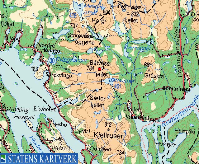
The name Båtevasfjellet (also written as Båtvassfjellet) relates to lake Båtevatnet southeast of the mountain. A long translation into English could be something like "the mountain by the lake where the boats are". In the older days, it was a long way to church for those who lived deep in the Masfjorden mountains. Taking into consideration the wild and rough mountain sides up here, getting across lake Båtevatnet by boat was a understandable way of transport.
The mountain does not stand out from the other mountains in the area. When looking at these mountains from distance, only the large Austlendingen massif and the Mexican hat-looking Ådneburen really stand out from the rest. The mountains Båtevassfjellet, Seterfjellet and Hemningsfjellet enclose lake Båtevatnet. Visiting these three mountains on a round-trip hike is by no means trivial, and being familiar with the area would indeed be helpful, should one plan such a walk. This page only describes how to reach Båtevassfjellet from Einestrand.
Primary factor:
Båtevassfjellet (784m) has a primary factor of 231m towards the higher Austlendingen (812m). The saddle is found in Urddalen valley, between Båtevassfjellet and Seterfjellet. Ref. Økonomisk Kartverk (5m contours), you cross the 555m contours on the high route, but not 550m. The saddle height has been interpolated to 553m.
Notes: Class ratings are in reference to YDS. Click here for more information.
The trails described below are not necessarily the *easiest* trails to this mountain.
|
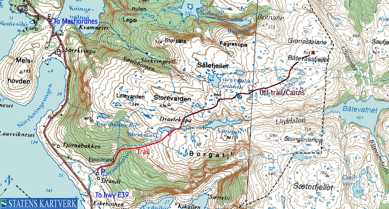
Einestrand - Båtevassfjellet (summer/autumn)
|
|
From Bergen, follow highway E39 northbound (Førde/Ålesund) Cross Nordhordlandsbrua bridge (fee for passenger cars per Oct 2004 is NOK 45,-) From the toll station, follow highway E39 for 26,2Km. Turn left onto highway 570 "Masfjordnes". Follow highway 570 for approx. 8,2Km. Turn right towards "Einestrand". Drive 800m to a farm. Ask for permission to park on the farm.
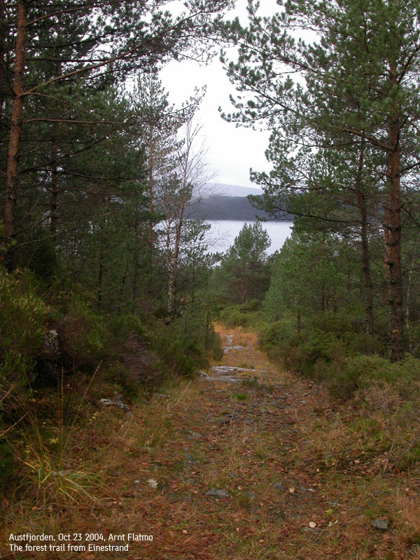
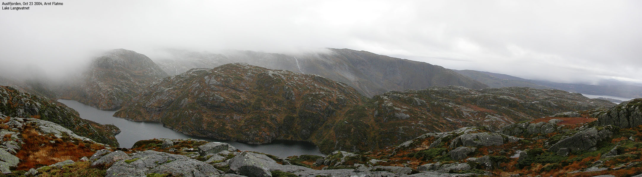
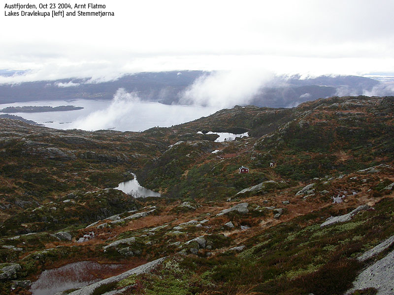
The route begins as a tractor road by the farm and heads up towards the stream from lake Stemmetjørna. The tractor road turns into a forest path higher up in the forest. Stay right in a tractor road fork before entering the forest path. The path is not marked, but is well traveled and quite visible. Follow the path past lake Stemmetjørna and to a cabin north of lake Dravlekupa (you have already passed another cabin at approx. 470m elev.) From this cabin at 530m elev., the path is not so visible anymore. The map shows a trail that runs towards Sørkvingo. I had problems locating this trail, so my advice is that you might as well go off-trail from this cabin.
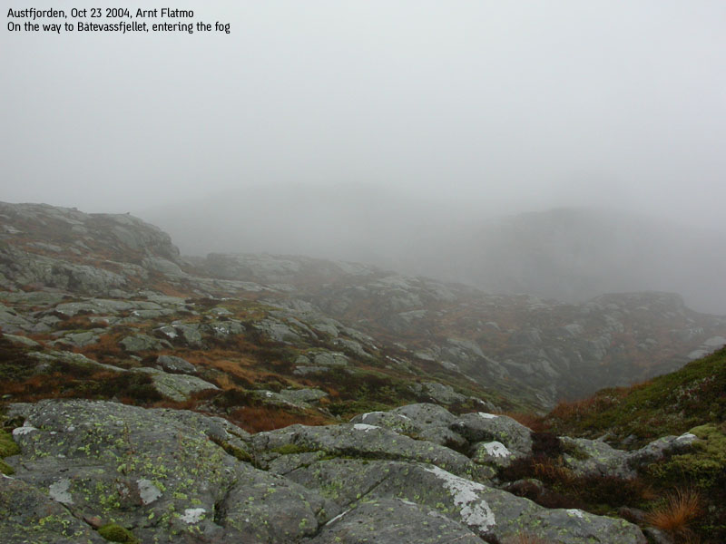
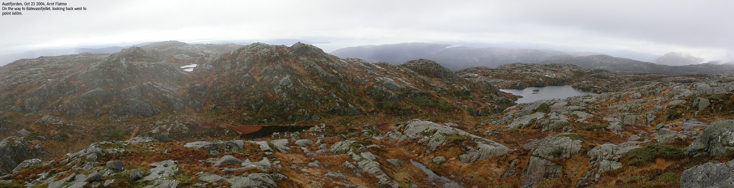
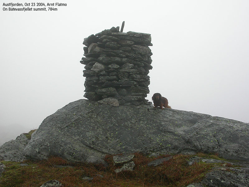
Hike on grassy pitches between the slabs until you get on the mountain. After passing point 660m, you descend down to a small valley. The east side of this valley has some steep cliffs. There are however several alternatives. Head between two ponds and follow a grassy path up the cliffs. When you pass the 700m contour, you will run into a series of small lakes, and you will just have to figure out where to go. The general direction is northeast all the way. The summit is marked by a proper cairn, and you can sign a summit register if the book isn't soaking wet (located at the bottom of the cairn) Descend your ascent route.
|
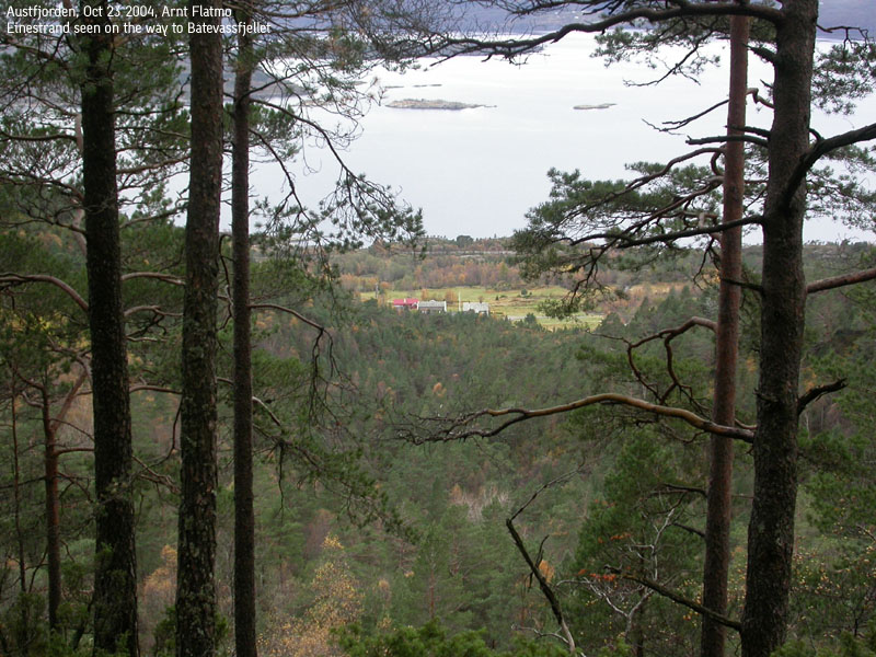
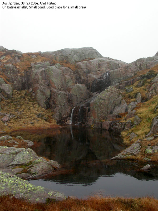
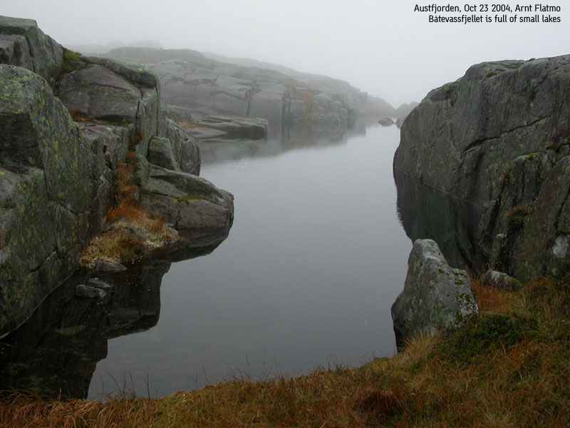
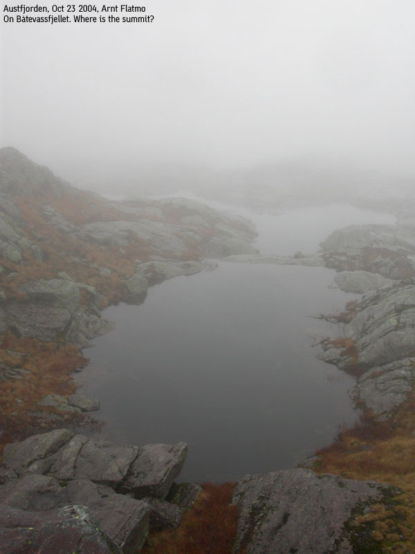
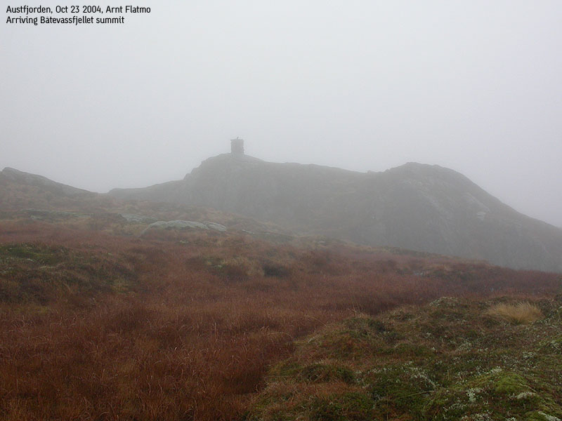
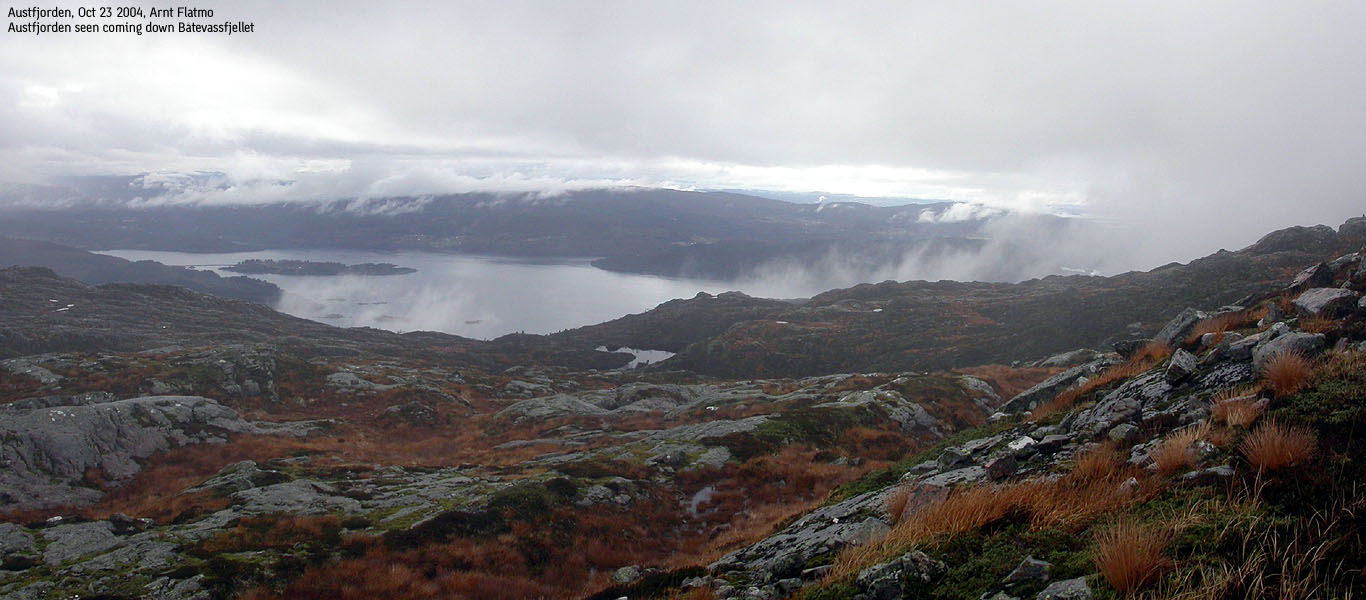
Trip report Oct 23 2004Another rainy day. The forecast promised showers from Bergen and towards the south, so I decided to head north. I brough along all the maps for the northern region of Hordaland and left on yet another journey. At the Nordhordlandsbrua toll station I discovered that it was possible to buy a coupon for 40 passes. The price per passing would then only be NOK 27,-. I sighed and tried to recollect how many times I had passed this station, paying NOK 45,-.I wondered how far north I would have to go to get a dry hike. It was still raining when I passed the exit to Ostereidet. When I got to the Masfjordnes exit, there was a touch of blue sky towards the west. I decided to go for Båtevassfjellet, the only mountain yet to do from this side. I drove to the farm at Einestrand and asked for permission to park by the farm. We left the car 11:05AM. The farmer kept us company for a short bit, and Troll was happy about this. He celebrated the new company by coming along in his own free will. When the farmer left the trail (he was on his way to cut bush on another old forest road), Troll executed a hard sit-down, and he spent the following 3 hours in the backpack. It was raining light as we headed up the mountain. The farmer had told me about a ledge on the north side of lake Båvatnet, and I started thinking about heading to Seterfjellet first, descend down to the Båtevatnet, head towards Urddalen pass and then up this ledge to Båtevassfjellet. Then I could return the normal route to Einestrand. Seterfjellet is not on my list of mountains with primary factor exceeding 100m (Seterfjellet has 92m), but I figured it could be an exciting hike anyway. I dropped this plan when I got to the cabin at 530m elev. and saw the fog on the mountain. Just getting onto the ridge towards Seterfjellet looked like scrambling that I would prefer to do without a dog on the back. I decided instead to focus on the main goal, and went off-trail from the cabin. I couldn't figure out where the trail towards Sørkvingo was, so I traded the trail for good views towards lake Langevatnet. After crossing the valley below point 660m, the fog made it impossible to figure out where to go without navigational aid. I had a map and compass, but decided not use them. I hadn't brought the waterproof map folder, and didn't want to ruin the map. Instead I paid attention to the trail profile on the GPS, making sure I was on a steady northeast course. After having passed numerous lakes, I reached a point which I thought was the summit. The fog wasn't too dense, and I could easily see the terrain around me. But from this point, I saw no more rising terrain anywhere around. The GPS told me that I was at 750m elevation, so I had to descend from this point and keep moving on. I was happy for having the GPS in this situation. The terrain was extremely confusing, and without keeping my eyes on the trail profile, I drifted off course right away. We reached the summit 13:10PM. The summit cairn suddenly popped out from the fog, and the GPS read 793m with an error margin of 4m. There was no doubt I was on the summit. The dog got his lunch-box, while I just waited for him to finish. There was nothing to take pictures of, except fog. I reflected instead on the trip. It was only 5Km to the top, but it felt like a very long walk. On the border of boring. I was almost glad the fog had given me something to focus on. We headed back 5 minutes later. Troll was still in the backpack. I decided to try to find my route back without using the GPS or the compass. The plan was to seek left whenever I felt a bit lost. Eventually, I would run into the south cliffs which I knew I had to stay away from. Within minutes, I was in terrain I didn't recognize, and stayed with the plan. After half an hour of switchbacking on the plateau I recognized a lake I had passed on the way up, and from there on, I had no more problems staying with the route back to the cabin. Troll decided to walk from the cabin, and we reached the car 14:55PM. Getting dry clothes on was the highlight of the day.
Pictures from the Oct 23 2004 hike
Move cursor to read notes, and click on the images to see full version.
No Javascript: 1 2 3 4 5 6 7 8 9 10 11 12 13 14 15 16 17
|


No Javascript:
Other hordaland mountains
 Other Masfjorden K. mountains
westcoastpeaks.com
Other Masfjorden K. mountains
westcoastpeaks.com


