
Click here for the main Blåskjerdingen page.

To Tindfjellet
The plan was merely to have a pleasant walk up to Tindfjellet, in order to take a look at the north ridge. The last time I was up here, I didn't see much, because of fog. As the plan was only to reach the top, I brought along my dachshund "Troll". We left the trailhead in Vatnedalen 16:50PM, and on this warm afternoon, Troll decided that he didn't want to walk after all. I put him in the backpack and continued upwards.
Entering the meadow below Tindfjellet, I stopped by a small lake and photographed some Water Lilys. Very nice, they were. I had assumed that I would get on the beginning of the south ridge, but now I found it convenient to follow the path to Vestresaelig;tra, and ascend the ridge directly from there.
I passed Vestresætra 17:30PM, and was a bit "struck" about the fact that I still had 620 more vertical meters to ascend. Oh well, step by step does it. By the time Troll found that he wanted to walk after all, the boulder on the ridge made it impossible. Not very happy, he had to deal with the situation. I reached the top of Tindfjellet 18:40PM after SLOW progress up the mountainside.
Across the ridge
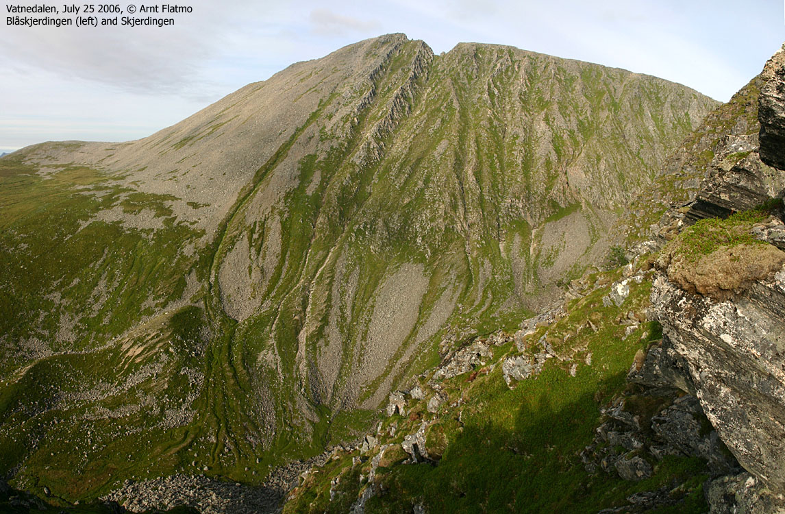
I got a good look at the upper part of the ridge, and decided to head down JUST A LITTLE BIT, in order to see more of the ridge. The ridge was broad, but tremendously cumbersome. With a dog in the backpack and a camera around the neck, I had to make sure a) I was in balance, b) didn't rely on unstable rock and c) didn't bounce into anything. This was a MAJOR boulderfield, and I felt small at times.
The ridge got eventually more distinct, and I still hadn't faced any big problems. So I moved on - JUST A LITTLE BIT longer. When I got the northernmost top in view, I quickly understood that this was the toughest part of the route. After a steep descent, I had to leave the dog and the backpack in order to explore some more. I scrambled (carefully) over to a huge rock that I couldn't imagine even sitting across. And there was no way around. I could have climbed across it with my hands on top, but the descent on the other side looked more like climbing. And there was no room for errors.
Time went fast, and I decided to play around up here some other time. I managed to find a route into a couloir, and was on my way home. But then another couloir came down on my right-hand side. Curious like a cat, I had just take a LITTLE LOOK higher up. I came up on the far side of the difficult rock, and just below the summit. Scrambling up would have been fun, but not with a dog. I traversed yet another couloir before I found an easy route up from the back-side. 19:50PM, I stood on the northern top and my GPS reported approx. 793m.
Now that the hard part was over, I continued down the - still cumbersome - ridge and started thinking about how to get to the tractor road from Vestrefjorden. But first on the agenda was the creek from Skjerdinghola. I could hardly swallow, because of thirst, and I had given the dog the only water I had brought.
After satisfying thirst, I got lucky and stumbled across a track, heading westbound down the forest. I lost it after a while, but it saved me time. Off-trail, I had to be extremely careful about not stepping into numerous holes in the forest, covered by grass. But finally, with needles all over the body, a whining dog, a CLOUD of flies on my head, I reached the tractor road. The flies disappeared by the time I stopped sweating, which was when I reached the Vestrevatna lakes. Troll seemed delighted about being out of the backpack, and knew very well that we were on our way home. 21:35PM, we reached the car. A 10Km(+), unplanned, but eventful traverse of Tindfjellet was now "in the bag". A BEAUTIFUL sunset sky captured my attention back in Ålesund. And I noticed a shooting star, just before going to bed.
Map: I followed routes 4.2 and 1.3 on this trip

To Tindfjellet


The north ridge, to the crux


The north ridge, crux bypass


The north ridge, descent


On the tractor road


No Javascript:
0 1 2 3 4 5 6 7 8 9 10 11 12 13 14 15 16 17 18 19 20 21 22 23 24 25 26 27 28 29 30 31 32 33 34 35 36 37 38 39
 westcoastpeaks.com
Other Møre & Romsdal mountains
Other Norwegian mountains
westcoastpeaks.com
Other Møre & Romsdal mountains
Other Norwegian mountains