
|

Eldsfjellet seen from Gaustadfjellet(No Javascript) |
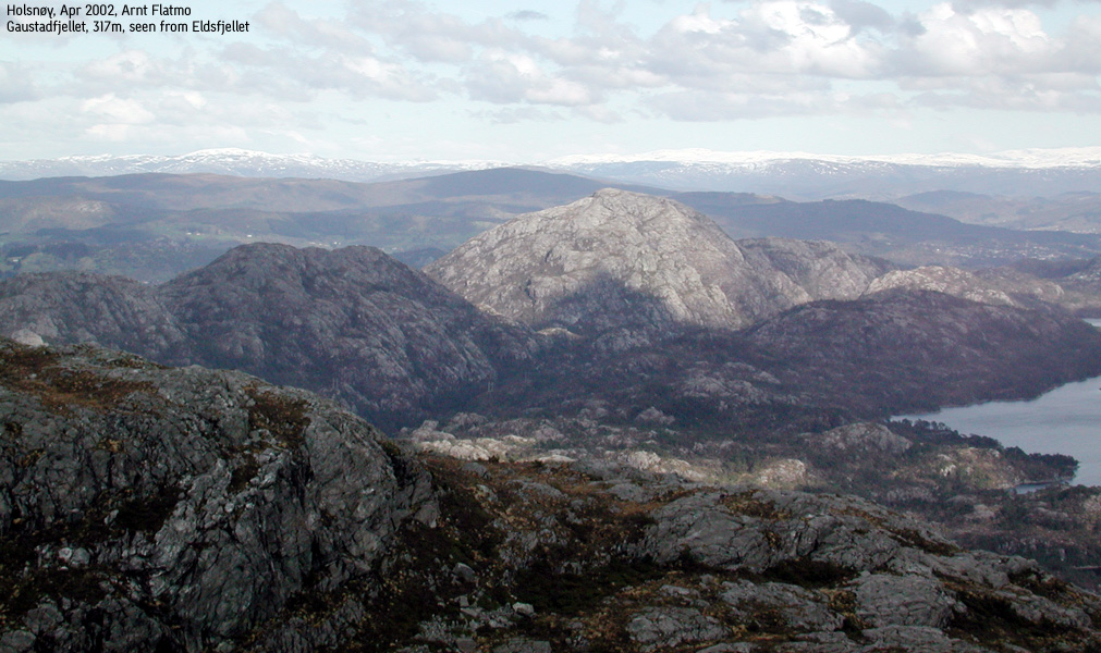
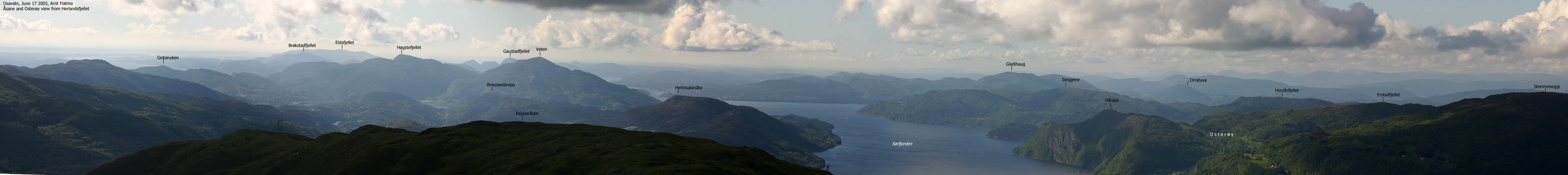
Eldsfjellet is the highest mountain on the Holsnøy peninsula, and the highest mountain in Meland kommune. Despite the modest height, Eldsfjellet is truly a giant among the low nord-Hordaland landmarks.
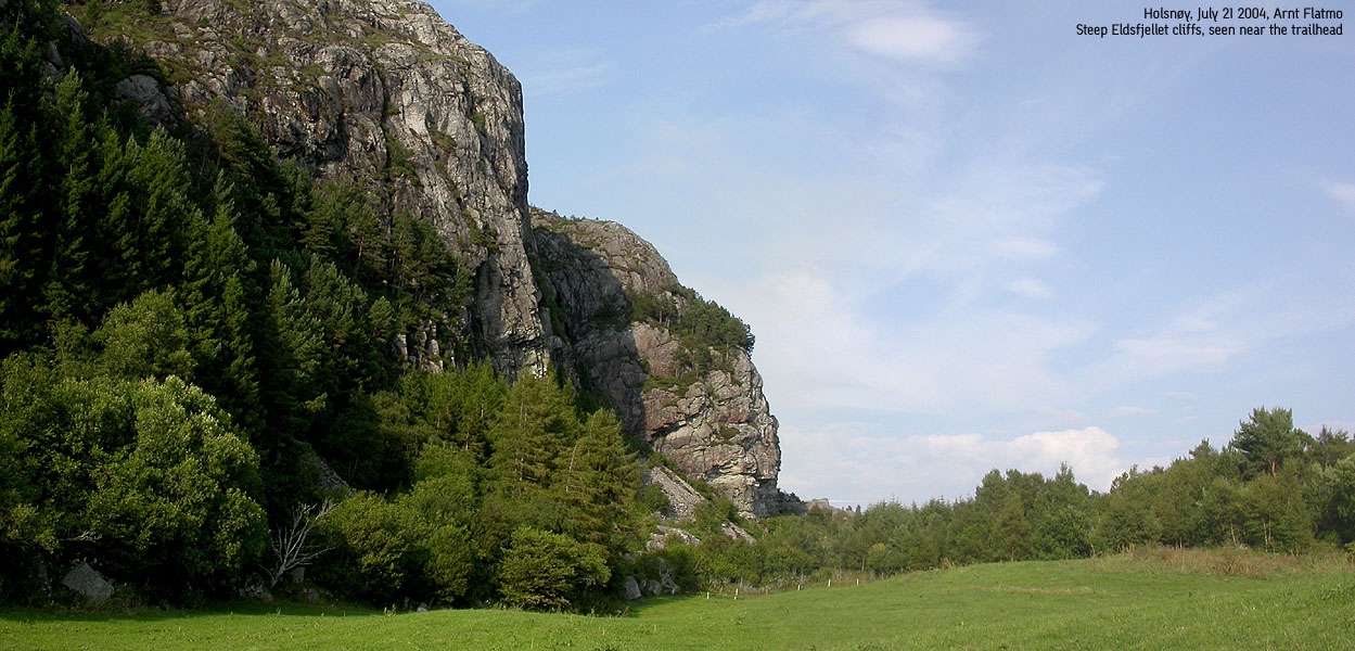
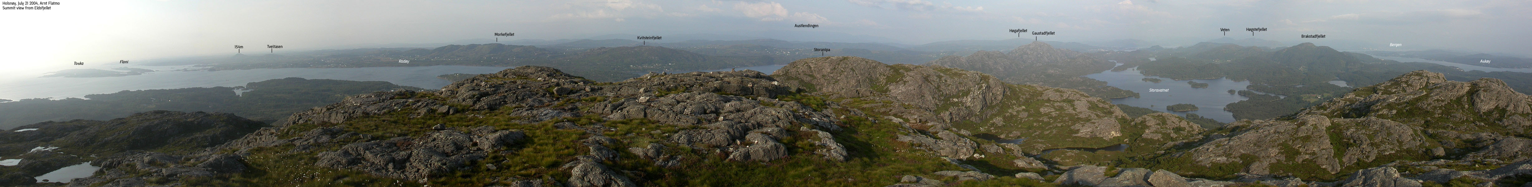
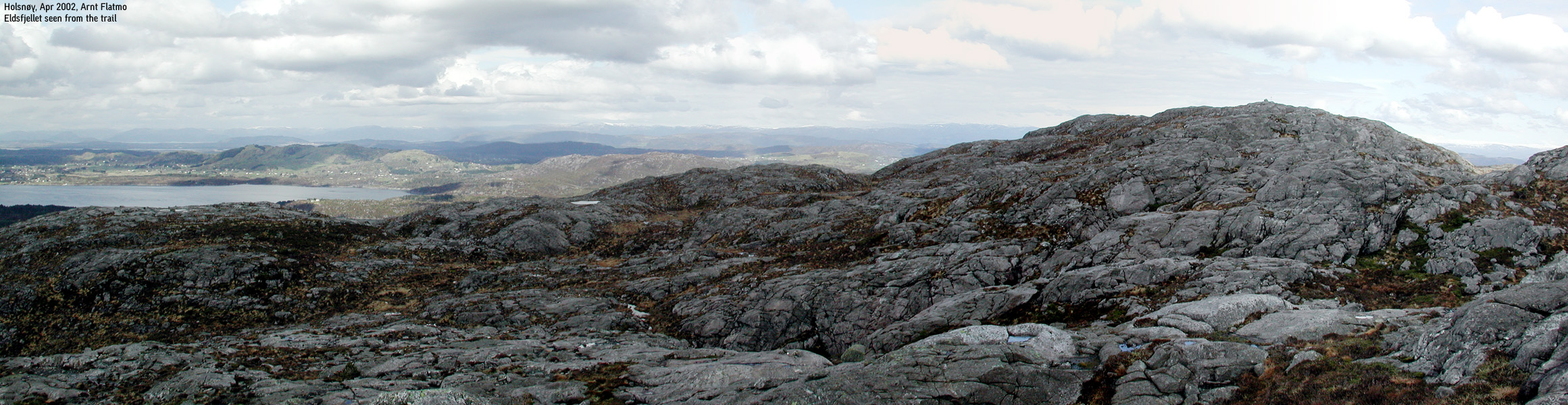
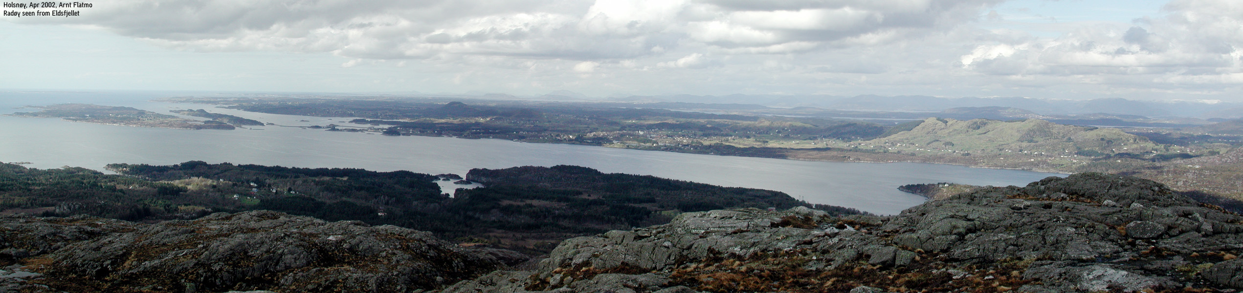
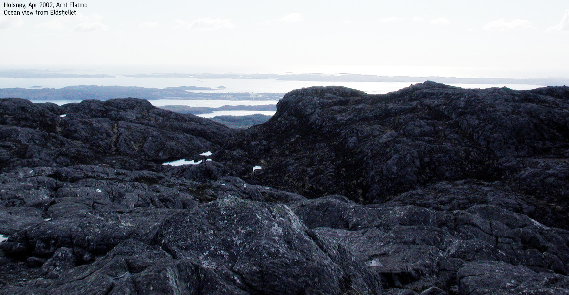
Unlike its neighbours - Gaustadfjellet and Brakstadfjellet, Eldsfjellet is a relative large massif with a steep southern face. One can hike around for hours on Eldsfjellet, excellent for families with kids. Visit this nice summit and enjoy the Bergen mountains in the southeast and the Sognefjorden mountains in the north.
From the viking age, and all the way up to the end of the 20th century, "vardebrenning" has been an important part of a.o. the defense system. "Vardebrenning" means lighting beacons (made by wood). Fire in Norwegian is "ild" or "eld". So Eldsfjellet might be called "Fire mountain" in English.
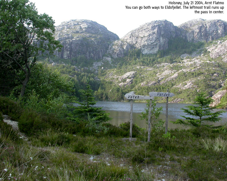
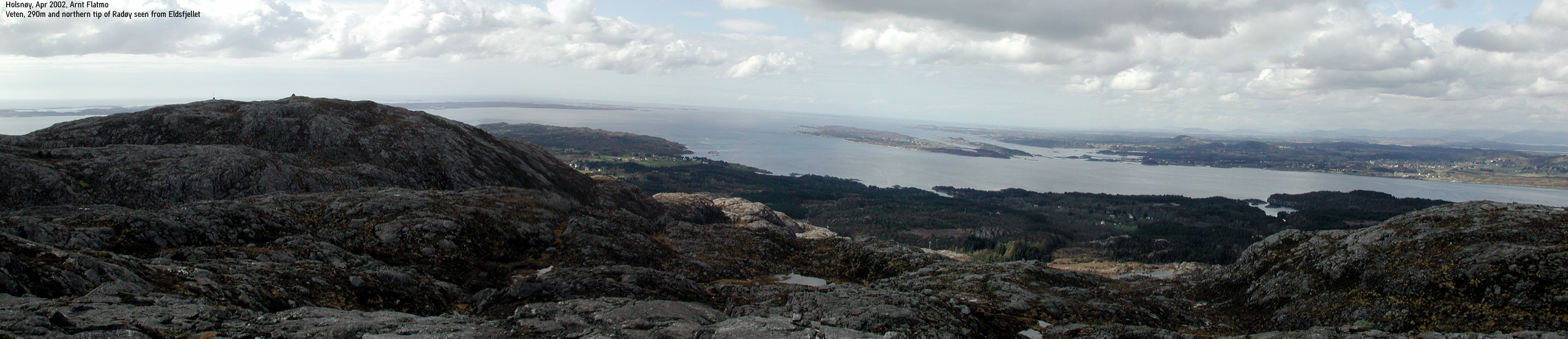
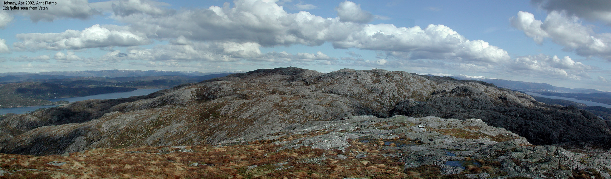
The "cairns" were built from wood and called "Vetter". There is most likely a connection here to "Veten" - the westernmost top on the Eldsfjellet massif.
During the second World War, German soldiers referred to the mountain as "Der Elefant" (the elephant). Seen from the west, the mountain apparently resembled a kneeling elephant.
Eldsfjellet is also known for rock climbing. More info here.
Primary factor:
Eldsfjellet's primary factor is 324m, as Holsnøy is an island.
Veten has a primary factor of 72m towards the higher Eldsfjellet. The saddle is found south of a lake (Trippesteinstjørna) between the two mountains. Økonomisk Kartverk (5m contours) states that the 220m contours define the saddle. The saddle height has been interpolated to 218m.
Notes: Class ratings are in reference to YDS. Click here for more information.
The trails described below are not necessarily the *easiest* trails to this mountain.
|
Skurtveit - Eldsfjellet - Veten round-trip (summer)
|
|
From Bergen, follow highway E39 northbound (Førde). Drive over Nordhordlandsbrua bridge and pay the toll fee on the other side - NOK 45,- for passenger cars per July 2004. Immediately after the toll, turn right towards Holsnøy. Continue approx. 400m to a roundabout where you drive straight through. You're now on highway RV564. Follow this road for approx. 15,5Km.
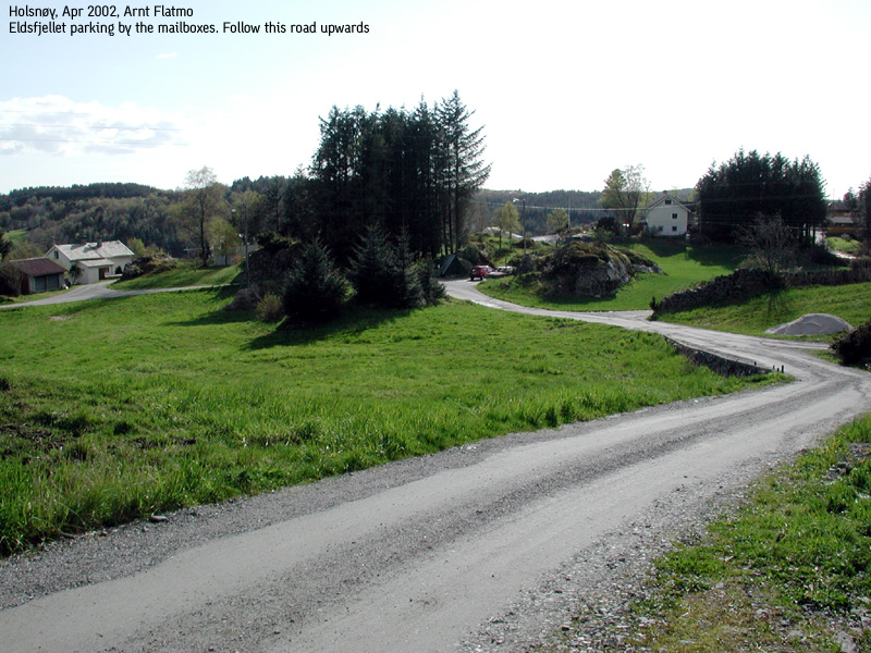
After 15,5Km, you have passed Frekhaug, Mjåtveit, Fløksand and Rossland. Turn left at the "Skurtveit" exit. Follow the road to Skurtveit approx. 600m and locate a large rack of mailboxes to your left. See if you can park here. The road gets quite narrow before you reach Skurtveit. Drive carefully.
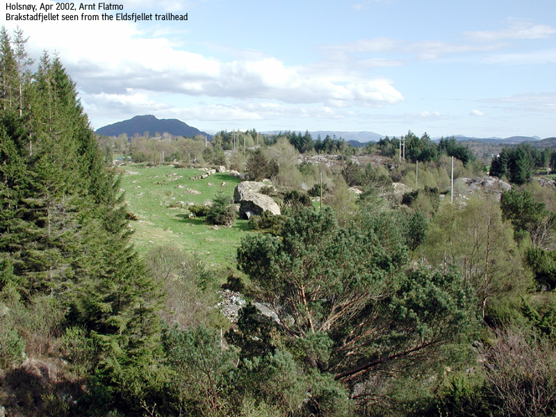
From the mailbox rack, follow the gravel road upwards. First, you reach a road junction. Go straight ahead. Next, you reach a three-way junction (the rightmost road runs up to a house). There is a "Eldsfjellet" trailsign here. Go left. Pass a farm and follow the gravel road until road end. You will be passing a series of gates along the 500m gravel road. Close them after you if they are closed already.
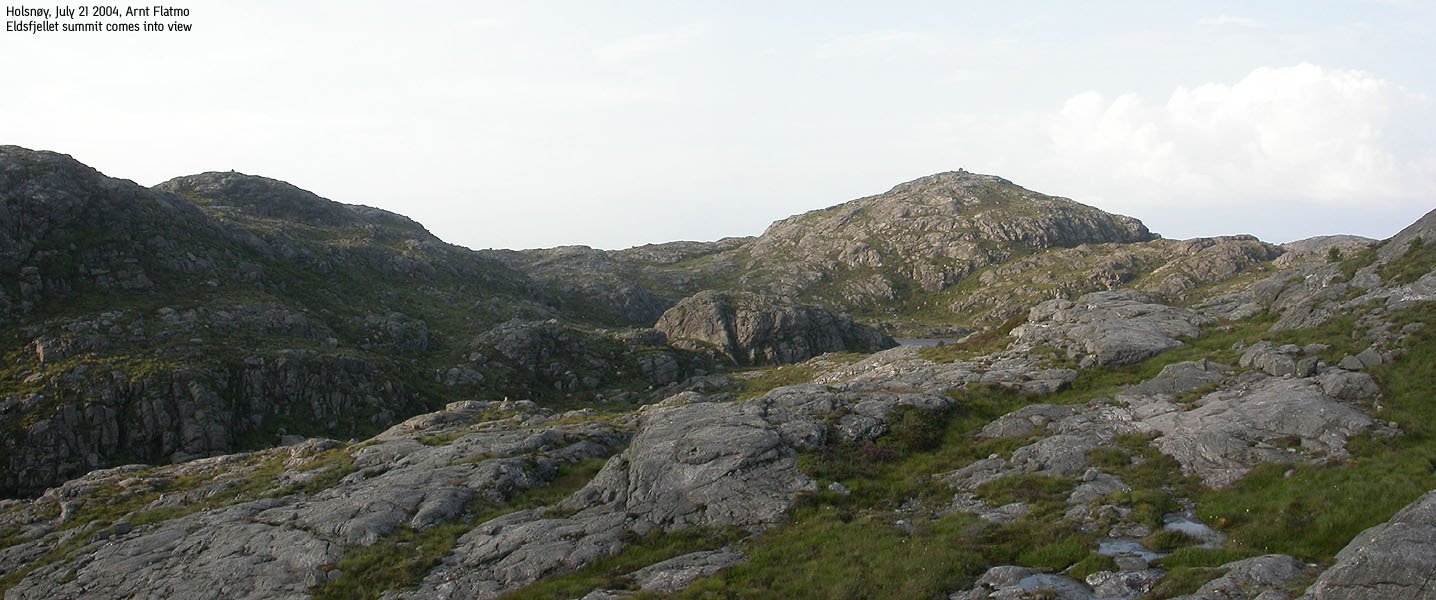
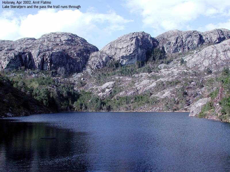
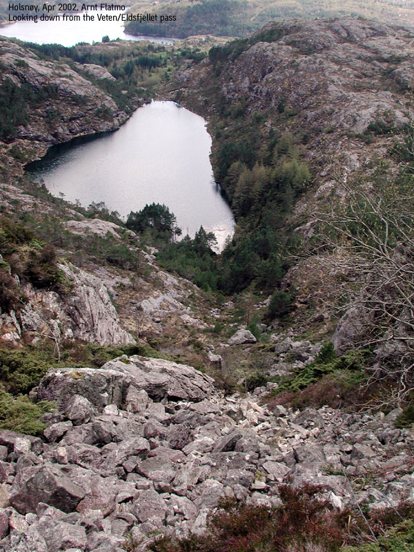
At road end you will reach lake Storatjørni and the trail junction. Either trail will take you to Eldsfjellet. You will see a trailsign pointing left towards Veten and right towards Varden aka Eldsfjellet. Go right towards Varden and follow red sticks up the mountain. High on the mountain, the marking is not quite as good as further down, but in normal weather you should have no problems sticking with the route. The terrain is easy. The Eldsfjellet summit (324m) is marked by a proper summit cairn.
On your descent, the general rule is to head westbound on or off paths until you reach the low pass between Veten and Eldsfjellet. From the pass, simply head up to Veten. The Veten summit is marked by a proper cairn. Descend your ascent route from the pass, or make a shortcut to the southwest and descend into the pass near a wire. Hike down a distinct boulder pass and walk alongside lake Storatjørni on the west side back to the trailhead.
A quite uneventful trip really. It was warm weather, and I decided to go to Eldsfjellet to sort out the views towards the Sognefjorden mountains. I see fairly distinct mountains from Bergen, but haven't been able to put the mountains in place. Anyway, warm weather often means haze, and this was definitely not the right day to go to Eldsfjellet.
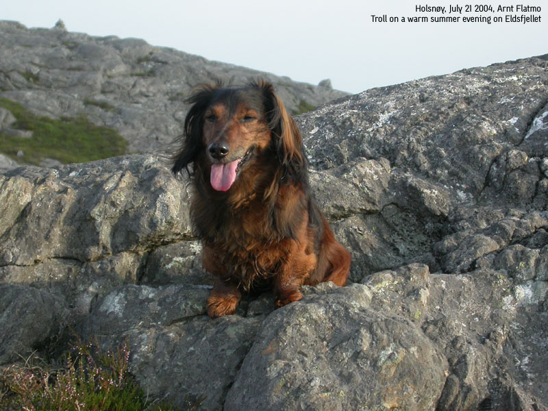
We left the trailhead 18:40PM. At lake Storatjørni, I had a feeling that there was something different about the trailsigns, compared to my last visit back in Apr. 2002. On my two previous visits I had hiked on the west side of the lake, but this time I followed a well-marked trail up the east ridge. Troll had a really bad day and refused to walk. He gave me a big grin when I tried to talk him into walking. He hasn't many teeth left, but he showed me the remaining ones. 3 minutes after I let him out of the backpack and he was literally storming up the trail. This must be some kind of mental game that I'll never comprehend.
We reached the summit 19:50PM. Troll's tongue had been touching ground for the last 45 minutes, and he was licking water in every still pond along the way. I nearly got stommach problems just by watching it. Every time we came upon running water, he wasn't thirsty. Go figure. Summit views weren't good. I could not see Bergen, and any northern views were out of the question. I had even brought binoculars for the first time ever.
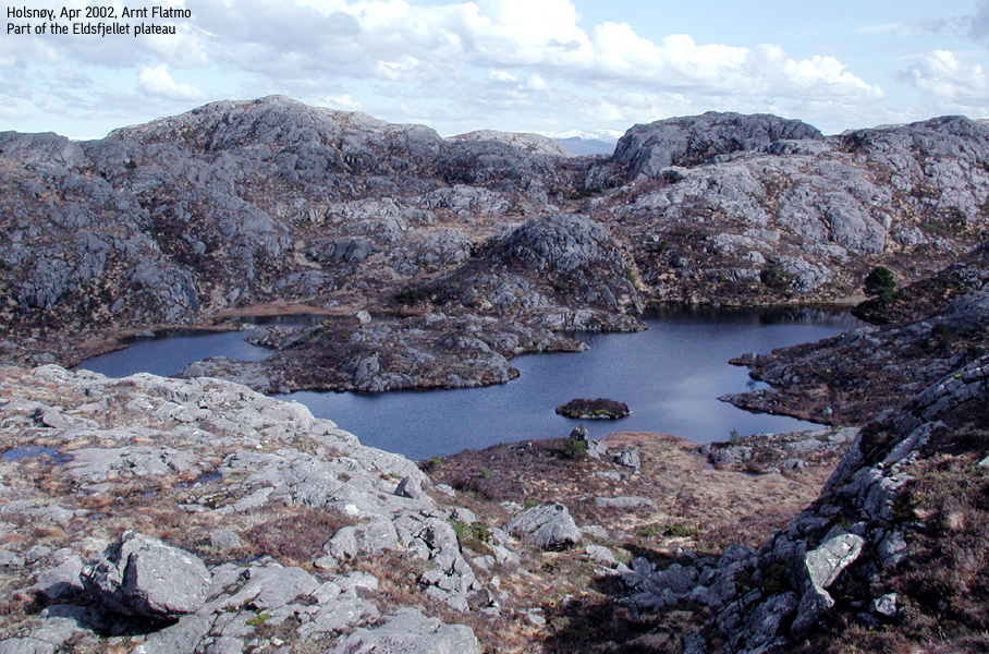
I considered doing a round-trip, but skipped the idea. I had already done the other route two times. Instead, I put Troll in the backpack and walked off-trail further east. I was stunned by the amount of cairns on this mountain plateau. It seems like someone has gone mad and built cairns on every possible hump. These cairns do not contribute to anything, except self-satisfaction to those who built them. I was thinking back when we tried to find a route down the fogged-in Hårteigen. Dozens of small cairns not indicating anything drove me almost insane. I don't generally have strong feelings about things like this, but I would like to suggest that cairns should indicate a path, an exit point or a summit. Everything else is just confusing.
I soon was back on my ascent route and let Troll out of the backpack. We were back at the trailhead by 20:50PM, and I promised myself to come back in clear weather.
Move cursor to read notes, and click on the images to see full version.
Some of the thumbnails may have been cropped to fit the format.


No Javascript:
I had been saving this modest height mountain for a rainy day. So what was I doing here on this beautiful Sunday evening? Due to a jetleg after a recent U.S trip, I awoke 2:30PM, and realized I had blown a perfect day for a higher mountain. So I decided to do a triple mountain (4 including a spur) hike, consisting of Eldsfjellet (I needed the pictures), Brakstadfjellet (a new mountain) and Ulriken (for the statistics and to get 1000m vertical meters that day).
I had been to Eldsfjellet before, and remembered the parking, the trailhead and the trail, so I was able to be back at the car 1 hour, 45 minutes after I left it. Next stop Brakstadfjellet, and then Ulriken..


No Javascript:
1 2 3 4 5 6 7 8 9 10 11 12 13 14 15 16 17 18 19 20 21 22


No Javascript:
Other hordaland mountains
 Other Meland K. mountains
westcoastpeaks.com
Other Meland K. mountains
westcoastpeaks.com

