
Norwegian Mountains, Møre og Romsdal
Veten, Jan 5 2008
Back to the main Veten page.

A Veten moment
(Click for larger image)
Bailing out
The plan was to visit Julaksla (west of Molde) this Saturday. As it was my turn to enter the Vestnes - Molde ferry, I suddenly decided to bail out and left my place in the queue. There was a storm on the coastline and when I saw the rugged Romsdalsfjord, I knew that Julaksla would be a very, very windy and rough spot. I didn't exactly look forward to spend 2x40 minutes on a small ferry on the rough sea, either. I get my naval "kicks" from commuting across Sulafjorden. And I bet that's even worse...
So now what?
I had no plan B or C. I didn't have snowshoes, crampons, ice-axe, skies, etc., which ruled out a whole number of mountain tops. Moreover, any top > 500m elevation would be very hostile today. I decided to visit Veten southeast of Eidsbygda, even if it meant another hour on the road. Since the roads were dry and nothing but a pleasure to drive, the decision was easy. Although driving 2 x 164Km for a 500m top is .. [the reader is welcome to enter the appropriate adjective]
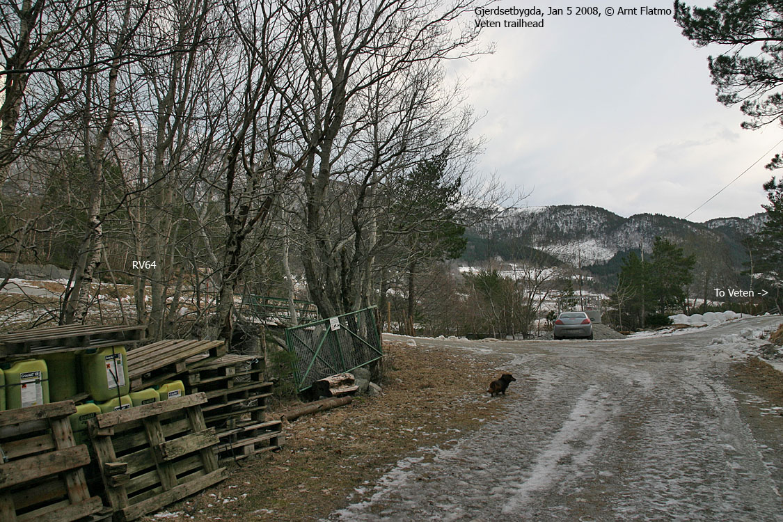
So off we went...
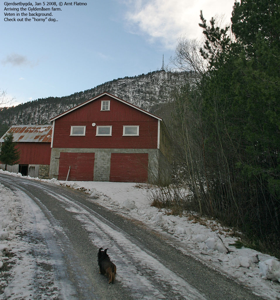
from the trailhead by Gjerdsetvatnet, 11:45AM, and in the wrong direction. After a while, I was able to figure out that we should NOT be on our way towards Hamrevågen. 10 minutes later, the dog and I were on our way towards Gyldenåsen, definetly on the right track.
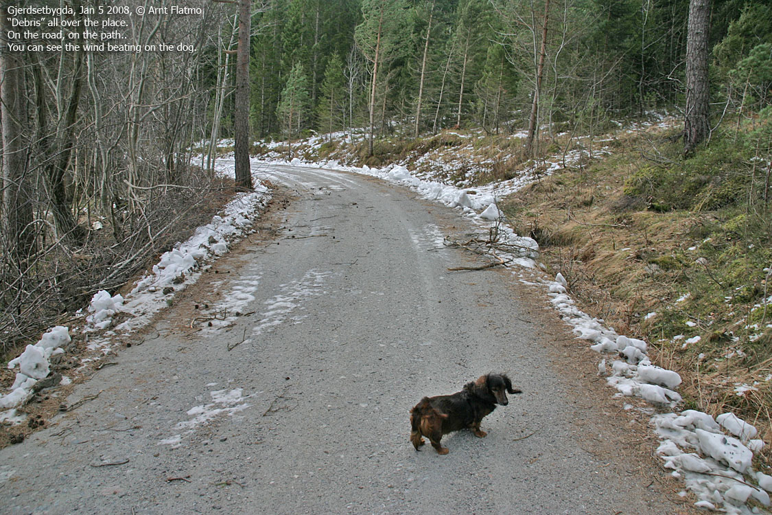
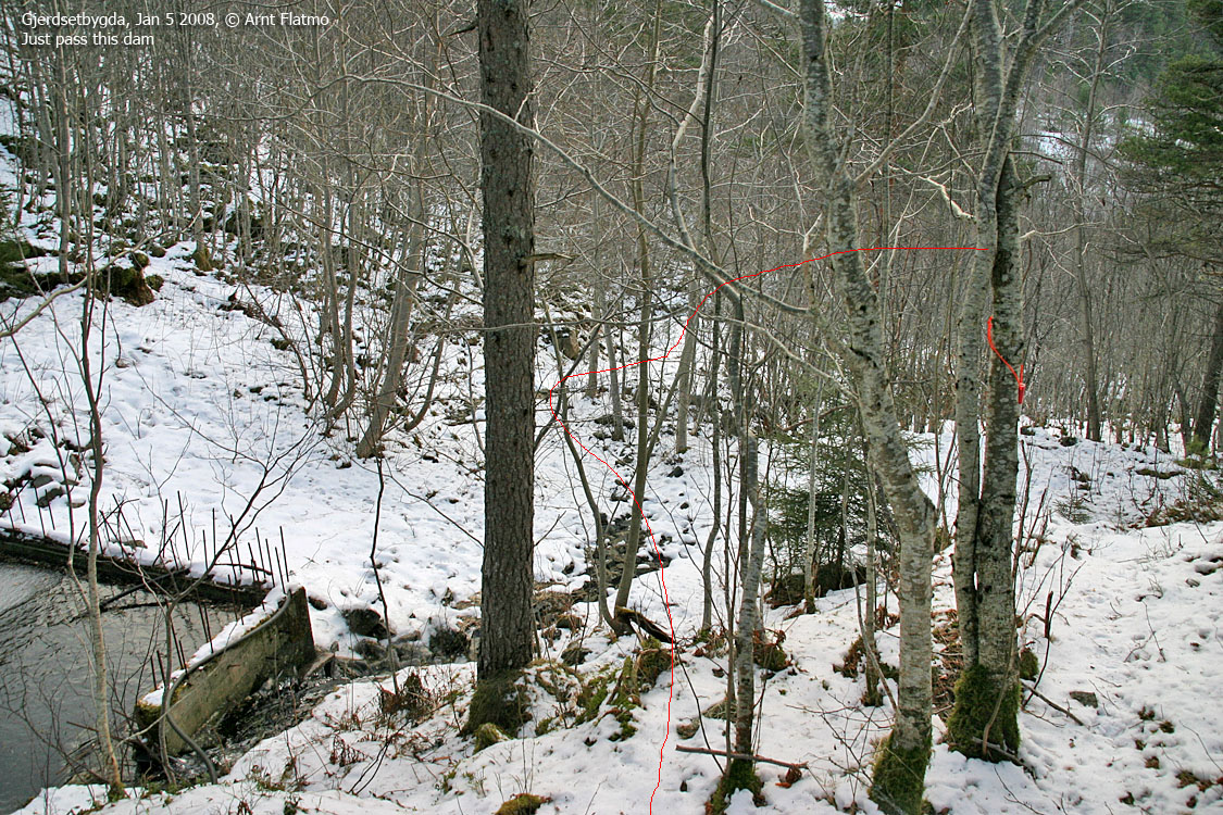
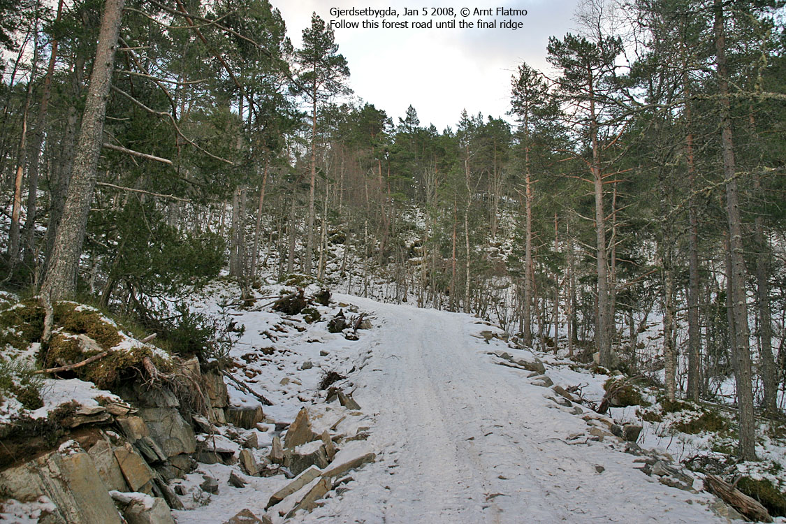
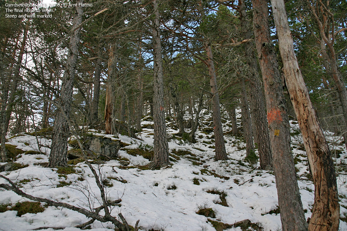
First there was this road to the farm, then a forest road, then a forest path which joined another forest road, then another forest path which joined yet another forest road, but only for 50m. Then there was yet another forest path. But the route marking was good, and I had no problems following the route, until I entered the forest directly below Veten. I lost sight of the markers, and ended up ascending the east ridge a bit north of where the path went.
In situations where one lose the path, it is often wise to ask "where would I have made the path". Most likely, the path is where you would have made it yourself. So I joined the path at 340m elevation, somehow knowing all the time where it was.
3 humps
I reached the first top 13:00PM. This top is named Klunglandsveten on Økonomisk Kartverk. But those living at Torvik calls it Torvikveten. And those are probably not the only names. The map doesn't state a height, but the visitor register under the building might have the answer (I forgot to look). My estimate is 481-482m. At least, Økonomisk Kartverk shows a 480m contour. My GPS was not trustworthy at this point, just having come out of the forest. Upon return, the track log reported 480m.
A ramp (helicopter?) was the only place on this mountain where I could take panorama pictures. Troll, which I had carried ever since Gyldenåsen, was in shelter on the building's terrace. The snow was knee-deep up here (windborn) and I had to put gaiters on before moving to top #2.
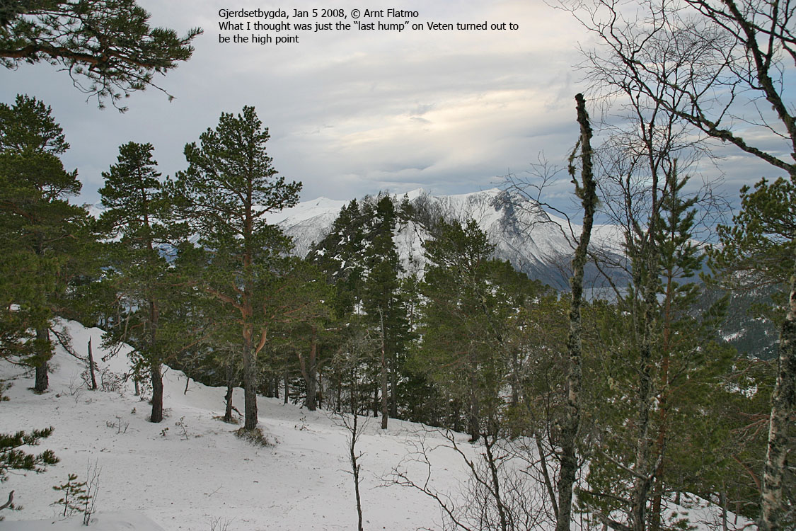
I was convinced top #2 was the highest. There was no doubt, irrespective of the angle I had looked at the mountain from. I found no summit marker, and no views either. The forest was higher than the mountain. Then I suddenly discovered another top further west. I was still convinced I was on the high point, as I could see terrain behind and above the last top.
I still decided to pay that top a visit. Once there, and looking back, I was no longer sure that the middle top was the highest. My GPS reported 505m here, and 501m on the middle top (Back home, I found that Økonomisk Kartverk says 503m and 499m, so the delta is the same). I am SO glad I stopped by the westernmost top also. It would have been no fun driving 328Km, only to miss the high point by 111m in distance.
The wind made a terrible noise up here, but it didn't really push me around. Gale-force in the gusts, surely, but not storm's strength. Still, I'm glad we didn't go for anything higher (and less sheltered). That would have been dog abuse.
Descent
Back on the easternmost top, Troll could finally walk. The wind had blown the snow off the east ridge. The path led us to a forest road, probably the one we had briefly touched on during ascent. We passed a couple of guys working in the forest, and we had a brief chat. It seemed hard for them to understand why a someone would come all the way from Ålesund to visit Veten.
14:30PM, we were back at the car, with a 2-hour drive ahead of us.


