
European mountains
|
| Location : | La Gomera, Canary Islands, Spain |
| Maps : |
La Gomera, Wander- und Radkarte 1:30 000 (Kompass) La Gomera Tour & Trail 1:40 000 (Discovery Walking Guides) La Gomera Wanderkarte 1:35 000 (Goldstadt) GPS: TOPO_España Insular y Ciudades de Ceuta y Melilla |
| Primary factor : |
Garajonay: 1489m (island high point) Fortaleza: 116m |
| Hiked : | Dec 2009 |
| See also : |
La Merica Los Roques Las Toscas Tejeleche & Roque de Mona Other European mountains on westcoastpeaks.com La Gomera - Nature and Magic (external link) |
See also the La Gomera index page for a list of all tops visited. Also note that mountain elevations have been taken from the TOPO_España Insular y Ciudades de Ceuta y Melilla GPS map.

Garajonay
(Click for larger image)
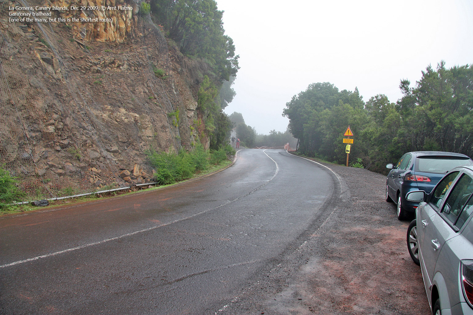
Garajonay and Fortaleza are two of the most visited top on La Gomera. Garajonay is the highest point on the island, and a vast number of trails from all directions will take you there. The shortest route is 1,3km and takes only 20 minutes for the average hiker (the elevation gain is merely 130m). This is the route described on this page.
| Garajonay
is located in the geographic centre (approx.) of the island, and inside
Parque Nacional de
Garajonay - a 40km² world heritage site. The park is a laurel (humid subtropical)
forest, and a distinct feature is the "water fountain" tree (see
picture to the right) near the top of Garajonay.
From the main trailhead, you follow a paved road (bricks) all the way to the top. Per 2009, you could also follow a forest path across Pajarito (1463m), allowing for a short round trip walk. For longer walks, refer to the La Gomera hiking maps. 
Garajonay trailhead
|

Water fountain on Garajonay
|
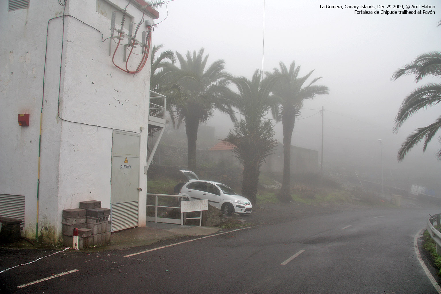
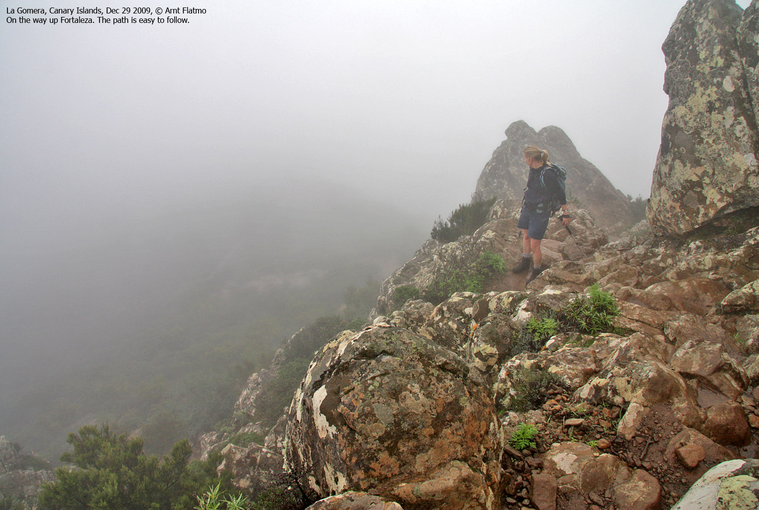
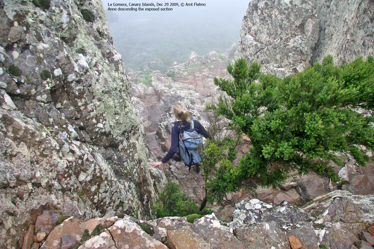
Fortaleza de Chipude is an impressive mesa located 3km southwest of Garajonay. The signpost at the Pavón trailhead refers to the mountain as "the fortress" - a good comparison due to the steep walls that surround the mountain. The only public route up the mountain runs through rugged terrain, and although the route (described below on this page) is technically easy (scrambling grade YDS 2+) the route is not suited for everyone. At least one section is quite airy and caution is required.

Fortaleza de Chipude
(Click for larger image)
The shortest route to the mountain runs from Pavón, near Chipude. The distance is 800m, and the elevation gain is only 160m. It is possible to hike from the summit of Garajonay to Fortaleza (hiking distance 4,5-5km). Refer to the hiking maps for various alternatives.

The route runs up here .. somewhere
(Click for larger image)
The mountain heights vary depending on which map you have. Below is a table of heights, collected from various sources. The Garmin GPS map has been chosen as source for computing the primary factors.
| Mountain | Kompass | Goldstad | Tour & Trail | Wikipedia | Garmin GPS map |
My GPS |
| Garajonay | 1484m | 1487m | 1487m | 1484m | 1489m | 1496m |
| Fortaleza | 1241m | 1241m | 1243m | - | 1240m | 1251m |
Throughout our stay, personal GPS readings were in average 10-13m above the map heights. Even at sea level, the GPS read 10-13m. This may indicate that the GEOID model is not very accurate for this island.
Garajonay (Garmin GPS: 1489m, N28.10975 W17.24834) has a primary factor of 1489m being the island high point.
GPS measurement read 1496m (on the manmade brick wall on the top), averaged over a 5-minute period (error margin +/- 2m). The manmade structure is approx. 2m high, which results in an approx. elevation of 1494m.
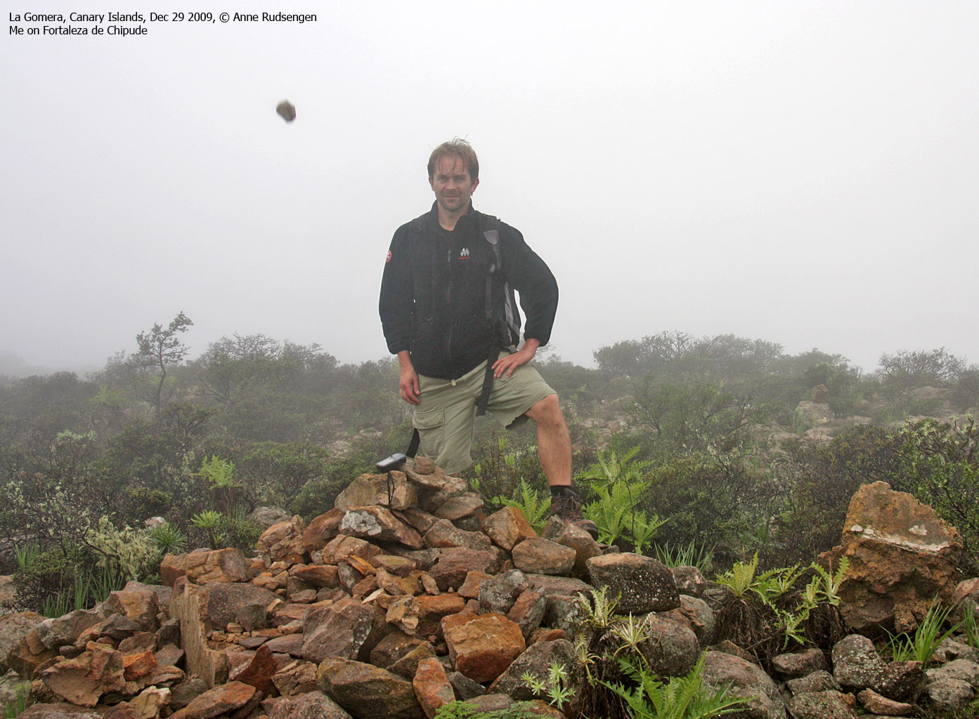
Fortaleza de Chipude (Garmin GPS: 1240m, N28.10038 W17.27649) has a primary factor of 116m towards the higher parent Garajonay. The defining saddle (approx. N28.10213 W17.27317) is found where the trail from Pavón turns into a mountain trail. The saddle height is 1124m on the Garmin map.
GPS measurement read 1251m (on the summit cairn, 0,5m high), averaged over a 5-minute period (error margin +/- 1,6m).

Fortaleza and the Pavón trailhead
(Click for larger image)
Google's interactive map. You can zoom, pan and click on the markers.
|
|
|
|
Route 1: Road TF-713 - Pajarito - Garajonay (round trip) (all seasons)
|
This route description is valid per Dec 2009
Access
(all distances are approx. distances)
The usual way to get to La Gomera, is to fly to Tenerife and take a jetfoil or ferry from Los Cristianos. Some ferries only run to San Sebastian de la Gomera, while others stop by San Sebastian and Playa de Santiago before arriving at Vueltas in Valle Gran Rey.
The starting point is along road TF-713 (Carretera del Centro), on the highest point on the road between San Sebastian de la Gomera and Vallehermoso/Valle Gran Rey. Find parking here.
The route

The route - as seen in Google Earth
(Click for larger image)
Follow a paved (brick) road 430m to a trail fork. The paved road continues straight ahead, but if the trail is open, turn left and follow a forest trail (across Pajarito) up to Garajonay. On the summit, you will find a 360 deg. manmade brick wall (2m high).
Upon descent, stop by the "water fountain" tree and then follow the paved road back to the trailhead.
|
Route 2: Pavón - Fortaleza de Chipude (all
seasons)
|
This route description is valid per Dec 2009
Access
(all distances are approx. distances)
The starting point is the small village Pavón. You can get there from TF-713 (Carreta del Centro) by following the road to Chipude. From Chipude, continue to Pavón (a short drive). The trailhead is next to a transformer station. Park here.
The route

The route - as seen in Google Earth
(Click for larger image)
Follow a paved road up through the village. After 330m, you see the Fortaleza signpost. Turn right and follow the mountain trail upwards. Don't be discouraged by the steep wall ahead of you. There is a way up!
At the base of the cliffs, proceed carefully along a rugged, visible path that takes you up to point 1224m through a crack (which is airy when you look down). Cross point 1224m carefully and follow the path up to the Fortaleza plateau. The summit (N28.10038 W17.27649) is marked by a pile of rocks, exactly 100m southeast of the cross found on the northwest side of the summit plateau. Descend your ascent route.
 westcoastpeaks.com
Other European mountains
Other Norwegian mountains
westcoastpeaks.com
Other European mountains
Other Norwegian mountains
