European Mountains, Slovakia
Gerlachovský štít (2654m),
Zadny Gerlachovský štít (2616m)
| Primary factor: |
Gerlachovský štít: 2356m Zadny Gerlachovský štít: 50m (ca.) | ||||
| Hiked: | July 2013 | ||||
| See also: |
| ||||
| See also : | Other European mountains on westcoastpeaks.com |
Gerlach and other high Tatra peaks seen from Kriván

(Click for larger image)
Introduction
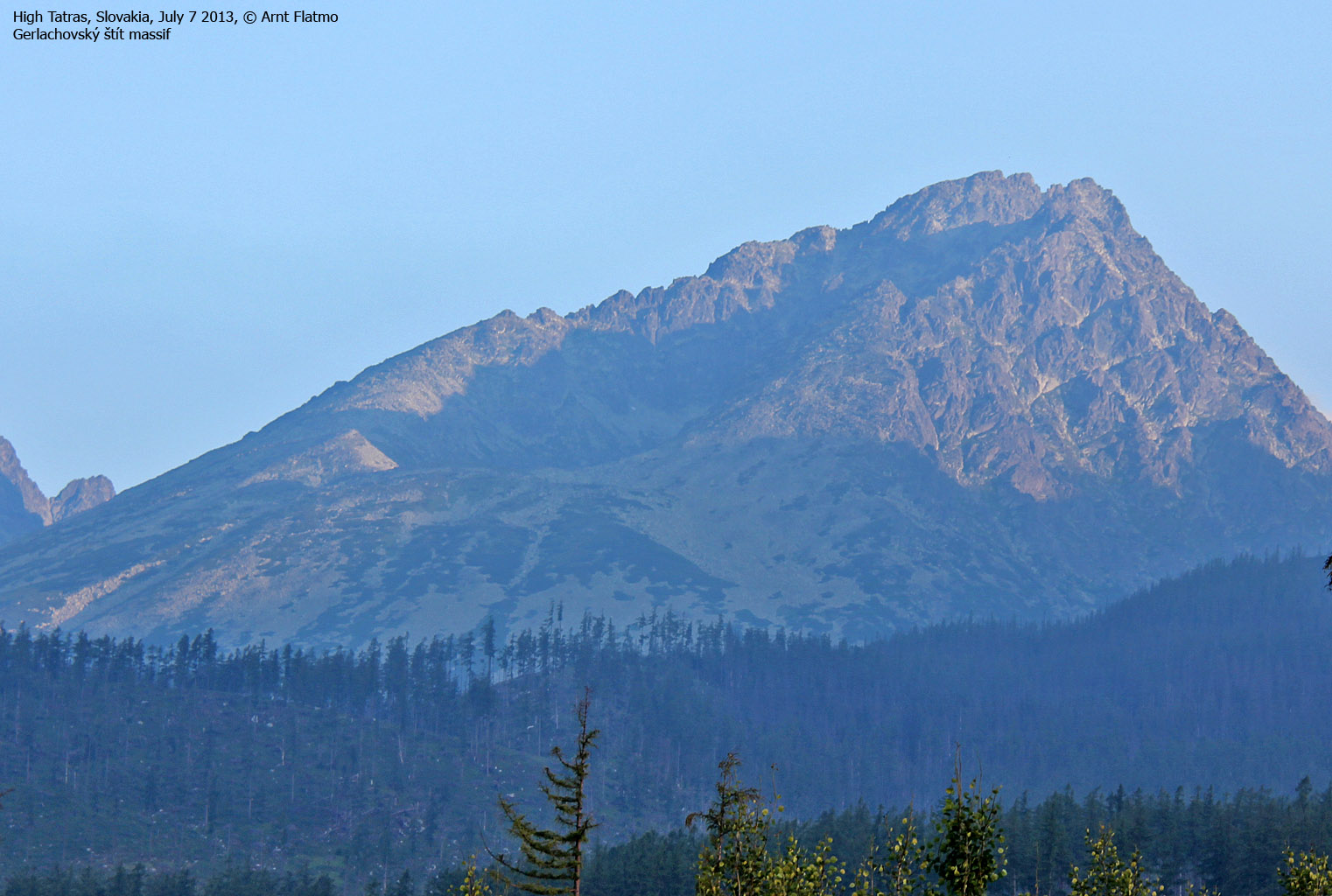
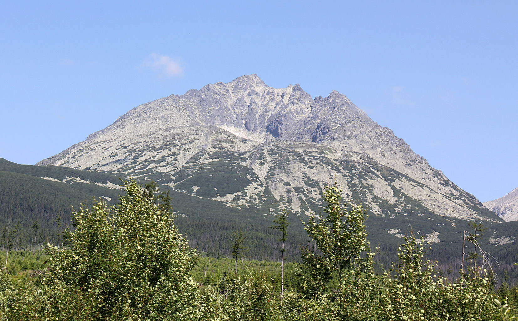
Gerlachovský štít (Gerlach Peak) is the highest peak in the High Tatras mountain range and the highest peak in Slovakia. The name is Slovakian, and refers to the village Gerlachov - Gerlachov's Peak. In Poland, this peak is referred to as Girlach and Garluch.
The peak is not open to
the public, unless you've hired a certified mountain guide (http://www.tatraguide.sk) or you are a
member of the national UIAA club. The mountain guides will (unless
something else have been agreed) take you on a east to west traverse,
with ascent from Velická Valley and descent into Batizovská
Valley.
The normal ascent route is graded UIAA II-III, without snow and without the use of fixed aids on the mountain. See this page (written by Petter Bjřrstad) for a detailed description of the normal ascent route.
The normal ascent route (in center)

(Click for larger image)
There are several other routes to the summit, but nearly all require climbing. This page describes an ascent along the Martin's route. This page on Summitpost claims that this is "one of the most classical and honourable ridge-routes in High Tatras". Visit this page for details, peak names and pictures. You can discuss this route with guide during your planning.
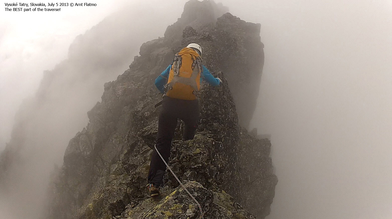
The Martin route ranges from UIAA II-IV, but is mostly in the II-III range. If you are with a guide, you will scramble and climb the ridge using running belays. The route offers everything; easy scrambling, tricky scrambling (climbing), good handholds, bad handholds, safe pitches, exposed pitches and hilariously exposed pitches...
There are a number of variations to the Martin route. Our ridge route started at the Litvorovo Sedlo (pass), which is a shorter route than the one described on the Summitpost page. The route passes Zadny Gerlachovský štít (Rear Gerlach/Hinter Gerlach) - located 300 meters north/northwest of the main summit. Zadny is the most prominent of all the smaller peaks along the Martin route.
Along the Martin route

(Click for larger image)
Primary factor:
Gerlachovský štít (2654m, UTM 34 U 436870 5446054) has a primary factor of 2356m. According to Petter Bjřrstad's page, the saddle location is near Moravska Brana (298m) - N49:33:22, E017:53:57.
Zadny Gerlachovský štít (2640m, UTM 34 U 436688 5446300) has a primary factor of approx. 50m. The saddle (34 U 436729 5446201) is found in Tetmajerovo Sedlo (pass) between Zadny and the main Gerlach peak. This information is taken from the Summitpost page where the summit is said to be 2640m and the pass is 2590m.
The profile of my GPS suggests that Zadny and the pass is approx. 20-25 meters lower. I just add this for information, as I do not trust the GPS (altimeter + GPS hybrid) enough to make any bold claims...
GPS profile for the two summits

(Click for larger image)
Google map
Google's interactive map. You can zoom, pan and click on the markers.
|
|
Route descriptions
| This disclaimer is regarding all of the literature and instructional guides posted on the westcoastpeaks.com website. These instructions are guidelines only, and should not be used in lieu of common sense or judgment when attempting any of the actions involved or instructed. Westcoastpeaks nor myself will not be liable nor will it indemnify any form of compensation to anyone who has injured, harmed or even killed themselves or others while following any of the instructions written within the website. It should be noted by any persons willing to undertake any of the instructions provided that mountains offer varying levels of risk, regardless of size or incline. Risks to be considered are as follows but not limited to: wild animals, weather, the terrain, bad judgment, inappropriate or insufficient equipment, improper training or experience and of course, bad luck... |
|
Route 1: Sliezcky Dom - Gerlachovský štít via Martin route
|
|
This route description is valid per July 2013
Access
(all distances are approx. distances)
The starting point for this route description is the village Starý Smokovec - approx. 10km northwest of the town Poprad and at the southeastern foothills of the Tatra mountains. Drive approx. 5km west along highway 537 to the village Tatranská polianka (N49.12307 E20.18566 - approx. 1000m). From here, you will have to make your way the 6,9km up to Sliezcky Dom (1670m). You can either walk or call the hotel and have them pick you up with their shuttle bus. Visit their website in advance to learn about your transportation options. Expect to pay some Euros for the transportation.
The route:
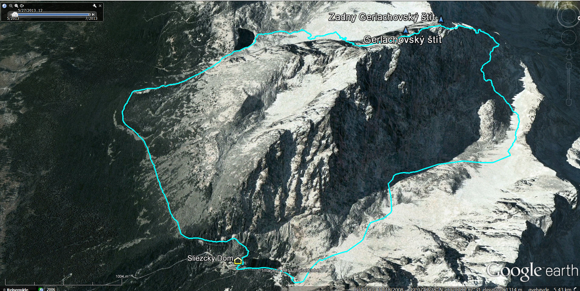
The ascent route (Google Earth)

(Click for larger image)
From Sliezcky Dom (N49.15607 E20.15673), cross the creek (east) and then follow a marked path to the north. At first, the path runs to the east of Lake Velické Pleso. The path climbs up to the upper valley with the waterfall on your left hand side.
In the upper valley, you can see the normal ascent route on your left hand side. The route is quite obvious even without climbers in it. The path continues up towards the Pol'sky Hreben pass at 2200m, but the guide might take you up to the Litvorovo Sedlo pass (N49.17029 E20.13100) - just south of Litvorowy Stit (2413m).
Please visit this Summitpost page for a very thorough description of the Martin route. Being new to this area, in addition to climbing in thick fog, it has been difficult to present an objective view of the route elements. Click on the trip report link at the bottom of this page to read about our subjective view...
What can be said is that
the route started out with easy scrambling. The scrambling got
increasingly more advanced, and the route got increasingly more exposed.
We were fairly experienced hikers - and even accustomed to some good
scrambling - but there were 3 or 4 places where we asked the guide to anchor
the rope (opposed to just moving as a 3-person group with a rope
in-between). There were hilariously exposed sections with excellent
handholds (good fun!) and equally exposed sections with not so good
handholds (not so good fun!). In other words, this route offers variety!
The ridge route takes you up to Zadny Gerlachovský štít - the "hinter peak" (N49.16625 E20.13150). The descent to the Tetmajerovo Sedlo saddle is fairly easy, but an exposed ridge (external picture here) rises steeply up towards the summit. The handholds are however excellent!
The descent route (Google Earth)

(Click for larger image)
At the summit (N49.16405 E20.13404 - marked by a cross), the three most popular routes come together; the normal ascent route, the normal descent route and the Martin route. The descent route is technically far easier than the ascent routes and it is called the descent route to avoid jams on the fixed aid sections (iron steps and handholds).
While there is no climbing involved (other in the sections with fixed aids) care is needed. The descent route is steep and kicking loose rocks must be avoid at all costs!
The descent route leads you into the Batizovské valley, where you follow a marked path from Lake Batizovské Pleso (N49.15236 E20.13030) and back to Sliezcky Dom.
Gerlachovský štít

(Click for larger image)
Gear (and other good practices)
Discuss what to bring with your mountain guide. The guide will tell you whether or not to bring an ice-axe or crampons. If you don't bring your own harness and helmet, let the mountain guide know in advance so he or she can bring extras. Do make sure you have enough clothes to keep you warm. The traverse takes many hours and bad weather can unexpectedly set in. Also carry enough water, as you can quickly get dehydrated up there. Do not bring your most worn-down hiking boots. A good grip - even for your feet - can come in very handy.
And whatever you do - don't fall! The guides do not traditionally operate with running belays with anchors - just a rope between the members of the party. If a pitch makes you feel uncomfortable - ask for an anchor to be set while you move past the section that you are uncomfortable with.
Gerlachovský štít

(Click for larger image)
Guides (some links and numbers)
- www.tatraguide.sk
- Jan Kostka (Phone: +42-1903624848, kostka.jan@post.sk)
- Eduard Lipták (known as Kuro) (+42-1903624853, kuro.namaste@gmail.com)
Gerlachovský štít

(Click for larger image)
Pictures and Trip reports:
- Gerlachovský štít traverse, July 5 2013
- Krakow sightseeing, July 2&3 2013
 westcoastpeaks.com
 Other European mountains
 Other Norwegian mountains


