
Norwegian Mountains, Sogn og Fjordane
Haukåbøra from Haukåvatnet, Aug 22 2009
To the main Haukåbøra page (maps, route descriptions, other trip reports, etc.)

Haukåbøra
(Click for larger image)
| Anne Rudsengen
works as Naturoppsyn (field inspector) in the
Jostedalsbreen National park. She is also the author of (a.o.) the books
Opptur Sogn og
Fjordane and
Opptur
Hordaland. I came into contact with Anne in 2006 through the
Hordaland book, and we've touched base via email since then.
For some time, we had talked about getting together for a hike, and on this weekend late in August, we decided to meet in Flora county and take a closer look at the Ålfotbreen mountain region. Anne had been visiting this region earlier, but didn't know it well. I had been to Gjegnen in 2003, but was totally unprepared for the beautiful scenery that was awaiting. The weather forecast promised rain showers, but there's always room for hope.. |
 |
 |
I left Gurskøya after work on Friday afternoon, and found it a bit challenging to drive through the rain showers with the roof down. But image is everything... I took the Skårheim - Isane ferry and realised that I had never taken this road before (bonus!). Cows (!) were being rounded up after the summer, so traffic was a bit slow west of Ålfoten. I stopped by the brand new petrol station and enjoyed a hotdog while watching the company sign being mounted. Then I continued into Flora county and met Anne by Haukåsvatnet.
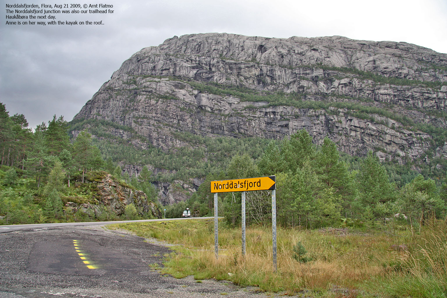
We found a nice camp-site by Norddalsvatnet. After putting up the tents, Anne took her kayak out on Norddalsvatnet, while I took a car trip in the direction of Grøndalen. Anne came back just as a massive rain shower set in. 10 minutes later, there was thunder and lightning all over the place, and Anne was glad that she was out of the water. While the rain was pouring down, Anne made dinner (steak!) and served wine. I was completely spoilt rotten! After dinner, we had a mild scare when we noticed that the lake was now hitting on our tents - 1.5 metres higher than just a few hours earlier. Flash flood! But this was the peak and the next morning, everything was back to normal. And the sun was shining!

Morning by Norddalsfjorden
(Click for larger image)
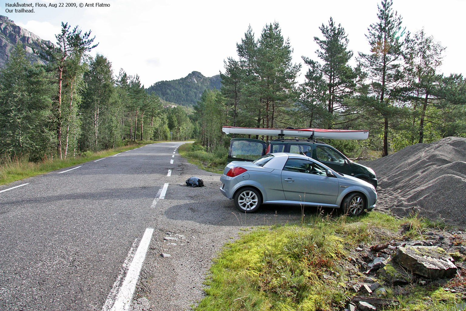
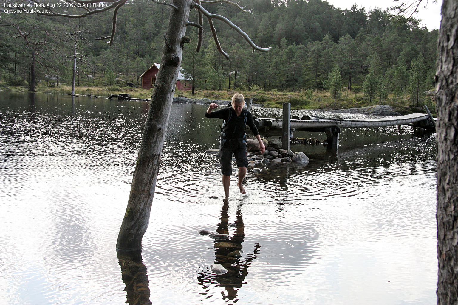
Anne had found the Haukåbøra trailhead the day before, and by 10am sharp, we were on our way. We found the bridges across Haukåvatnet, but discovered that one section had to be forded. I wondered if the landowner had removed a section of the bridge, but Anne reckoned that this section was normally above water. At least the rocks suggested so. Fortunately, the water wasn't very cold, so fording was no problem. This area was so gorgeous, and a bit to the west was the Brudesløret waterfall - possibly the most beautiful waterfall I've seen...

Brudesløret
(Click for larger image)
Then we entered a green moss "fairy tale" forest, with giant rocks and "faces" everywhere. Ulldalsnipa was towering high and mighty above us, with a type of rock I've never seen in Norway before. After a steep ascent through the forest, we arrived at Lake Grisebotsvatnet. I was overwhelmed. Surely, this was a climber's paradise! Just the wall above Grisebotsvatnet could entertain a climber for years!
We could see Haukåbøra in the distance. The mountain seemed quite far away, but I was too busy observing the many details to even give the mountain a second thought. We would surely get there. With time...

Grisebotsvatnet and Haukåbøra
(Click for larger image)
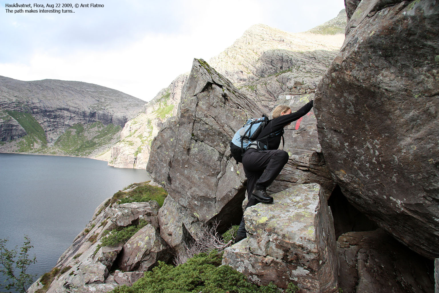
We missed the Haukåbøra fork and ended up at Børevatnet, only to conclude that a climb directly from the dam was not particularly safe. It didn't take long before we found the Haukåbøra path and had an enjoyable walk above the lake, which included some (voluntarily) climbing, scrambling of big boulder and close encounters with European garden spiders...
We passed an unnamed lake, had a quick lunch break (nuts & chocolate) and set course for the mountain. The cliffs above made us look small...

On the way up Haukåbøra
(Click for larger image)
Anne was excellent company, and I enjoyed listening to her explanations about details in the nature surrounding us. And I will certainly recognise Alchemilla alpina (and recall the story behind the name) the next time I see the flower!
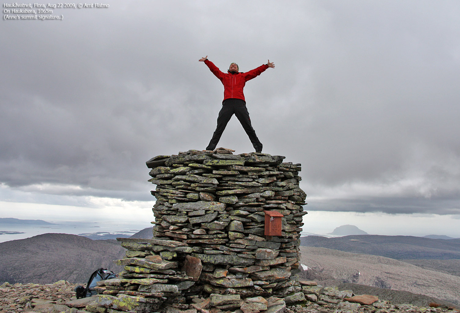
We reached the top of Haukåbøra 2:20pm - 4h:20m after heading out. We could see rain showers here and there, but none were touching on Haukåbøra. Bonus! Ålfotbreen and the highest tops were hidden in fog, so the panoramic view wasn't perfect. But I didn't care. The hike itself had been just fantastic.

View from Haukåbøra
(Click for larger image)
After a nice stay at the top, it was time to head back down. With limited knowledge about the area (and the many steep cliffs), it seemed best to descend our ascent route. The same interesting details we noticed on our way up, were also paid attention to on our way down. Twice the fun!. One wall was particularly hard to leave behind. I climbed it until it wasn't safe to proceed and wondered when I will find myself on a wall like this again..

NICE climbing wall
(Click for larger image)
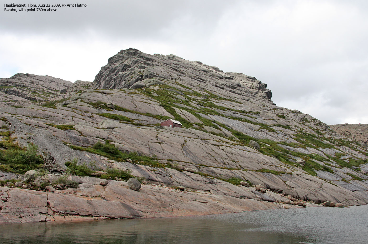
Anne was fascinated by the terrain surrounding Grisebotsvatnet, especially the smooth slabs leading straight into the lake. It would definitely be worthwhile to come back and climb on these slabs - slowly, gently, feeling the balance, touching the smooth surface and perhaps a voluntarily fall into the water. And I really, really want to visit point 760m above the lake.

Point 760m and Grisebotsvatnet
(Click for larger image)
I had divided the hike into sections. For every section without rain, I claimed a virtual bonus. The number of bonuses was now high. Anne liked the idea, but wanted to call it "opptur" instead (alternative Norwegian word for a.o. bonus..). I promised I would adhere to the new term.
Back at Lake Haukåvatnet, the time had come for the second ford of the day. With colder water, poles would have been very handy. Balancing on round rocks while you're cold can be a challenge. But the temperature was OK, and Anne couldn't resist taking a swim in the lake.
It was perhaps unavoidable - it started raining. We picked up speed and returned to the trailhead 6pm sharp - 8 hours after heading out. We agreed to visit the Ålfotbreen region again on the following day, and decided to check in at Svelgen Hotel.
The stay at the hotel was sort of predictable for a Saturday evening in a small village; they didn't serve dinner after 6:30pm (but pizza and beer works just as well), kids were partying around the hotel until 5am, and the rooms were definitely not omigod standard. But no complaints; the beer was terrific, and the next morning we were on the way to Vingekvarven in Bremanger county.

Across Lake Haukåvatnet
(Click for larger image)


 hill")


