
Norwegian Mountains, Sogn og Fjordane
|
| Fylke/Kommune : | Sogn og Fjordane/Selje | ||||||||||
| Maps : | 1019-I Stad (Statens Kartverk, Norge 1:50 000) | ||||||||||
| Primary factor : | 334m | ||||||||||
| Hiked : | Mar 2009 | ||||||||||
| See also : |
| ||||||||||
| See also : | Other Sogn og Fjordane mountains |
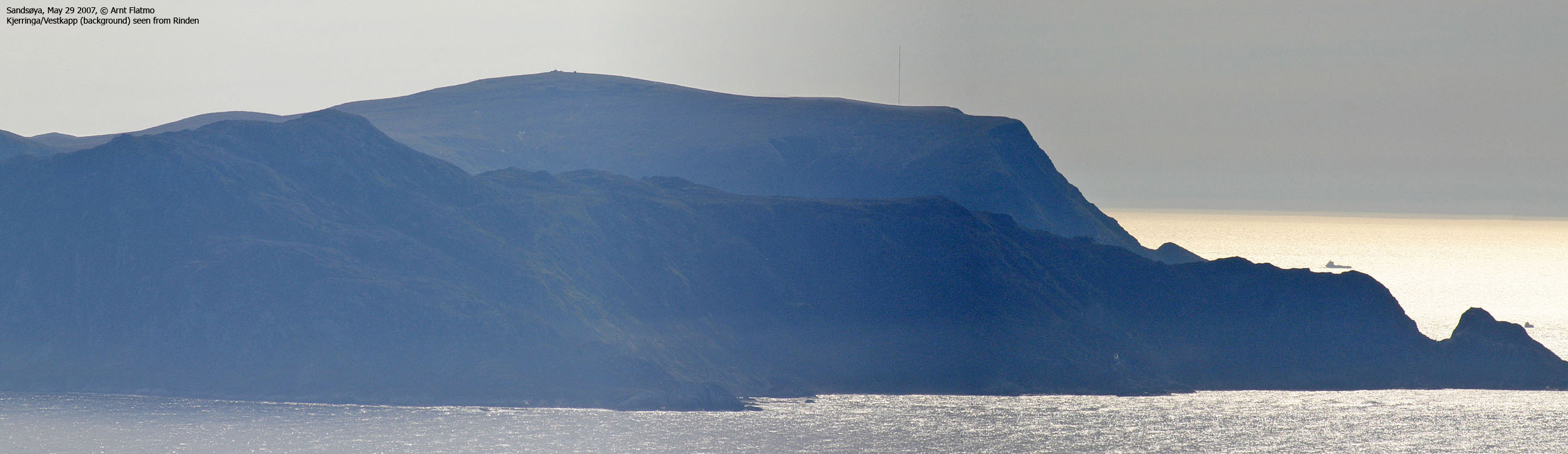
Kjerringa/Vestkapp
(Click for larger image)
Kjerringa is found on the very northwest side of the Stadlandet peninsula, and belongs to the municipality of Selje. The mountain is also known as Vestkapp (the West Cape), perhaps once considered to be the westernmost point on the Norway mainland. Today, Vardetangen (Austrheim, Hordaland, near Mongstad) holds the rank as the westernmost mainland point. However, Vestkapp is not located in a fjord, and has no islands between itself and the ocean.
Kjerringa is also one of the few Norwegian mountain tops where you can drive to the top. There is a tourist centre on top (open in the summer season), where you can get food, postcards and souvenirs. Given its western location, the mainland views are phenomenal. Bring binoculars.

On Kjerringa/Vestkapp
(Click for larger image)
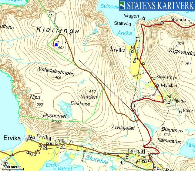
Kjerringa (Norge 1:50,000: 497m, Økonomisk Kartverk: 496,70m, UTM 32 V 298458 6901002) has a primary factor of 334m towards the higher parent Gnullane (508m). The defining saddle (approx. UTM 32 V 300547 6899090) is found west of Blautmyrhammaren. Ref. Økonomisk Kartverk (5m contours), the saddle is within the range 160-165m, interpolated to 163m.
GPS measurement read 495m (on the ground), averaged over a 5-minute period (error margin not recorded).
Google's interactive map. You can zoom, pan and click on the markers.
|
|
|
|
Route 1: From the Vestkapp parking (summer/autumn)
|
|
Access
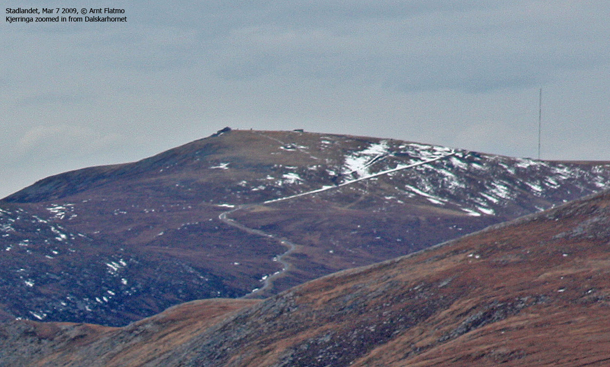
Kjerringa seen from Dalskarhornet
(Click for larger image)
(all distances are approx. distances)
The nearest larger city is Ålesund. From Ålesund, follow highway E39 towards Bergen, and then RV61 towards Hareid. Take the Sulesund - Hareid ferry, and from Hareid, follow RV61 (roughly) 42Km to Årvika, 5,1km from Larsnes.
Take the Årvika - Koparneset ferry, and follow RV61 past Eidså, Fiskå, Sylte and Åheim (32km). At Åheim, turn right towards Stadlandet/Vestkapp. Follow RV620 7,8km. Just after Kjødspollen, turn right towards Stadlandet/Vestkapp. Follow RV620 19,8km to Leikanger. At the Eltvik/Borgundvåg junction, continue straight ahead and drive 11km, passing Dalskaret and lakes Morkavatnet, Sætrevatnet and Dalsbøvatnet along the way.
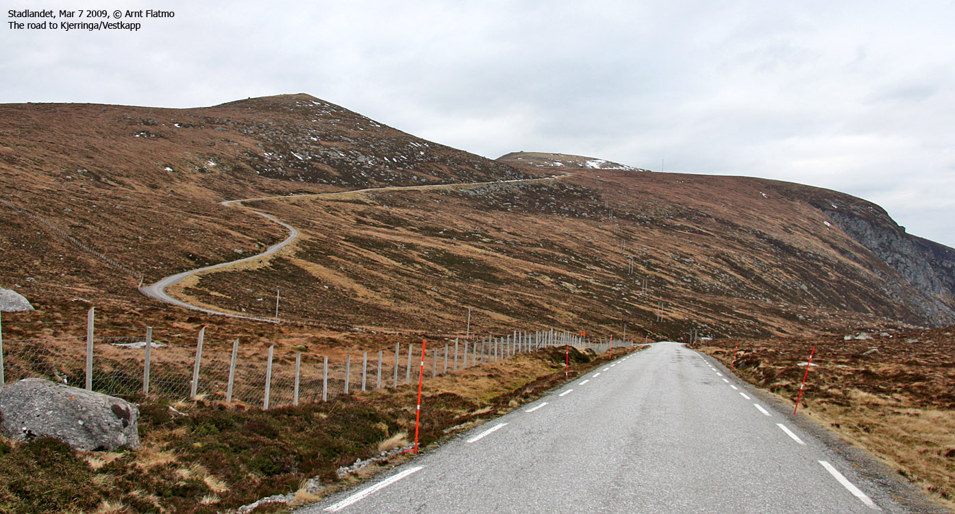
Turn right towards Refsnes/Vestkapp, and follow this road 1,8km. The road to Kjerringa/Vestkapp is now on your left-hand side. Snow (if any) will determine if you can drive the 3,1km up to the Vestkapp parking.
The route
From the parking, follow the road 200m to the summit.


No Javascript:
|
|


