
Norwegian Mountains, Møre og RomsdalNonshornet, 289m (Ytste Nonshornet)
|
| Fylke/Kommune : | Møre og Romsdal/Sande | ||||||
| Maps : | 1119-III Vanylven (Statens Kartverk, Norge 1:50 000) | ||||||
| Primary factor : |
Nonshornet: 289m Skinhammaren: 67m |
||||||
| Hiked : | Mar 2009 | ||||||
| See also : |
| ||||||
| See also : | Other Sande mountains |

Nonshornet seen from Stadlandet
(Click for larger image)
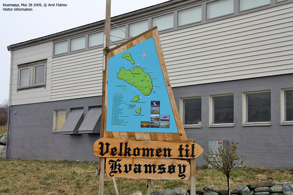
Nonshornet is the highest point on Kvamsøya island, located between Stadlandet and Gurskøya. You get there via the Larsnes-Åram-Voksa-Kvamsøya ferry shuttle, and if you study the vistor info as you get onto the island, you make the most of the time spent on this small island.
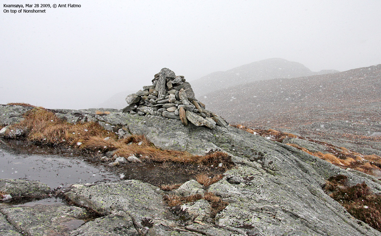
This page will describe a public path to Nonshornet, as well as a detour across Skinhammaren. The views from Kvamsøya are quite good, being located so far towards the ocean. Unfortunately, this page does not offer any panoramic pictures from Nonshornet (thanks to a snowstorm). But you have a look at pictures from Rinden (5,2km to the northeast), you'll get an impression of what the view from Nonshornet is like.
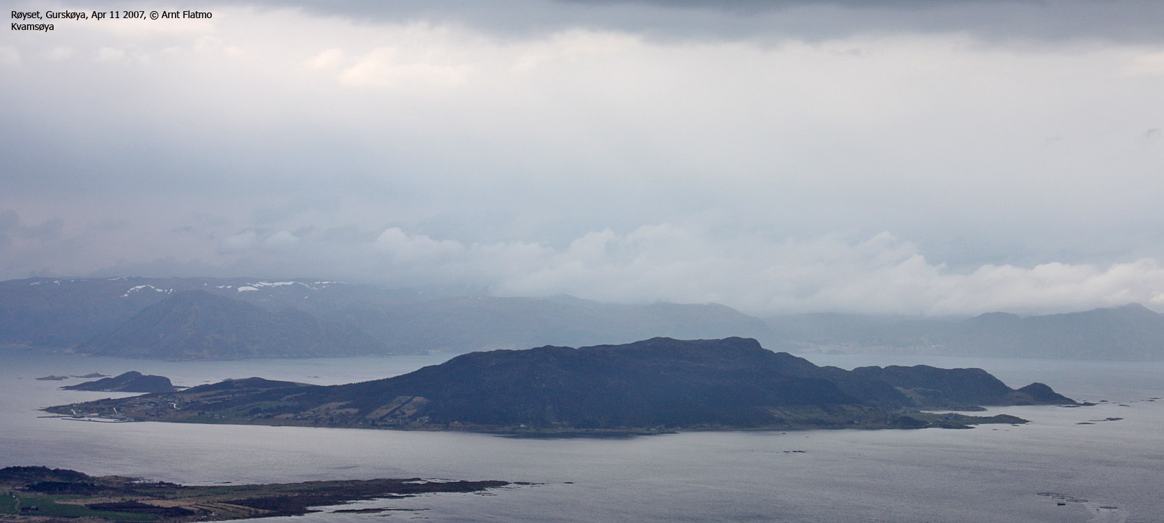
Kvamsøya seen from Gurskøya
(Click for larger image)
Nonshornet (Norge 1:50,000: 289m, Økonomisk Kartverk: Highest contour: 285m, UTM 32 V 311562 6902953) has a primary factor of 289m, being the high point on Kvamsøya island.
GPS measurement read 291m (on the summit cairn, < 1m high), averaged over a 5-minute period (error margin +/- 2,2m).
Skinhammaren (Norge 1:50,000: 272m, Økonomisk Kartverk: 271,89m, UTM 32 V 312820 6902760) has a primary factor of 64m towards the higher parent Nonshornet. The defining saddle (approx. UTM 32 V 312217 6902533) is found in the pass (Blautemyrane) between the two tops. Ref. Økonomisk Kartverk (5m contours), the saddle point is within the range 505-510m, interpolated to 508m.
GPS measurement read 271m (on the ground), averaged over a 5-minute period (error margin +/- 4,4m).

Kvamsøya seen from Sandsøya
(Click for larger image)
Google's interactive map. You can zoom, pan and click on the markers.
|
|
|
|
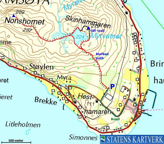
Route 1: Bringsinghaug - Nonshornet - Skinhammaren (summer/autumn)
|
|
Access
(all distances are approx. distances)
The nearest larger city is Ålesund. From Ålesund, follow highway E39 towards Bergen, and then RV61 towards Hareid. Take the Sulesund - Hareid ferry, and from the roundabout in Hareid, follow RV61 3Km to a roundabout outside Ulsteinvik. Continue 5,4Km along RV61 and make a sharp right turn (Måløy/Fosnavåg). Stay on RV61 2,9Km and turn left towards Måløy at Myrvåg. Follow RV61 17,7Km to Larsnes.
Take the Larsnes - Åram - Voksa - Kvamsøya ferry. The ferry goes to Åram first, then to Voksa, then to Kvamsøya and then back to Sandsøya.
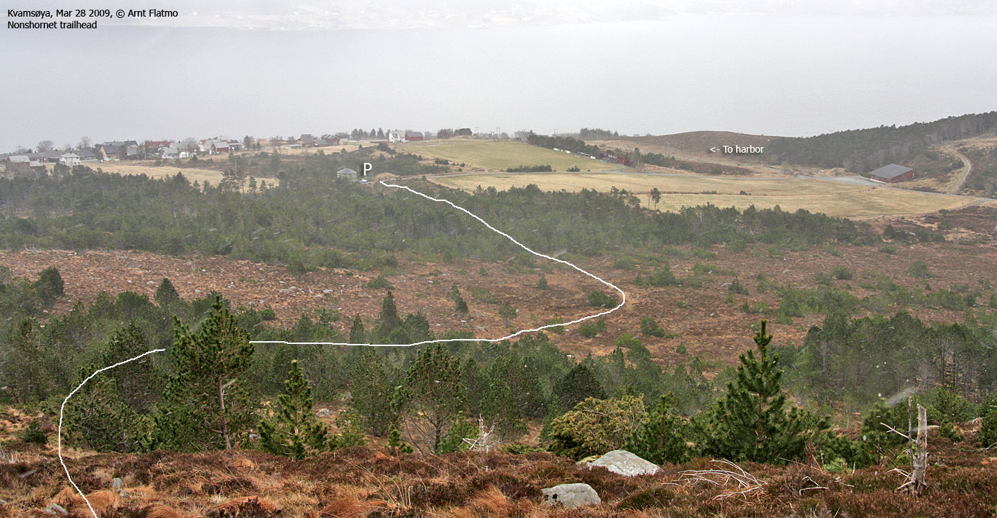
From Bringsinghaug on Kvamsøya, drive 200m, turn right onto the main road, drive 300m, turn left when you see the "Stadion" sign, and then turn right at the Y-fork (this is a 3-way junction). Drive 1,1km until you see a club house on your left-hand side. Turn right onto a narrow road and follow it until it ends by the waterworks. Park here.
The route

The trailhead
(Click for larger image)
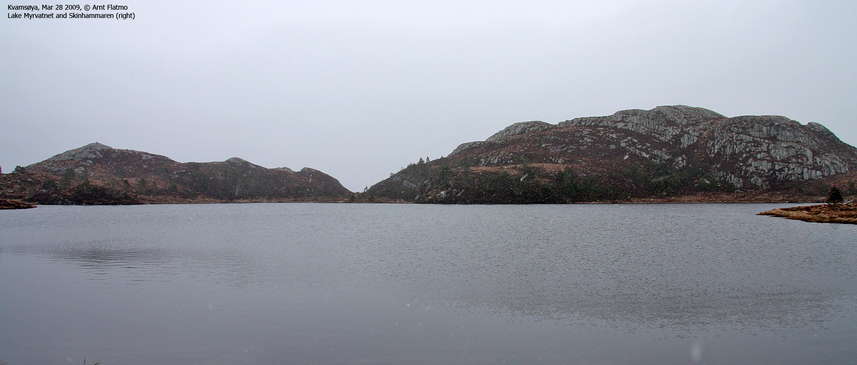
Follow the marked path upwards, and then signs pointing to Nonshornet. The path forks just before Lake Myrvatnet. Go left (if you can see the fork). Both paths lead up to the lake. Stay on the south side of the lake. Skinhammaren is seen on the other side of the lake. You might want to stop by this top upon your return.
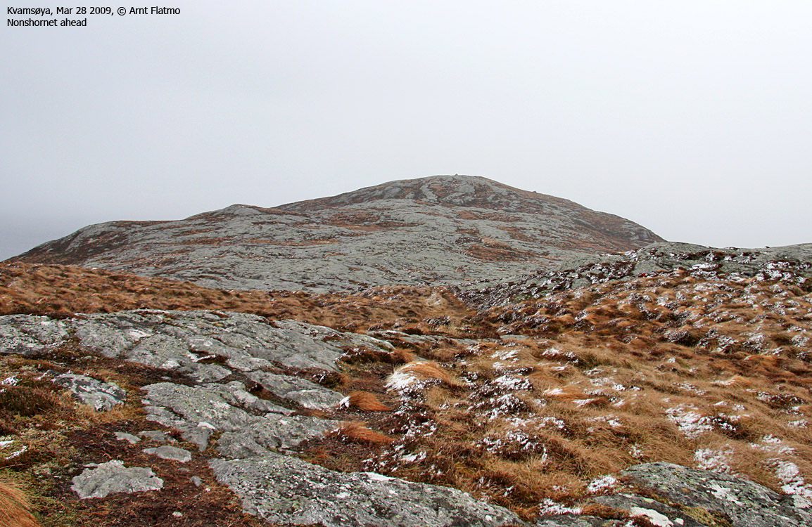
Head down to the Blautmyrane meadows and follow a ridge up to the summit plateau. You cross point 287m, then descend slightly before you ascend Nonshornet and the summit cairn.
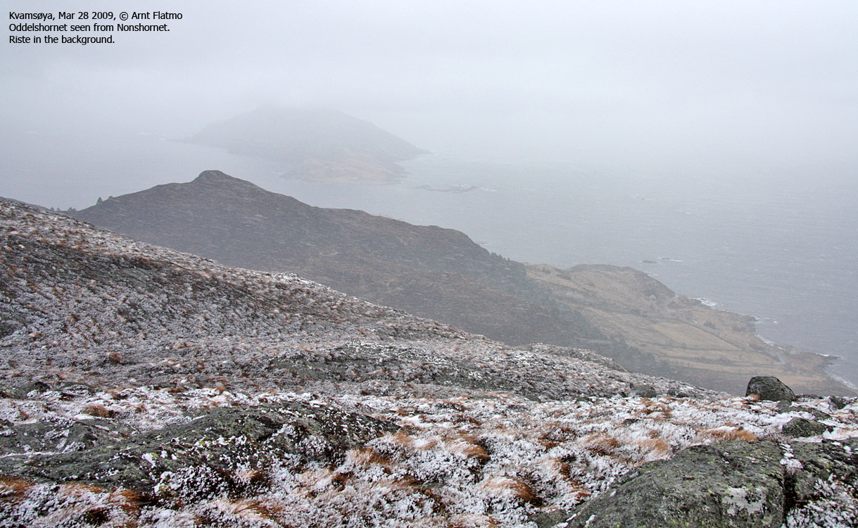
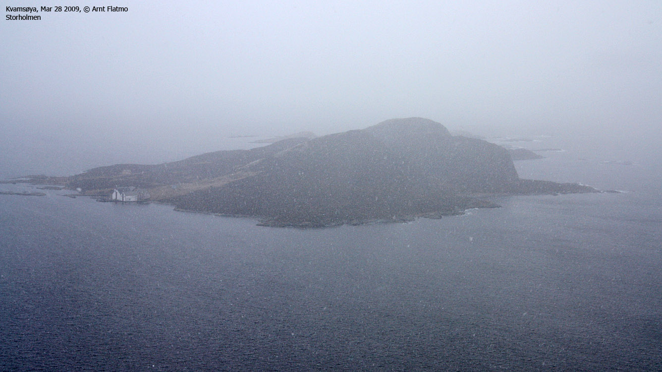
Follow the same route back to Myrvatnet, then turn left and walk around the lake on the north side. Halfway across, leave the path and head off-trail up to Skinhammaren, marked by a trigonometric point. You see the Riste 2,6km to the north and Storholmen 2,3km to the south.
Continue across Skinhammaren, then across (or around) a smaller hump before you are back on the path. Continue on this path until you join your ascent route.
GPS track here (picture only).
Note: From the club house, you can also visit Hesthamaren
(114m, pf 36m), partly along a forest road just above the club house, then
off-trail a few meters up to the top.
 westcoastpeaks.com
Other Møre & Romsdal mountains
Other Norwegian mountains
westcoastpeaks.com
Other Møre & Romsdal mountains
Other Norwegian mountains


