
For Information, maps, trailhead and route descriptions, click HERE.
Earlier in the day, my Mom and I had visited Kjøsvikfjellet. After driving back to Brønnøsund and enjoyed a well-deserved dinner, my feet got a bit restless in the afternoon. The weather was just fine, but we were just waiting for the rain to move in during evening. I figured I should do *something* before the rain sat in, and decided to go for Lysingen. I don't even think Mom raised her eyebrows, as it's perfectly normal to "run" from one mountain top to the other, day after day, year after year..
Given the unclear weather situation, I hoped that I could drive along Lake Holandsvatnet. But a sign told me this was prohibited, and by 15:28PM, I headed out from the public parking at the northwest side of the lake. Generally pissed about roads that are closed to the public. After a small detour, I was on the tractor road 15:40PM. This was a pleasant surprise, as I didn't know there was any. The tractor road led me through the denser forest, all the way to 120m elevation. But parts of the road was insanely muddy. But going off-trail didn't seem as a better alternative.
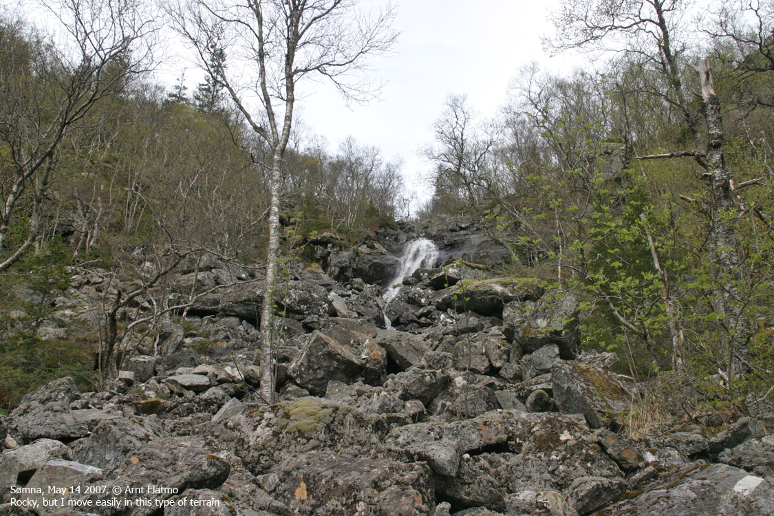
I headed up for the waterfall, and noticed - to my joy - that the waterfall area was one huge boulder area. I move pretty fast across boulder, and don't spend much energy (opposed to on grass). Above the waterfall, I crossed a slightly boring meadow. To relieve myself from boredom, I decided to hike IN the river. The fun side of this hike got restored.
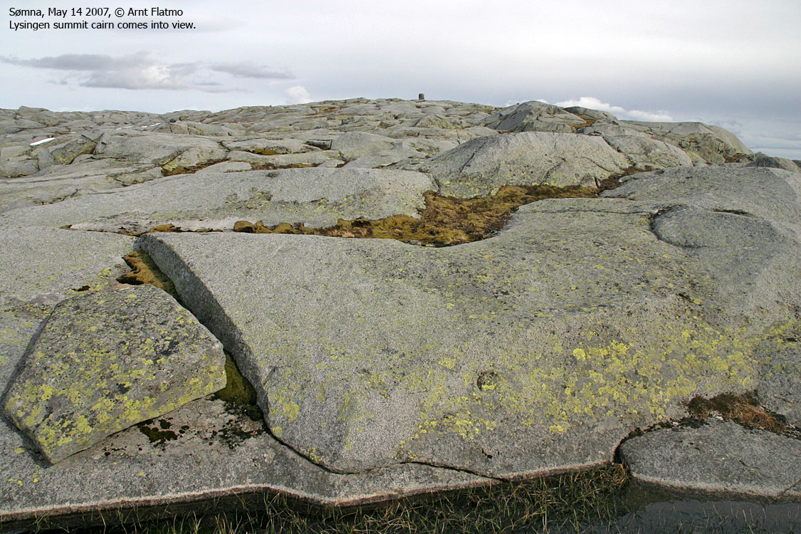
Hiking IN the river means jumping from rock to rock, and my pace wasn't bad. Besides, I could drink-water-on-the-fly. Everything was going just well, and the rain didn't seem to arrive for yet a couple of hours. Eventually I got the summit cairn in view, and by 16:55PM I was standing next to it. According to my friend Petter Bjørstad, this was the 157th FINEST top in Nordland, and the 47th FINEST top in Helgeland. I'll be happy to discuss the term "FINEST", especially for this mountain, but the primary factors cannot be argued.
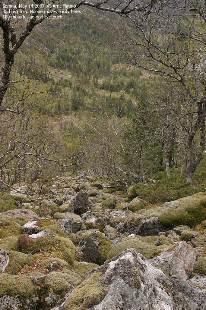
After pictures, I left the summit 17:05PM, descended my ascent route and was back at the trailhead 18:10PM. I figured that was a fairly quick hike down the mountain. The moss on the rocks in the boulder was simply dangerous. Back home, I concluded that my short visit to northern-Norway had been quite effective. Four tops and one confirmation in two days. The next morning, my Mom and I headed to Kjølsfjellet.
(Help text (ALT) is available when your cursor is above the thumbnails. Make sure you've got the ALT switch turned on in your browser)
To the waterfall


To Lysingen


Wide-angle view from Lysingen

50mm views from Lysingen, 2 parts


Zoom views from Lysingen, 2 parts


No Javascript:
0 1 2 3 4 5 6 7 8 9 10 11 12 13 14 15 16 17 18
 westcoastpeaks.com
Other Nordland mountains
Other Norwegian mountains
westcoastpeaks.com
Other Nordland mountains
Other Norwegian mountains