
Norwegian Mountains, Møre og Romsdal
|
| Fylke/Kommune : | Møre og Romsdal/Hareid | ||||||||
| Maps : | 1119-I Ålesund (Statens Kartverk, Norge 1:50 000) | ||||||||
| Primary factor : | 560m | ||||||||
| Hiked : | Mar 2006 (first time) | ||||||||
| See also : |
| ||||||||
| See also : | Other Hareid mountains |

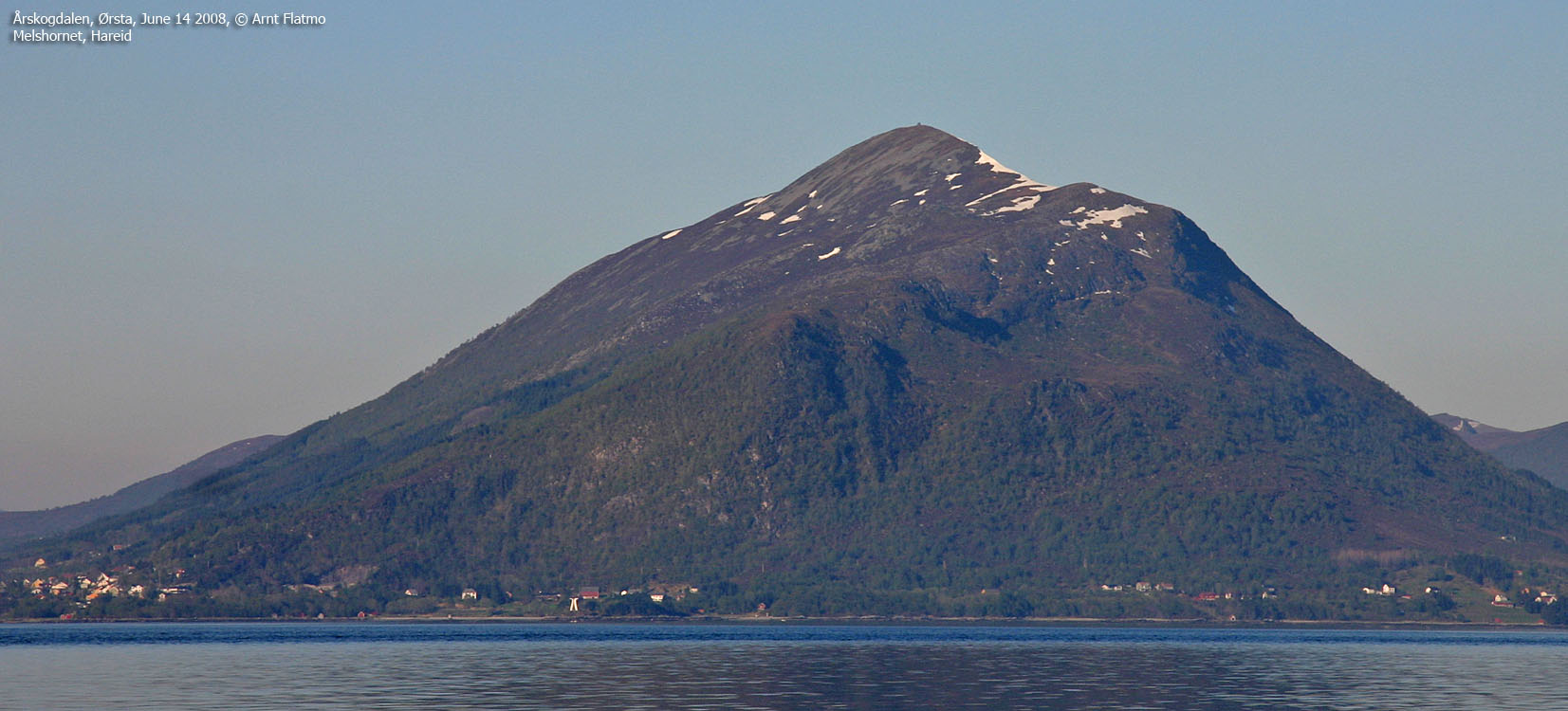
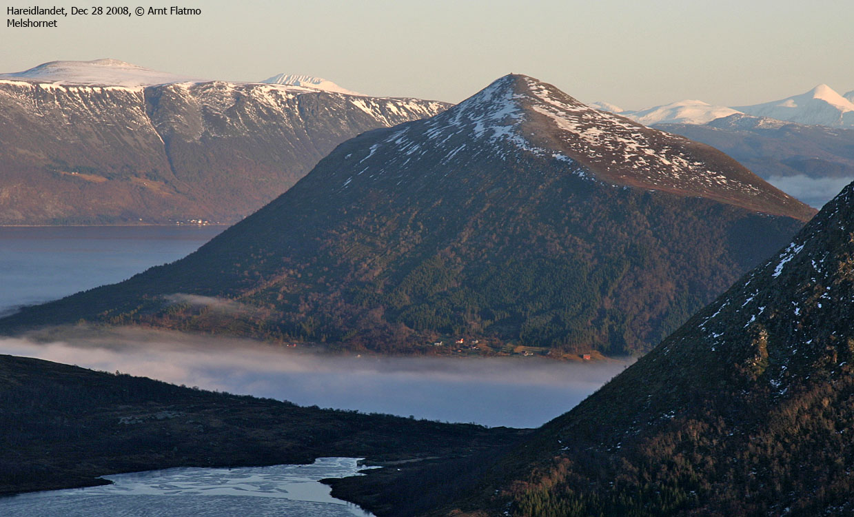
Melshornet (The Flour horn) is perhaps the most characteristic and popular mountain on the Hareidlandet island. Routes run both from Hareid and Ulset, and the Ulset route is described on this page. It wrong to say that the mountain is ideal for skiing. True, the upper side can offer a good run, but the lower forest doesn't provide optimal skiing conditions.
The mountain is the third highest on Hareidlandet, preceded in elevation by Blåtind (697m) and Kongsvollen (683m). Its primary factor is however the second highest, only outranked by Blåtind which is the island high point. Melshornet is also the second highest mountain in Hareid kommune, following Kongsvollen (Blåtind is located within Ulstein kommune).
Melshornet is a tremendous viewpoint and was (as such) a part of the coastal defence system in the earlier ages. The summit beacon was torched during "Jonsok" (mid-summer day) in 1880. The beacon was then rebuilt and became a pointy cairn, like it used to be. During the occupation in WW2, the Germans added volume to this cairn, to dismay among the local people.
On the summit, you will also find a circular viewfinder. Read all about this device on hjorungavaag.com (Norwegian text).

Melshornet (Norge 1:50,000: 668m, Økonomisk Kartverk: Highest contour: 665m, UTM 32 V 345960 6916521) has a primary factor of 560m towards the higher parent mountain Kongsvollen (683m). The defining saddle (approx. UTM 32 V 344870 6913602) is found near Ulset. Ref. Norge 1:50,000 (20m contours), the saddle is within the range 105-110m, interpolated to 108m.

Hareidlandet. Melshornet to the right

(Click for larger image)
Google's interactive map. You can zoom, pan and click on the markers.
|
|
|
The route descriptions are valid per Nov
2010.
|
Route 1: Ulset - Melshornet (summer/autumn)
|
|
Access
(all distances are approx. distances)
The nearest bigger city is Ålesund. From here, follow highway E39 towards Bergen, and then highway RV61 towards Hareid. Take the Sulesund - Hareid ferry and follow RV61 (roughly) 3Km in the direction of Ulsteinvik.
Turn left at the "Røyset" junction (signposted, N62.35999 E5.97626). After 1Km on this road, stay right in a Y-fork. Drive along Lake Snipsøyrvatnet, and roughly 4km after the previous junction, you meet an intersecting road. Turn left and drive uphill for 650m. After passing a couple of houses, locate a tractor/forest road on your left-hand side. Find parking here (N62.32422 E6.00597), if permitted.
The route

From the parking, follow the tractor road for 900 meters where the forest path begins (N62.33131 E6.00657). The path is well-worn and easy to follow up Melshornet's southwest ridge. The summit (N62.34799 E6.02398) is marked by a circular viewfinder and a huge cairn.
 westcoastpeaks.com
 Other Møre & Romsdal mountains
 Other Norwegian mountains