
|


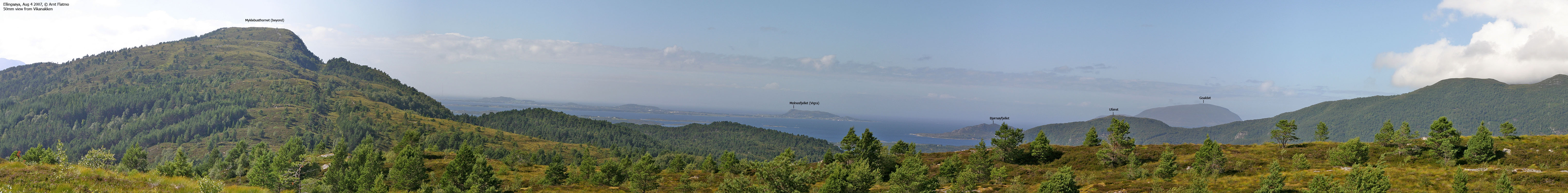
The coastal mountain Molnesfjellet is the highest point on Vigra island, Giske kommune on Sunnmøre - one of three regions in Møre og Romsdal county. The summit is located just 3Km north of the runway on Vigra airport (a great place for planespotting..), and is just a short drive away from the city of Ålesund.
Molnesfjellet is an exposed point, directly facing the north sea and the regular winds from the southwest. I came upon this great photo by Rune Werner Molnes, which captures the mountain versus the weather. For more pictures from the area, visit Galleri Molnes, which is located next to the Molnesfjellet trailhead.
In addition to being a wildlife preserve, the area is popular as a recreation area. Paths surround, and traverse the mountain. This web-page only describes the shortest route up to Molnesfjellet summit.
Molnesfjellet (M711: 122m, Ø.K.: 122,39m, UTM 32 V 350617 6942764) has a primary factor of 122m, being the Vigra island high point.
Notes: Class ratings are in reference to YDS. Click here for more information.
The trails described below are not necessarily the *easiest* trails to this mountain.
|
Molnes - Molnesfjellet (all seasons)
|
|
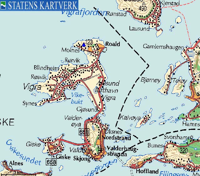
Access
From Ålesund, follow highway RV658 towards Vigra (airport). On Vigra; from the junction where you have to turn left towards the airport, continue 1,5Km on RV658. Turn right towards "Roald" and drive 600m before you turn left towards "Molnes". Follow the Molnesvegen road 2Km until you reach the parking next to Galleri Molnes.
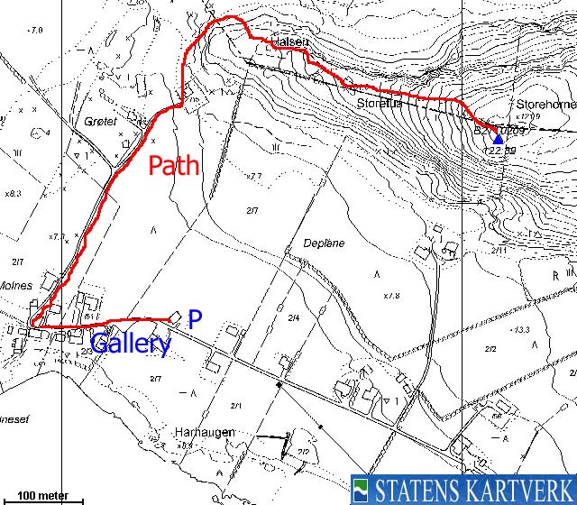
The route
Follow the gravel road westbound between the houses and then turn 90 degrees and follow a gravel road that heads towards Molnesfjellet's west ridge. Walk around the lower ridge and follow a path that takes you onto the west ridge. Continue up to the top, which is marked by a trig. point.


No Javascript:
 westcoastpeaks.com
Other Møre & Romsdal mountains
Other Norwegian mountains
westcoastpeaks.com
Other Møre & Romsdal mountains
Other Norwegian mountains


