
For Information, maps, trailhead and route descriptions, click HERE.
Background:
I was excited to visit my first Vanylven mountain this fine Friday afternoon. The weather was just great, but the light wasn't favorable for pictures. This was of no big concern, especially because I would be targeting the higher Vanylven mountains on sunny days.
These afternoon hikes in Søre Sunnmøre make for long days. Up early in the morning to travel from Ålesund to Ulsteinvik (1h:10m). Getting from Ulsteinvik to Åram takes close to the hour, when you're aligning with the ferry schedule. Getting on the ferry to Åram can be quite chaotic. Cars to Sandsøya and Kvamsøya have to enter the ferry in reverse, while the cars to Åram don't. If there had been two lanes, this would have been trivial, but there's only one.
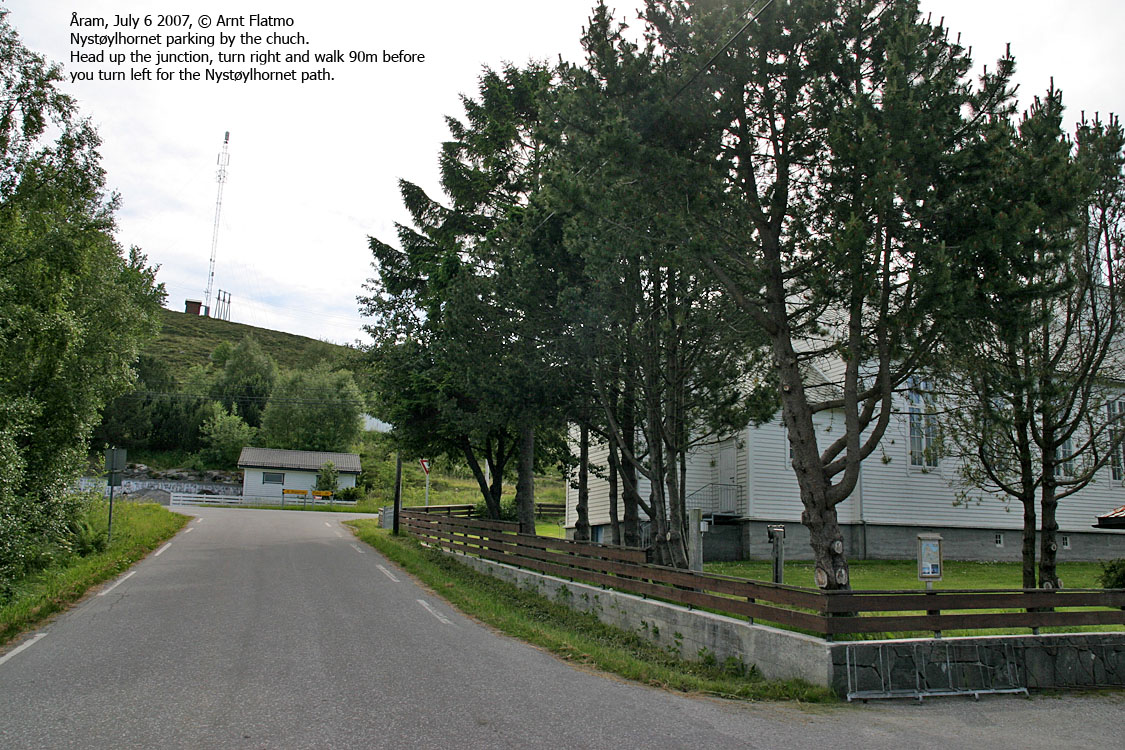
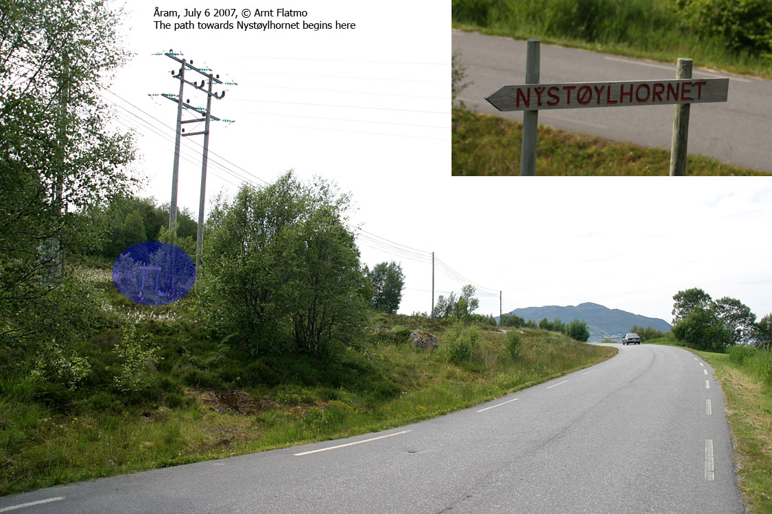
As the path to Nystøylhornet ran directly up from Åram, there was no need to bring the car, but I did it anyway. I didn't know how long I would have to wait for the returning ferry, and then a laptop is nice to have at hand. The night before I was pondering on where to hike from. Since I was bringing my dog, it would be convenient with a path. Since there was no path to be found on the map, I had to do some research.
On the internet, I found that Gursken I.L (Trimgruppa) had arranged trips to Nystøylhornet. I looked up their website, and gave the Chairman a call. The Chairman was a nice lady named Mariann, who actually recognized my name from my website. She explained everything I needed to know about getting to Nystøylhornet.
Up the mountain:
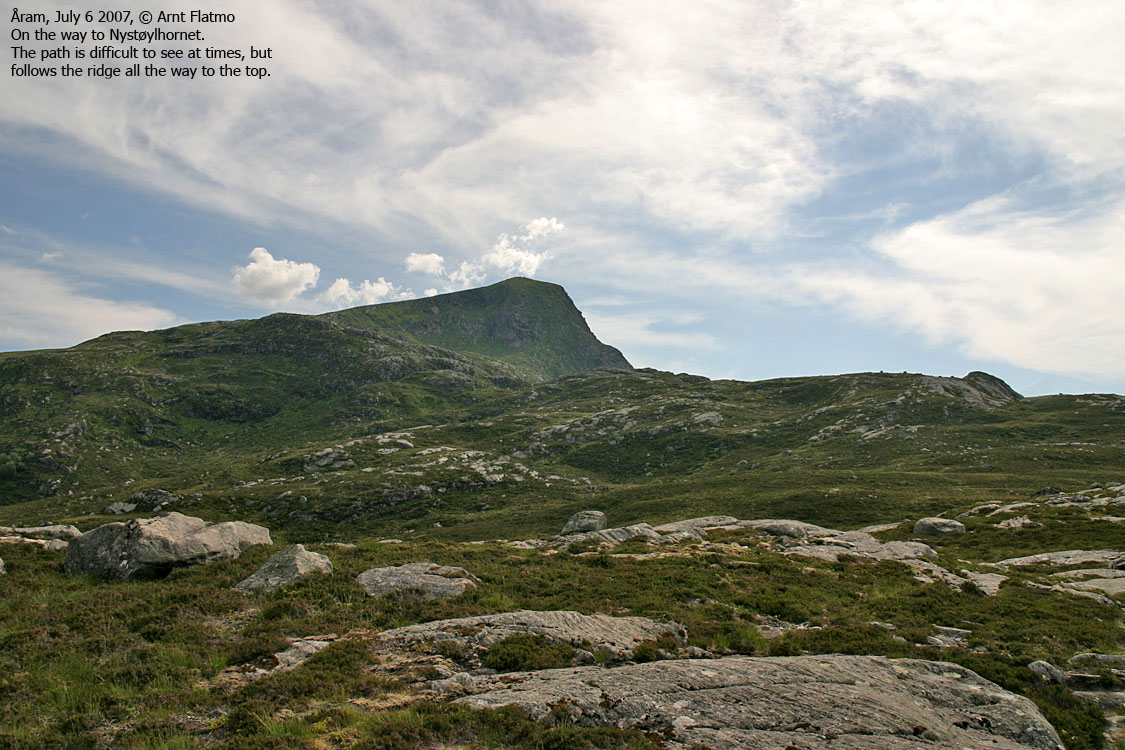
I parked by the church and was on my way 16:20PM. I was carrying the dog. It was too hot for him to try walking uphill. He's a very senior dog now, and there is no point in losing him prematurely. The path was vague, but easy to follow. It was intensely hot and there were flies. I was hoping for a light breeze, but didn't get any.
Mariann assumed that I would reach the top within the hour. She had a perception about me walking waster than the average hiker. How in the world did she get that idea? In order to do that, and with 600 vertical meters, the terrain has to be fairly steep. But it wasn't, and I was "lagging behind". But still, I must have kept a reasonable pace (considering the backpack weight and the temperature - 25 deg. C.), because I reached the top 17:20PM - on the minute!
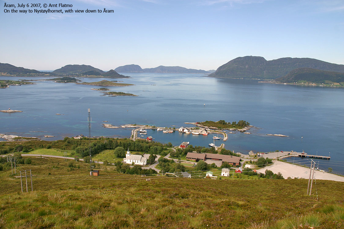
I had one litre of water. I had a small zip and gave the rest of the water to the dog. That didn't seem quite enough, but that's all there was. The light was just as bad as I had expected, and wasn't very happy about the pictures. The views however, were just excellent.
Going home:
Troll volunteered to give walking a try, and did a good job down the rocky upper side. With his mouth wide open, all the way. We were back down in Åram 18:40PM and had 35 minutes before the ferry arrived. Fortunately, there was running water in the graveyard behind the church, otherwise I would have to knock on doors. I had soda water in the car, but the dog needed water. Amounts of it, too.
As the next ferry from Hareid ran 20:00PM, there was no rush. I was home just before 21:00PM, and it had been yet another long day on the road.
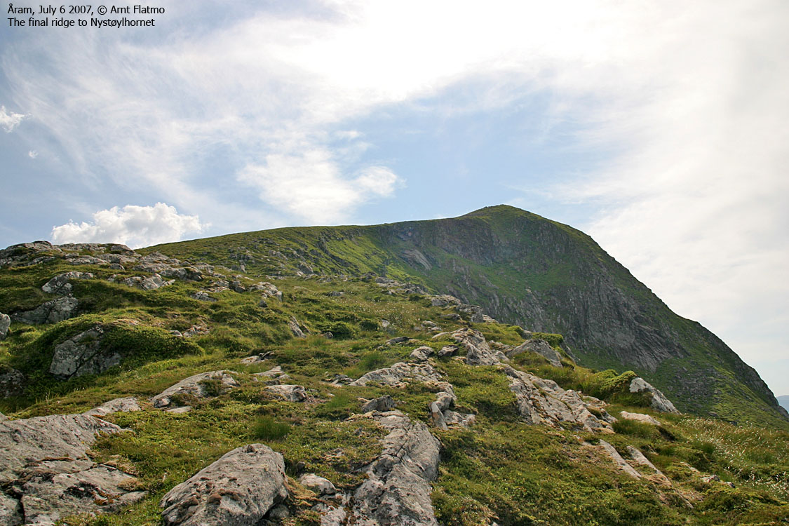
To Nystøylhornet


Wide-angle view from Nystøylhornet

48-88mm views from Nystøylhornet


Various zoom views from Nystøylhornet


Descent


No Javascript:
1 2 3 4 5 6 7 8 9 10 11 12 13 14 15 16 17 18 19 20 21
 westcoastpeaks.com
Other Møre & Romsdal mountains
Other Norwegian mountains
westcoastpeaks.com
Other Møre & Romsdal mountains
Other Norwegian mountains