
Norwegian Mountains, Møre og RomsdalMelshornet, 807m
|
| Fylke/Kommune : | Møre og Romsdal/Ørsta,Volda | ||||||||||||
| Maps : | 1119-II Volda (Statens Kartverk, Norge 1:50 000) | ||||||||||||
| Primary factor : |
Melshornet: 564m Vardehornet: 60, | ||||||||||||
| Visited : | Mar 2008 | ||||||||||||
| See also : |
| ||||||||||||
| See also : | Other Ørsta and Volda mountains |

Melshornet
(Click for larger image)
Melshornet (Flour horn) is located between the villages Ørsta and Volda, and the municipality border runs across the summit. This mountain should not be confused with Melshornet on Hareidlandet island.
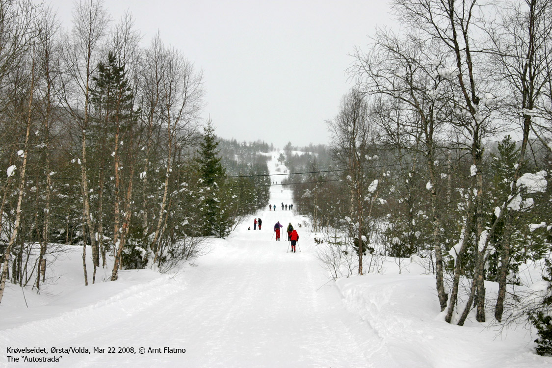
Melshornet is a popular mountain all year around, and especially in winter. It would be tempting to nominate Melshornet as one of the most popular skiing mountains in western Norway, measured on number of visitors during the skiing season. Many factors point to this; number of citizens in this region, the snow stays long, the tracks are prepared (all the way to the top), the mountain is fairly low, the distance to the top is short and there are no steep parts. In other words, Melshornet is a mountain that fits everyone.
There are several summer paths that lead to Melshornet. This page will describe the normal winter route from Krøvelseidet and a popular route from Volda. The view from this top is very good.
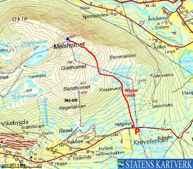
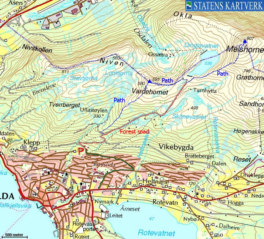
Melshornet (Norge 1:50,000: 807m, Økonomisk Kartverk: 807,08m, UTM 32 V 351240 6896823) has a primary factor of 564m towards the higher parent mountain Koppefjellet (940m). The defining saddle (approx. UTM 32 V 353356 6894389) is found on Krøvelseidet. Ref. Økonomisk Kartverk (5m contours), the saddle is within the range 240-245m, interpolated to 243m.
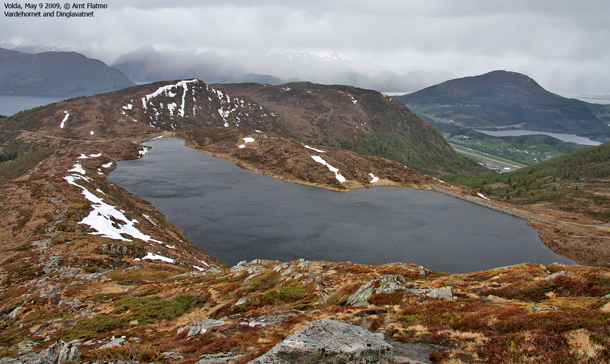
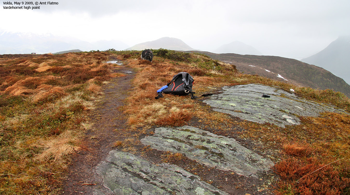
Vardehornet (Norge 1:50,000: 595m, Økonomisk Kartverk: 600m, UTM 32 V 349407 6896088) has a primary factor of 60m towards the higher parent mountain Melshornet. The defining saddle (approx. UTM 32 V 350560 6896463) is Lake Dinglavatnet. According to the map, this lake seem to drain in two directions. Ref. Økonomisk Kartverk (5m contours), the lake is 540m above sea level.
Google's interactive map. You can zoom, pan and click on the markers.
|
|
|
Notes: Class ratings are in reference to YDS. Click here for more information.
The trails described below are not necessarily the *easiest* trails to this mountain.
|
Route 1: Krøvelseidet - Melshornet (winter)
|
|
Access
(all distances are approx. distances)
From Ålesund, follow highway E39 towards Bergen/Volda to the ferry at Solavågen. Take the ferry over to Festøy, turn right at Festøy and follow E39 towards Ørsta (38,3Km). In the highway RV655/E39 junction in Ørsta, follow RV655 (Sæbø). Follow this road 8,8Km into Åmdalen and turn right towards Volda.
Drive up to Krøvelseidet (3,4-3,6Km) and find parking alongside the road. The skiing route begins by Helgatun (UTM 32 V 352944 6894627)
The route

The winter route
(Click for larger image)
The entire route is shown on the picture above. At least in the Easter time, the tracks are normally prepared, and they lead all the way to the top. Actually, the word tracks is misleading. The prepared route is an autostrada.
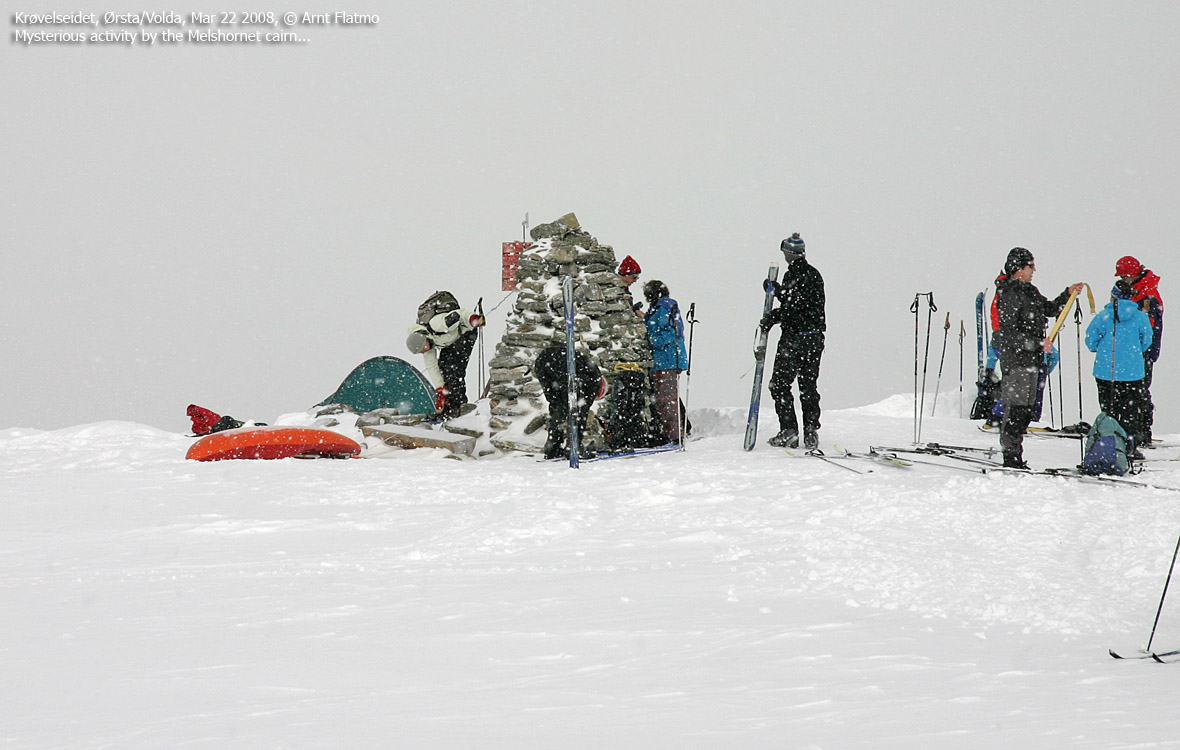
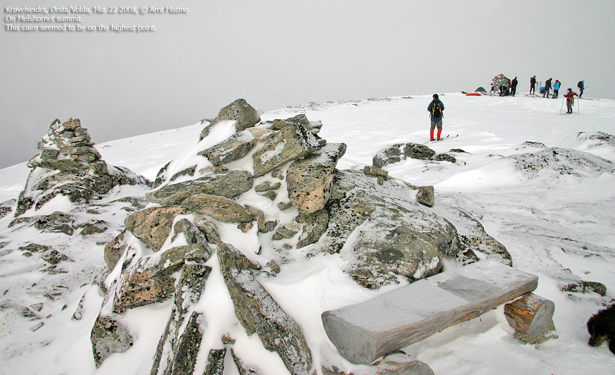
Melshornet summit is marked by a proper cairn, and two smaller cairns 50m to the south. The southernmost cairns seem to mark the highest point, marginally higher than the point where the main cairn is located.
You have many options for descent. If you descend the prepared route, be considerate towards others, as this is a very popular skiing route.
|
Route 2: Volda - Melshornet (summer)
|
|
Access
(all distances are approx. distances)
The nearest bigger city is Ålesund. From Ålesund, follow highway E39 towards Bergen/Volda to the ferry at Solavågen. Take the ferry over to Festøy, turn right at Festøy and follow E39 towards Ørsta (38,3Km). At the highway RV655/E39 junction in Ørsta, keep following E39 (Volda) for 9Km until you have the ferry harbor in Volda on your right-hand side.
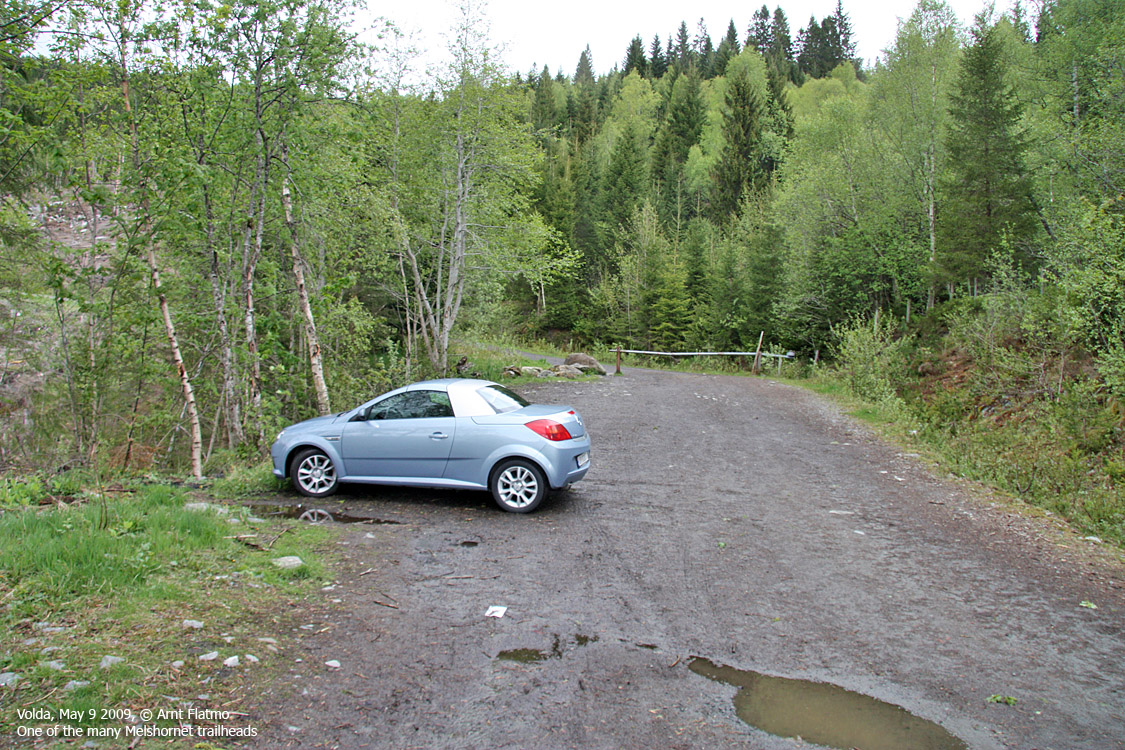
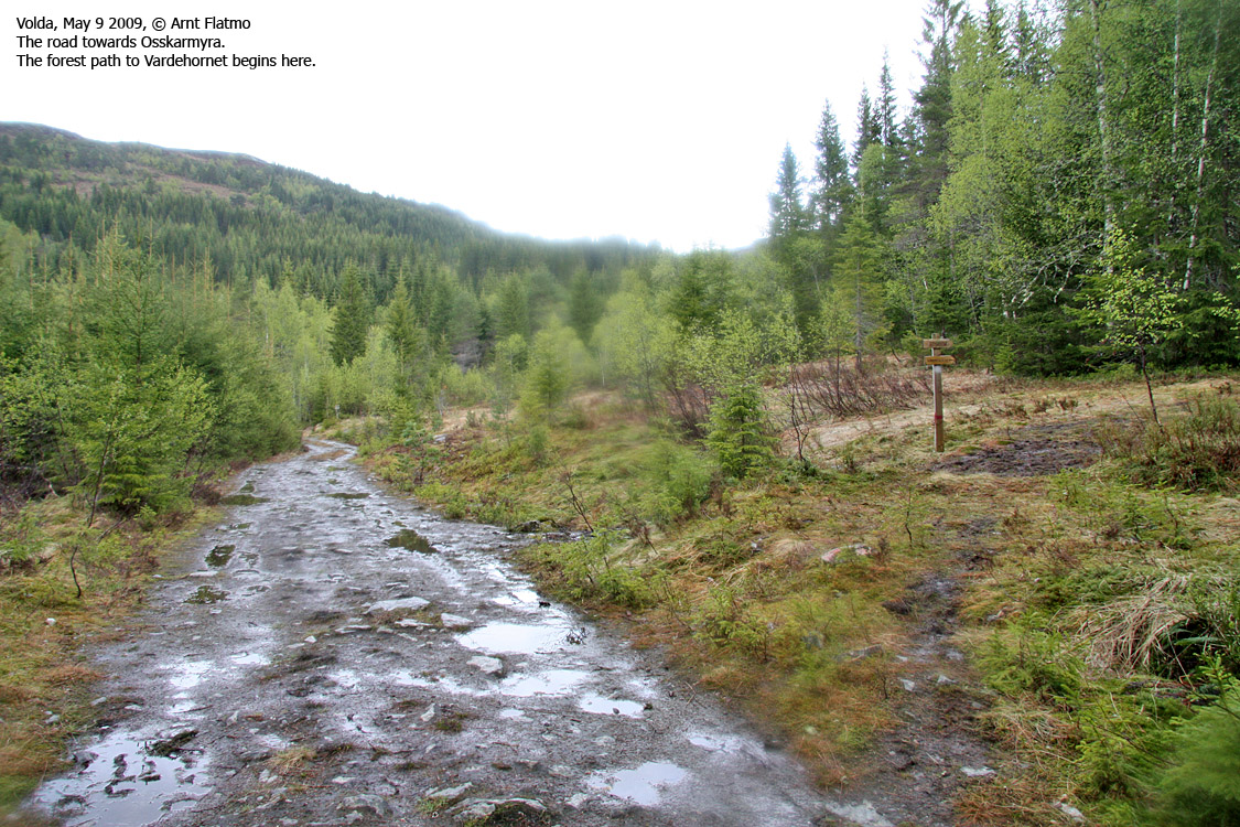
Drive 750m along RV651 through Volda and turn left in the Andaneset junction (signposted). Drive 800m to a roundabout. Go straight ahead, then turn left after 100m onto Heltnevegen. Drive 850m, turn left and drive 1,1km until you reach a gate that marks the beginning of the forest road. Park here.
The route

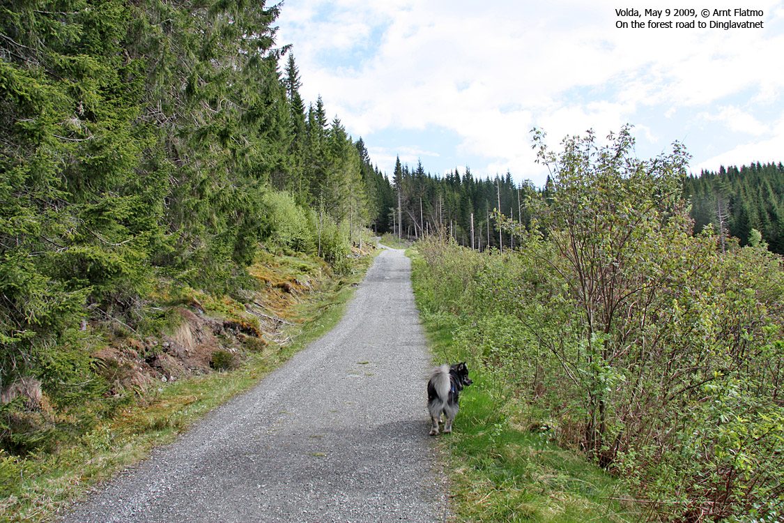
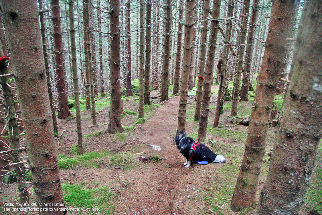
The forest road from Volda
(Click for larger image)
Follow the forest road almost up to Dinglavatnet (approx. 3,1km). Turn right onto a path that runs along the ridge in the direction of Melshornet. Follow this path all the way up to the top. You pass - what appears to be the high point - 50m before the trigonometric point.
Upon descent, consider hiking Vardehornet from Dinglavatnet. A path runs up the ridge. From the (unmarked) high point, follow the path down to the trigonometric point and the cairn. Follow a path that runs southwest down the forest. This path leads you to another forest road. Turn left. The forest road you ascended along is only 150m down the road.
 westcoastpeaks.com
Other Møre & Romsdal mountains
Other Norwegian mountains
westcoastpeaks.com
Other Møre & Romsdal mountains
Other Norwegian mountains


