
Norwegian Mountains, Møre og RomsdalOppstadhornet, 737m
|
| Fylke/Kommune : | Møre og Romsdal/Midsund | |||||
| Maps : | 1220-II Vestnes (Statens Kartverk, Norge 1:50 000) | |||||
| Primary factor : | Oppstadhornet: 737m | |||||
| Primary factor : | Heggdalshornet: 176m | |||||
| Hiked : | Aug 2007, Apr 2008 | |||||
| See also : |
| |||||
| See also : | Other Midsund mountains |
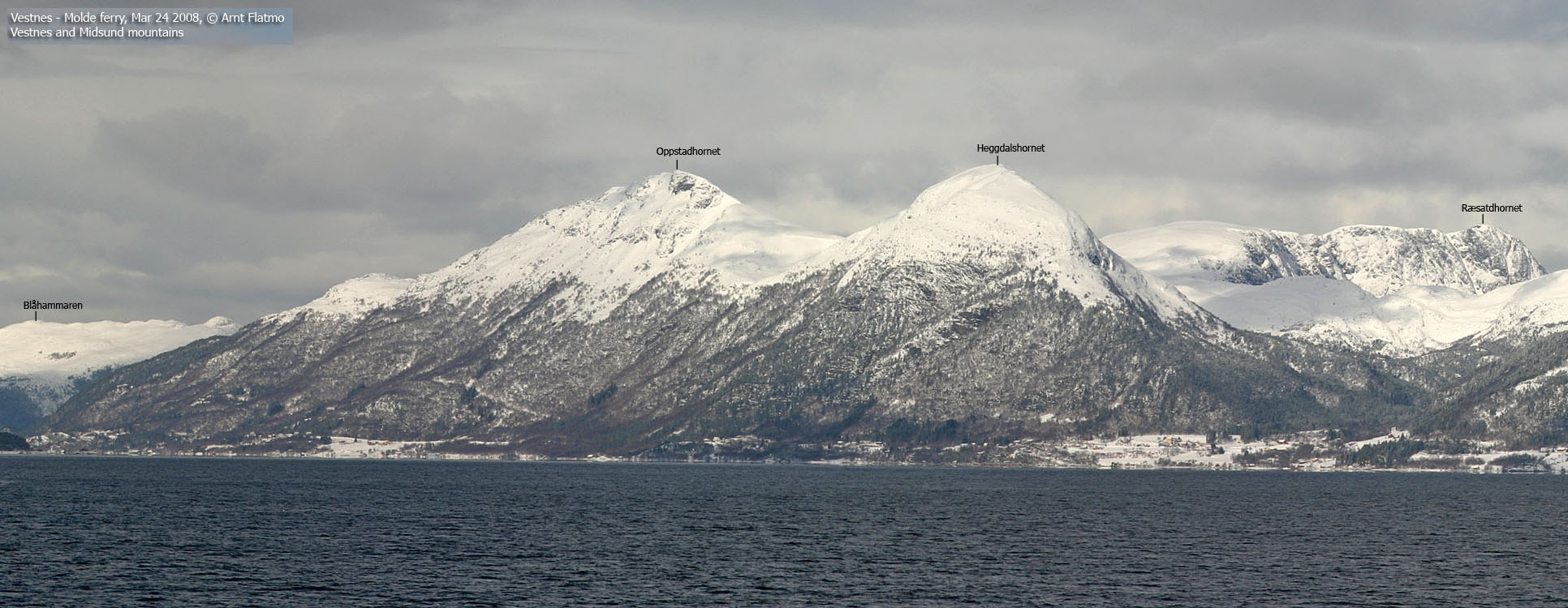
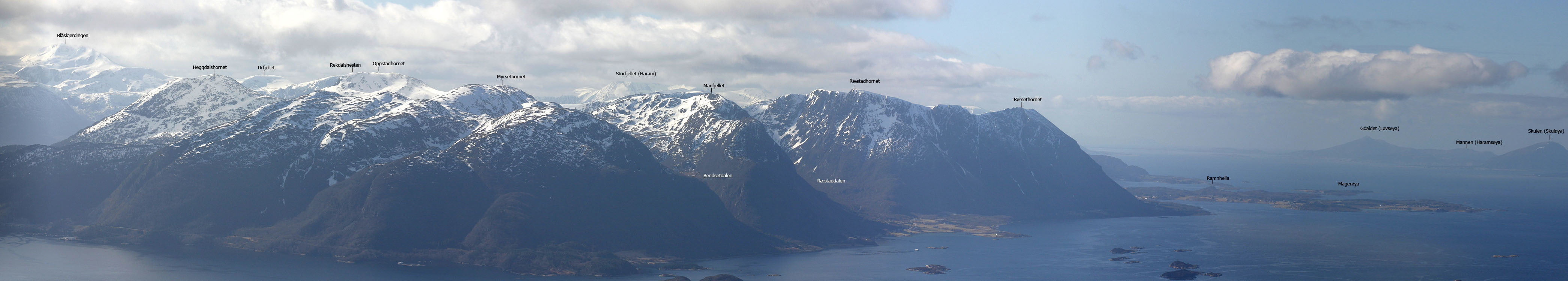
Oppstadhornet and Heggdalshornet
(Click for larger image)
Oppstadhornet is the highest point on Otrøya island and in Midsund kommune. Otrøya island was formerly presented as Otterøya on some maps. Thus, a number of pictures on westcoastpeaks.com refer to the island as Otterøya. The present official name is Otrøya.
Heggdalshornet is the 4th highest independent top on the island. Both tops have steep faces towards the south. A number of ridges and couloirs can be explored by the curious ones. Besides the steep south face, Oppstadhornet and Heggdalshornet are mountains that are easy to reach on their easiest routes.
Oppstadhornet, along with Åkernesremna (Synnylvsfjorden) and Hegguraksla (Tafjord) are potentially dangerous mountains as large parts of the mountain can possibly to fall into their respective fjords, in turn causing tsunamies with catastrophic proportions. Oppstadhornet is considered safer than Åkernesremna, but is nevertheless closely monitored by geologists.
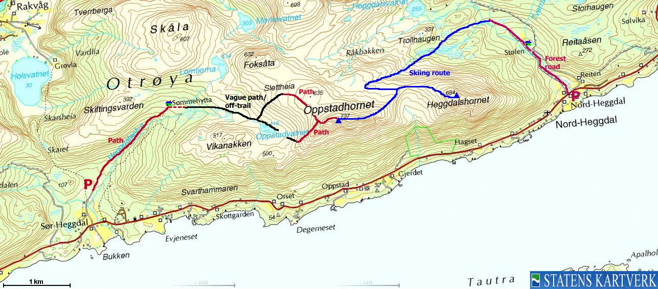
Both mountain tops can be reached from Sør-Heggdal and Nord-Heggdal. This web page will describe a summer route from Sør-Heggdal to Oppstadhornet and a winter route from Nord-Heggdal to both tops. Both routes are described in the book Turbok for Molde og Omegn (Olsen/Pedersen)

Oppstadhornet (Norge 1:50,000: 737m, Økonomisk Kartverk: 736,75m, UTM 32 V 389508 6953889) has a primary factor of 737m, being the highest point on Otrøya island.
Heggdalshornet (Norge 1:50,000: 684m, Økonomisk Kartverk: 683,58m, UTM 32 V 391281 6954234) has a primary factor of 176 towards the higher parent mountain Oppstadhornet (737m). The defining saddle (approx. UTM 32 V 390524 6954366) is found between the two tops. Ref. Økonomisk Kartverk (5m contours), the saddle is within the contours 505-510m, interpolated to 508m.
Google's interactive map. You can zoom, pan and click on the markers.
There is a slight incaccuracy on the markers (seen when zoomed in). This will be
fixed soon.
|
|
|
Notes: Class ratings are in reference to YDS. Click here for more information.
The trails described below are not necessarily the *easiest* trails to this mountain.
|
Route 1: Sør-Heggdal - Oppstadhornet (summer)
|
|
Access
(all distances are approx. distances)
From Ålesund, follow highway E136->E39 towards Åndalsnes. From the E136/E39/Olsvika roundabout near Breivka, follow E39 13,3Km. Turn left onto highway RV661 (Skodje/Brattvåg/Vatne). Pay toll at an unmanned toll booth (coins + credit cards, AutoPass) 1,5Km later. 8,7Km after you left E39, you reach the 659(Brattvåg)/661(Vatne) junction. Turn left towards Brattvåg.
13,6Km later (from this junction), turn right towards the ferry to Dryna, and continue 600m down to the ferry harbor.
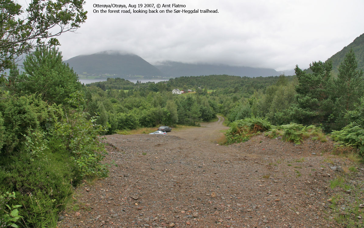
On Dryna, turn right on RV668 and follow signs to Molde. After passing Midøya island and entering the place Midsund on Otrøya island, turn right towards Heggdal (signed). Drive 6,2Km and turn left onto a gravel road signed Skarsvegen. Drive this road 600m, passing a wooden, narrow bridge along the way. There is a motorcross field to your left. Park here.
The route
Ascent:
From the parking (UTM 32 V 385882 6952851), head northeast on a forest road. After 550m, the forest road turns into a forest path and continues northeast along Heggdalselva river, on the west side of the river. At one point, parts of the hillside has fallen into the river. On the other side of the river, you'll see an even greater landslide.
At 240m elevation, there is another forest path to your left. You may not see it upon ascent, but it is easy to make the wrong turn upon descent. Do not follow this path. Proceed northeast to Sømmehytta cabin at 360m elevation (UTM 32 V 387607 6954117).
From this cabin, continue eastbound on a less pronounced path. Once out of the forest, head southeast and pass Lake Oppstadvatnet on the north side. Aim for the low pass between Oppstadhornet and Vikanakken.
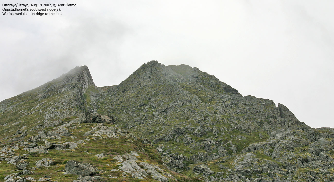
From the pass, you'll see two ridges leading up to Oppstadhornet. Follow the leftmost ridge, which gradually gets more and more exposed to the south. Half-way up the ridge, look to the right, and see the distinct crack that can eventually lead to a tsunami in the Romsdalsfjorden fjord.
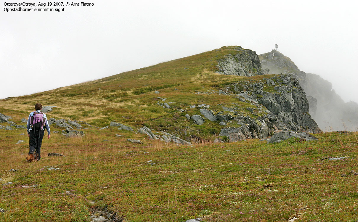
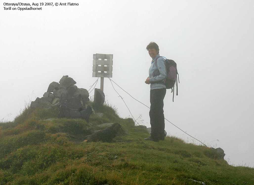
Above the ridge, proceed on gentle terrain up to the Oppstadhornet summit, marked by a trigonometric marker and a small cairn.
Descent:
Descend your ascent route until you reach the SW ridge. Head northwest on a vague path leading down to Slettheia. Follow this path in the direction of Foksåta and gradually descend towards your ascent route.

|
Route 2: Nord-Heggdal - Heggdalshornet - Oppstadhornet (winter)
|
|
Access
(all distances are approx. distances)
From Ålesund, follow highway E136->E39 towards Åndalsnes. From the E136/E39/Olsvika roundabout near Breivka, follow E39 13,3Km. Turn left onto highway RV661 (Skodje/Brattvåg/Vatne). Pay toll at an unmanned toll booth (coins + credit cards, AutoPass) 1,5Km later. 8,7Km after you left E39, you reach the 659(Brattvåg)/661(Vatne) junction. Turn left towards Brattvåg.
13,6Km later (from this junction), turn right towards the ferry to Dryna, and continue 600m down to the ferry harbor.
On Dryna, turn right on RV668 and follow signs to Molde. After passing Midøya island and entering the place Midsund on Otrøya island, turn right towards Heggdal (signed). Drive 14,2Km and find parking on the right-hand side of the road, just before a bridge.
The route
Heggdalshornet:
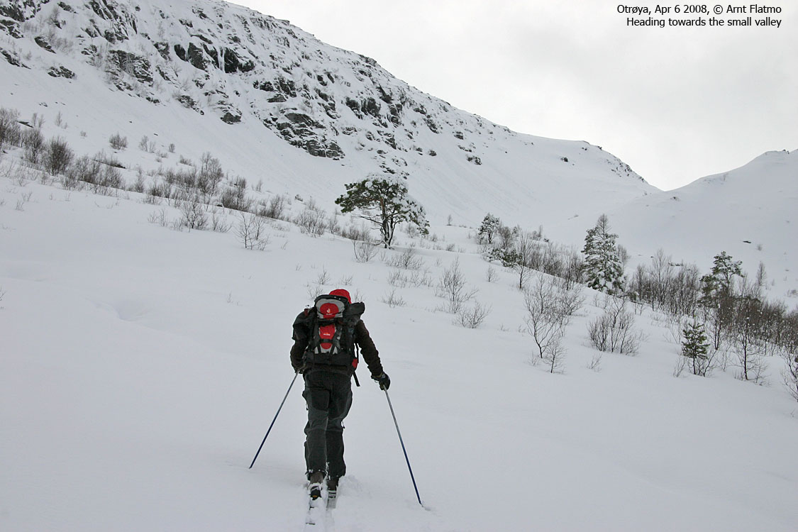
From the parking (UTM 32 V 392951 6954288), go west to the nearest house and follow a forest road that runs on the west side of the river. The forest road runs 1,7Km in the northwest direction and crosses the river on a bridge.
From the end of the forest road, make your way to the west along a creek and you'll enter a small valley with Trollhaugen straight ahead. Look for the obvious place to cross the ridge on your left-hand side. Once you're in the neighbour valley, aim for a distinct col ahead. After you've crossed this col, look for an entry point to the ridge up to your left.
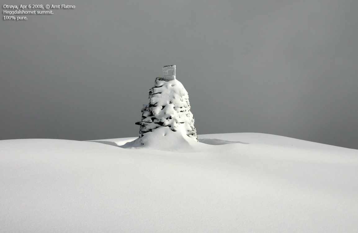
Once on the ridge, continue eastbound towards Heggdalshornet. The amount of snow will determine the best route. Heggdalshornet summit is marked by a cairn with a trigonometric point on top.
Oppstadhornet:
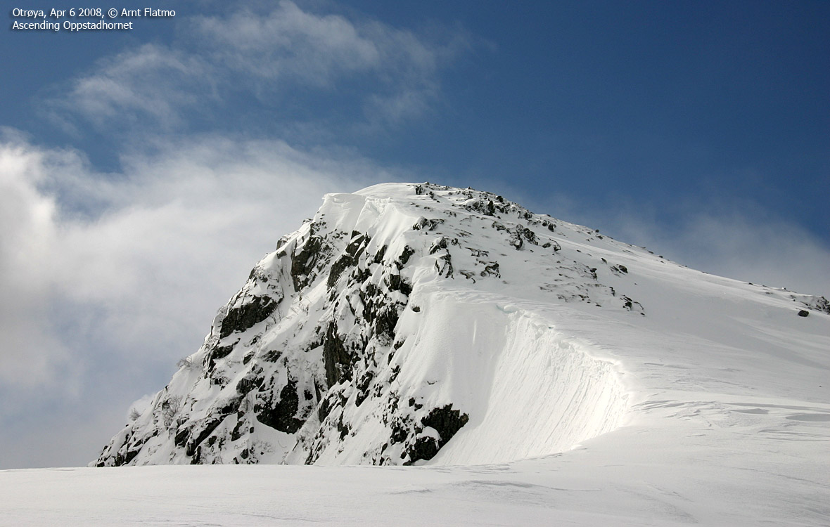
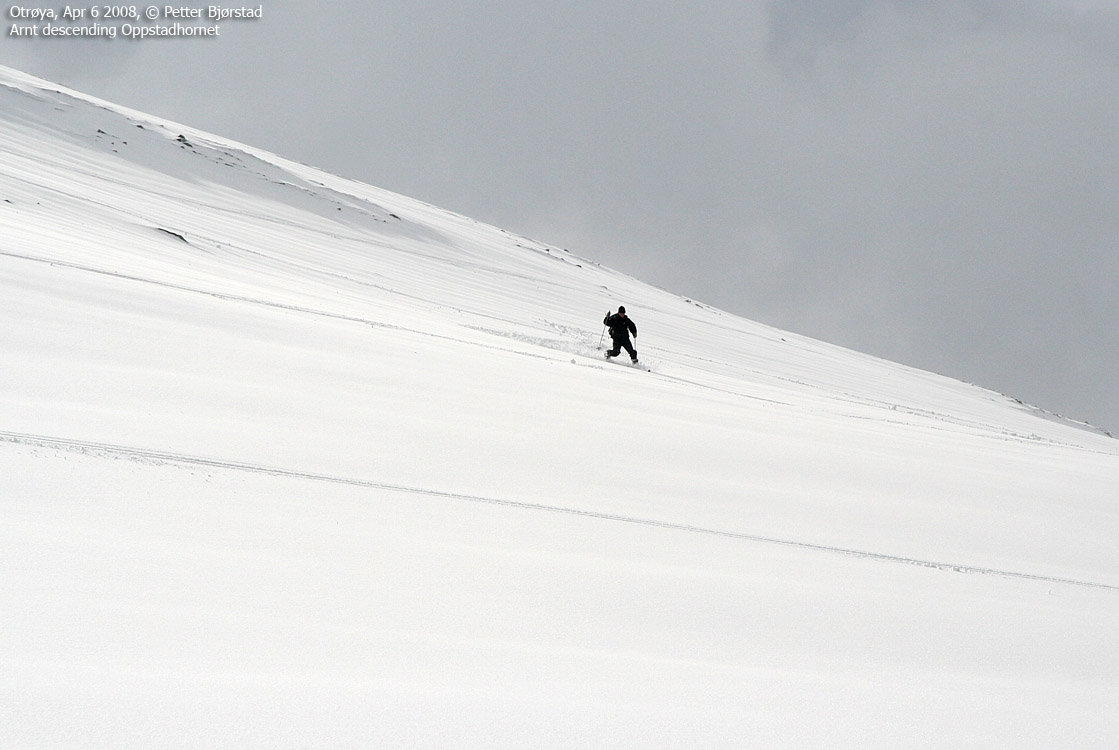
Follow the ridge between Heggdalshornet and Oppstadhornet. One section on Oppstadhornet's east ridge is steeper than the average, but you can seek to the right for more gentle terrain. Skiing this ridge with the fjord 700m below is a journey in contrasts. Oppstadhornet summit is marked by a cairn and a (per Apr 2008) fallen trigonometric point.
Descend Oppstadhornet's
northern flank until you join
your ascent route near the col.
 westcoastpeaks.com
Other Møre & Romsdal mountains
Other Norwegian mountains
westcoastpeaks.com
Other Møre & Romsdal mountains
Other Norwegian mountains


