
Norwegian Mountains, Møre og Romsdal
Sandsøya
7-toppsturen, Apr 24 2010
(Vorakletten - 130m, Voren/Kulen - 116m, Rinden - 369m, Øyna/Signalen - 359m, Hellandsfjella/Svadfjellet - 122m, Hornet - 250m
To the main Sandsøya page (maps, route descriptions, other trip reports, etc.)

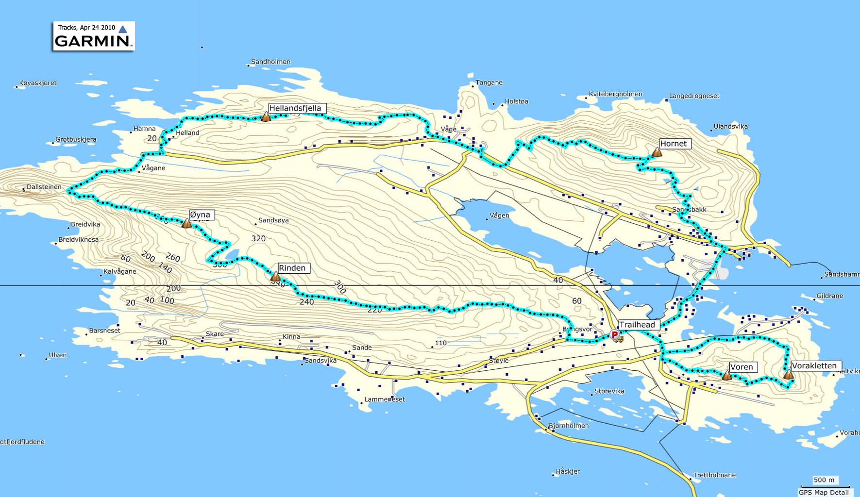
7-toppsturen on Sandsøya
(Click for larger image)
I hadn't heard about 7-toppsturen on Sandsøya until a colleague joined this annual event (in April) and told me about it afterwards. As I still hadn't been to Vorakletten, Hornet, Hellandsfjella and Voren, why not do the whole round trip, including Dollsteinen?
So, on this nice Saturday late in April, Anne Rudsengen and me took the trip to Sandsøya. We took the 11:45am ferry from Larsnes, and arrived on Voksa 12:15pm. We had expected that we could take the time we needed, and that we wouldn't have to wait more than one hour for the return ferry. But onboard, we learned that there was a ferry leaving at 4:15pm, and the next at 7:pm! To be honest, I'd rather be at home, thinking back on the hike with a cold beer, than spending hours on Voksa...
We had to make a decision. We could be on our way by 12:30pm, and if we planned to be back at the car 4pm, then we would have 3,5 hours to do the 16km, 1000 vertical meters hike. Were we willing to bring this element of stress into the hike? The answer was "Heck, yeah! Let's give it a try!"
I drafted a plan; start 12:30, hike Vorakletten and Voren in 30 minutes, be back at the trailhead 1pm, hike across Rinden & Øyna in one hour (we would have to skip Dollsteinen, but it's not a part of 7-toppsturen either), pass Vågane at 2:15pm, allow 45 minutes across Hellandsfjella, ascend Hornet by 3pm, and allow one hour for the traverse and the walk back to the trailhead. I had no idea if this plan would hold, but at least we could try...

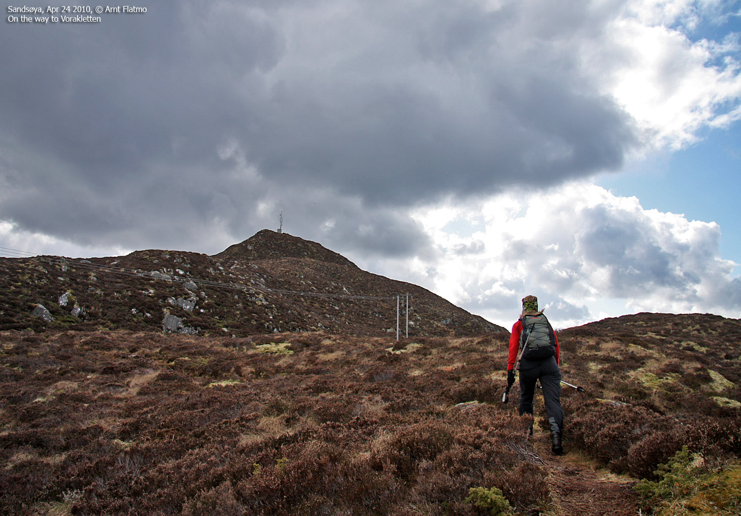
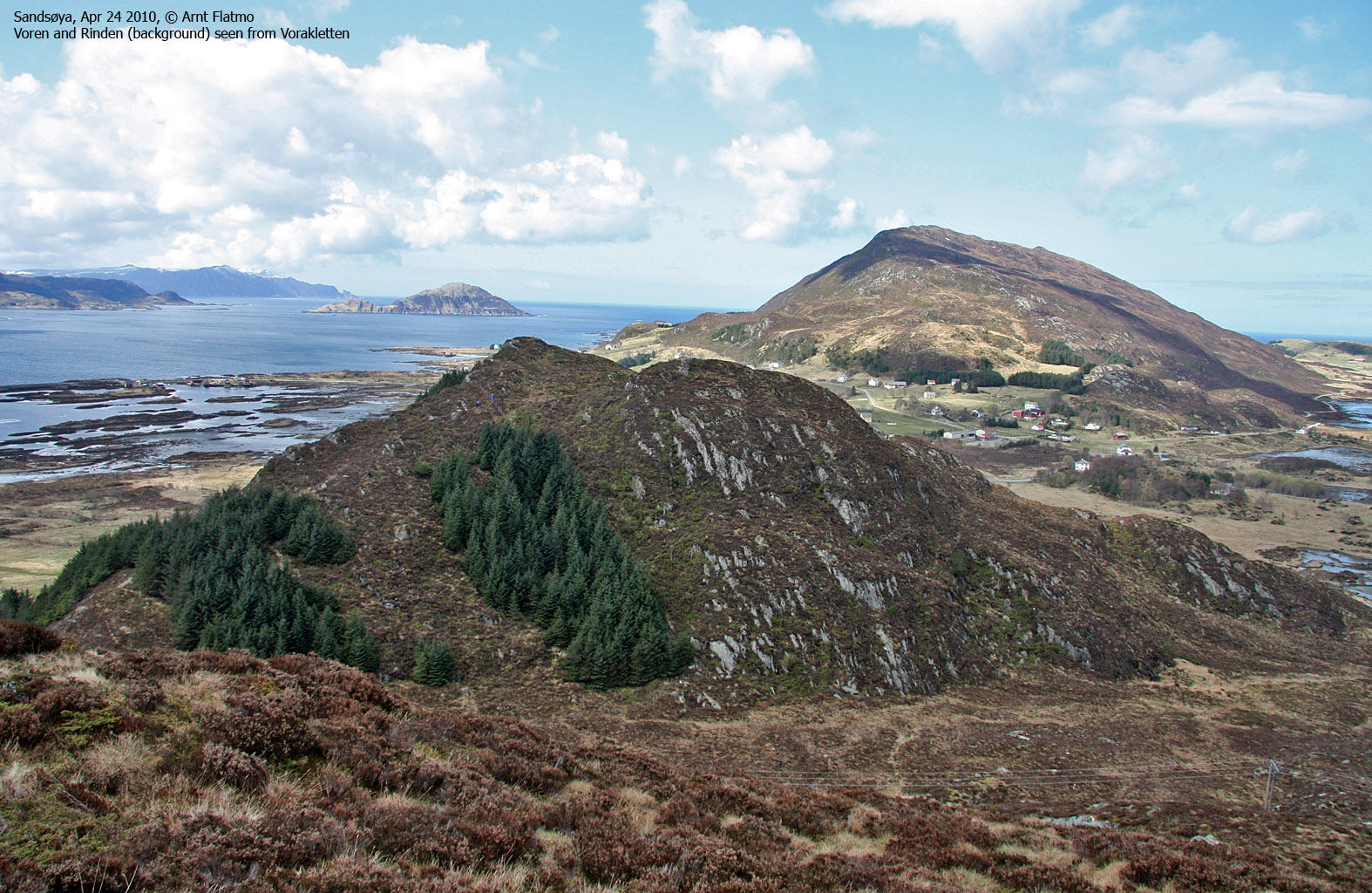
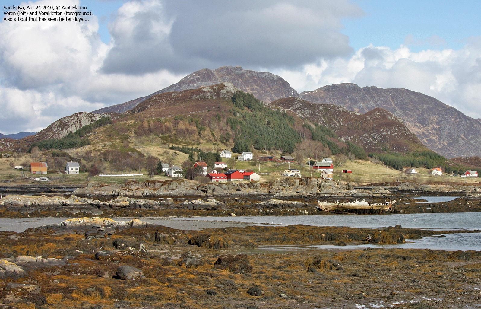
The route across Vorakletten and Voren
(Click for larger image)
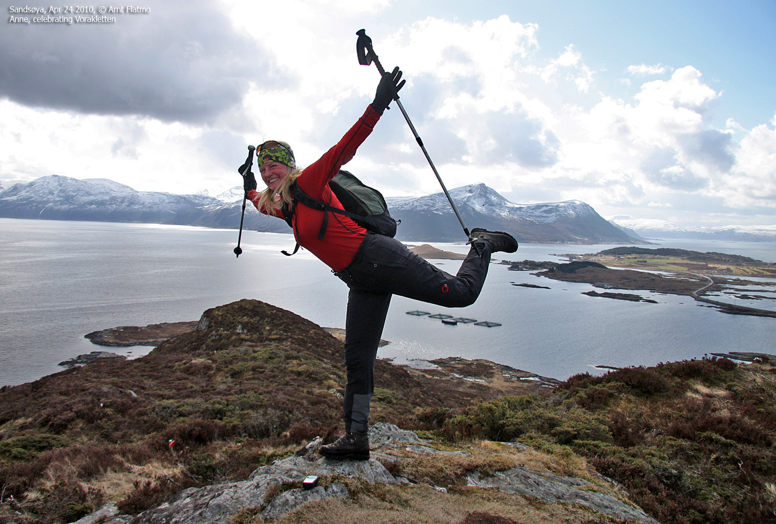
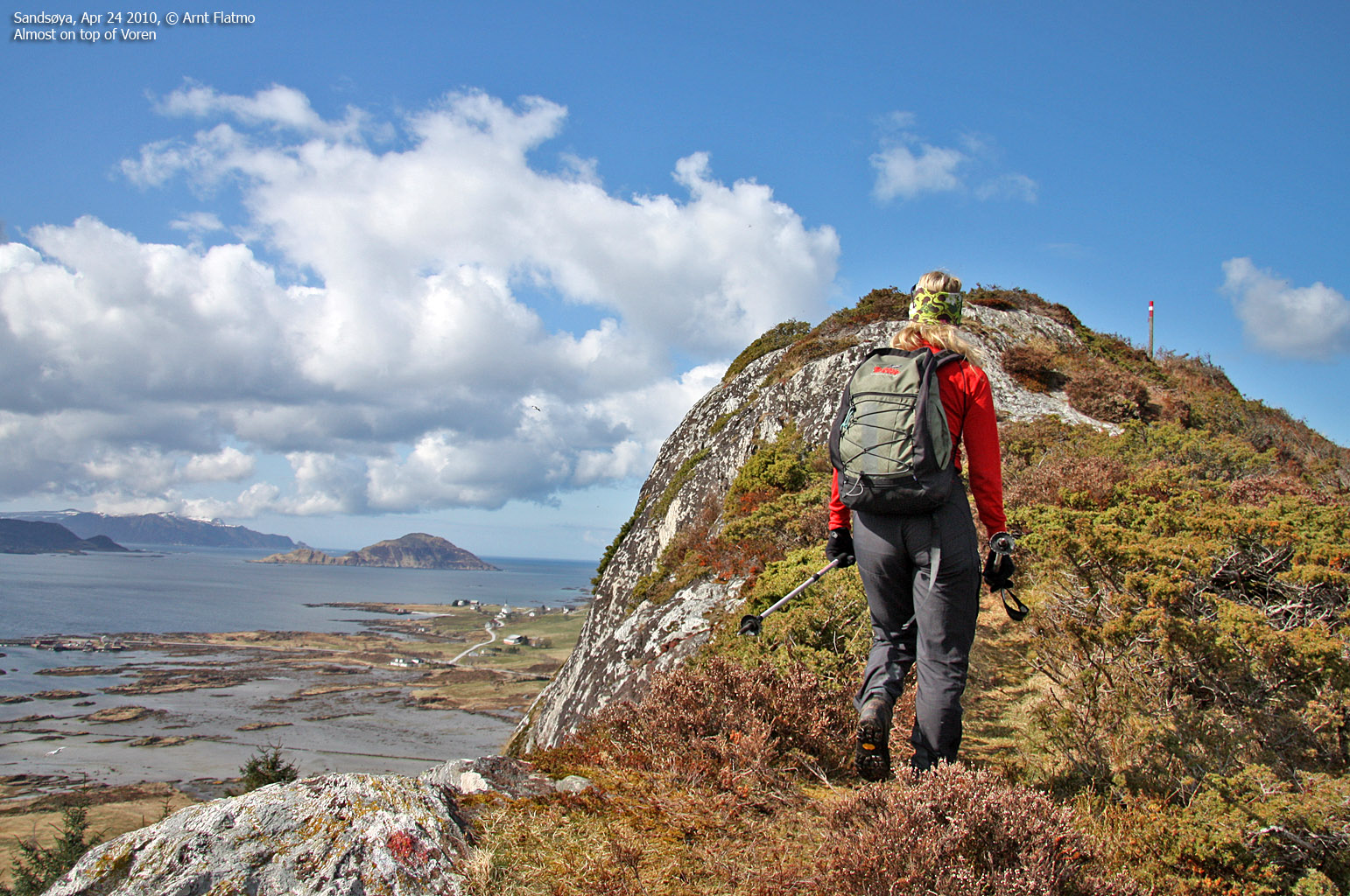
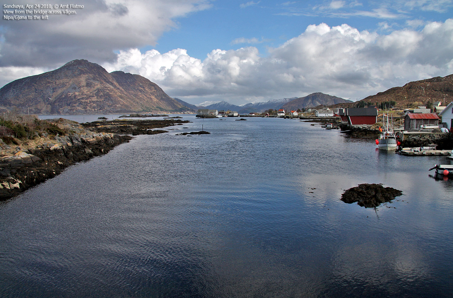
At 12:24pm, we were on our way, and we were already 6 minutes ahead of plan! Anne kept a fierce pace. In fact, I've never seen her walk faster. I think she enjoyed the challenge. After 1km along the road, we found the path to Vorakletten ("Kletten" -130m). The hike up the ridge went fast, and we could celebrate our first top at 12:47pm. As the plan was to be back at the starting point by 1pm, we were now behind schedule. We continued towards Voren (116m) and passed the top 12:57pm. As there was no time to lose, we moved on and were back at the trailhead by the school 1:08 - 8 minutes behind plan.
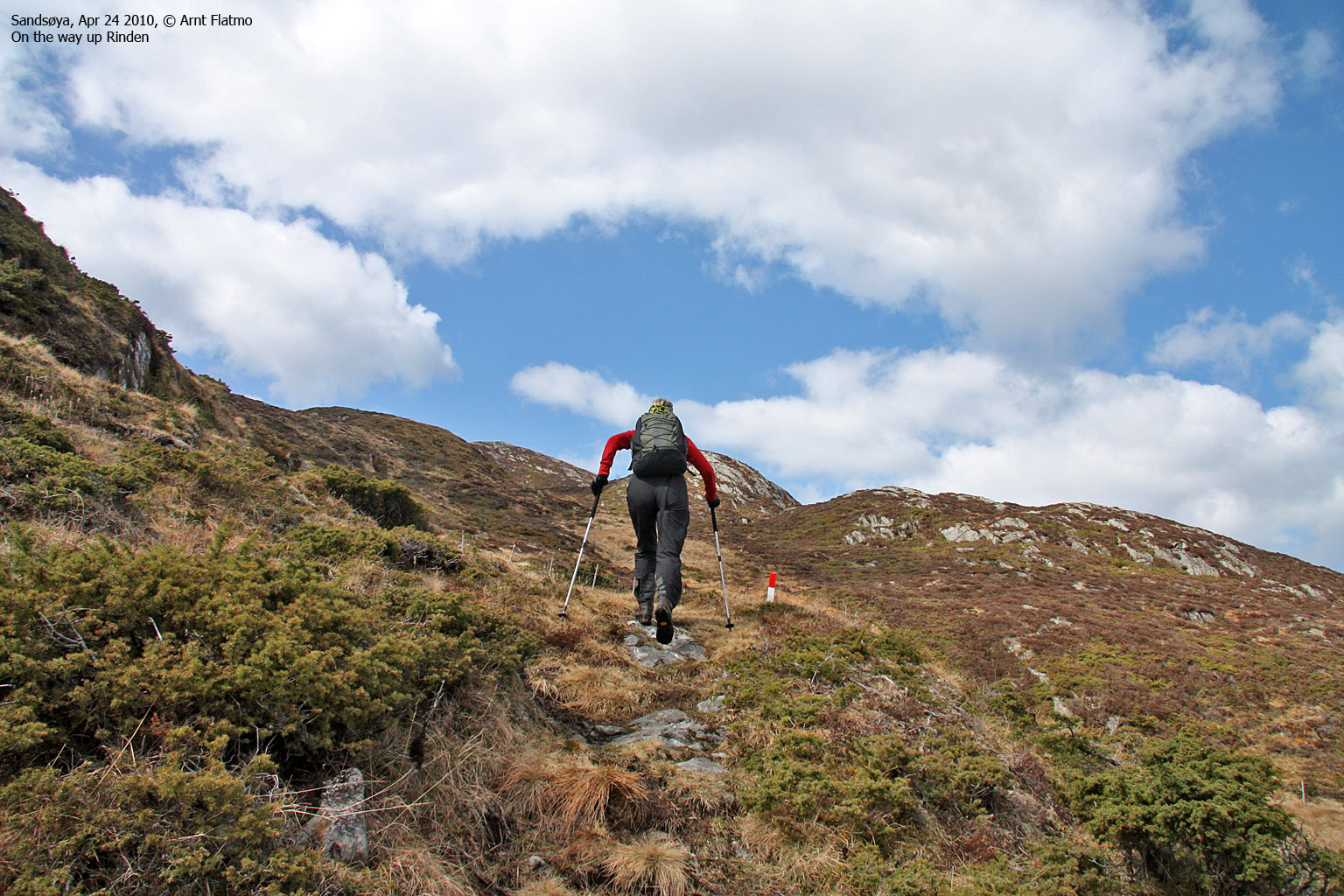
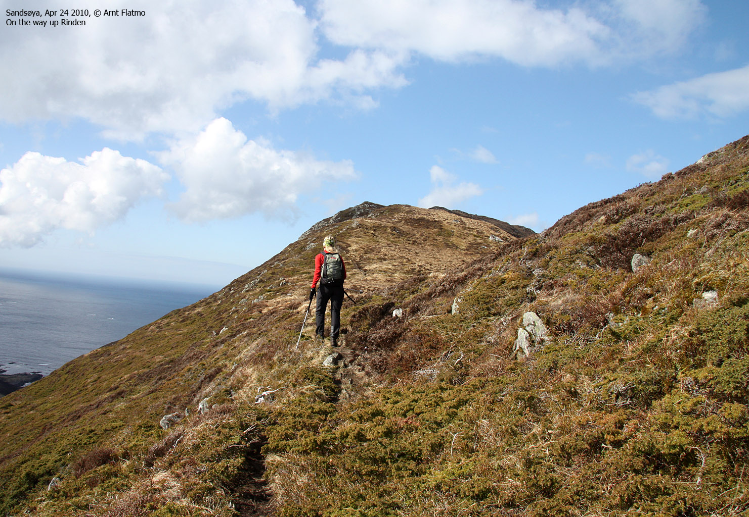
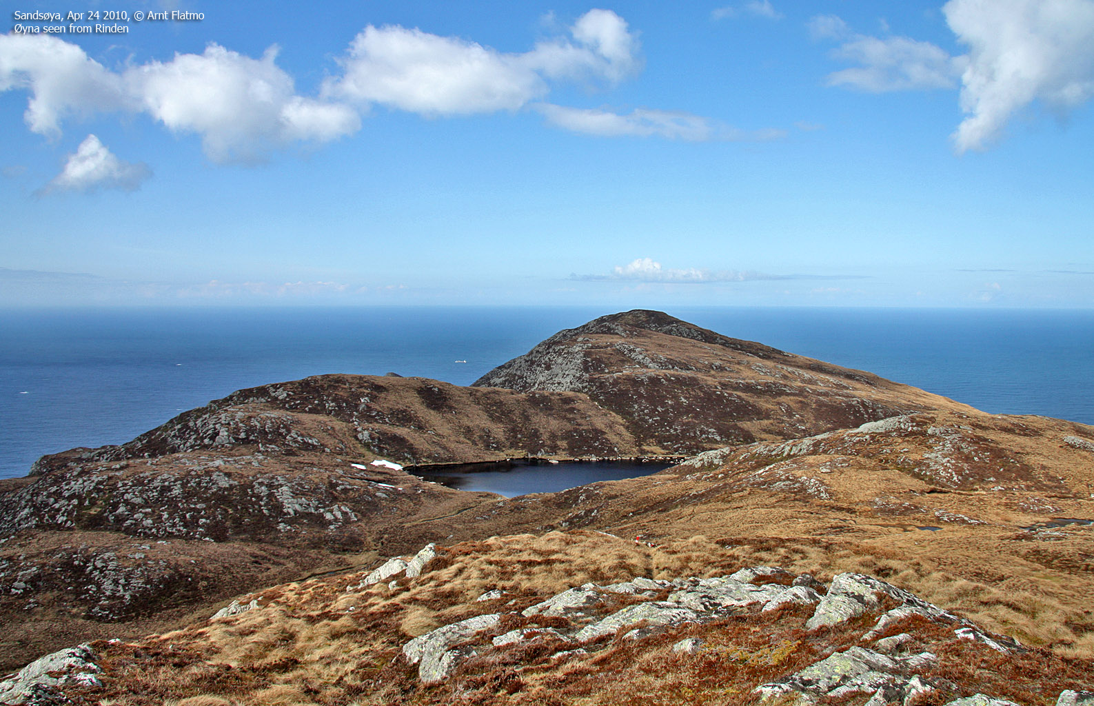
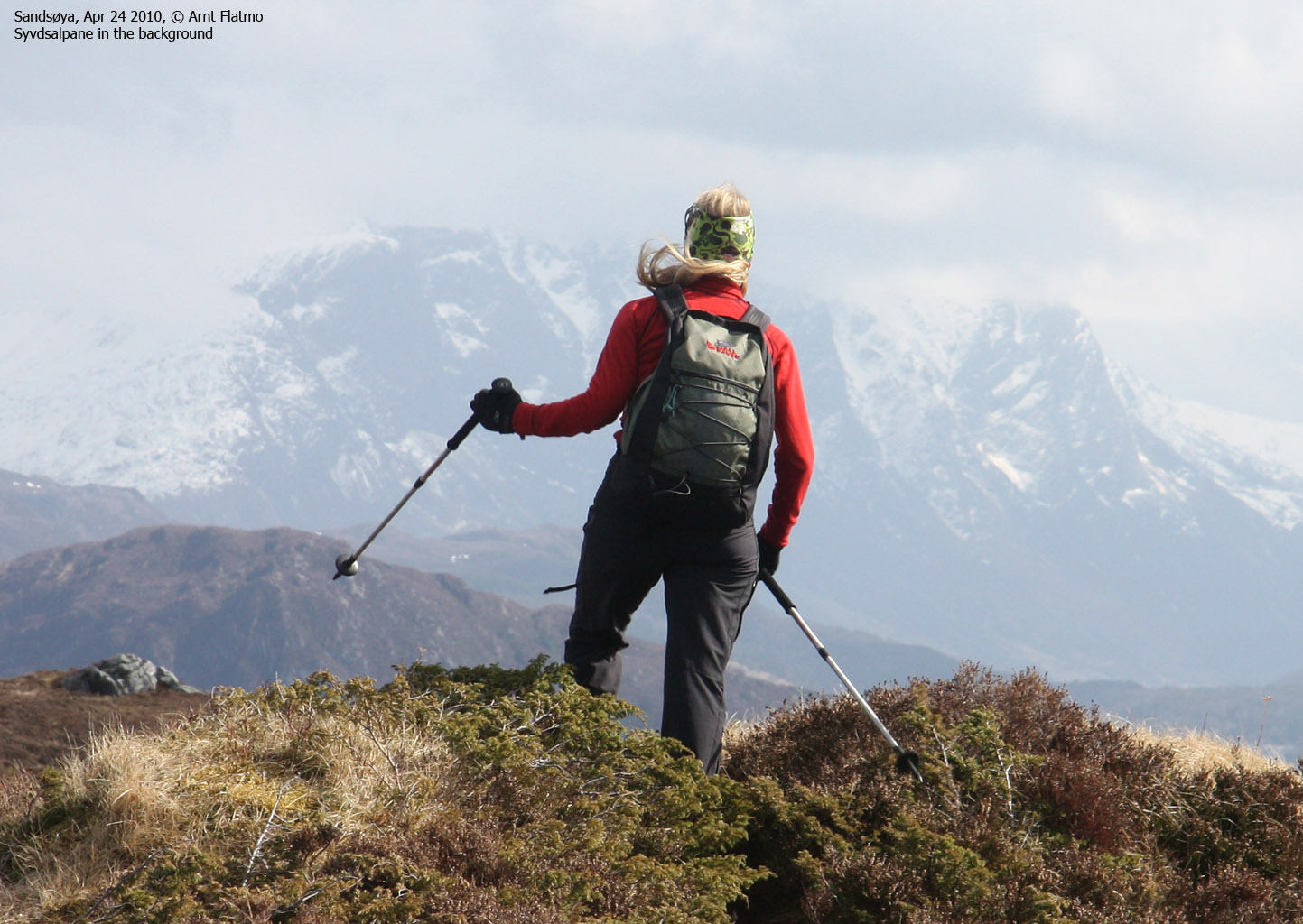
Next on the list was Rinden (369m) - the highest point on the island, and Øyna/Signalen (359m). The big question was; how long would it take to cross these two tops?

The route to Rinden
(Click for larger image)
I visited Rinden together with Vidar in 2007 (he was also the one who told me about 7-toppsturen), which was an advantage to us now. No time was lost in finding the path. Anne was still keeping a tremendous pace, and I remained optimistic. I dislike stress as an element in a hike, but I was willing to make an exception today. OK, so there would be no close-up of flowers and frogs, but we still had the time to enjoy the views.
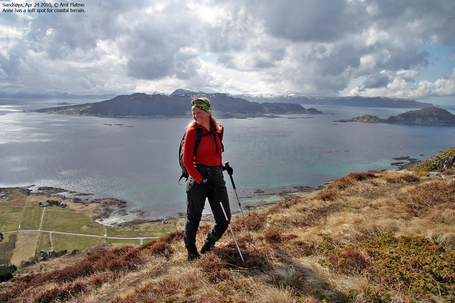
We reached the top of Rinden 1:44pm, which meant that we only had 16 minutes to cross Øyna and descend to Vågane. This sounded a bit too optimistic, so I put my trust in that we could make up some time across Hellandsfjella. After enjoying the views from Rinden for a few minutes, we moved on to Øyna. This was a short hike, and we passed the top 2:01pm.
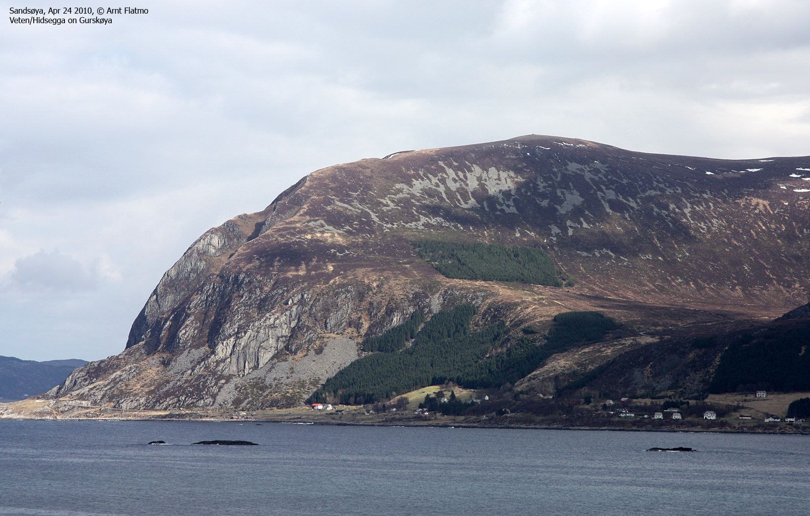
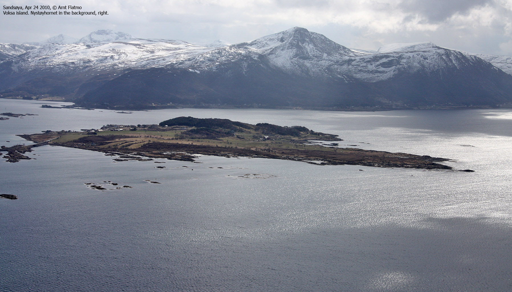
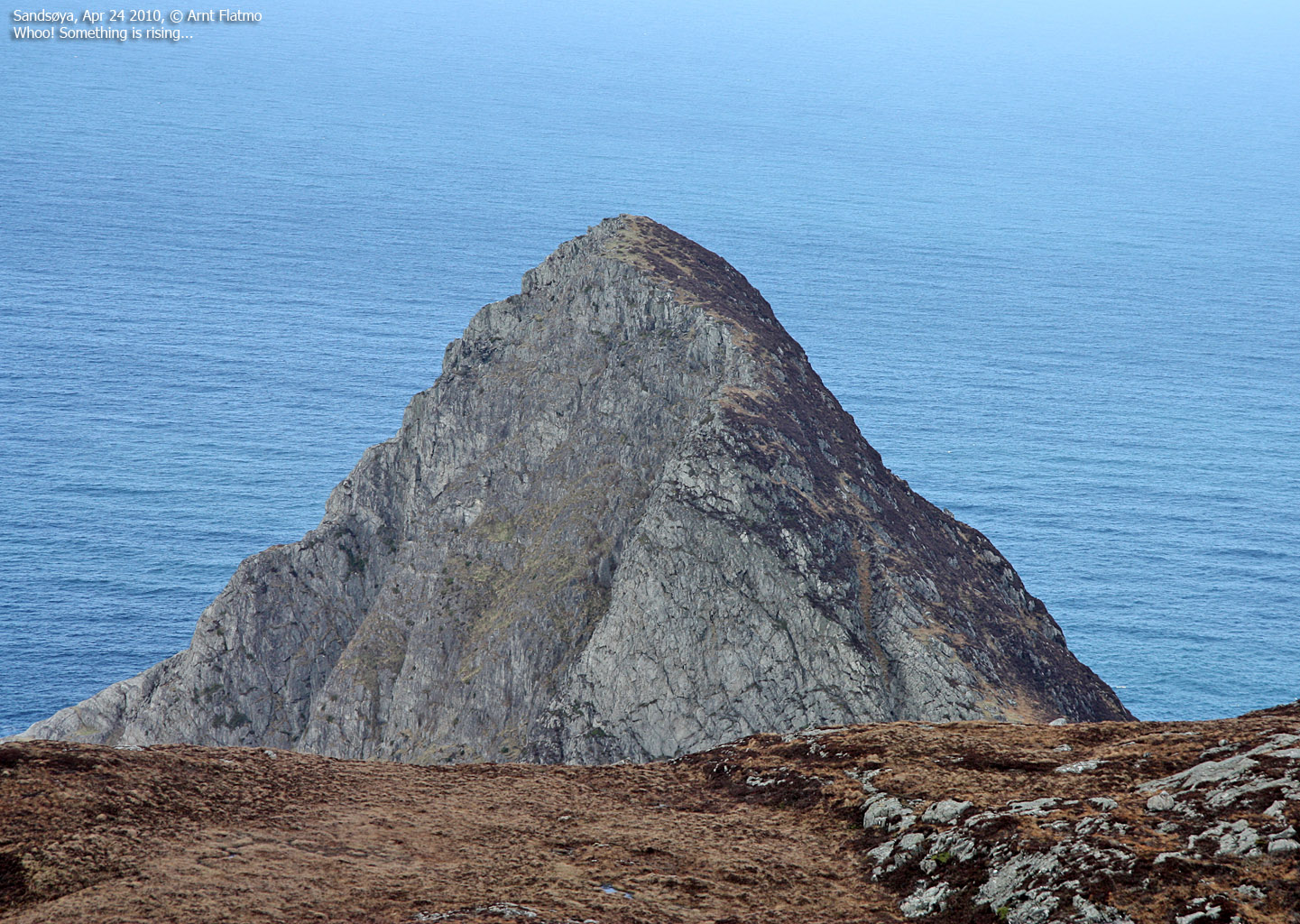
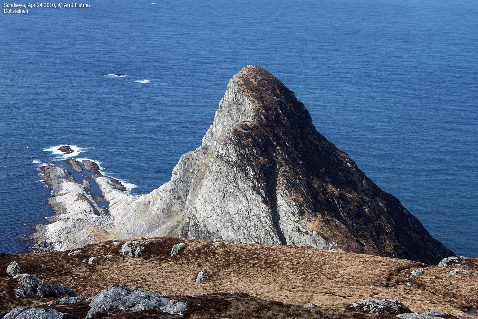
On the way down from Øyna, a rugged peak appeared in front us. Anne was euphoric. Not only were we heading directly towards the Atlantic (which is cool in itself), but now a beautiful peak was rising just ahead of us. And I was proud to present Dollsteinen...

Dollsteinen
(Click for larger image)
We didn't want to trade our plan for a visit to Dollsteinen. Dollsteinen alone is a good reason to come back to Sandsøya, and moreover, as my attempt to reach the "palace" inside Dollsteinhola in 2009 failed, there will be another trip to Sandsøya.
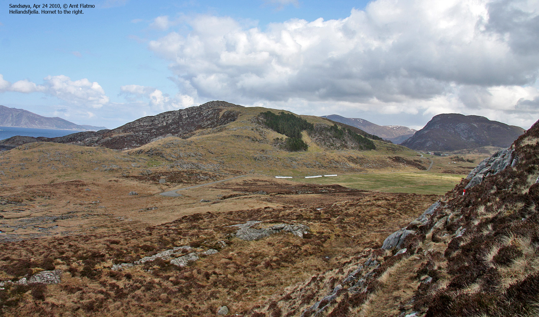
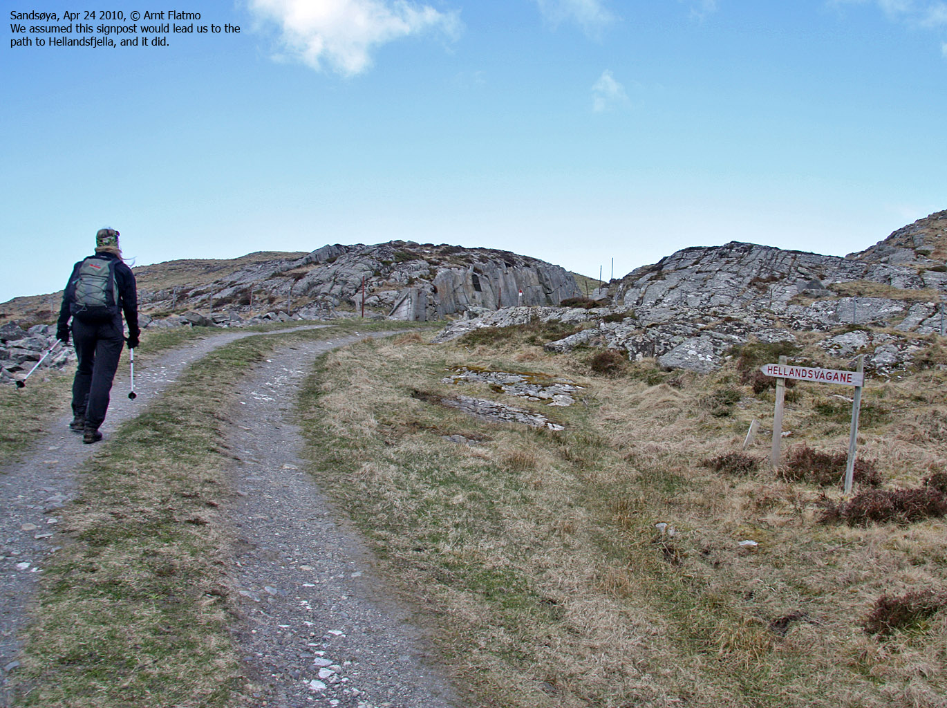
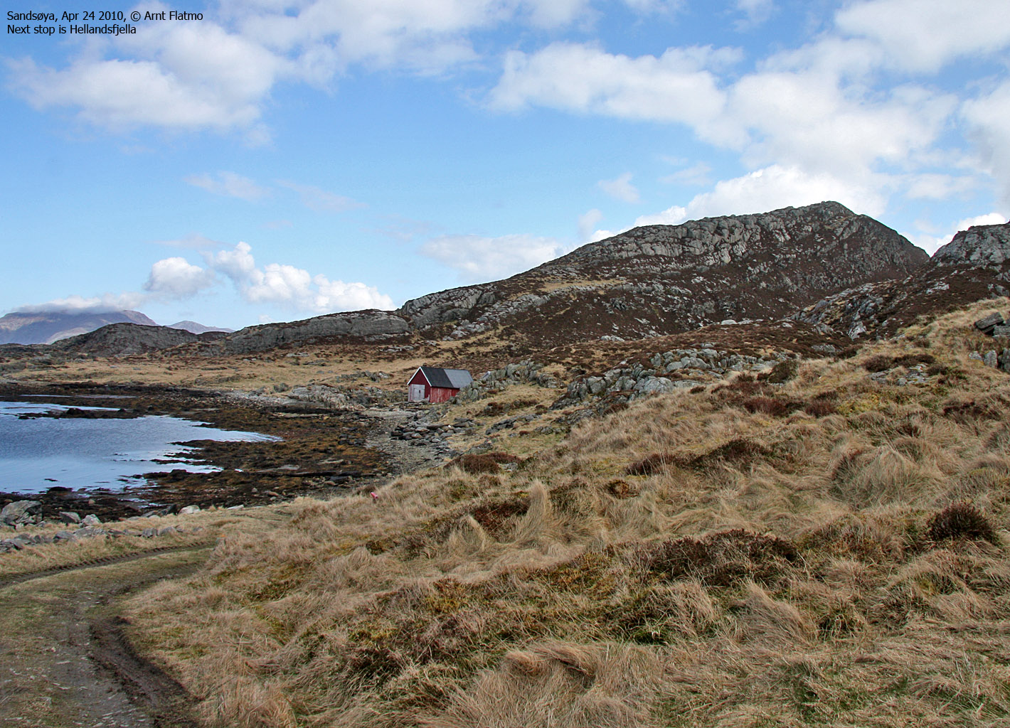
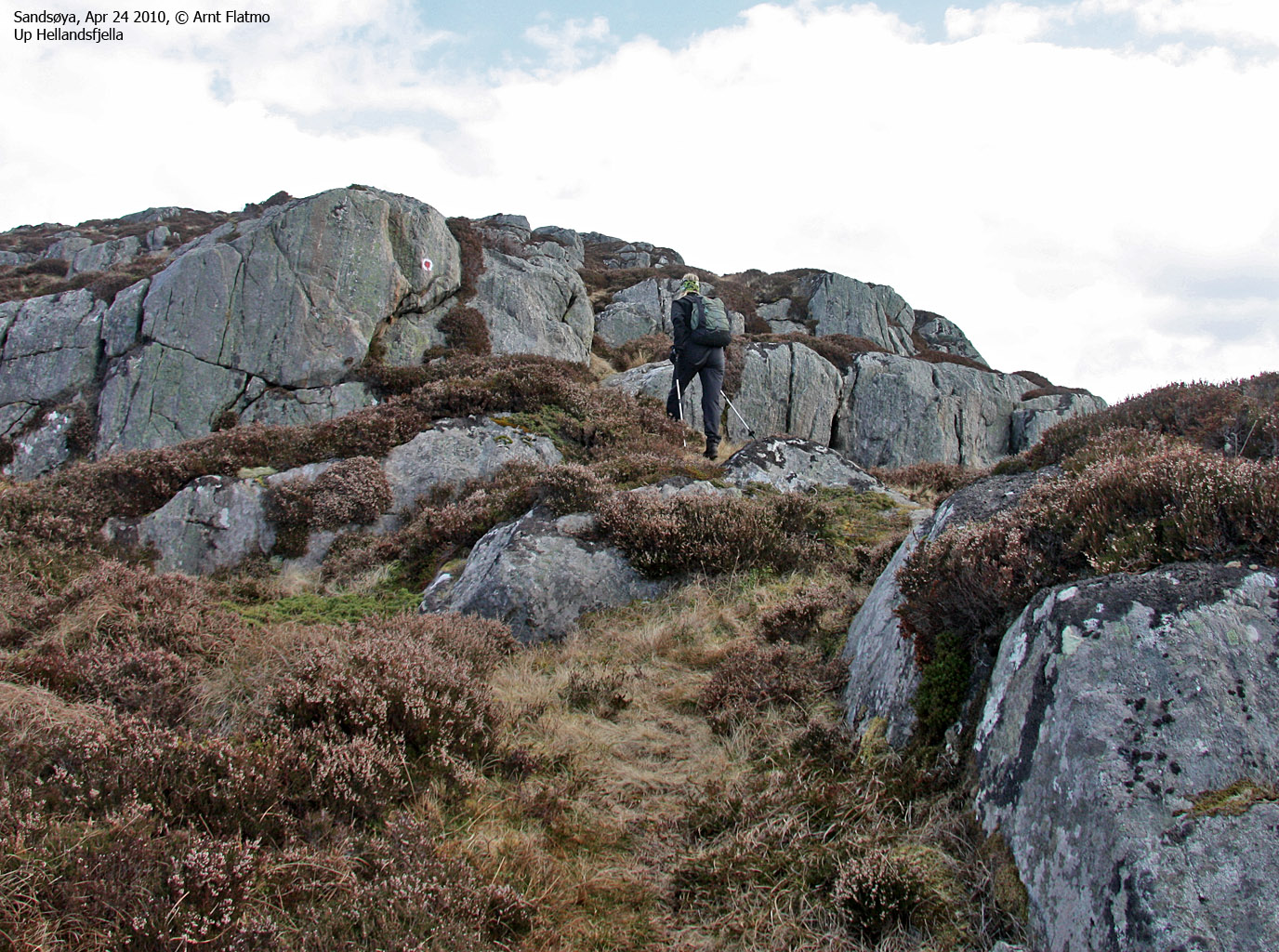
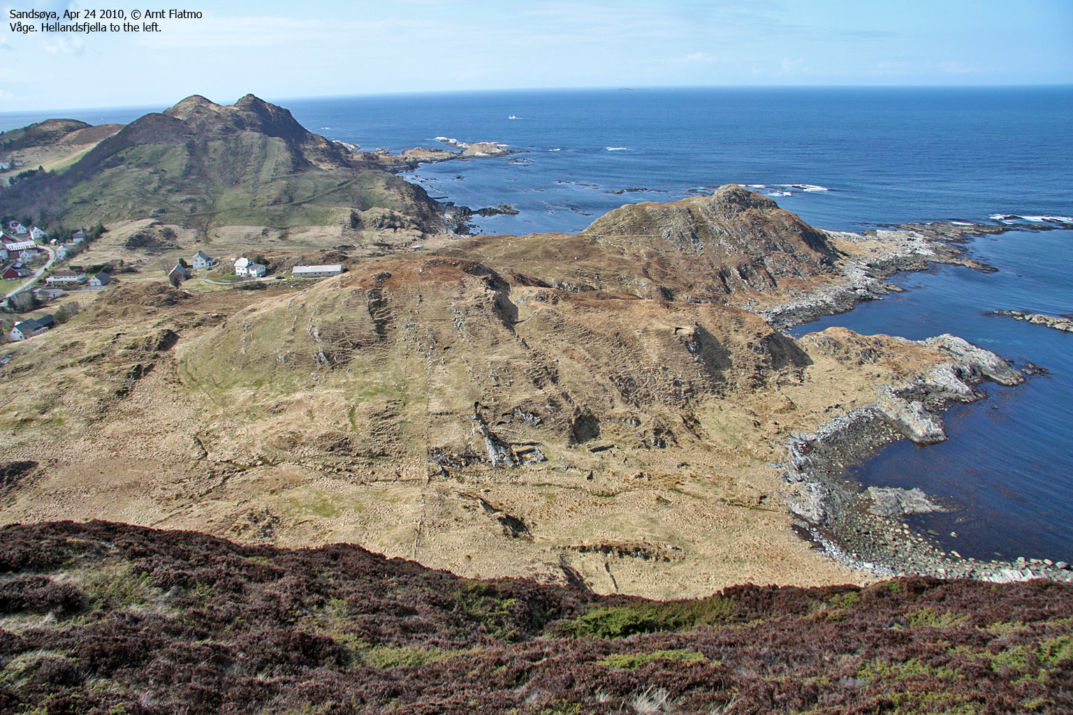
We reached the road at Vågane 2:20pm - 20 minutes behind schedule. I had allowed 45 minutes for the hike across Hellandsfjella (122m). Could we save some time across?

The route across Hellandsfjella
(Click for larger image)
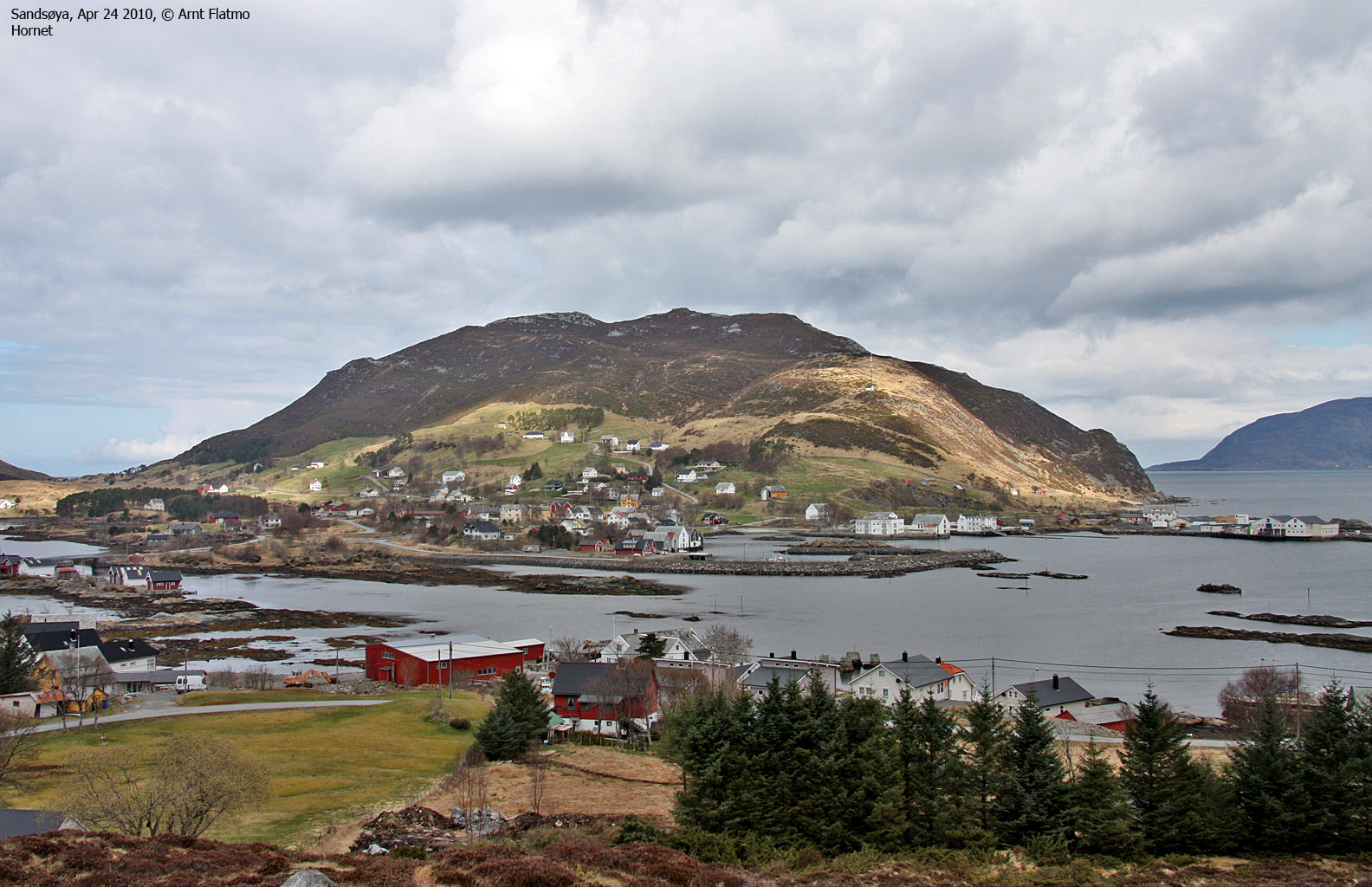
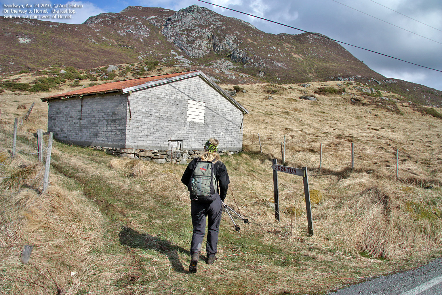
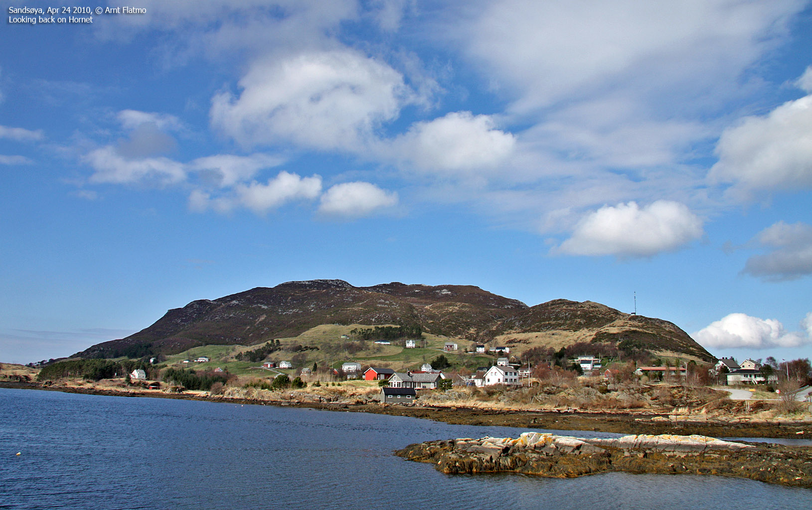
We found the Hellandsvågen signpost and followed this road. At the bay, we found the marked path and hurried upwards. We passed the first (and highest) point 2:35pm and the second point 2:40pm. Things were looking up! The plan was to begin the ascent of Hornet at 3pm, which gave us 20 minutes to cover the remaining distance of 1,6km. Vidar had explained the route to me, but as we passed Våge, I lost the overview. I called him up, and when he answered, I noticed the Grøntua signpost. "Talk to you later, I'm busy". The time was 2:58pm when we began the ascent of Hornet (258m).

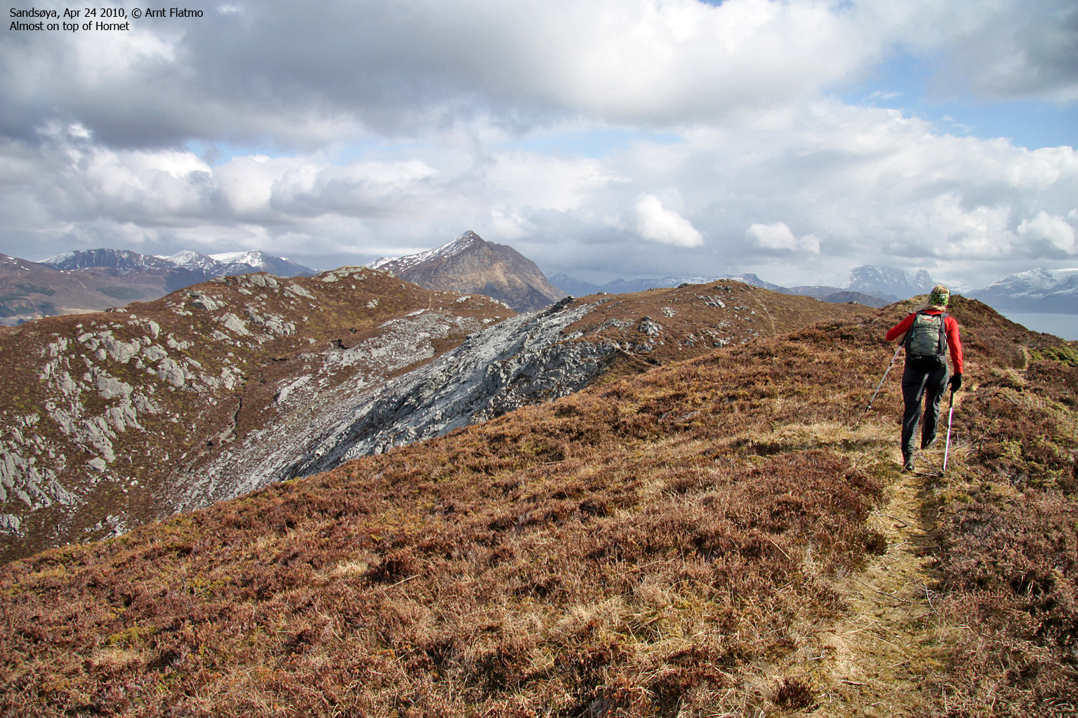
The route across Hornet
(Click for larger image)
On the way up to Grøntua (and later on; Hornet), I noticed that Anne was slowing down. No wonder, as we had been going non-stop, full pace for 2,5 hours. It was time for a chocolate bar! Once we reached Grøntua, Anne found new strengths. Whether it was the chocolate or knowing the last top was just ahead of us, I don't know (Grøntua is one of the 7 tops on 7-toppsturen, but it's just a small hump in comparison).
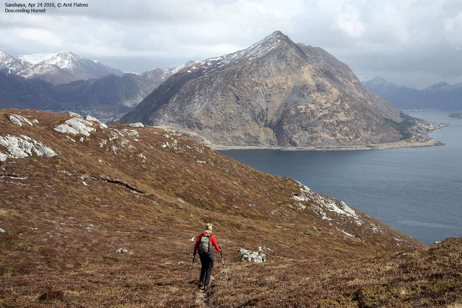
We arrived on Hornet 3:21pm, and had finally full control of the time. We had 40 minutes to get back to the car, and even 15 more minutes to get to the ferry. We celebrated the last top with a couple of sandwiches before moving on.

Descending Hornet
(Click for larger image)
We were back at the trailhead by the school 3:51pm - 9 minutes ahead of plan and 3h:27m after heading out. I was quite satisfied about my own estimate, and the fact that we accomplished what we sat out to do. This was my third visit to the island, and clearly the most strenuous one. I'm now looking forward to the fourth - and the Dollsteinhola "palace"...


 on Gurskøy")


")


")


 by Gursken")
