
Norwegian Mountains, Møre og RomsdalInstehornet, 653m
|
| Fylke/Kommune : | Møre og Romsdal/Volda |
| Maps : | 1119-II Volda (Statens Kartverk, Norge 1:50 000) |
| Primary factor : | Instehornet: 200m |
| Primary factor : | Rotsethornet: 26m |
| Hiked : | Mar 2008 |
| See also : | Melshornet |
| See also : | Snøhornet |
| See also : | Helgehornet |
| See also : | Skarphornet |
| See also : | Hornet |
| See also : | Koppefjellet |
| See also : | Kornbergveten |
| See also : | Matøskja |
| See also : | Eidskyrkja |
| See also : | Høgåsen |
| See also : | Velsvikskåla |
| See also : | Ytrehovdeåsen |
| See also : | Other Volda mountains |
Rotsethornet
(Click for larger image)
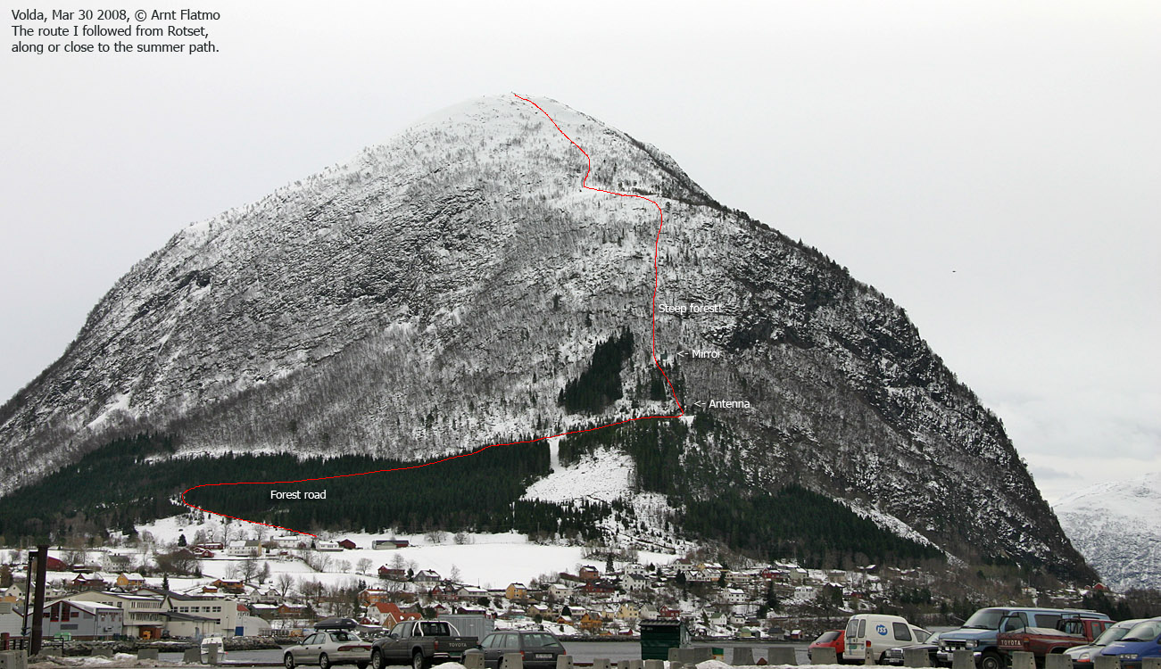
Rotsethornet is the common name of the mountain that comprises the tops Rotsethornet and Instehornet. The two tops are only 300m apart, and Rotsethornet is located directly above the village of Volda.
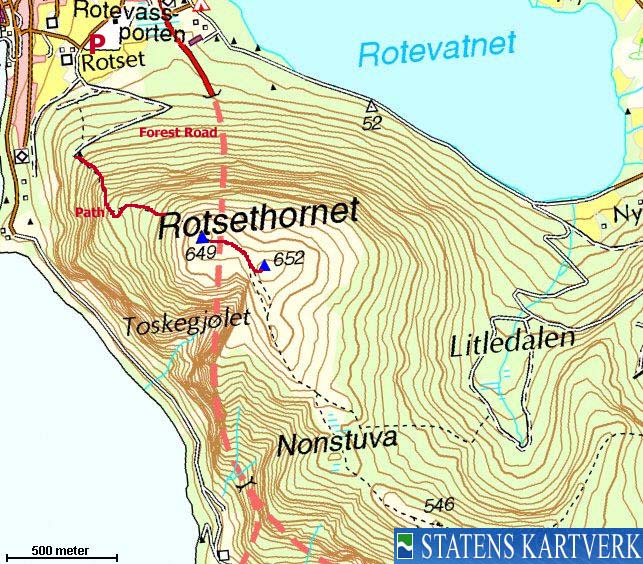
The summer and winter routes are different. The mountain is normally skied (and also walked) from Lake Rotsetvatnet via Litledalen valley. The shortest route, normally just hiked in summer/autumn runs from the Rotset farm, northwest of the mountain. The route from Rotset will be described on this page.
With up to 10,000 Volda citizens (students included), Rotsethornet is naturally a popular and frequently visited mountain. Unfortunately, injuries and accidents are often the consequences and Rotsethornet has had its share. Tragically, in the recent years some hikers have fallen off the mountain and into their deaths. Because of the dome-shaped top, it is easy to take the wrong direction in bad weather unless you're following a compass, GPS or tracks. To know a mountain inside and out, is (unfortunately) just a myth.
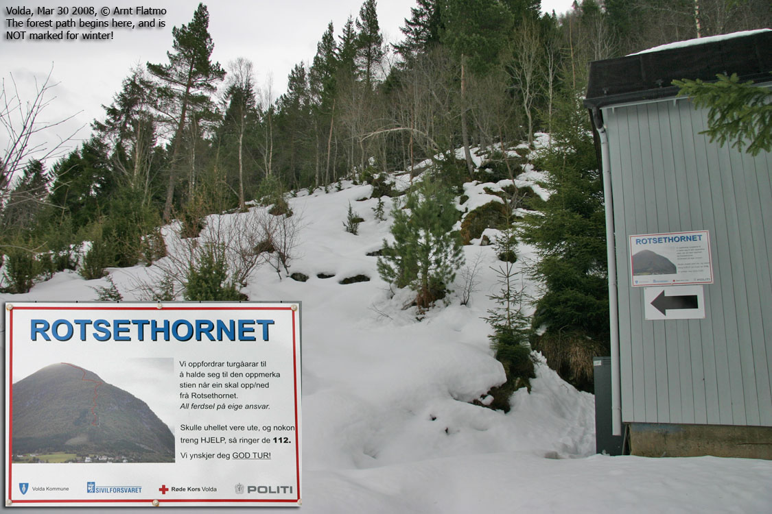
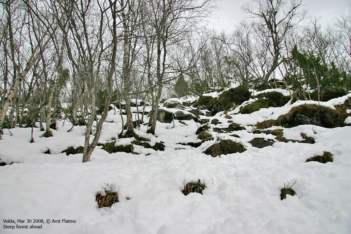
The route described on this page has a steep forest section. A rope and some ladder steps have been put in place. This information might discourage those who don't have a big head for heights, and those are instead recommended to follow the route up Litledalen valley.
Rotsethornet has (at least) 4 cairns on or near the summit. On the summit point you will find a canister with the visitor register. Instehornet is located 300m to the southeast and a couple of rocks will, in a few places, attempt to nominate a high point. In any case, at UTM 32 V 348738 6892113, you can claim having summited Instehornet.
Instehornet (Norge 1:50,000: 652m, Økonomisk Kartverk: 653m, UTM 32 V 348738 6892113) has a primary factor of 200m towards the higher parent mountain Hornet (695m). The defining saddle (approx. UTM 32 V 350105 6890310) is found just west of Homborsetsætra. Ref. Økonomisk Kartverk (5m contours), the saddle is within the contours 450-455m, interpolated to 453m.
Rotsethornet (Norge 1:50,000: 649m, Økonomisk Kartverk: 649,40m, UTM 32 V 348467 6892262) has a primary factor of 26m towards the higher parent mountain Hornet (695m). The defining saddle (approx. UTM 32 V 348622 6892223) is found between the two tops. Ref. Økonomisk Kartverk (5m contours), the saddle is within the contours 620-625m, interpolated to 623m.
Google's interactive map. You can zoom, pan and click on the markers.
There is a slight incaccuracy on the markers (seen when zoomed in). This will be
fixed soon.
|
|
|
Notes: Class ratings are in reference to YDS. Click here for more information.
The trails described below are not necessarily the *easiest* trails to this mountain.
|
Route 1: Rotset - Rotsethornet (summer)
|
|
Access
(all distances are approx. distances)
The nearest bigger city is Ålesund. From Ålesund, follow highway E39 towards Bergen/Volda to the ferry at Solavågen. Take the ferry over to Festøy, turn right at Festøy and follow E39 towards Ørsta (38,3Km). In the highway RV655/E39 junction in Ørsta, follow E39 (Volda) for 9Km until you have the ferry harbor in Volda on your right-hand side.
Drive 750m along RV651 through the village centre and turn right towards Andaneset (signed). Follow 651 for another 300m and turn left onto the Ristevegen road (signed). Follow Ristevegen 600m and turn right towards the church. Park here unless signs prohibit you to do so.
The route
From the church, follow the road towards the Rotset farm. Pass the farm on the left-hand side and follow a forest road that runs 500m to the southeast, curves and runs 500m to the southwest. You're now next to an antenna (ca. UTM 32 V 347890 6892633, 170m elev.) You'll see the forest path drawn on a picture on the building below the antenna.
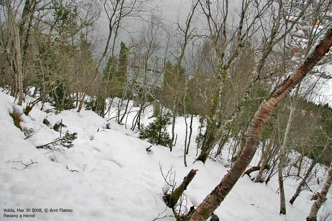
The forest path passes a mirror a bit higher up in the forest and then the forest get gradually steeper. At the steepest part, you can use a rope and some ladder steps that have been firmly bolted in rock. Higher up, you'll walk a ridge before heading up the final mountainside below Rotsethornet summit. You'll see (at least) 4 cairns up there. The visitor register is found inside a canister with Rotsethornet engraved on top. Neat.
You now have the option to proceed towards Instehornet - 300m to the southeast. You'll see a couple of minor cairns on Instehornet. Descend your ascent route or find your way down Litledalen valley and return to the trail head along Lake Rotevatnet.
General note: In case of poor visibility, make sure you
bring a compass or a GPS to safely navigate down from the summit.
 westcoastpeaks.com
Other Møre & Romsdal mountains
Other Norwegian mountains
westcoastpeaks.com
Other Møre & Romsdal mountains
Other Norwegian mountains


