
Norwegian Mountains, Møre og Romsdal
Saursegga & Nipa/Gjøna from Haugsbygda, Mar 26 2007
To the main Saursegga/Nipa/Haugshornet page (maps, route descriptions, other trip reports, etc.)

Saursegga
(Click for larger image)
This afternoon, I was on my way to Veten, on the south side of the Gursken fjord. Arriving Gursken, I noticed a pointy top on the north side that caught my attention. The mountain reminded me very much about Storhornet on Godøya. I called my friend Torbjørn, who checked out the internet map and gave me the essentials about this mountain.
I drove until I was below what appeared to be the high point, and asked a couple of locals where the path was. They told me to drive back and head for the uppermost houses. So I did, and rang the doorbell on one of the houses. The owner told me that I was at the right spot, but expressed concern when he heard that I was heading for Nipa. He assumed that I would run out of daylight, and thus, without saying it loudly, run into all sorts of troubles. ON THE OTHER hand, if I was a very strong hiker, he figured I should be OK. In any case, he was kind enough to let me park outside his house, and I didn't even need to ask.
The middle thing is of course to have the wisdom to turn around before heading into "trouble", yet I assumed that I would be OK with 4 hours of remaining daylight. The time was 16:10PM when I put my dog Troll into the backpack and headed up the forest path. I was determined to reach the high ridge within 17:00PM. Halfway up the forest, I was 10 minutes ahead of this schedule, but was put back on schedule when I realised that I was on a path towards Haugshornet, and not Saursegga.
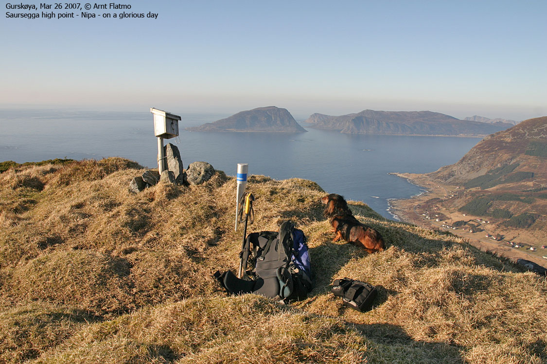
After a fast, off-trail leg, I was on Saursegga, and reached point 514m at 17:00PM sharp. Now that the time schedule was "under full control", I began to enjoy the hike a bit more. Nipa - my main goal - didn't look too far away (only 1,2Km straight distance), and I decided to take it easy.
I had expected that my dog could walk the ridge, but there was too much snow on the path and the grass outside the path was just too high or awkward. After a fun ascent up to Nipa, I reached the high point 17:40PM. Both the views and the ridge walk were first class. I truly enjoyed myself, and the weather doesn't get much better than on this afternoon. The main purpose of the trip was to get a better overview of the Stadlandet tops, but the evening sun made the southwest horizon quite hazy.
Nipa was covered with sheep or goat poo, which tells me that visitors should be very careful when sheep/goats are present. This ridge is not wide enough for sheep/goats to be scared off in all directions. On my way back, I discovered an airy route on the south side of Egga, which I followed for a little while. Below the Egga high point, the terrain became quite exposed, and I headed back up to the ridge. At point 514m, my dog was finally let out of the backpack, and he was just as glad to be on the ground as I was, having him "off my back". We were back at the trailhead 19:03PM, and was met by the owners. They seemed "relieved", now that the stranger with the Oslo dialect had come back down, safe and sound. The way the man looked at his watch, told me that my leg time was probably acceptable.
So it was time to head back to Ålesund, in the sunset on this warm afternoon, with the car roof in the trunk, with a nice hike "in the bag", and good impressions from a new region. The only downside was that I missed the Hareid-Sulesund ferry by 3 minutes, and had to wait one hour for the next. Oh well..


