
|

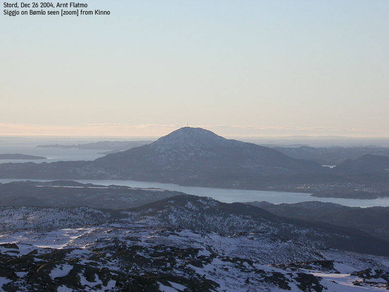
Siggjo seen from Kinno(No Javascript) |
Siggjo is the high point on Bømlo island, located on the western coastline, just southwest of the larger island Stord. Siggjo, when viewed from Ulriken in Bergen, is easy to identify due to its cone-shaped appearance. The distance between the two mountains is approx. 70Km.
Siggjo is a very popular mountain, and the trails are well traveled. There are several trails up the mountain, and a trail from the northeast will be described on this page. From the top, you get a good view towards Sunnhordland and Stord island. This top is absolutely worth a visit, and thanks to a new road, access from Bergen is easier than what used to be.
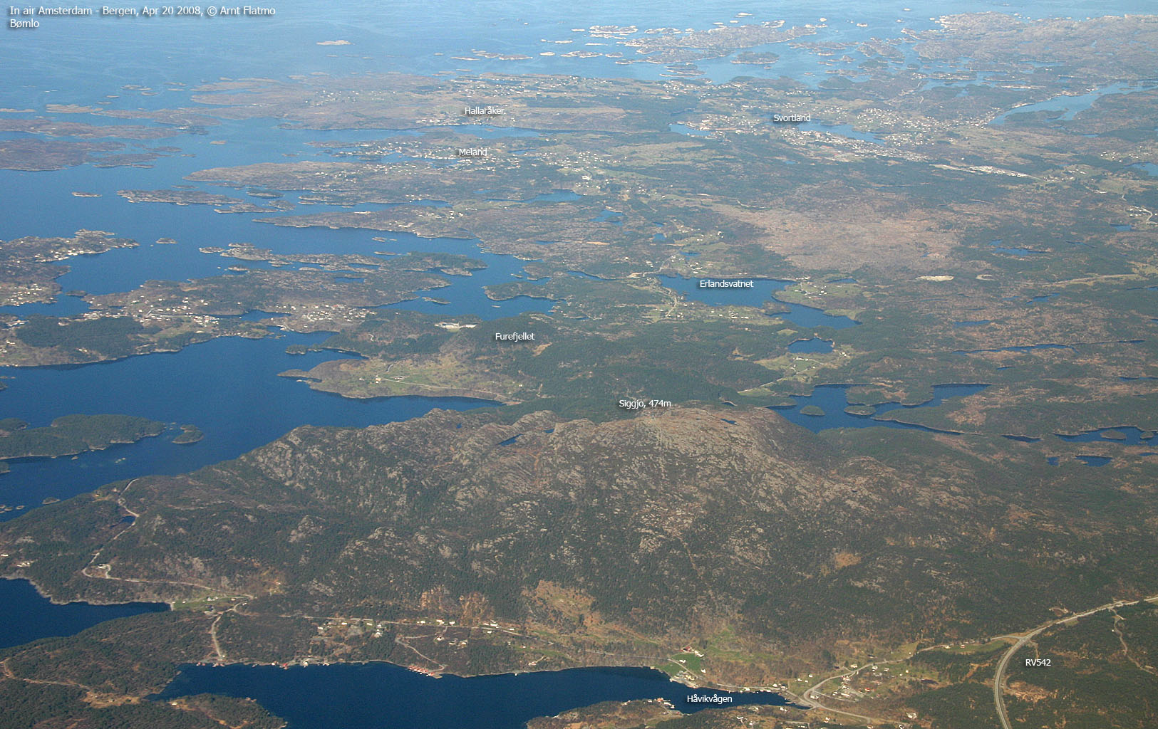
Siggjo (M711: 474m, Ø.K: 473,67m) has a primary factor of 474m, being the highest point on Bømlo island.
Notes: Class ratings are in reference to YDS. Click here for more information.
The trails described below are not necessarily the *easiest* trails to this mountain.
|
Hwy RV542 - Siggjo (all seasons)
|
|
Note: The below information is outdated
A new road system allows you to drive from Stord to Bømlo. I will revisit Bømlo and provided updated information.
Old access route:
From Bergen, take highway E39 southbound to Osøyro and then continue to Halhjem. Take the ferry to Sandviksvåg on Stord island. At the first junction, turn right and follow highway 545 south. Pass the sign to Stord airport and exit right towards Siggjarvåg, and take the ferry over to Bømlo island. On Bømlo, at the first junction, turn left, and continue to the top of the hill (Stokkafjellet). You will find parking on the right hand side (this is only 1km or so after the ferry). The trailhead starts by a gate.
The trail follows a forest road. After approx. 15 minutes, the forest road turns into a forest trail. Do not continue straight ahead. The trail up to Siggjo goes up to the right from this point. There is also a sign pointing towards Siggjo. From this point, the trail is well marked all the way to the top.
|
Trip notes Oct 2000In a quick pace, I reached the top in approx. 25 minutes. The ascent reminds a lot of hiking Ulriken in Bergen. "Slippery when wet" is not a cliche after rain. You really have to watch your step on the way down. On top, a tower and a hut gives shelter from the winds. Good views in all directions, especially towards the Stord mountains. From Bømlo, I took the ferry to Sveio and climbed Trollvassnibba (432m), which you see across the fjord towards west. From Sveio I took the ferry to Stord, and if I hadn't already climbed Mehammarsåto (749m, Stord) and Litlasåto (676m, Fitjar), this would have been a nice end to a long day, with 4 Kommune high points.
|
Move cursor to read notes, and click on the images to see full version.
Some of the thumbnails may have been cropped to fit the format.


No Javascript:
Other hordaland mountains
 Other Bømlo K. mountains
westcoastpeaks.com
Other Bømlo K. mountains
westcoastpeaks.com
