
Norwegian Mountains, Møre og RomsdalSilsetfjellet, 629m (Vardhaugan, Vardhågan)
Silsetfjellet
IntroductionSilsetfjellet by Eide must not be confused with Silsetfjellet by Batnfjordsøra. According to the official Norwegian maps, there is only one Silsetfjellet, and it's the one by Eide. The mountain has its name from the place Silset east of the mountain. Most of the Eide tops is found along a municipality border, and Eide is (by far) the most prominent mountain fully located within Eide municipality. Its primary factor is also the third highest within the municipality. Silsetfjellet can be hiked or skied from all around and is a very popular mountain. The most popular route runs from Eide, and stops by the viewpoint Stortua (449m). Some turn around here and some continue. The summit plateau is huge, and the 600m contour stretch 1Km across the plateau. Whenever the Nordmøre coastal region is blessed with snow, Silsetfjellet is a good mountain to ski. The top is also known as Vardhaugan/Vardhågan (cairn hills), and you'll find a number of cairns on the summit plateau. Silsetfjellet (and the route described below) is well documented in the book Turbok for Molde og Omegn (Olsen/Pedersen) Primary factor:Silsetfjellet (M711: 629m, Økonomisk Kartverk: 628,53m, UTM 32 V 418942 6978640) has a primary factor of 576m towards the higher parent mountain Melen (768m). The defining saddle (approx. UTM 32 V 415860 6979060) is found SW of Lake Lyngstadvatnet, more precisely Furumo and Myrebø. between Ref. Økonomisk Kartverk (5m contours), the saddle is within the contours 50-55m, interpolated to 53m.
Google mapGoogle's interactive map. You can zoom, pan and click on the markers.
Trail descriptions
Notes: Class ratings are in reference to YDS. Click here for more information.
The trails described below are not necessarily the *easiest* trails to this mountain.
Access (all distances are approx. distances) From the highway RV662/E39 junction in Molde, follow highway E39 eastbound (Kristiansund/Åndalsnes) 4,3Km. Turn left onto RV64 (Eide). Follow Rv64 6,1Km to a manned toll station (fee for passenger cars is NOK 15,- per Feb 2007). Proceed 6,1Km to the Molde/Bud/Elnesvågen/Eide roundabout and turn right towards Eide. Follow RV64 15-16Km to the Bollia junction just north of Eide. Turn left, drive 100m and across two speed bumps, then turn right and drive 200m. Turn left when you see the "Stortua/Lysløyper sign" and drive 300m straight ahead, where you will find parking (UTM 32 V 420789 6977967). The route Next to the parking, you'll see a lit forest road. As you enter this forest road, turn right. After 180m, on top of a small hill, turn left onto an unmarked forest trail. This trail takes you up the forest in the northwest direction, and crosses some boggy ground along the way. Wooden paths take you across the worst bog. At 270m elevation, the trail turns west/southwest and leads you up to Stortua. From Stortua, you have Silsetfjellet straight ahead to the west. As you're above the forest, you don't need any further trails. There are some steep cliffs west of Stortua. Seek north to bypass them. On top of Silsetfjellet, there is a vague path and some occasional markers, but if it's foggy, bring a compass or a GPS. There are several cairns on Silsetfjellet. The high point is
located at position UTM 32 V 418942 6978640. Descend your ascent route.
Pictures and Trip reports:
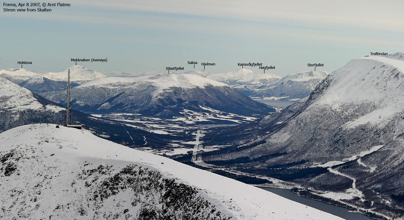
Other pictures
No Javascript:
|


