
For Information, maps, trailhead and route descriptions, click HERE.
This was the first stop on a rather busy Nordmøre weekend. I left Ålesund early Saturday morning, with plans to do Melen, Sjurvarden, Mekknøken (Averøya) on Saturday, Freikollen (Frei) and Saksa (Halsa) on Sunday. Monday was a public Holiday, but I assumed I would be back in Ålesund by then.
Melen:
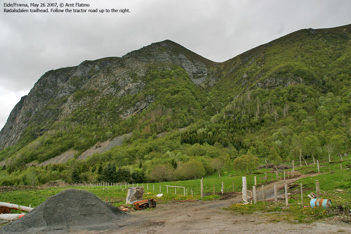
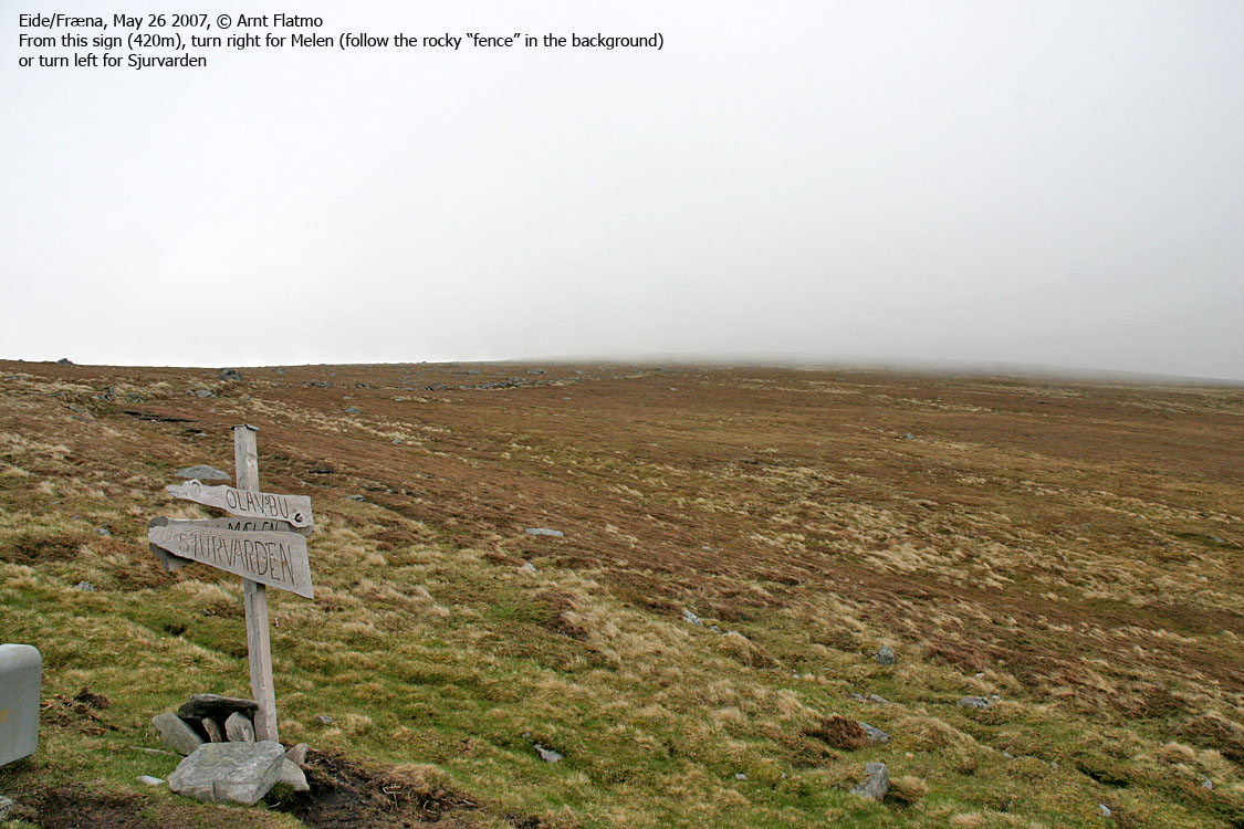
After asking around, I found the Rødalsdalen trailhead and was on my way up the valley 11:20AM. Wouldn't you know! It had been a brilliant morning, but now the sea fog came rolling in. After passing the Melen/Sjurvarden trail fork, I let my dog Troll out of the backpack. This was ideal terrain for this old and stubborn buddy of mine.
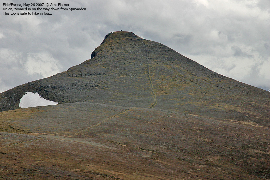
We reached Melen in thick fog 12:30PM, and I was depressed. No fun in being up here in fog, and moreover, would I be reaching ALL of these tops in fog? I had noticed that Averøya, my next stop, got the sea fog too. We only stayed on Melen for a few minutes, then headed back to the trail fork.
Sjurvarden:
Since I was up here, I could just as well visit Sjurvarden too. If the fog didn't lift, then there would always be a future visit to Bollen, the third top on this plateau. Near Skottenvarden, I stumbled upon a cool stone hut. It was named Olavsbu, but I didn't know that at the time. I took a look inside. One could certainly find shelter in this hut, should the sea fog take you by surprise (the trail isn't very distinct near Skottenvarden. It's rocky terrain. Small rocks.)
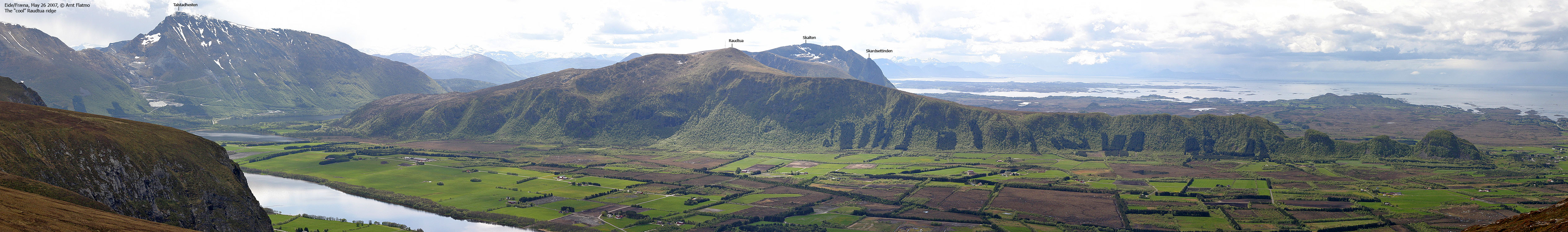
And wouldn't you know! On the way to Sjurvarden, the sea fog began to lift. Pretty soon, Sjurvarden was clear, but Melen could not yet be seen. The depression faded, and I reached Sjurvarden 13:30PM in a very good mood.
We stayed a while, hoping the fog would lift all around, but that didn't happen until I was on my way down the mountain. But at least, I got to see Melen summit before descending down Rødalsdalen. Troll was mighty tired when we reached the trailhead 14:30PM. I carried him up to the trail fork, and from the trail fork up to Olavsbu. He walked the rest of the route.
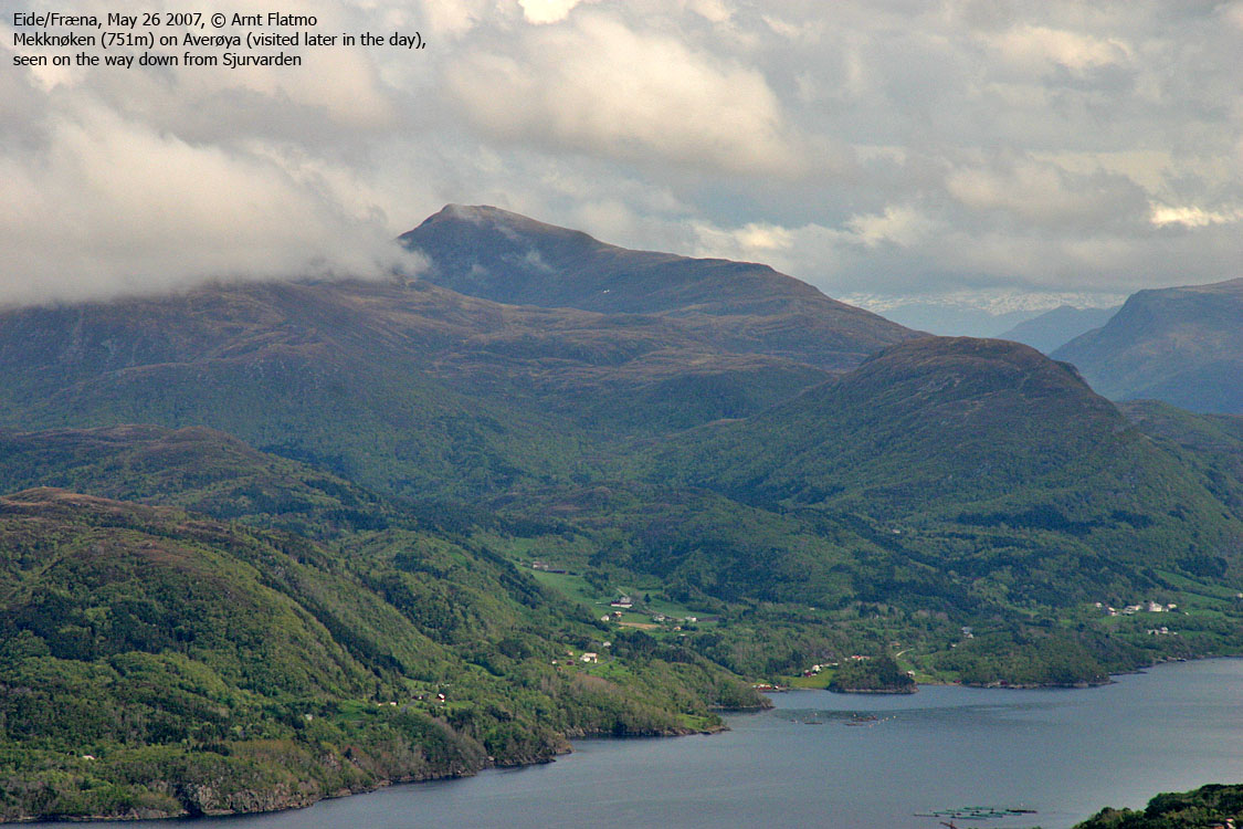
I was very uplifted by now. Tops #1 and #2 were in the bag, and next on the list was Mekknøken on Averøya. I looked forward to reach that top in sunshine. That didn't happen of course. More about that in the Mekknøken trip report.
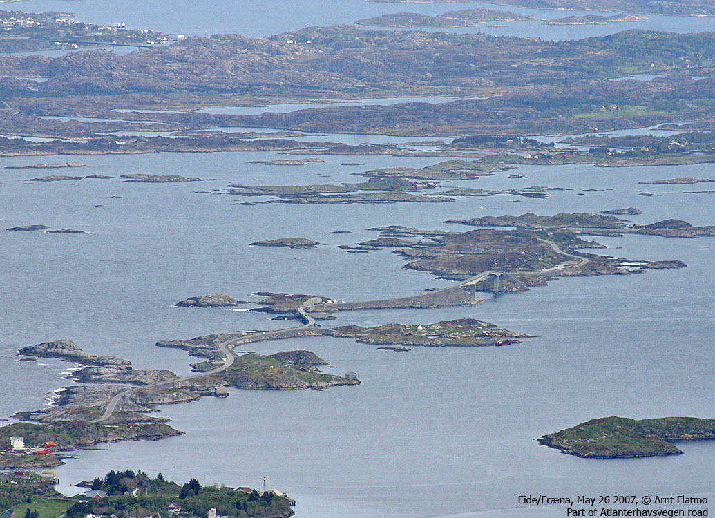
For the first time, I drove the road that is named Atlanterhavsvegen. Before I knew it, it was over. Only 8Km across some small islands. I had expected quite a longer drive. Sorry, RV17 up the Helgeland coastline is another planet in comparison.
To Melen


To Sjurvarden


Wide-angle view from Sjurvarden

50mm view from Sjurvarden

Other pics from Sjurvarden


Descent


No Javascript:
0 1 2 3 4 5 6 7 8 9 10 11 12 13 14 15 16 17 18 19 20 21 22 23 24 25 26 27 28 29 30 31 32 33 34 35
 westcoastpeaks.com
Other Møre & Romsdal mountains
Other Norwegian mountains
westcoastpeaks.com
Other Møre & Romsdal mountains
Other Norwegian mountains