
Norwegian Mountains, Møre og RomsdalSkarphornet, 698m

Skarphornet
IntroductionSkarphornet (The sharp horn) is one of the local Volda (the village) mountains. And it's not really that sharp. There are several routes to the top, but most routes start out at Lake Rotsetvatnet. This page will describe access via the "Himmelstigen" (The stairway to heaven) forest road. In winter, this road offers quite a memorable ski-descent. If you ascend Skarphornet on skis, the north ridge (Vardehei[d]a) is the best route to the summit. You have also several choices for a round trip. You can descend the south ridge and return via Horndalsvatnet, or continue across Hornet and return via Høgedalen. Even if Koppefjellet is obscuring the views to the east, you'll have a great view towards Ørsta peaks such as Saudehornet, Vassdalstinden, Kolåstinden and Sætretindane. You'll also have a fine view towards Volda (on your way up) and Melshornet.
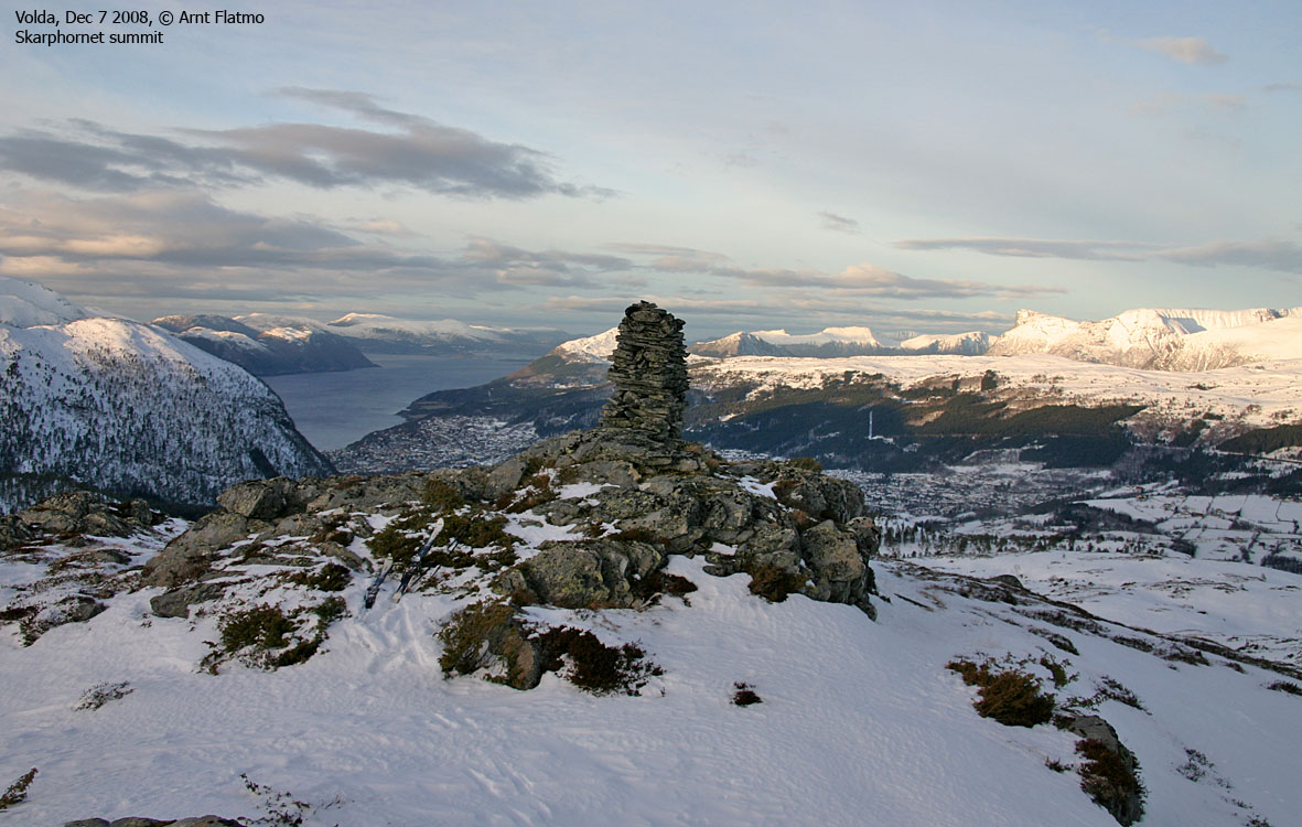
Primary factor:Skarphornet (Norge 1:50,000: 695m, Økonomisk Kartverk (ØK): 698m, UTM 32 V 352217 6890566) has a primary factor of 165m towards the higher parent mountain Koppefjellet (940m). The defining saddle (approx. UTM 32 V 352447 6890067) is found between lakes Vassteinvatnet and Sætrevatnet. Ref. Økonomisk Kartverk map (5m contours), the saddle is within the range 530-535m, interpolated to 533m. GPS measurement on the cairn (1,5m high) read 689m, averaged over a 5-minute period (error margin +/- 0,9m). There ground just east of the cairn seemed to be higher than where the cairn was located, so measuring on top of the cairn is probably acceptable.
Google map
Google's interactive map. You can zoom, pan and click on the markers.
Trail descriptions
|
|
Route 1: Rotsetvatnet - Skarphornet (all seasons)
|
|
Access
(all distances are approx. distances)
(all distances are approx. distances)
The nearest bigger city is Ålesund. From Ålesund, follow highway E39 towards Bergen/Volda to the ferry at Solavågen. Take the ferry over to Festøy, turn right at Festøy and follow E39 towards Ørsta (38,3Km). At the highway RV655/E39 junction in Ørsta, keep following E39 (Volda) for 9Km until you have the ferry harbor in Volda on your right-hand side.
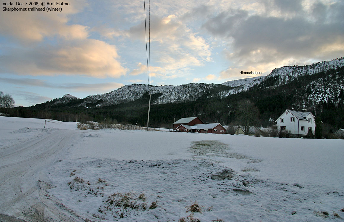
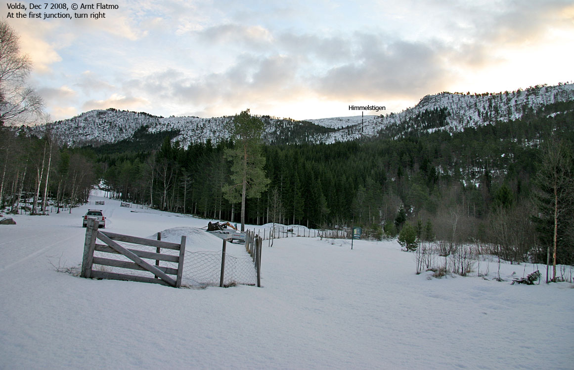
Drive 750m along RV651 through the village centre and turn left at the Andaneset junction (signposted). Drive 800m to a roundabout. Take the 2nd exit (go straight ahead and don't turn right towards Fyrde). You're now on the road to Krøvelseidet and Åmdalen. Drive 1,8km on this road and turn right towards Vassbotnen. Follow this road 1,4km down to the east end of Rotsetvatnet. You see a forest road on your left-hand side, and a farm nearby. Find parking along the road you're on, or see if you can find parking along the forest road.
The route

Upper route to Skarphornet
(Click for larger image)
From the Vassbotnen road, follow the forest road 400m, then turn right onto another forest road. This road soon forks. Stay to the left. There a "million" forks along the main forest road, so you'll need to have a "feeling" about the main road. At 190m elevation, the road turns to the southwest. Don't be alarmed about this direction. At 230m, the road turns to the southeast, and you follow a 650m long stretch before the road gets curvy. You're now on the "Himmelstigen" road with the "Huldresvingane" curves. A ski-descent on this road will be quite something, but cross-country skis are not recommended..
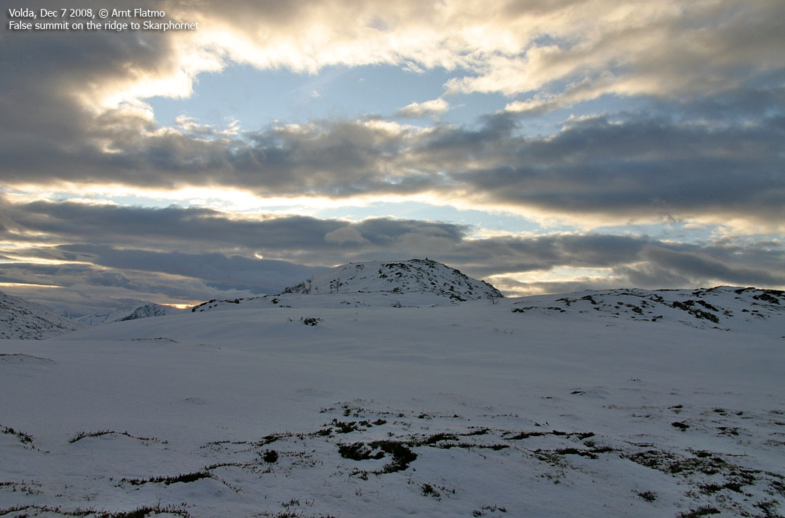
At 450m elevation, the road ends. Continue southeast onto Skarphornet's north ridge. You'll pass a couple of cairns along the ridge until you reach the high point, marked by a proper cairn. The ground next to the cairn may be slightly higher than the summit point.
 westcoastpeaks.com
Other Møre & Romsdal mountains
Other Norwegian mountains
westcoastpeaks.com
Other Møre & Romsdal mountains
Other Norwegian mountains


