
Norwegian Mountains, Møre og Romsdal
Store Smørskredtind (on foot) via Tverrdalen,
July 6 2008
To the main Smørskredtindane page (maps, route descriptions, etc.)

The route to Smørskredtinden
(Click for larger image)
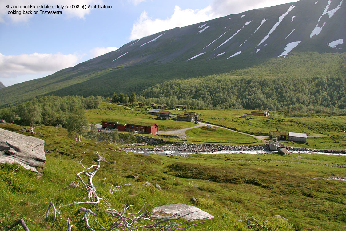
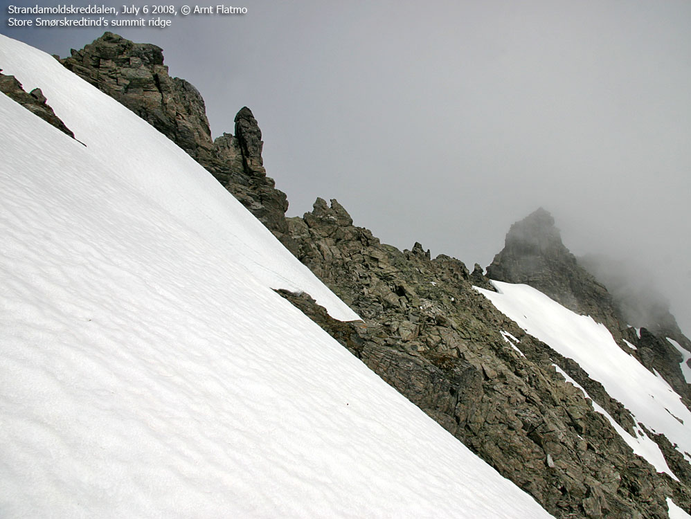
on ascending Store Smørskredtind on this Sunday, I might have gone looking for other mountains when I saw that the highest Ørsta peaks were hidden in clouds. But perhaps the clouds would lift during the day? I decided to stay true to my plan and see what the day would bring. I had chosen to hike out of Strandamoldskreddalen, where I had never been before.
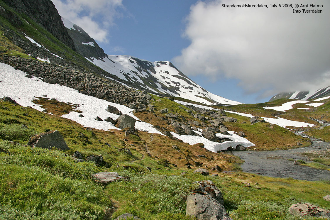
I left Instestølen 10AM and found the path towards Tverrdalen. The hike through Tverrdalen was slightly boring, as the mountain tops surrounding me were still hidden in clouds. But halfway through the valley, Store Smørskredtinden "opened up" in front of me, and I felt small. Very small. I was just below 800m elevation, and Store Smørskredtind looked like Everest. Well, not exactly, but it looked huge. The couloir had snow from head to toe. And I don't like long, steep snow slopes.
practice on stuff I don't like. Clouds moved in and hid the mountain once again. But now I had been staring the monster in the eyes, and I was ready. The hillside up to the glacier was truly agonising, and I screamed in pure frustration while crossing one-step-forward-and-two-steps-back scree. The snow, soft as it was, was an even worse alternative.
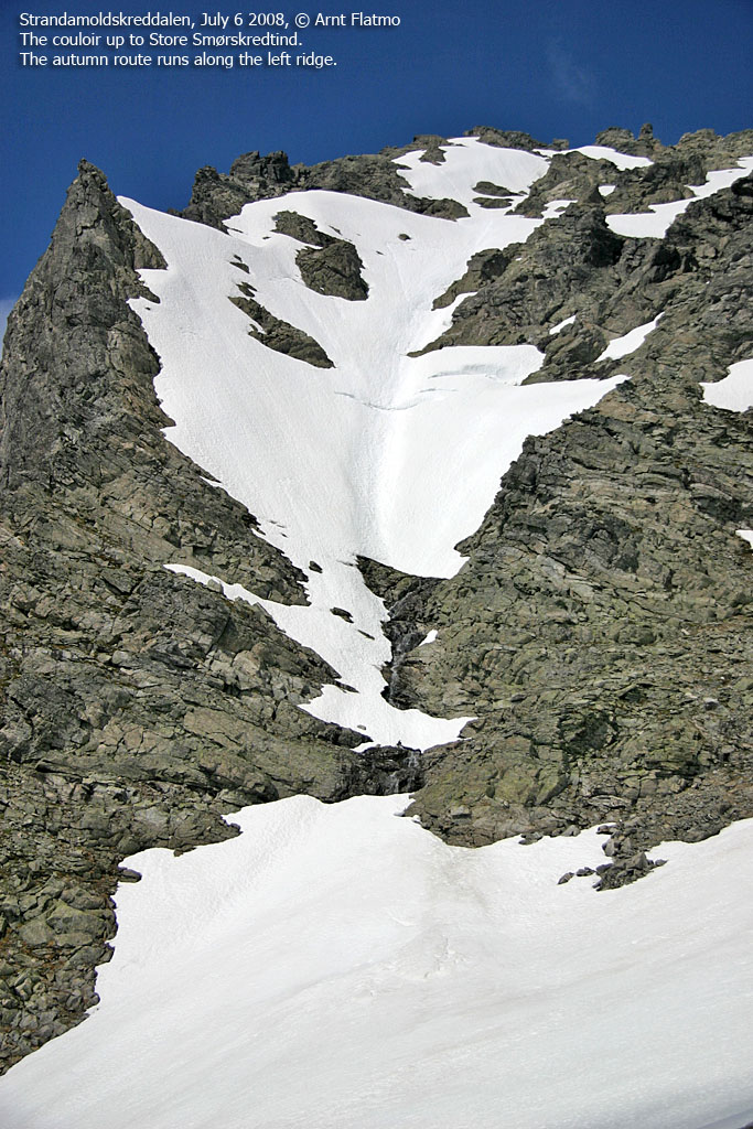
Standing in front of the couloir, I noticed that I could actually scramble a long way on the left-hand side. But I couldn't avoid snow, so I decided to stick to my original plan. As the soles on my boots have seen their best days, it felt better with crampons on. After some scary moments on snow in the past, I've begun to carry two axes. Moreover, the couloir wasn't very steep. Things looked good, and I looked forward to get on with it.
The ascent of the couloir ..was quite fun. Some parts called for extra attention, especially where I found slab rock 1cm below the snow. Workaround: descend and move sideways until proper snow is regained. Halfway up, there was a section where I could just walk, but then I ran into the steepest part, which was probably around 40 degrees. This section didn't last very long and minutes later, I was standing next to the summit cairn. The time was now 12:50PM.
The clouds didn't lift. At least not until the afternoon. But I didn't miss the views. I have had the pleasure of superb views from the nearby Slogen, Jakta, Saksa, Brekketindane and Kvitegga peaks. Now, I was just happy about having completing the ascent of this mighty mountain. I sat down, enjoyed my lunch (yes, I had brought sandwiches!) and just chilled out.

Halfway up the couloir
(Click for larger image)
Descent
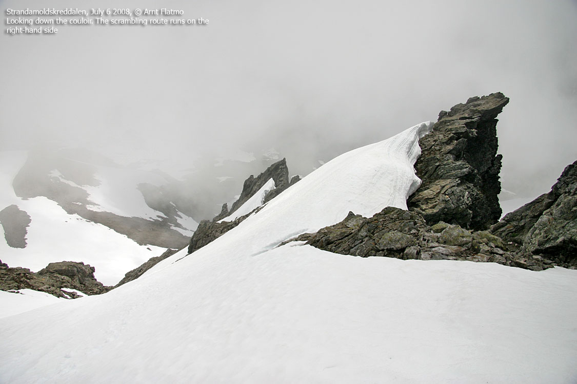
1:10PM, I left the summit. I tried to walk down face out, but wasn't able to find a good, working method. The snow gave way under me. I kept sliding and had to go into self-arrest. I chose to descend as I had ascended, which meant I would have full control, but on the expense of time. It took me 55 minutes(!) to descend 250 vertical meters down to the glacier. But I wasn't in any hurry, and it was altogether pure fun. But I made a mental note about not having a desire to descend anything steeper than 40 degrees, unroped.
Tverrdalen was more enjoyable now that I was filled with good moments from the mountain. Approaching Instestølen, I tried to be a good sport and not disrupt a heard of goats down by the river. Quite futile, as they all came running towards me. But I enjoy goats, although there has been episodes. 3:36PM, I was back at the car, having completed a 5,5 hour memorable trip.


