
Norwegian Mountains, Møre og RomsdalSolavågsfjellet after dark, Oct 31 2007
This route is described on the Solavågsfjellet main page.
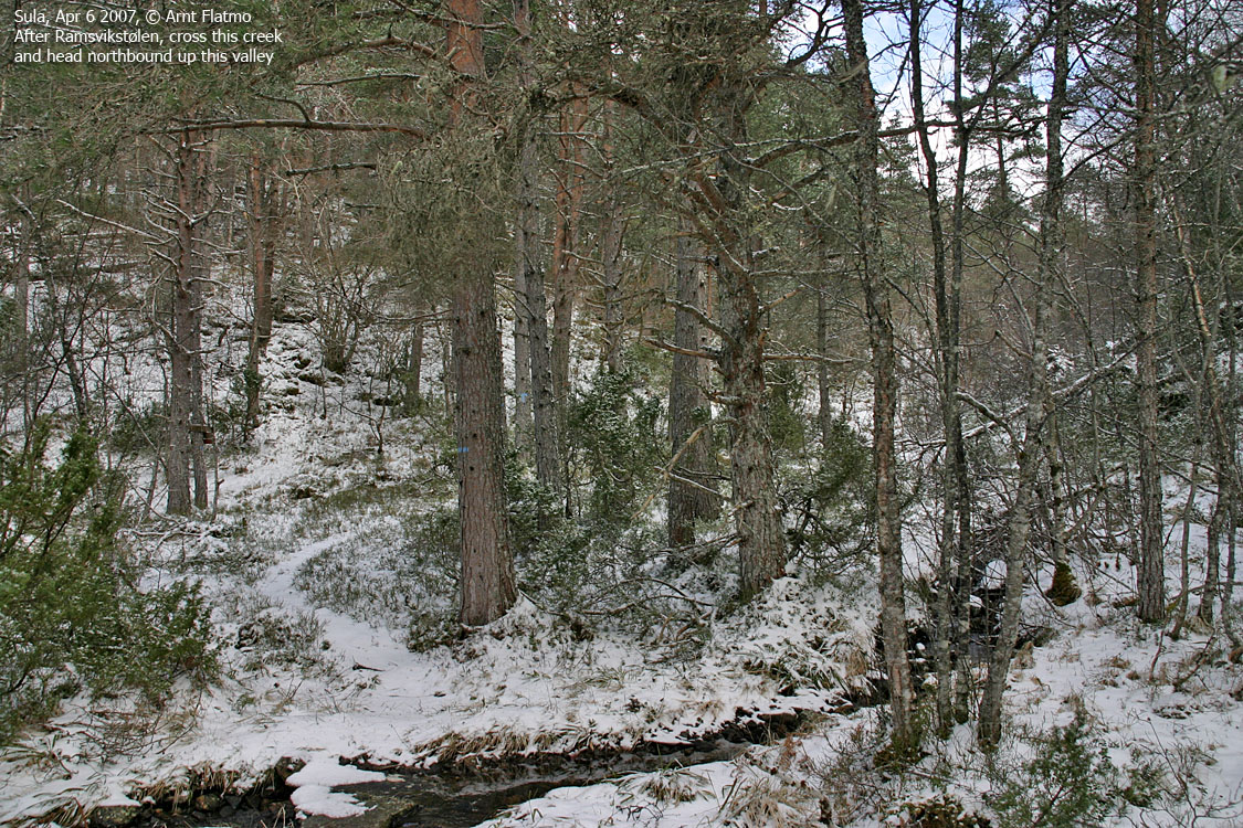
It was one of those evenings where hiking mountains would be a very bad idea. A storm was roaming the coastline, and massive amounts of rain was falling. Probably not as much as in Bergen, but still. My colleague Arngeir and I had planned this little forest walk some days earlier, and we normally like to stick to our plan. We met at Solavågen and headed out 16:35PM, while it still was daylight, heading for Ramsvika. We (unintentionally) scared off 3 deer on the road to Ramsvika. At Ramsvika, we headed up the forest, and after passing Ramsvikstølen, we crossed a creek that had now gone wild. It certainly deserved to be called a river, and we could barely jump across it. The whole area around Ramsvikstølen was one big pool. After switching on our headlamps, we continued up to the ridge south of Svartevatnet. On the ridge, it became rather evident that life above the forest would be severely hard on this evening. We reached the high point 17:25PM and I had one chance for a picture before the lens was all wet. It was good to be outdoors, and we had a good chat during the hike. We descended the northeast ridge, which was probably the most boggy route I've ever seen in my life. Descending with an efficient pace in a mix of bog, slippery rock and even more slippery roots is a neat challenge. You have to focus and think quickly. I reckon it's good for the brain.. We were back at the trailhead 18:00PM, after this (approx.) 4,8Km round-trip. I was quite wet. My Patagonia jacket isn't water resistant anymore. But that figures. Nothing I wear last more than one year, anyway. Map of the route and 1 picture
No Javascript:
|


