
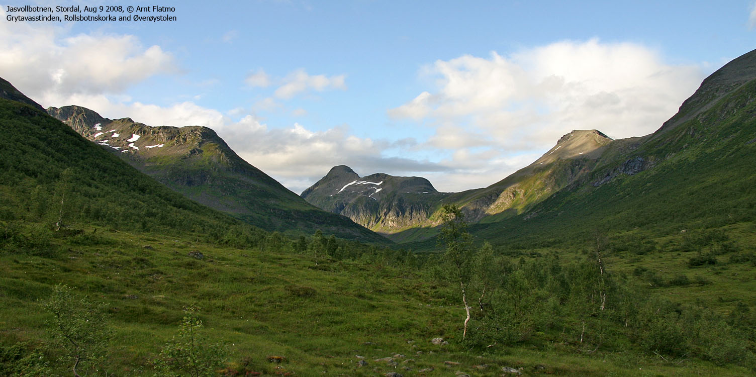
Norwegian Mountains, Møre og Romsdal
Storbotnshornet (failed attempts), Aug 9 2008
Storbotnshornet main page will be added when the summit has been visited...
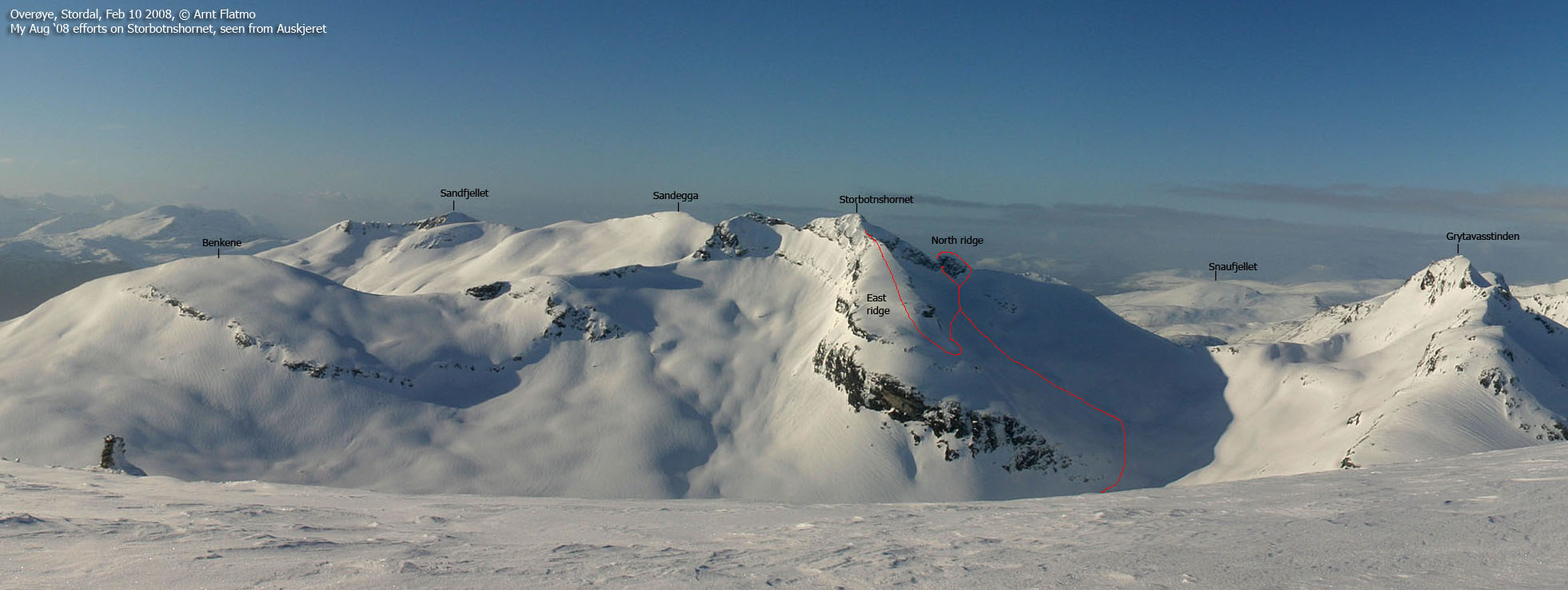
The ridge attempts
(Click for larger image)
On this Saturday, I was about to give Storbotnshornet a try. There are no easy ways up this mountain, so I would need OK weather. yr.no had yellow symbols on the forecast, which is a good color for hikers. I drove out of Ålesund with the roof down, playing loud music and being in a very good mood.
Passing Skodjevika, it started to rain. Light at first, then more. 70Km/h was just enough to keep raindrops from falling on the seats and me. The folks in the car behind me must have figured me for a weird-o. The wipers were doing medium-speed, and I guess it looked a bit odd. I began pondering on a plan B, but as my mind had been so focused on Storbotnshornet, I decided to stay true to my plan. It was just raining. No low clouds or anything. So what if I got wet? The temperature was still good.
Having been to Storheimshornet in 2006, I remembered the trailhead and the path. I was on my way 2:20pm, passed Jasvollsætra 2:40pm and Botnastølen 3:05pm. From here, it was all new terrain. Ahead of me was a 3Km walk before I could begin my ascent of the mountain. Fortunately there was a vague path halfway through the valley, which at least helped me maintain a fair pace.
Into the valley
(Click for larger image)
A friend had told me that reaching Storbotnshornet on the north ridge wouldn't be too hard. So that's where I was heading. But first, I had to pass a huge slab section. The rock was still fairly dry, so I got up by stepping on minor slab folds here and there. But if it kept on raining, I wouldn't be able to descend exactly this way. My direction was straight towards the summit. As I reached the snowfields in the basin, I adjusted my course towards the north ridge.
I remembered my friend saying something about "you will need to descend
into ..",
and what he meant was quite
obvious when I was standing on the ridge with a 15-20m drop below me.
"Holy cow, this is serious", was my
first impression. And my first impression was correct. My friend had come the
other way, ascending here. Which (IMHO) is quite different. I had brought a short rope, and two nuts (just
emergency gear). But no slings, harness
or other important gear. I was already halfway down the cliff, and could
scramble some more until I would get
to a point where I would be truly exposed. The rock was slippery. The grass was
slippery. I ended up listening to my inner
voice, which told me to "come back some other time,
with proper gear and just rappel down the cliff".

My north ridge problem
(Click for larger image)
So now what? Go to Grytavasstinden instead? Not now that the east ridge had caught my attention. I could see a huge step on the east ridge, but perhaps it could be bypassed? I went back to the snowfield. But before moving on to the east ridge, I tried to climb up back to the north ridge via a small cleft. This might have worked for a proper climber, but I didn't have the guts. The rock was wet. The moss was wet (and loose) and it was steep.
So
I glissaded down the snowfield until I reached the entry point for the east ridge.
The glissade had it's nerve,
as I could NOT afford any weak points in the snow. That would mean I would be
trapped below the snow and be gone
forever, as I doubt this snow ever goes away. While just being a snowfield, it
resembled a glacier, with crevasses
here and there.
The east ridge was broad in the beginning, but turned narrow at 1300m elevation. It wasn't raining anymore, it was hailing! I wiped snow off my jacket, and the rock was slippery as soap. Sections which would have been easy on dry rock were now out of the question. I had to find alternative ways around small problems. At 1320m, I ran into the big step. It was of the sort which wasn't too hard to climb (YDS 4), but *I* couldn't easy climb back down. I would have to rappel this section, and since I had already abandoned this idea on the north ridge, I knew my ascent would end here. I took a good look at the remaining route, which was much easier than the problem in front of me. I was convinced that I could easily get up and down this route on dry rock, but I would need to bring proper gear for a rappel.

My east ridge problem
(Click for larger image)
That would be another day. My focus now turned towards the descent, which would be serious enough. First, there was the boulder on the east ridge. I made it back down to the snowfield without incidents, and now I had the choice of sliding down the snow, or scrambling down the mountain. I chose the snow, although the lower snowfields looked less safe. At one point, I made a sudden stop. There was no evident reason for my inner alarm to go off, but it did. I poked the axe in the snow in front of me, and it was like cutting butter. I carefully backtracked and moved onto the slabs.
The slabs had turned really nasty by now. Slippery like soap. The whole basin was just a huge slab area, but in-between the slab folds, small boulder had piled up. I could use these rocks as braking points, and I was able to get back down to the river without big drama.
Walking this long valley wasn't so fun now that I didn't have a peak to show for, but I was able to change my mindset and concluded that it had been a nice trip after all. I was convinced I had made all the right decisions, even though the feeling of defeat was hard to shake off. I was back at the car 8:40pm, after walking almost 18Km. The sun was now shining, like the forecast had promised. Only a few hours too late...


