
For Information, maps, trailhead and route descriptions, click HERE.
Yet another after-work-in-Ulsteinvik hike in the Herøy/Sande region, and the weather was outstanding. My main goal was Storetua, one of the higher mountains on Gurskøya. The original plan was to hike from Leikongeidet, but on the way to Gursken, I decided to include Røddalshorn on my hike. So my new trailhead became Holte, which seemed like a better choice. Providing there would be paths..
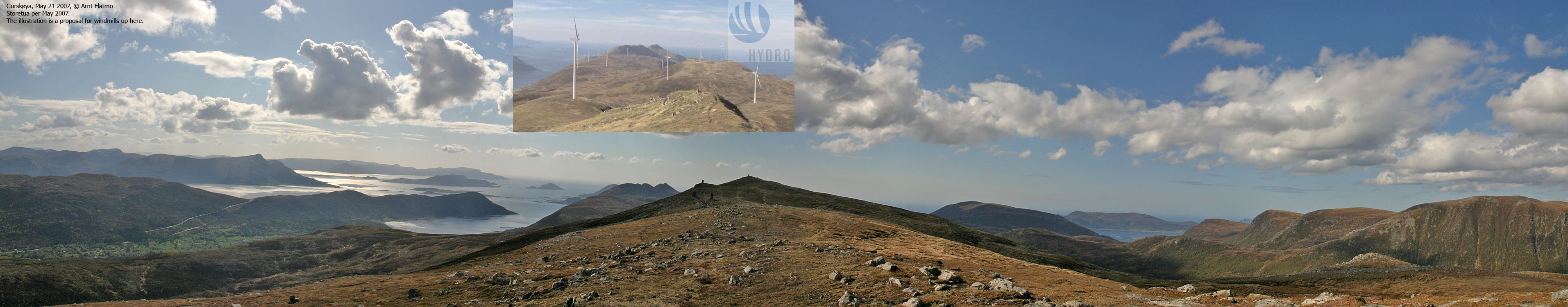
I asked a local guy about paths up the mountain. Instead of just "Yes, there are", I got a TON of information which I was not able to process in real-time. Then, in the middle of a sentence, he acted weird. Almost like he froze. Then he said - "You're not one of those windmill guys, are you?". (At the time, there was an ongoing debate about putting windmills up on the mountain...)
In a situation like this, it would be in my nature to answer "Hell, I sure am". But now that I was trying to OBTAIN information, I gave him my cutest smile and replied "No!". The cramps on the guy's face disappeared, the PAUSE button went off and he continued rambling on about paths to the left and paths to the right.
Storetua:
At the trailhead, I found an information board with all the trail info I ever needed. I left the trailhead 16:10PM. It was a very hot day, and I carried my dog "Troll" for a while. The length of his tongue suggested that hiking was not priority #1. The path towards Sæsvatnet was just fine. And then I noticed the path up to Storetua. Troll was now willing to give walking a try, but only for a little while.
It was just great to be up on the Storetua plateau. There was nothing rugged or sharp about this terrain. Just a looong plateau (1Km), where Troll could easily follow. We reached the top 17:05PM. I was glad I got to do this hike before any windmills would come into place (if they ever do).
Stadlandet is getting closer and closer. I have worked my way southwest from Ålesund. First Hareid and Ulstein kommuner, then Herøy and now I'm getting a grip on Sande. Vanylven and Stadlandet is unknown terrain to me, and I look forward to do the first tops down there.
Røddalshorn:
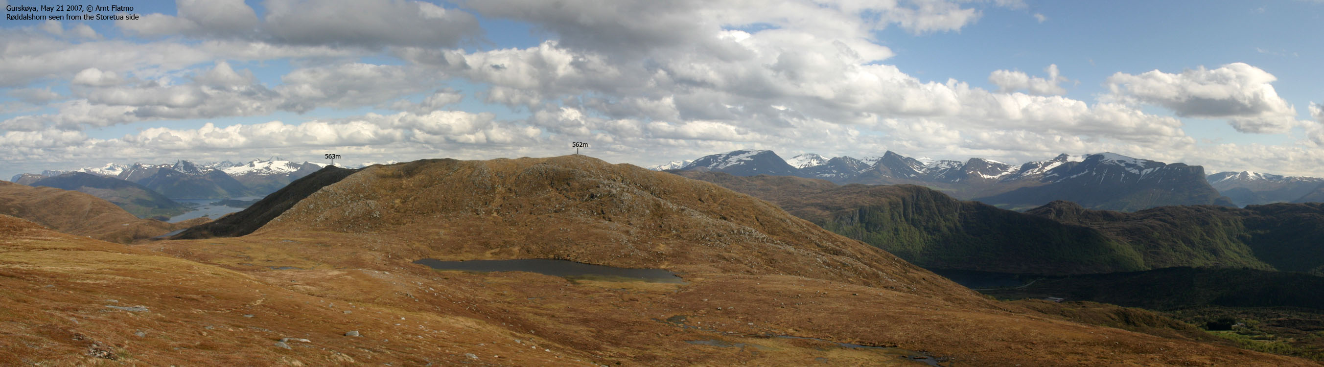
We left Storetua and headed over to Røddalshorn. On the way up the plateau, I noticed a top 1Km to the east. That top appeared to be the highest, but once I reached point 562m (not a map point) and saw a small cairn, I wasn't so sure anymore. The time was now 18:00PM, and I decided that it was time to return back to Ålesund. If the eastern point was higher, it would be no big deal to visit that point from Leikongeidet. It turned out that on Økonomisk Kartverk, the eastern point was 1m higher. But my GPS indicated that the western point was (probably) around 566m. All the more reason to go back and measure some more.
From Røddalshorn, I took a direct (off-trail) short-cut back to the trailhead. This short-cut was getting more and more cumbersome the lower I got, and there was even a moment or two that I regretted not following the path back down. In any case, it was a good day, a good hike and good views.
GPS track and some morning pics


To Storetua


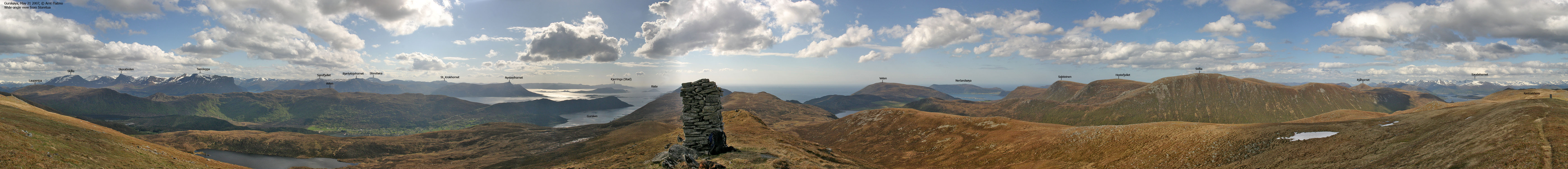
Wide-angle view from Storetua

Zoom views from Storetua


To Røddalshorn


Wide-angle view from Røddalshorn, point 562m

Other pics from Røddalshorn + descent


No Javascript:
0 1 2 3 4 5 6 7 8 9 10 11 12 13 14 15 16 17 18 19 20 21 22 23 24
 westcoastpeaks.com
Other Møre & Romsdal mountains
Other Norwegian mountains
westcoastpeaks.com
Other Møre & Romsdal mountains
Other Norwegian mountains