
|

Snilstveitøy seen from Malmangersnuten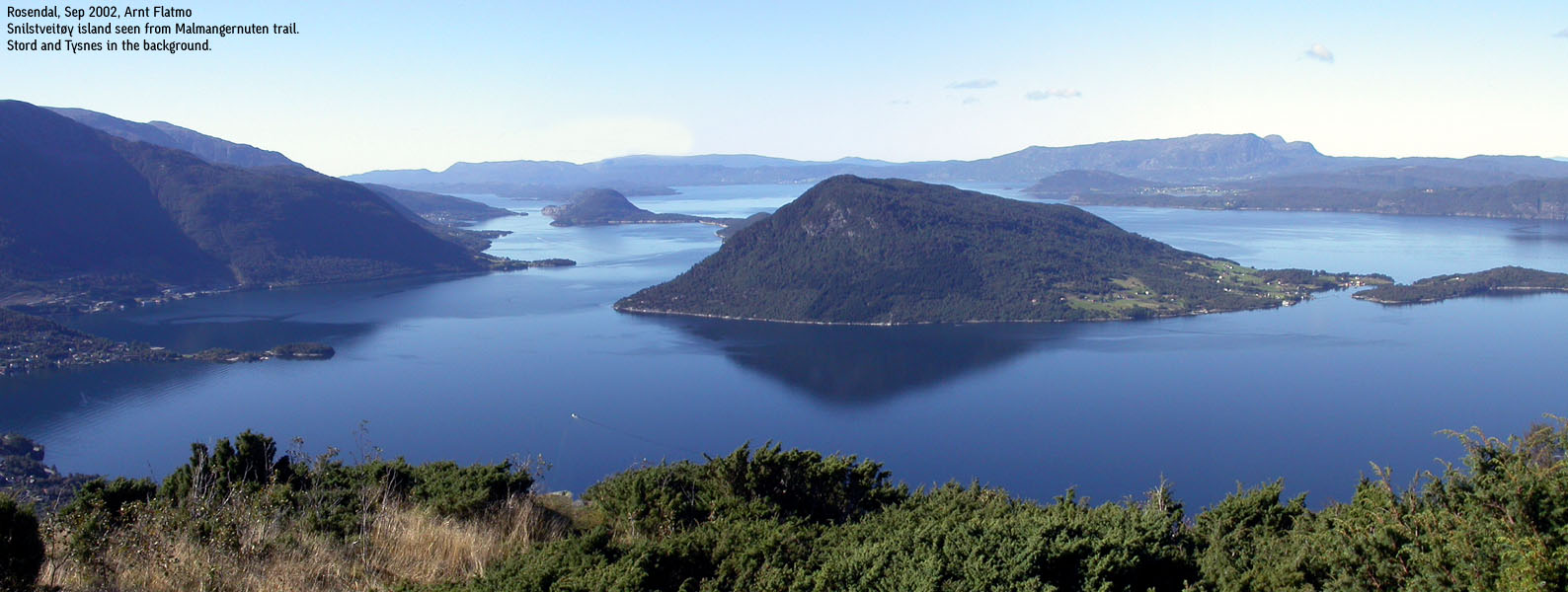
|
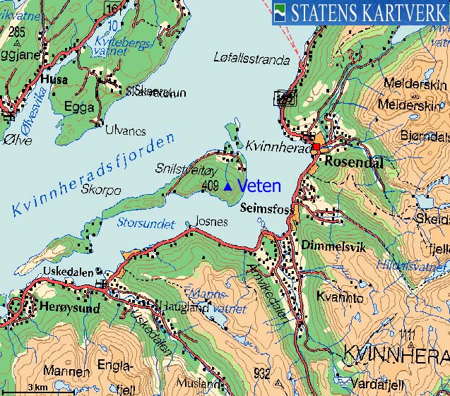
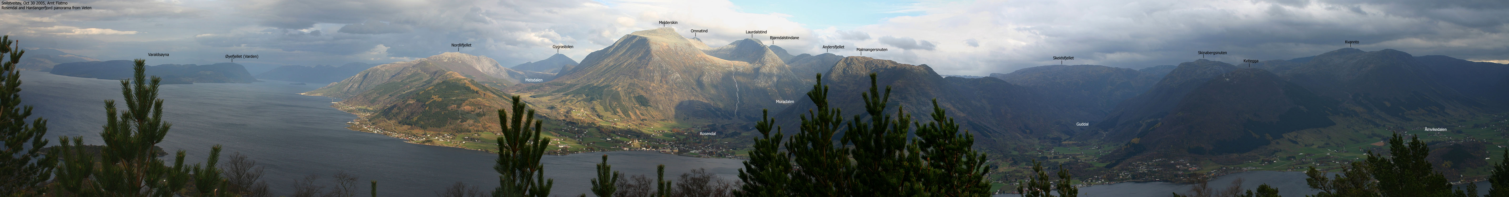
Snilstveitøy island is located just outside Rosendal in Kvinnherad. The highest point on this characteristic island in Hardangerfjorden, is Veten (409m), offering "front-row" views towards the mighty mountains rising up from Rosendal. Although a few handfulls people are living permanently on this island, Snilstveitøy "awakes" in spring/summer, and in the holiday season especially. The only way to Snilstveitøy is by boat. Snilstveitøy is separated from its neighbour island Skorpo by the narrow Mjødnasundet strait, although some maps can make you think everything is one island.
If you would like to visit region, there are various sources you may contact for further information. Rosendal Turistservice, Rosendal Fjordhotel, Kvinnherad kommune, Baroniet, to name a few. You may also view on-line pictures from Snilstveitøy's local newspaper Øyaposten. Visit hsd.no for boat service to Snilstveitøy. The shuttle to and from Snilstveitøy is run by Kvinnherad Båtservice (Johannes Tveitnes) Tlph: +47 53480200. (This shuttle information is valid per Nov 2005. Thanks to Atle Røyrvik for sending along this information).

The harbor in Snilstveitøy show signs of inspiration from near and far. Above "Vikinghallen" (the Viking Hall), you will find "Hårek" (Hagar the Horrible) and "Gyda". Let yourself be excited. "Eirik Raudes Bu" (Eirik the Red) can also be just the right place to be at, on those long and warm summer nights by the fjord. See groceries aligned perfectly at the local store.
From the viking age, and all the way up to the end of the 20th century, "vardebrenning" has been an important part of a.o. the defense system. "Vardebrenning" means lighting beacons. The beacons were built from wood and called "Vetter", and this is where the name "Veten" originates from. In other words, Snilstveitøy's high point was among the coastal hills and mountains that served as the defense communication system. The following information (in Norwegian) was available at the summit per Oct. 2005;
|
"Veten" er det sikraste fornminnet på Øyo. Dete stadnamnet fortel at her var ein av dei mange vardestadene i fjorden. Frå Veten kan ein sjå sju kyrkjesokner, seisest det. Sikkert er det at Øyeveten låg lagleg til når vardeelden skulle varsla vidare innover. Om veret var lagleg, såg ein elden på Skorpo, Tysnes og Ølveshovda. Vardehytta under Vetaknausen hadde dører eller gluggar i dei fire himmelretningane. Slik var påbodet i Magnus lagabøters landslov. Så det var nok hustre å sitja der og stira ut i natta. Og når det så - endeleg - loga opp i vardane sørvest i fjorden, så var det med famlande hender og rennande augo å få den suprå veden til å brenna. Men brenna måtte det. For om vardane brann, "fyrir sunnan ok nordan", men ikkje på Veten, måtte den som var ansvarleg for veten på Øyefjellet, bøta for Kongen. Tradisjonen seier at den siste vardehytta - truleg frå omlag 1700-talet - vart flytt heim i Øye og teken til grishus! Om den siste veten fortel Karstein Hauch at bålet var ei stor, avborka fura, som på den måten var full av tyri. Denne fura var knusktørr og full av tjøra, slik at ho same kva veret var, stod der klar til å bli sett eld på. Kilde: Kvinnherad 3, gards-og-ættesoga.
The short summary is that the top was a windy place, and if you weren't able to light the beacon when you were supposed to, you would have "issues" with the King.

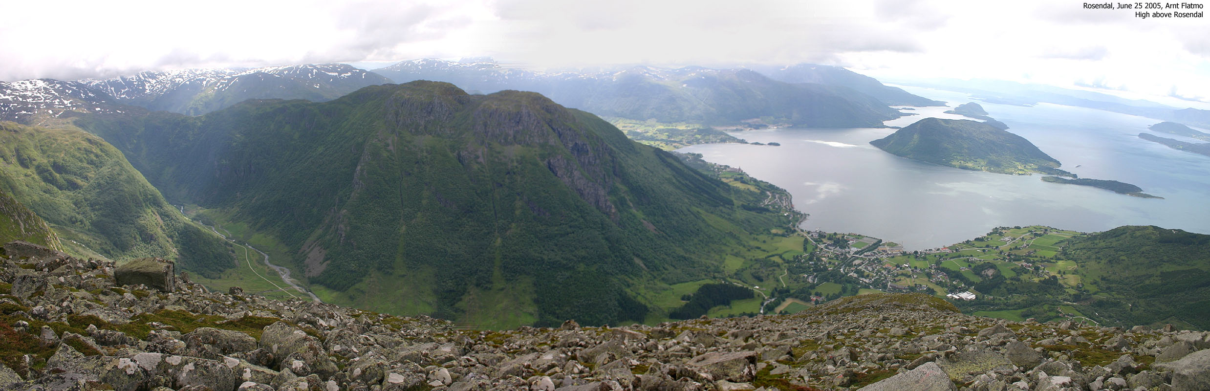
Snilstveitøy seen from Solfjellet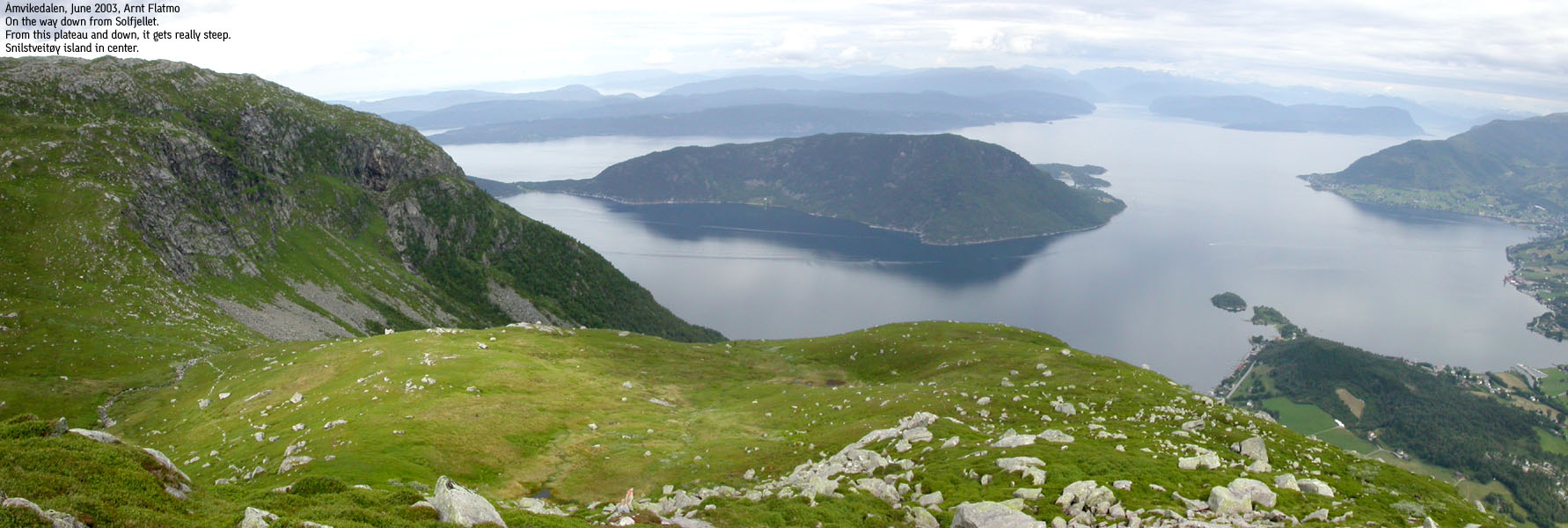
|
Varde
Det høyrdest ved natt
eit dunder på dør,
og husbonden vaknar,
spring fram og spør:
"Kva er det som belar?"
"Jau, no må du ut!
for varden lyser
på Høgenut!"
Og kvar mann visste
i same ande
at no var det kome
ufred til landet.
Og mennene herklede
på seg tok,
og skjold og øks
dei lyfta frå krok;
dei hekta i beltet
sitt gode sverd,
treiv spjut og boge
og skunda til ferd.
For kom der dei
ville Noreg herja,
så fanst det og dei
som ville det verja.
Og alt som varde
frå varde vart tend,
dei sanka seg saman
frå grend til grend.
Og fylkingi bygdest,
og veg ho fann,
der føre gjekk hovding
og merkesmann.
Og ufreds-karen
fekk jamnan smaka
kva det hev på seg
at vardar vaka.
Og gjev det aldri
må verta sagt
at landet ligg
utan varde-vakt.
Og logar kje varden
på tind og nut,
han logar i hjarta
hjå Noregs gut.
Ja brenn, du varde,
du signade, klåre,
bjartare,høgre
for kvart eit året!
Per Sivle (1857-1904)
Thanks to Liv Nygård for sending the poem. |
Primary factor:
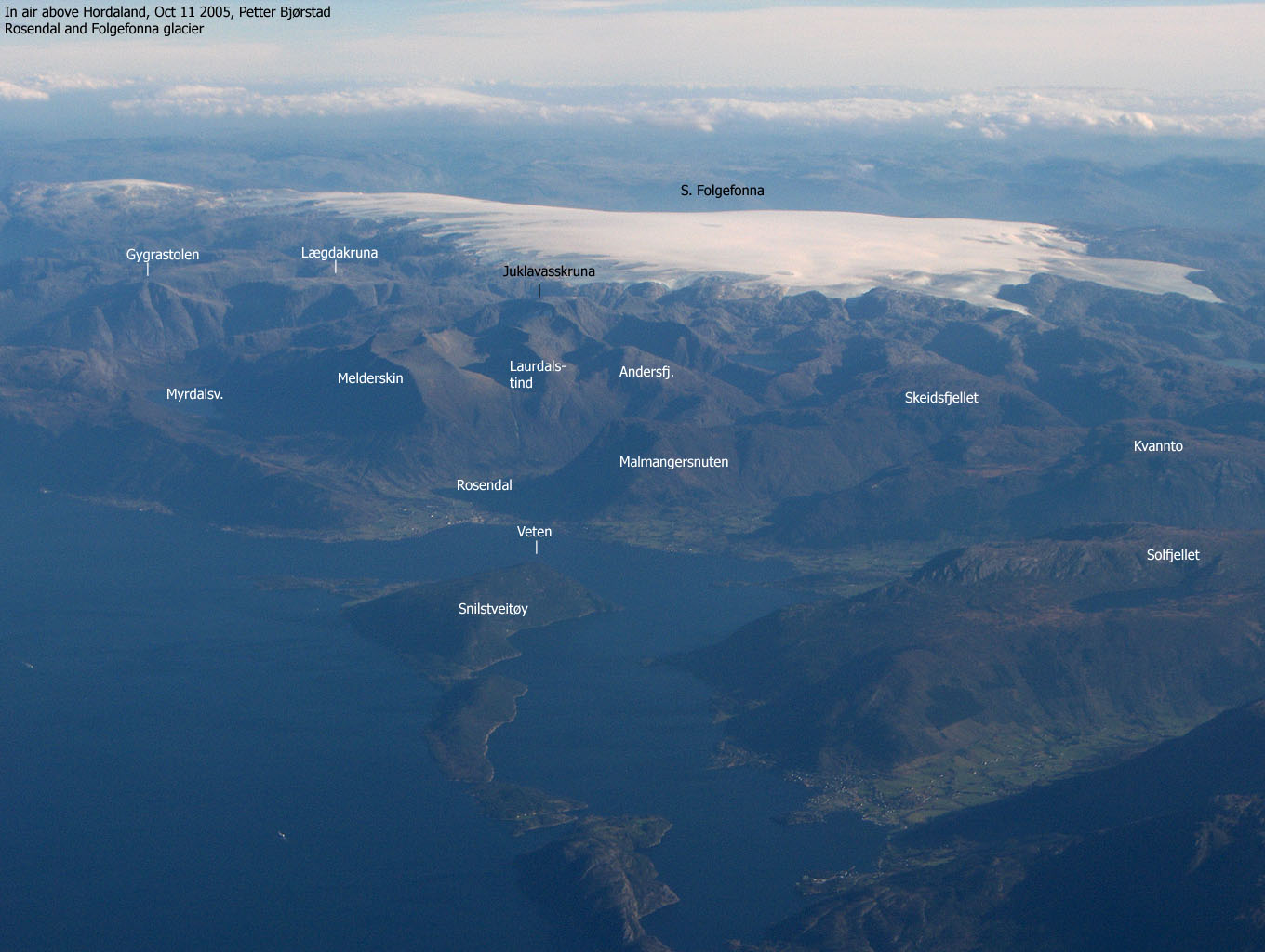
Veten (1214-I: 409m, Ø.K.: 408,78m) has a primary factor of 409m, as it is the highest point on Snilstveitøy island. Veten is ranked among the top-60 on the Hordaland-by-primary-factor list. In other words, quite a prominent top on the county scale.
Notes: Class ratings are in reference to YDS. Click here for more information.
The trails described below are not necessarily the *easiest* trails to this mountain.
|
Snilstveitøy harbor - Veten (summer/autumn)
|
|
From Bergen, follow highway E16 towards Oslo. In the E16/RV7 junction at Trengereid (roundabout), turn right onto RV7. Drive down to Samnangerfjorden, Pass Bjørkheim, two tunnels and turn right onto highway RV48 (Rosendal/Tysse/Mundheim).
Drive to Mundheim by Hardangerfjorden, approx. 41,5Km from the highway RV48 junction. Turn right onto highway RV49 towards Gjermundshamn/Rosendal, and follow this road for approx. 12,9Km to the Gjermundshavn ferry. Cross Hardangerfjorden on the Gjermundshavn - Løfallstrand ferry.
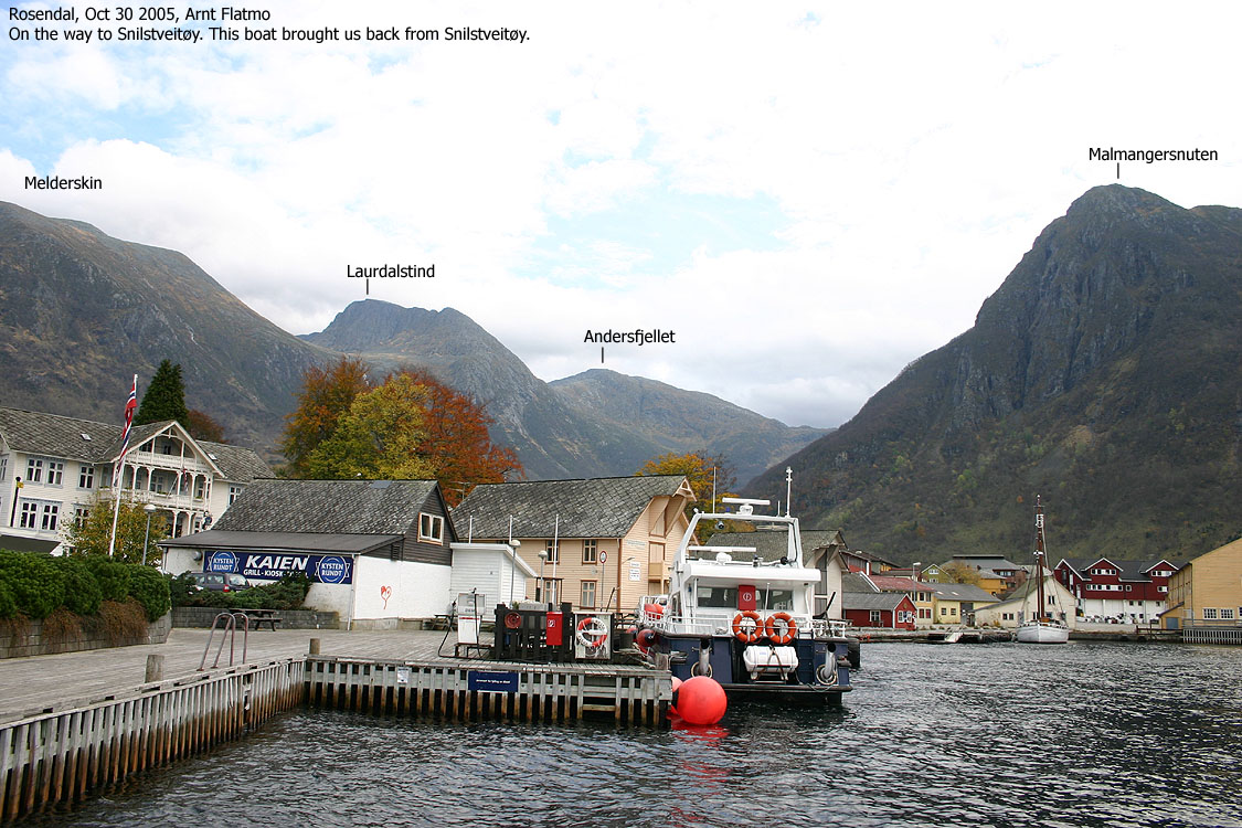
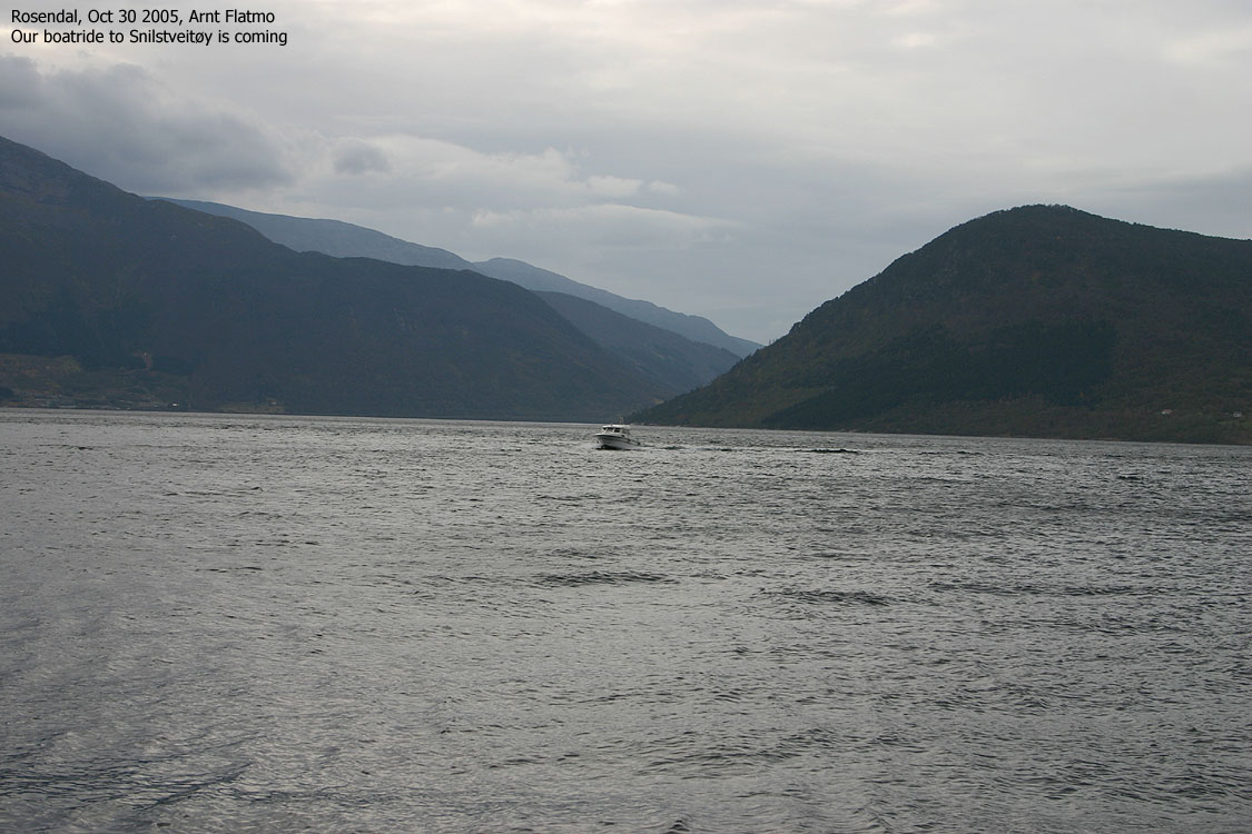
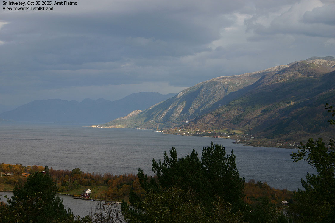
From Løfallstrand, turn right towards Rosendal. In Rosendal, your boat connection will determine where you should go.
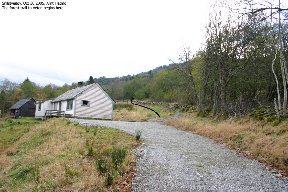
From the Snilstveitøy main harbor, follow the main road up to the first junction. Turn right and walk approx. 370m westbound. Then, turn left onto a gravel road and follow this road all the way to the uppermost house.
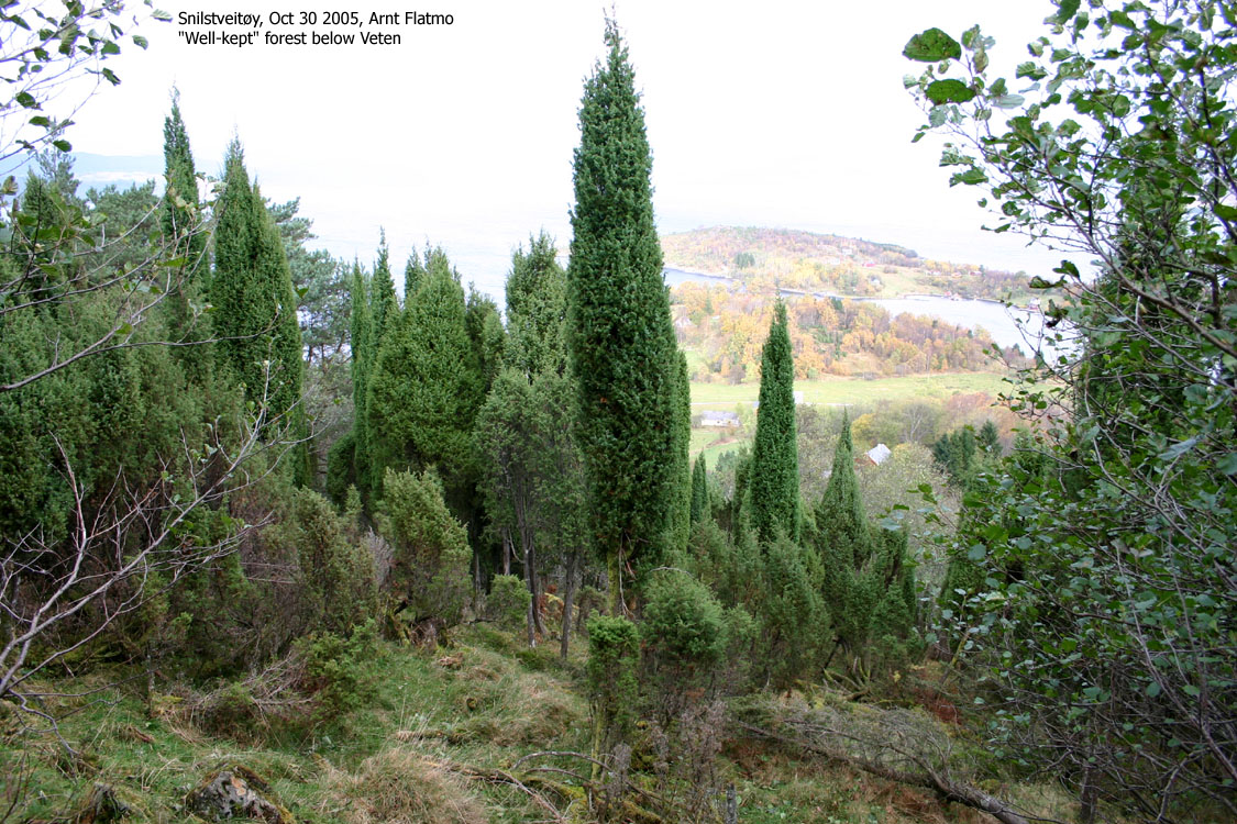
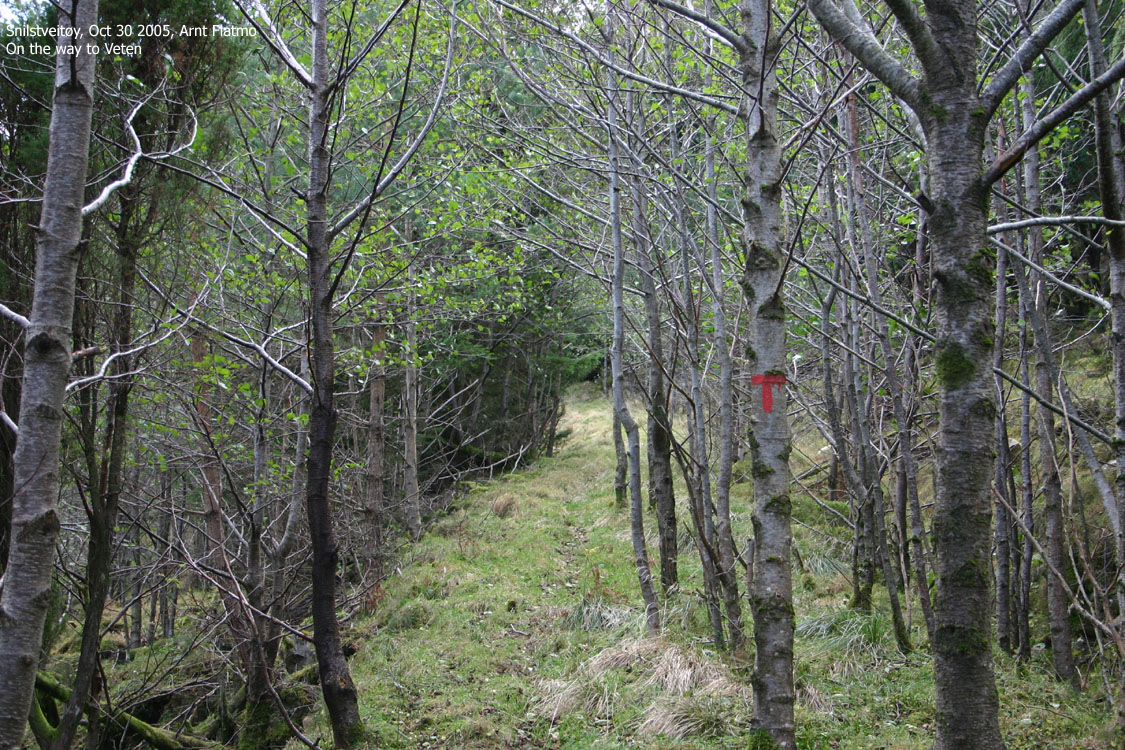
A vague forest trail begins by this house. The forest trail switches back and forth west of the stream in Vetadalen and gets more distinct and visible the higher you get! After a while you will see red "T"'s on trees. At 330m elevation, the forest road ends. Turn southeast (slightly left) and walk up the final hill to the summit point. Easy terrain. The summit is marked by a trig. point and (maybe) a visitor's register.
Preface
I didn't feel too well before this week-end. Some virus-type-of-thing had taken my energy away. A high mountain was out of the question. I looked into the Mountain Bible for advice. The Mountain Bible suggested I should look for a smaller mountain. Preferably with minimal physical effort. And with good views. I added a few more criteria; it had to be a new mountain (for me) and preferably with a decent primary factor. It didn't take long to realise that Veten on Snilstveitøy would be my target.
Research
First on the to-do list was to figure out how to get to Snilstveitøy. After some research, I learned that Tor Kalven on Snilstveitøy could get me to the island. I could then join the regular shuttle boat back to Rosendal later in the day. I never found out who was running the regular shuttle boat, and how often it went.
The week-end budget would be considerable (petrol, ferries, toll roads, etc.), so I decided to camp in Muradalen. Driving into this valley is prohibited unless you have special priveleges. At least this is what the sign in the entrance of the valley tell you. After some research, I learned that the road into Muradalen IS AVAILABLE TO THE PUBLIC. This is (apparently) stated in the license agreement for the Muradalen power plant.
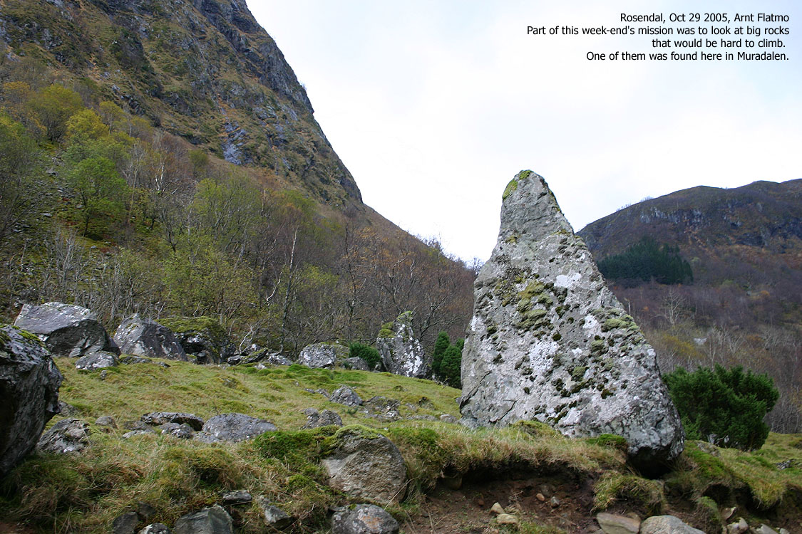
Sightseeing, big rocks and camping
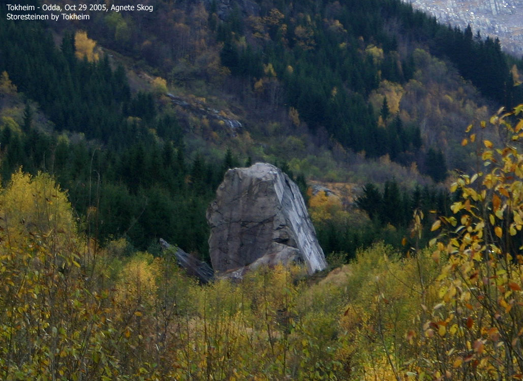
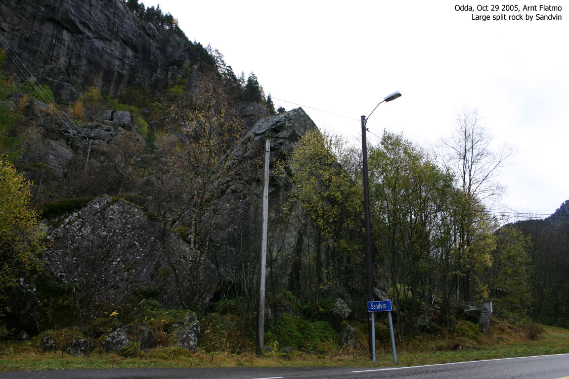
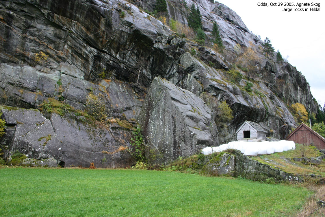
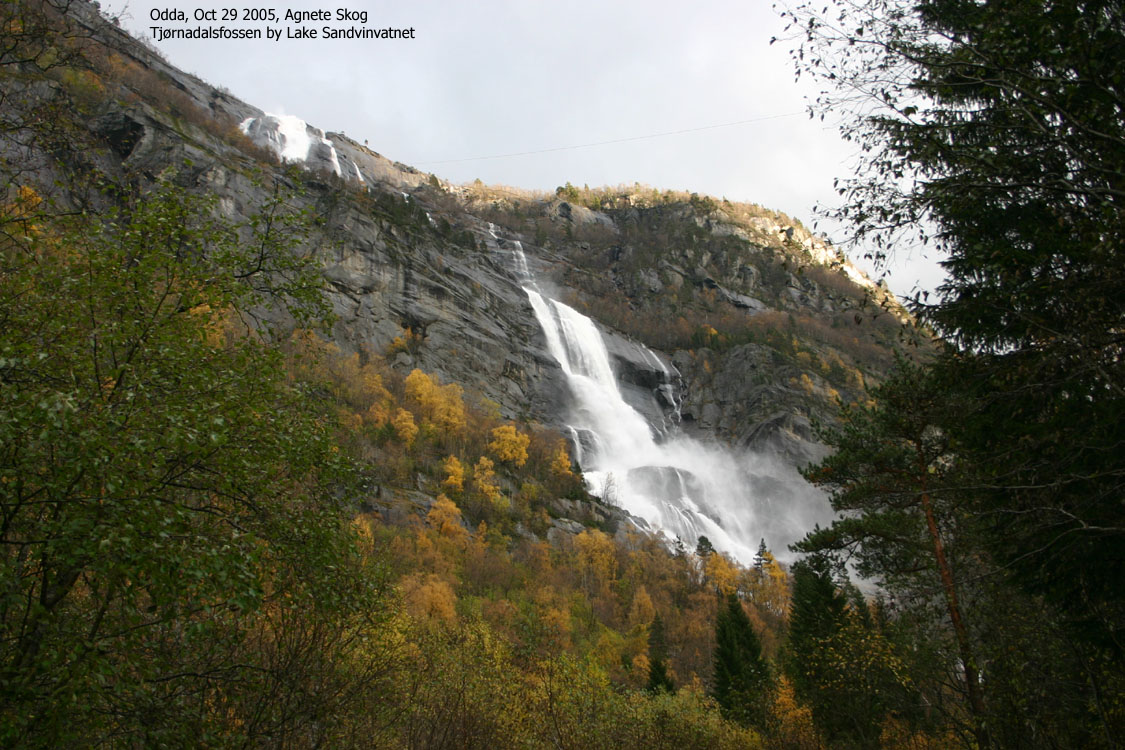
I arrived Muradalen midday on Saturday and found a good place to camp. I could park the car close to the tent, and a stream was nearby. Then I drove towards Odda and took a look at some big rocks by Lake Sandvinvatnet.
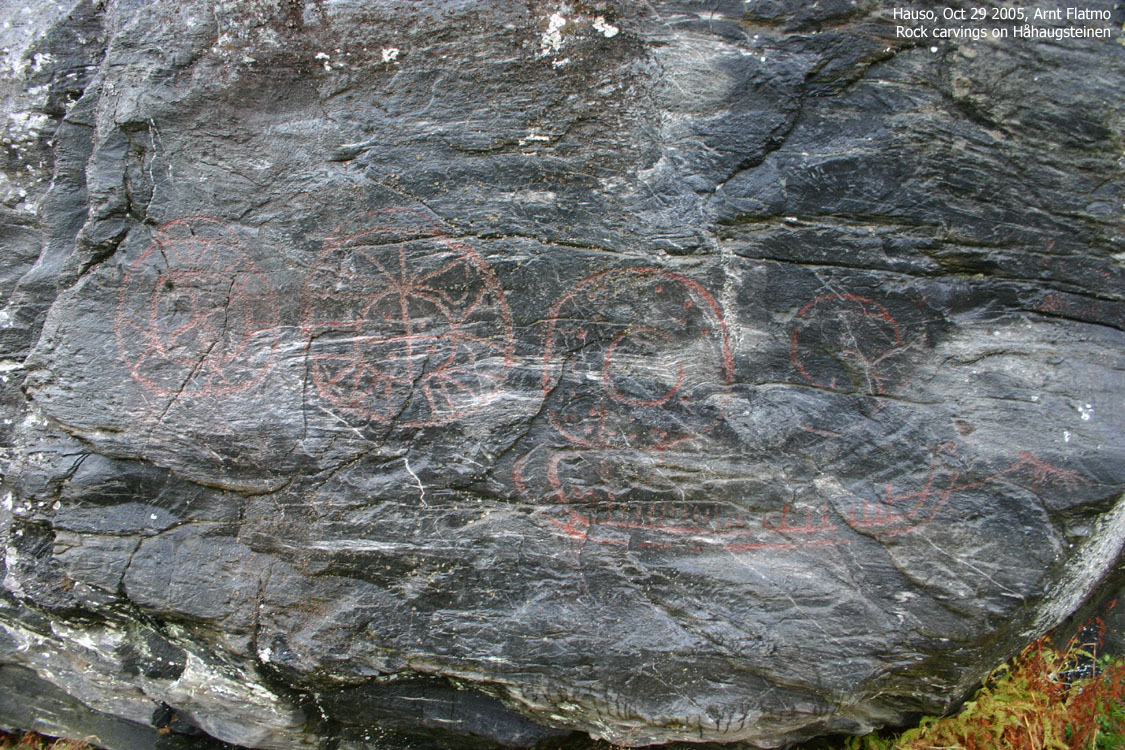
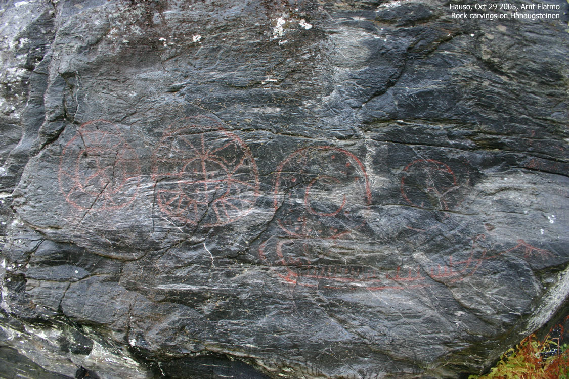
I continued down to Jåstad where I payed Liv Nygård a visit. Liv is my "primary source of information" on the east side of Folgefonnhalvøya. She had noticed my current (and probably temporary -) interest in big rocks. She took me up to Haustveit and "Håhaugsteinen". This rock is known for its petroglyphs, and was a fascinating sight.
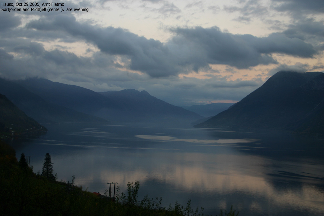
After enjoying a brilliant sunset over Storeflåtten, I drove back to Rosendal. It was dead dark when I arrived the tent, and above was the starriest sky I've ever seen in my life. It was simply breathtaking. And in the midst of my marvel, a shooting star added 12 exclamation marks to the moment. Wind gusts were strong, and I had put effort into securing the tent properly. Adding value to the "ongoing discussion" about using ice-axes in the summertime; the shaft was brilliant for hammering the tent plugs into the ground. And not to mention for pulling them out the next day.
The temperature was "ridiculous". Almost 20 degrees in the very end of October. But the southern winds were strong. It took some time to get used to the gusts which sounded like a freight train coming up the valley, then almost ripping the tent apart before there was total silence. My dachshund "Troll" was surprisingly quiet, laying close to me, maximising the heat dissipation. Sometimes I checked his heartbeat, as he normally needs some time to settle down in new environments.
Veten
The next morning, I rigged down the campsite and drove up to Blådalen where I had camped earlier this autumn. The plan was that Tor Kalven would pick us up at Rosendal harbor at noon, so the Blådalen visit was a bit hasty. At noon, no boat was in sight, and a sneaky feeling came creeping along. I took the phone and dialed a number.
- Mom, what time is it?
It was good to learn that the time was 11:00AM now that the summertime had come to an end - secretly during the night. This meant that there was still a chance that Tor hadn't forgotten about me. And Tor came right on time. After a bumpy ride across the fjord, I was on my way towards Veten 12:10PM.
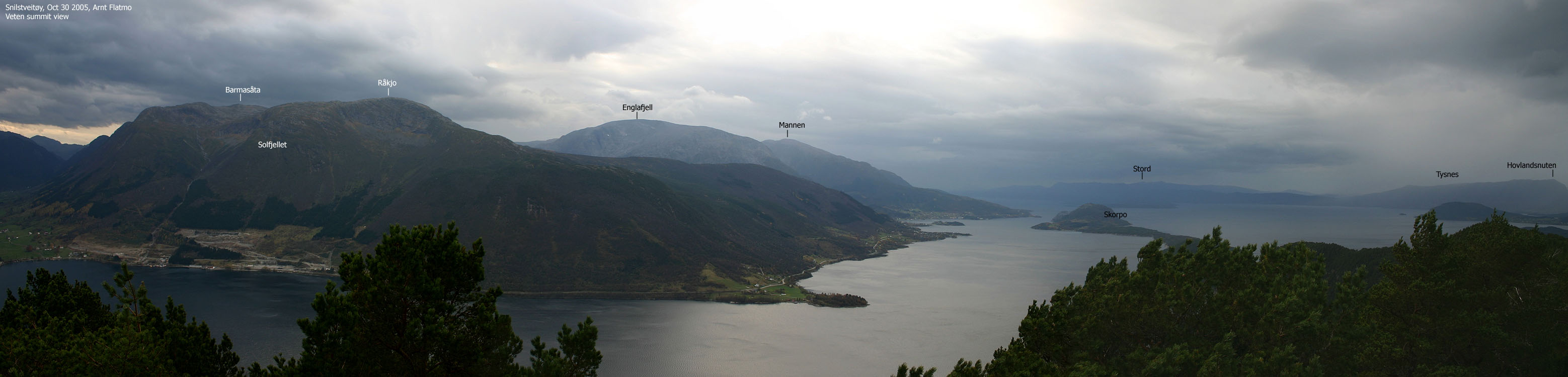
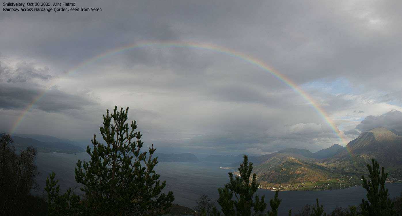
I had obtained a fairly accurate route description, and had no problems locating the forest trail. In a slow pace, I reached the top within the hour. It was a bit windy, but nothing that prevented me from staying a while on the summit. Some bush was in the way for getting the perfect panorama towards the Rosendal mountains, but it was nevertheless a great view. It seemed as rainshowers swept by in all directions, except for above. A very special light fell on the Rosendal mountains, and a rainbow stretched all the way from Gjermundshamn to Løfallstrand. It's the first time I've seen a 180-degree rainbow.
While having summit lunch, I concluded that this wasn't the worst place to be on a Sunday. Especially with rainshowers everywhere except here. I don't know what it was, but nausea came and went. After lunch, I headed down and passed a guy sitting in the forest just below the summit. He showed no signs indicating a need for conversation, and for some reason, I started thinking about Hannibal Lector.
The shuttle boat to Rosendal didn't leave until 15:50PM, and I had to kill an hour so in the windy harbor. By the time the boat came along, a dozen of persons had arrived. My guess is that this shuttle boat takes people to the island on Friday afternoon, and brings them back on Sunday afternoon. The fare was NOK 23,- per person and although Tor charged A WHOLE LOT MORE, I still found his price reasonable.
I didn't have to wait too long for the Løfallstrand - Gjermundshamn ferry. After a 2 hour drive in the dark, I was back in the city. Another fine week-end in the Rosendal region had come to its end.
Move cursor to read notes, and click on the images to see full version.
Some of the thumbnails may have been cropped to fit the format.
To Snilstveitøy


To Veten


Snilstveitøy harbor


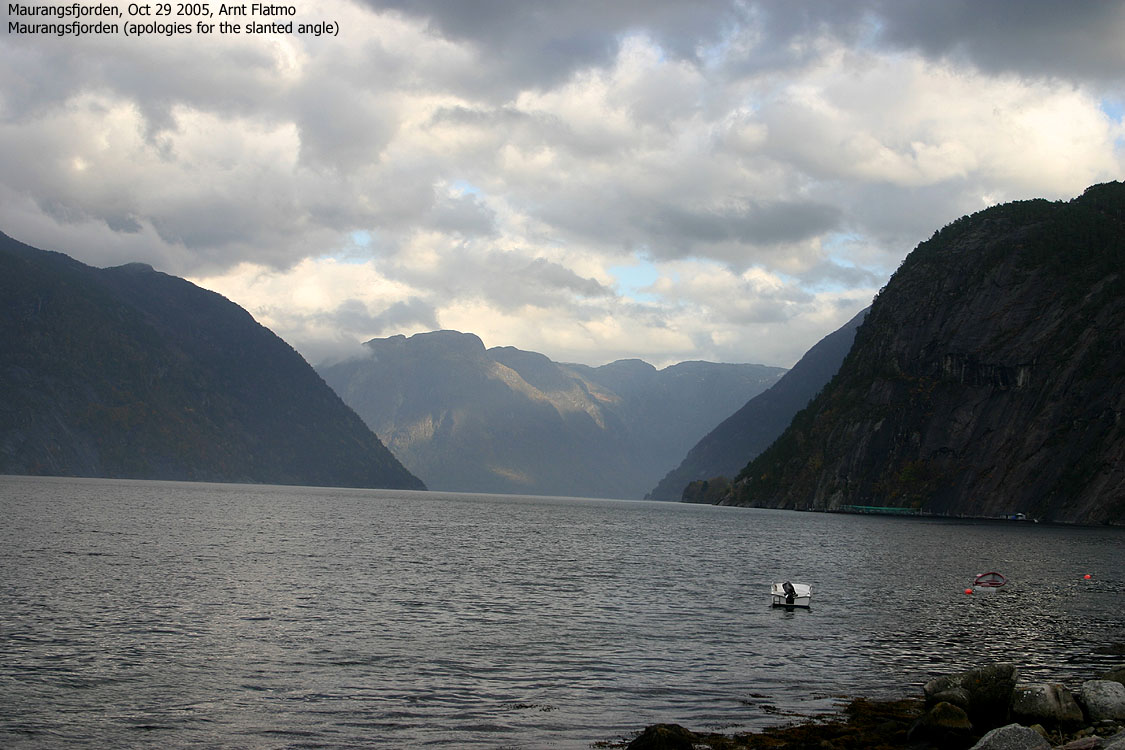
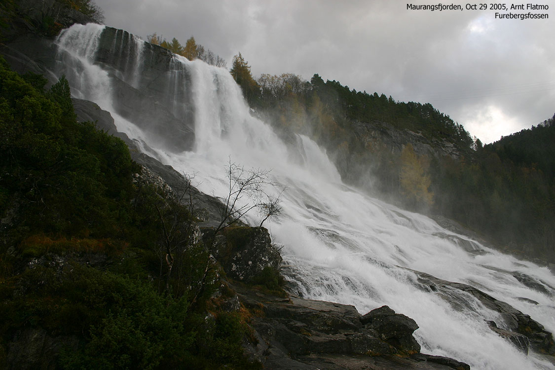
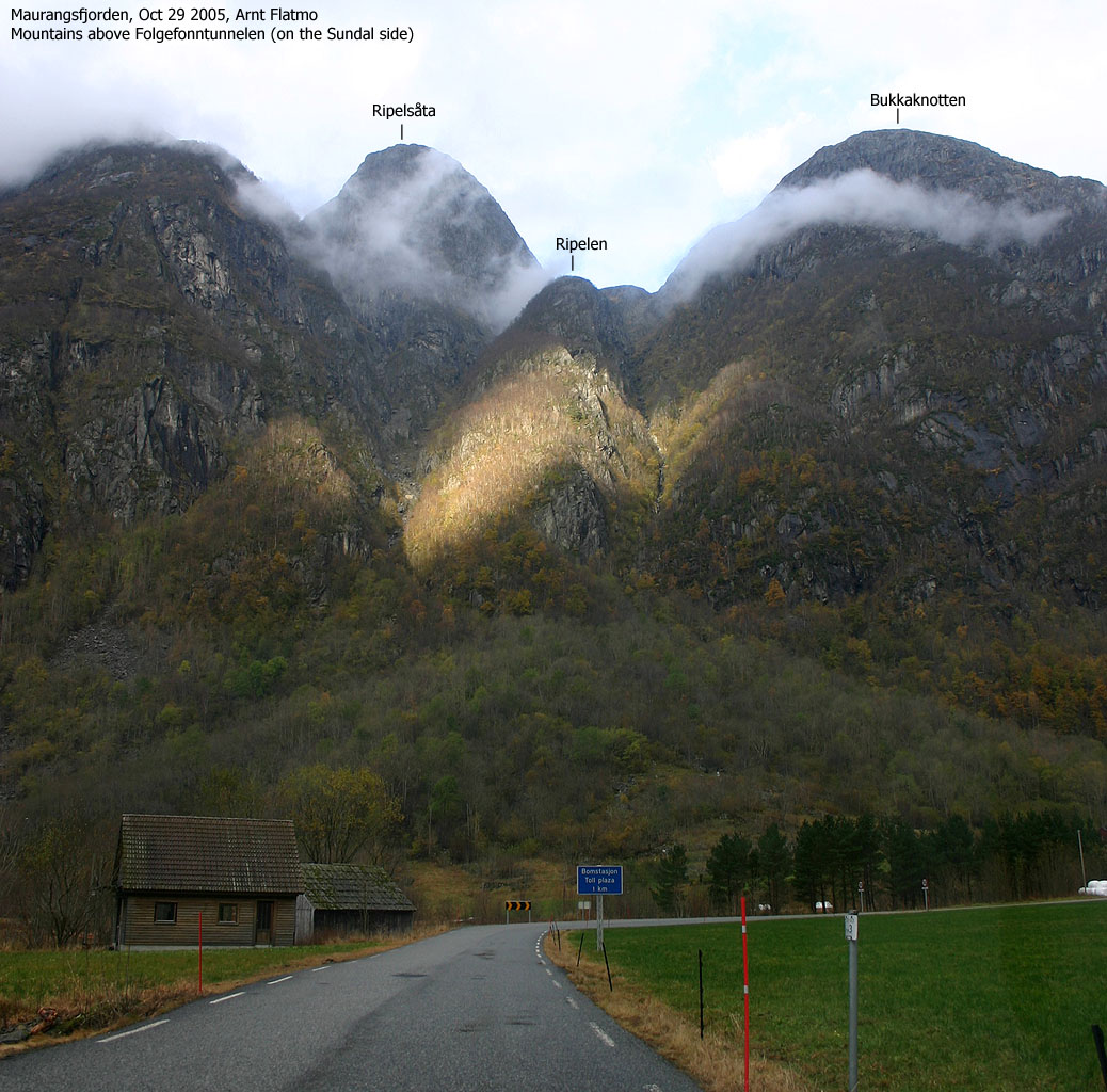
Muradalen/Rosendal - Oct 29 2005


Big rock sightseeing in and around Odda - Oct 29 2005


Håhaugsteinen in Haustveit
More information about this rock.


1 2 3 4 5 6 7 8 10 11 12 13 14 15 16 17 18 19 22 23 24 25 27 28 29 30 31 32 33 34 35 36 37 38 39 40 41 42 43 44 45 46 47 48 49 50 51 52 53 54 55 56 57 58 60 61


 Other hordaland mountains
Other Kvinnherad K. mountains
westcoastpeaks.com
Other hordaland mountains
Other Kvinnherad K. mountains
westcoastpeaks.com


