
Norwegian Mountains, Nordland
Vega
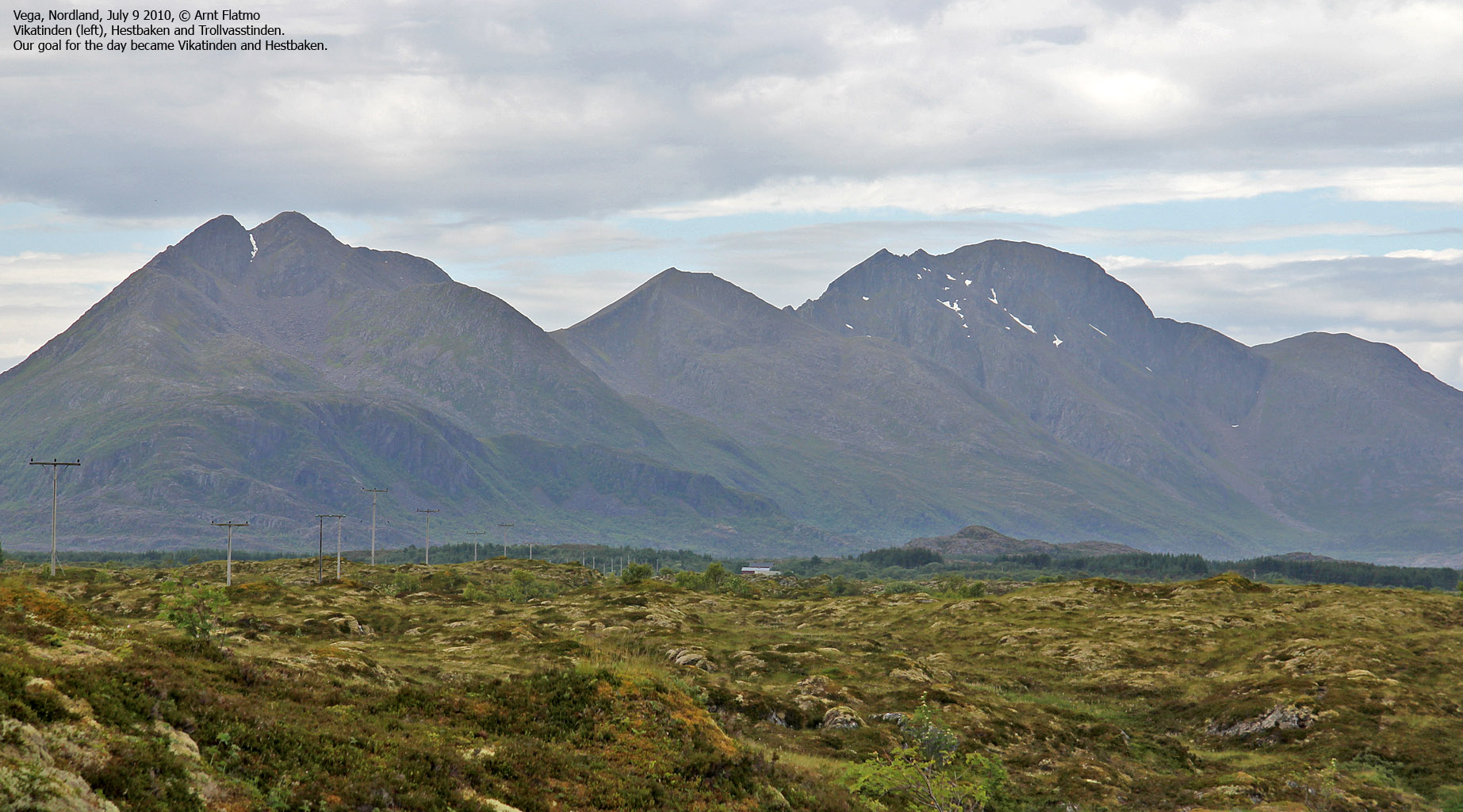
Vikatinden and Hestbaken, July 9 2010
To the main Vega page (maps, route descriptions, other trip reports, etc.)

Vikatinden - Hestbaken round trip route
(Click for larger image)
With Brønnøysund as the
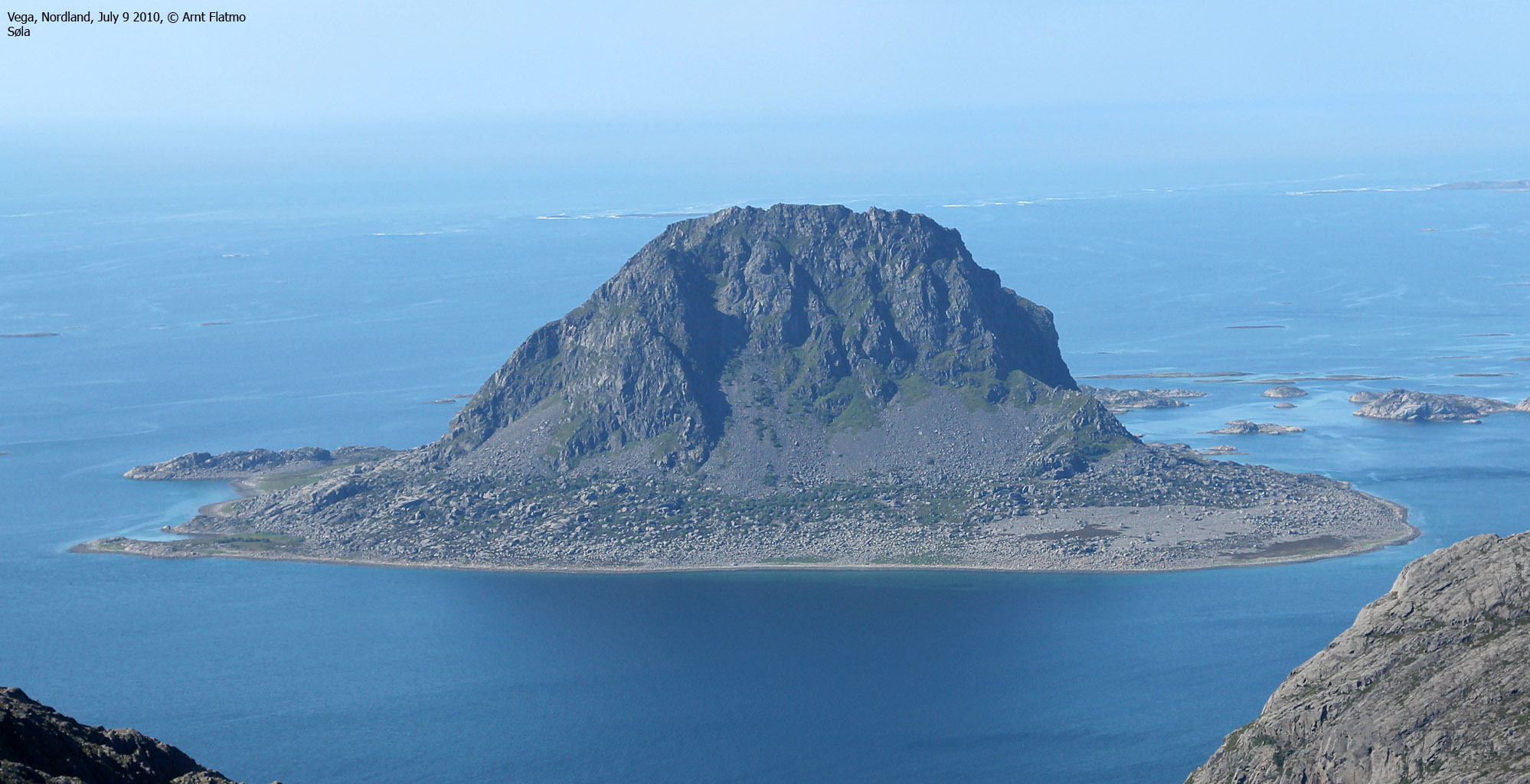
summer base-camp, the island Vega was a mandatory place to visit. Anne
Rudsengen and me wanted to visit Søla - a small (and desolate) island just west of
Vega. If we were unable to find someone who could take us there, then plan B
was to hike Vikatinden (and possibly Hestbaken). In addition, Anne
wanted to see Vega's contribution to "Skulpturlandskap Nordland".
We took the Horn - Vega ferry
and stopped just after passing the bridge across Grimsøysundet. There was a
"Skulpturlandskap" signpost (at least that's what I think there was...), and we started looking for the sculpture. After
searching around for a while, we found something that surely had to be it. We
took pictures and ticked off the cultural part of our agenda.
| I wrote this report more than 4 months after the hike, and after checking www.skulpturlandskap.no, I noticed that the Vega sculpture is NOT the one I photographed. So for now, this is a small mystery... |

The cultural part of the trip
(Click for larger image)
We continued to Gladstad and
visited the tourist information office. They gave us a telephone number to
someone who probably could take us to Søla. We dialed the number, and the man on
the other end of the line said that he could indeed take us there. At a
reasonable price, too. But just not today. "Engine problems", he explained to
us. "Could we come back tomorrow?"
That was not an option. Today
was Vega day and we moved on to plan B. We asked the person in the
tourist information office if there was a path to Vikatinden/Hestbaken. She
didn't know of any paths, but recommended that we should start at Myra. So then
we drove to Myra...
At Myra, we were granted
permission to park on a field, which saved us the 160 meters (!) walk from the
main road. There were cliffs at the foot of the mountain, and there didn't seem
to be an obvious route straight up to Vikatinden. We had been told to hike via
Ørnheia, but that seemed like a detour. And I don't like detours...
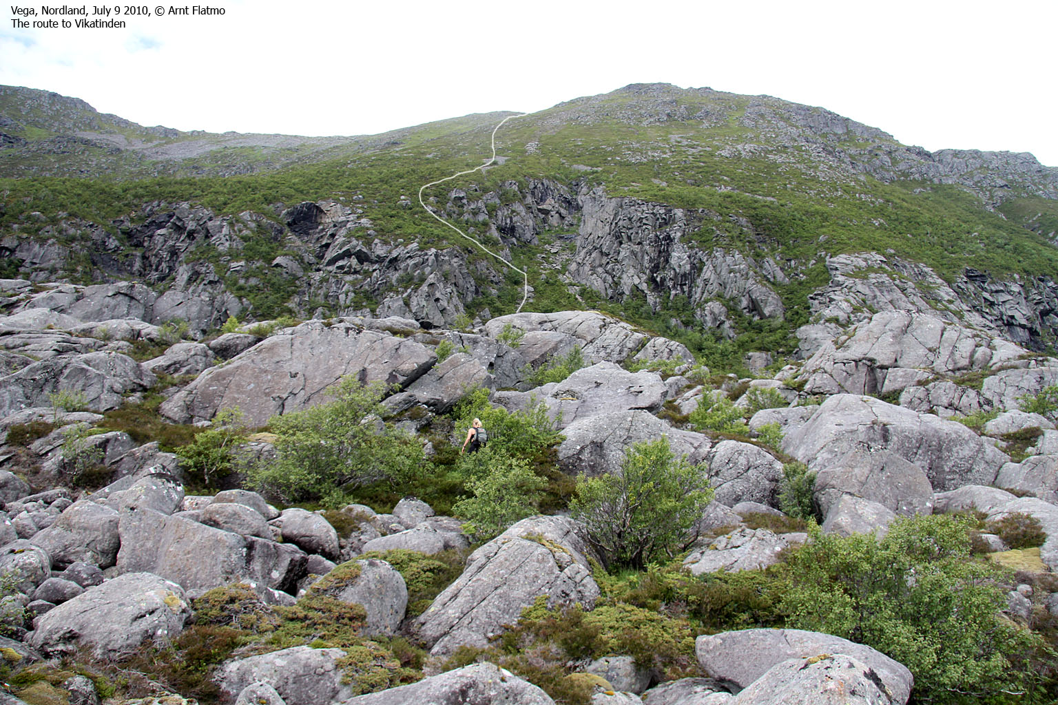
There was a cleft that
perhaps could provide a way up, but it was hard to say for sure from our
position. So what should we do? 1) take the "detour" or 2) go for the cleft?
Option 2 seemed like the most exciting of the two options, so now we had a plan.
But first, we had to cross 600 meters of rocky terrain.

Part of the route to Hestbaken
(Click for larger image)
With a narrow margin - the cleft provided a route upwards that was not associated with any risks, and after a short, but aggravating scramble through the bush, we reached the proper hillside. The rest of the route was strenuous, but easy; straight up! We followed a boulder field for as long as it lasted, then followed grass up to the saddle between Vikatinden and its lower spur to the east.
A grouse did its best to get our attention (yes, we know why they do that), and succeeded. To cause a distraction, Anne and I went in different directions. The bird must have had a hard time in keeping track of the two of us, and the end result was the best grouse pictures I've ever taken...

Grouse on Vikatinden
(Click for larger image)
Before continuing up to Vikatinden, we paid a visit to the cool eastern spur (approx. 640m). Light scrambling was required to reach the cairn, where we could take a short break and enjoy the Vega scenery and the infinite chain of mountains on the mainland.

Vikatinden eastern spur
(Click for larger image)
Next stop was Vikatinden's main summit. We arrived on top at 2:15pm - 2h:15m after leaving Myra. We had a brilliant view from up here, and could even see Lovund - 84,5km to the northeast. Other notable tops were De Syv Søstre, Nordre & Søndre Høyholmstindan, Finnknean, Visttindan, Snøfjelltinden, Anddalshatten and Heilhornet. And not to forget Dønnamannen - which we visited two days later.

On Vikatinden
(Click for larger image)
We moved on to Hestbaken (the horse's ass), which was a straightforward hike. We reached the summit 3:20pm, and now had a good view towards Trollvasstinden (804m) - the highest peak on the island. We studied the ridge to Trollvasstinden, and the conclusion was that this ridge should be attempted without a rope.

Trollvasstinden seen from Hestbaken
(Click for larger image)
More than happy about two new Vega tops, it was time to head back down. I had already set my eyes on a given ferry departure, when Anne got a strong desire to go swimming in one of the bays. With a swift descent, we would have enough time for the swim and still reach that ferry. We agreed to head down via Kammen and Ørnheia, and had a fantastic view down to the shore during the descent.

Above Eidem
(Click for larger image)
The section between Ørnheia and the trailhead was cumbersome. Off-trail with capital letters! We were back at the trailhead 5:03pm - 5 hours after leaving. We then drove to Åkvika, where we both took a swim in the bay. A perfect end to a perfect Vega visit...

Åkvika
(Click for larger image)


")


