
Norwegian Mountains, Sogn og FjordaneNordre Vingekvarven, 940m
|
| Fylke/Kommune : | Sogn og Fjordane/Bremanger | ||||
| Maps : | 1118-II Eikefjord (Statens Kartverk, Norge 1:50 000) | ||||
| Primary factor : |
Nordre: 530m Søre: 64m |
||||
| Hiked : | Aug 2009 | ||||
| See also : |
|
||||
| See also : | Other Sogn og Fjordane mountains on westcoastpeaks.com |

Vingekvarven
(Click for larger image)
Vingekvarven is a twin-top mountain, located centrally in the county of Bremanger. Although highway Rv614 through Sørdalen separates this mountain from the Ålfotbreen massif, you will find the shelf- and sandstone formations that are characteristic for this region here too. Through its central location, the mountain gives a good view towards Ålfotbreen and the distinct Keipen, Plogen and Saga peaks. And the view towards Hornelen is second to none.
Vingekvarven is an easy mountain to reach from Langevatnet in Sørdalen. There is also a much longer route from Svelgen - the nearest village. The easiest route to Vingekvarven is a straightforward walk. But it's quite possible to add variety (without enlarging the hiking distance), as described below on this page.
The mountain got its name from the place Vingen - northwest of the mountain. In this area, you will also find Vingepollen, Vingelva, Vingevatnet and Vingesætra.

Vingekvarven seen from Hornelen
(Click for larger image)
Nordre Vingekvarven (Norge 1:50,000: 940m, Økonomisk Kartverk: 940,16m, UTM 32 V 308187 6859250) has a primary factor of 530m towards the higher parent Klakegga/Dombesteinseggene (1093m). The defining saddle (approx. UTM 32 V 311767 6861477) is found at the north end of Lake Nibbevatnet. Ref. Norge 1:50,000, the saddle is within the range 400-420m, interpolated to 410m.
GPS measurement read 946m (on the summit cairn, 2m high), and 944m on the ground, averaged over a 5-minute period (error margin +/- 0,9m)
Søre Vingekvarven (Norge 1:50,000: 934m, Økonomisk Kartverk: -, UTM 32 V 308383 6858635) has a primary factor of 64m towards the higher parent Nordre Vingekvarven. The defining saddle (approx. UTM 32 V 308429 6858952) is found in the small valley between these tops. Ref. Norge 1:50,000, the saddle is within the range 860-880m, interpolated to 870m.
GPS measurement read 934m on the ground, averaged over a 3-minute period (error margin +/- 1,1m). The terrain is most likely 1-2m higher just north of the summit cairn.

Søre Vingekvarven summit
(Click for larger image)
Google's interactive map. You can zoom, pan and click on the markers.
|
|
|
|
Route 1: Langevatnet - Vingekvarven (summer/autumn)
|
|
Access
(all distances are approx. distances)
The nearest bigger town is Svelgen. From the main road junction in Svelgen, follow RV614 13,1km towards Isane. Find parking on the left-hand side of the road at the western end of Lake Langevatnet.
If you come across Nordfjord on the Stårheim - Isane ferry, drive 21,3km to this trailhead.
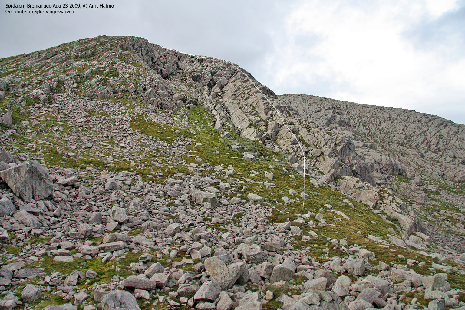
The normal route

The route to Vingekvarven
(Click for larger image)
Locate the (unmarked) path that begins by the parking area. Very soon (after 1-2 minutes), the path runs up the ridge to your right. Once on this ridge (see the above picture), follow it approx. 1,8km until you reach an unnamed lake at 500-510m elevation.
The path ascends along the creek draining to this lake. Next, you'll pass a small lake at approx. 610m elevation. From here, the path m o s t l i k e l y continues straight ahead (to the west), towards Søre Vingekvarven. The summit is marked by a medium-sized cairn.
From Søre Vingekvarven, head north and find a convenient place to descend into the pass between the two tops. Proceed up to Nordre Vingekvarven summit, which is marked by a proper cairn.
Alternative routes
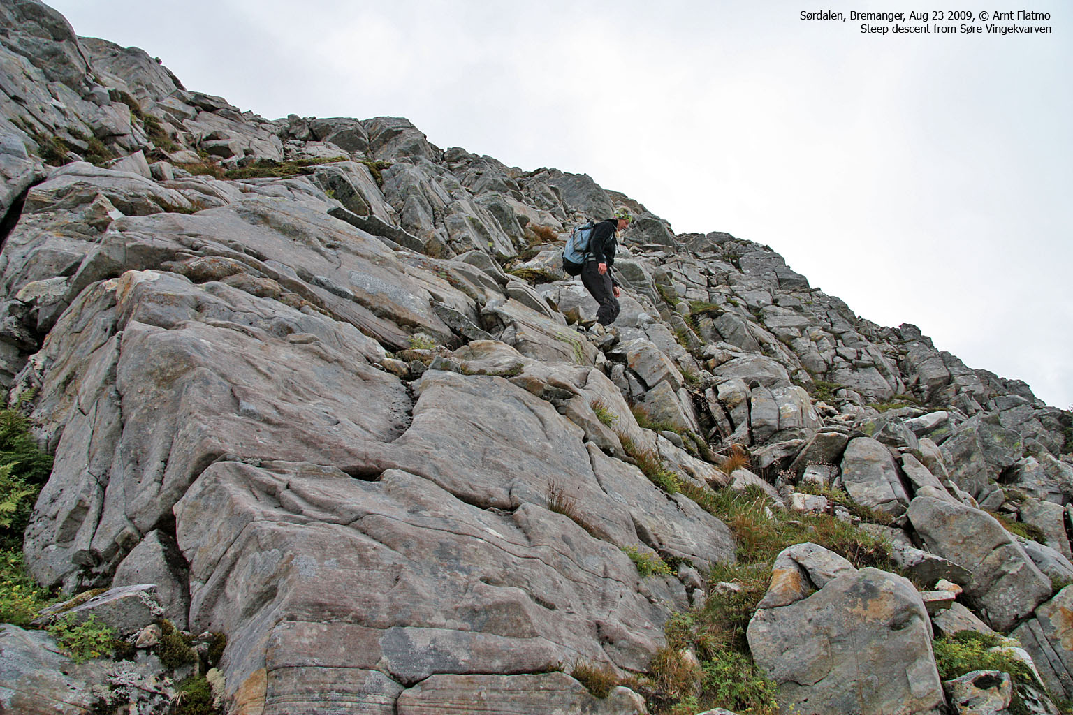
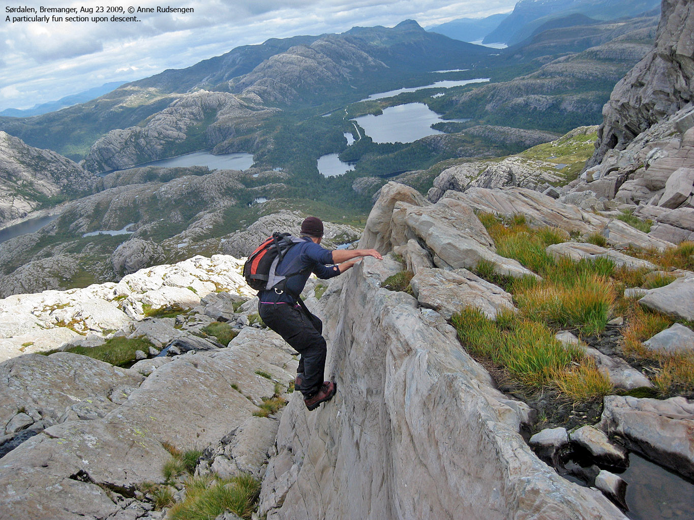
From the small lake at 610m (see above), go north in the direction of point 668m. Follow the distinct ridge to the right, which offers some fun and easy scrambling (YDS class 2+).
Another variation is to hike up the valley between Søre and Nordre Vingekvarven (see the below picture). Pass point 668m and gradually turn towards this valley. This valley is easy to hike, but the slabs may be slippery when wet. Fun things to do can also be found here.

The east ridge on Søre Vingekvarven
(Click for larger image)
 westcoastpeaks.com
Other
Sogn og Fjordane mountains
Other Norwegian mountains
westcoastpeaks.com
Other
Sogn og Fjordane mountains
Other Norwegian mountains


