
|
|
Austevoll is a kommune in the Sunnhordland region, founded on a number of islands, where Huftarøy and Selbjørn are the two largest. Approx. 4400 people are spread out over the 9 largest islands. The coastline measures 337 Km and the total area is 114 sq.Km. The highest point in Austevoll kommune is Loddo, 244m elev. Storebø is the kommune centre, located on Huftarøy island. Bekkjarvik is a central village on Selbjørn island, and one of the very popular harbors in Sunnhordland. The largest islands are connected via bridges. Only a bridge between Huftarøy and Hundvåkøy is missing, before all the larger islands are connected. The main access route (cars) from the north (Bergen) is via the Krokeide - Hufthamar (Huftarøy) - Austevollshella (Hundvåko) ferry across Korsfjorden. The main access route (cars) from the south (Stavanger) is via the Sandvikvåg - Husavik ferry across Selbjørnsfjorden. In addition, express boats from Bergen and Stavanger will get you quicky to and from Austevoll. Check the hsd.no web-site for ferry routes and information. Marsteinen Fyr is a well known lighthouse, being a central element in the fairway to and from Bergen, across Korsfjorden. The lighthouse has been in use since 1877 and has a lot of interesting history, well documented on the internet. |
Map of Hordaland. Copyright Hordaland
Fylkeskommune.
|
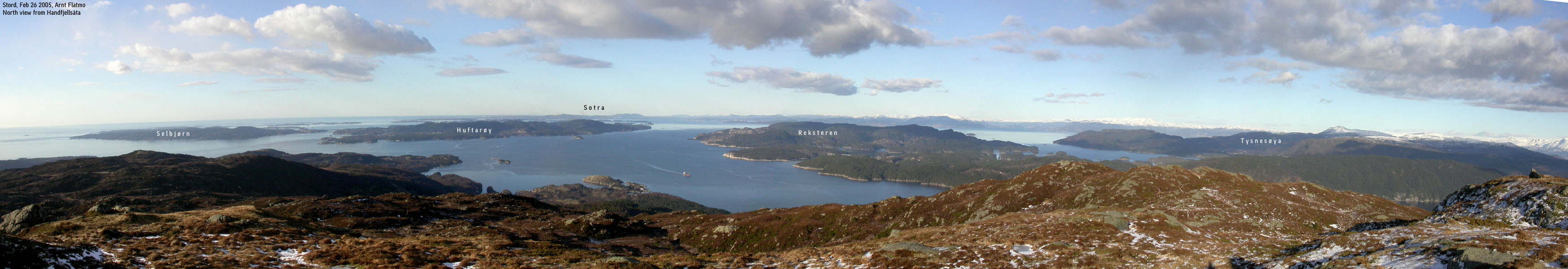
Huftarøy and Selbjørn seen from Handfjellsåta on Stord island
General information:
Below is the list of independent mountains, sorted by
various categories.
Names and heights originate from Statens Kartverk (M711)/Norgesglasset
(20m contours) or Økonomisk Kartverk (part of Norgesglasset, 5m contours). The
height from Ø.K. override the M711 heights. A number of mountains may have a point higher than the
M711 trig. point marked on
the maps. Note also that if the high point of a mountain lies within
another kommune, the mountain is listed under that specific kommune. If a
mountain high point is shared by two kommuner, the mountain is listed under both
kommuner. The asterix (*) means that the high point is
(exactly) found
on a kommune
border.

There are no independent mountains in Austevoll kommune, exceeding 300m elevation

<none>

The below table is sorted by height.
| Rank | Name | Height | PF | Map |
| 1. | Loddo (Huftarøy) | 243m | 243m | 1115-II Austevoll (Highest in Austevoll kommune) |
| 2. | Skaftefjellet ¹ (Huftarøy) | 232m | 109m | 1115-II Austevoll |
| 3. | Kongsfjellet (Selbjørn) | 185m | 185m | 1115-II Austevoll |
¹ The name Skaftefjellet is only found on Økonomisk Kartverk
 Back to Hordaland index
Back to my home page
Back to Hordaland index
Back to my home page
