
To the main Auskjeret page (maps, route descriptions, etc.)
I was invited to this trip by Svein Myhre, the man behind tinderangling.net, and his friends Roger and Torgeir would join in also. The original plan was Blåtinden, the highest point on the Lafjellet-Langfjella ridge, but the plan was changed due to cornices and avalanche hazard. A neighbour would look after my dog until I returned, and with great spirit I joined Roger and Torgeir at the 08:00AM ferry from Magerholm.
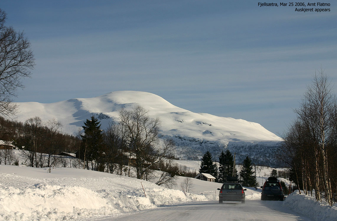
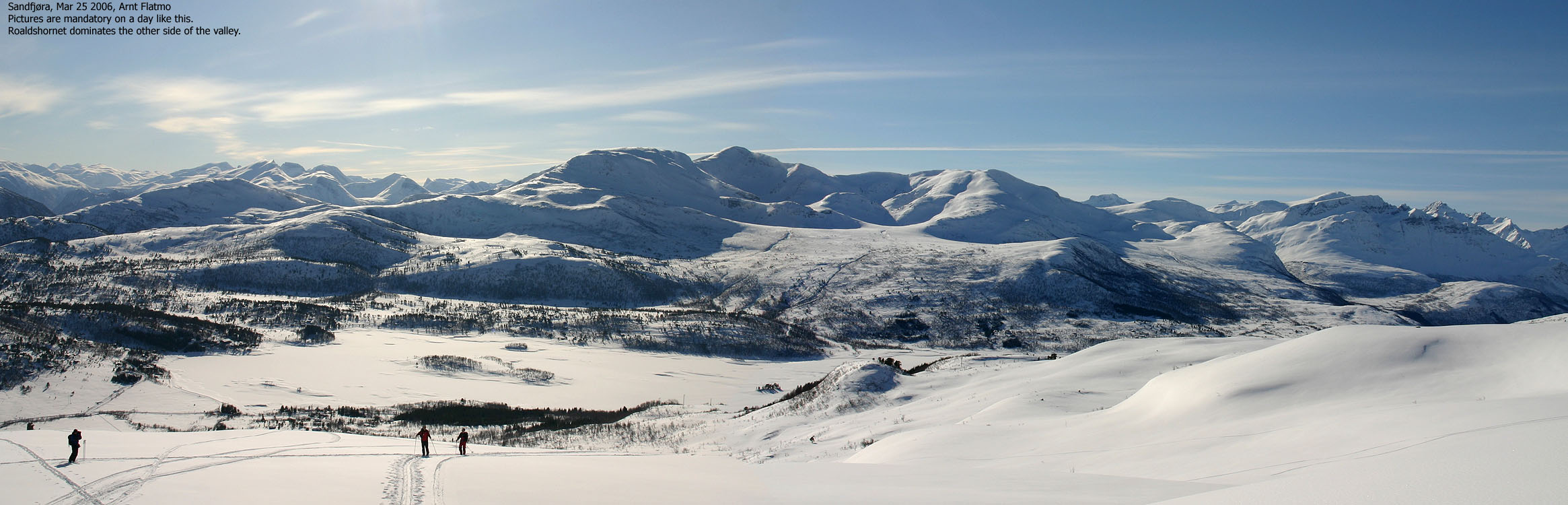
It was a gorgous day, yet I could see the snowdrift from the top of Auskjeret from the ferry. I had been very cold on Melshornet the day before, and I had dressed *very* well for Auskjeret, almost twice as high was Melshornet. We joined Svein at Sandfjøra just before 09:00AM and were ready to leave the trailhead 09:10AM.
Besides a woman who started out a couple of minutes earlier, the Fjellsætra-Sandfjøra region was completely dead. A few hours later, this would be a "boiling" region with few opportunities for convenient parking. Around 50cm of snow had fallen during the week, and we were happy about the already broken trail. We could see from the tracks in the hillside, that Telemark skiers had optimal conditions in the previous days. Today it would be our turn. The snow was soft as butter and a mild breeze kept the sun from settling on the snow.
We kept a slow pace up the mountain, stopping for pictures and chat. We paused for lunch by some naked rocks at 940m elevation, with only one final hill between us and the top. After the break, I continued to the top without waiting for the others in order to a) get a 360 degree panorama without moving people and b) capture the other guys with the zoom lens just as they arrived the summit plateau. I arrived the top 11:25AM, and the others followed a few minutes later.
50 vertical meters below the summit, with yesterday's lesson from Melshornet in mind, I stopped for "technical adjustments". I put on the wind-jacket and sealed every air inlet with fleeze. I was now tightly sealed, and had changed to camera-friendly gloves, thus avoiding getting cold when I arrived the summit plateau, very much exposed to the wind. The female skier was now returning from the top, a bit worried about the long downhill, running on regular cross-country boots and skis.
Even if Urfjellet, in primary factor theory, offers the best view in this mountain region, it was by no means obvious. In fact, I had to look twice to find Urfjellet, blended by the massive string of peaks stretching from Smørskredtindane to Skopphornet. This was simply an astounding viewpoint, and I used up all of my 512MB flash card on the very summit. Just in case..
The others didn't stay long at the summit. After removing the skins, we were ready for the big bonus. Having been a novice skier, I cannot claim one single delightful descent on skis, since I started skiing back in 2002. But this day would change all of that. With all this powder, and no dog on my back, I let the skis flow, making turns I was proud of. Of course, I could not in any way compare to the others, who descended the steepest slopes in "yahoo-style", keeping a *fast* pace on their skis. But nevertheless, this was a run I will look back on with tremendous pleasure. If I didn't have a dog back home to consider, I would surely climb the mountain one more time, just for the fun of skiing. After this trip, I boldly "upgraded" myself from novice to moderate in terms of skiing techniques.
We were back at the trailhead 12:15PM, and the next mission was to reach the 13:00PM ferry. Svein had told me that later in the day, you could expect missing out on a couple of departures due to the "rush-traffic" from Fjellsætra. Seeing the number of parks parked at Fjellsætra, I suspected this was pretty accurate information. On my way down Velledalen, the scenery just blew my mind. I stopped numerous times for pictures, up to the point where I feared I wouldn't reach the ferry. But I did, and Roger and Torgeir followed a minute later.
Back at the house, the normally quiet dog was repeatingly barking loud, leaving no room for doubt about what he wanted to do. "A walk, perhaps?", I queried, and the dog ran around in circles. I took him up to Blindheimsfjellet, a 4,5Km walk with 400 vertical meters. Back at the house (18:00PM), I realised I hadn't eaten since breakfast (06:30AM), and this could explain why I was so damned hungry.
To the trailhead


Up the hill


Near 360 degrees, wide-angle panorana

360 degrees, 50mm panorama, 3 parts


Dalmannshornet - Blåbretindane zoom panorama, 2 parts


Eastern zoom panorama, 2 parts


South to west zoom panorama, 2 parts


Other zoom panoramas


Descent


Velledalen moments. Pictures are *not* taken from Sandfjøra


Ferry moments


No Javascript:
1 2 3 4 5 6 7 8 9 10 11 12 13 14 15 16 17 18 19 20 21 22 23 24 25 26 27 28 29 30 31 32 33 34 35 36 37 38 39 40 41 42 43 44 45 46
 westcoastpeaks.com
Other Møre & Romsdal mountains
Other Norwegian mountains
westcoastpeaks.com
Other Møre & Romsdal mountains
Other Norwegian mountains