
Asian Mountains, Bali
Gunung Batur (Mount Batur), 1716m
Nov 15 2012
To the main Batur page (route descriptions and maps)

Gunung Batur
(Click for larger image)
To Batur Lake and Hotel Segara
The day after hiking Mt. Agung - the highest point on Bali, we were hungry for more volcanoes and after making a reservation at Hotel Segara, we sat course for Batur Lake. Our cab driver who took us from our base camp at hotel Sanur Beach didn't understand why went up to Batur Lake in the afternoon! We explained that the hike to Mt. Batur starts at 4am and that it would be good to get a couple of hours of sleep in advance.
Hotel Segara looked promising when seen from the main yard; there were a number of bungalows organized as a horseshoe around it, and we looked forward to check out our Deluxe room. At the first glance of the room, I was fairly disappointed. Apparently, "Deluxe" took on a whole different meaning in this region. After checking out the bathroom, I was just annoyed. Not that I'm spoiled, but I require three things from a bathroom; a bed, a flushing toilet and hot water. And this room only delivered two of my requirements...

Our -deluxe- bathroom
(Click for larger image)
We complained about the toilet and we were told it would be repaired while we had dinner. The hotel made arrangements for the Batur hike and we paid IDR 700,000 (USD 70-75) for 2 persons which included a guide and breakfast. The transport to and from the trailhead would cost us IDR 50,000 extra. It was nice to have everything organized and just enjoy a nice dinner and a cold beer while waiting for the 3:30am wake-up call. Oh yes - and a flushing toilet of course...
Mt. Batur
Our driver was waiting for us at 3:40am and 5 minutes later, we arrived at the Batur trailhead. I had perhaps imagined that we would be alone, or at least almost alone on the mountain, but there were guides and clients everywhere. This was indeed a popular mountain!
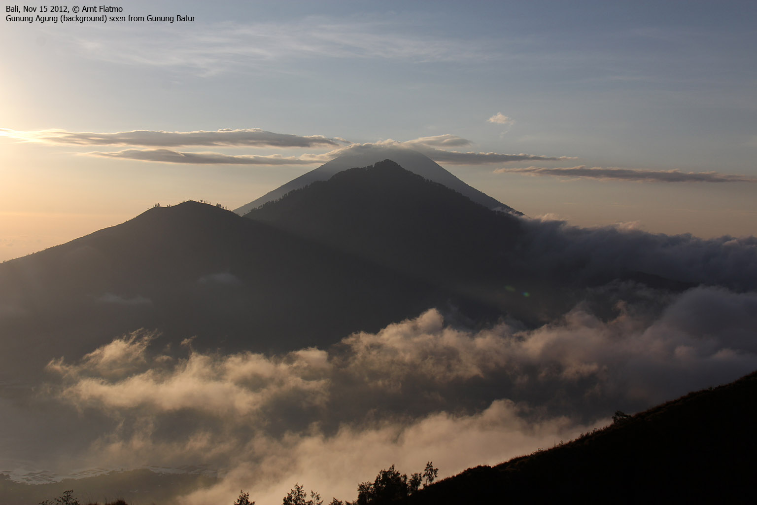
Our guide was Nyoman Sudirman. And there are thousands and thousands of Nyomans. You should definitely read up on the naming system on Bali. It's quite something different from what you are accustomed to. Nyoman had a big smile all over his face (at all times!) and knew the basic English sentences like "very nice sunrise!". And what a sunrise we had in store!
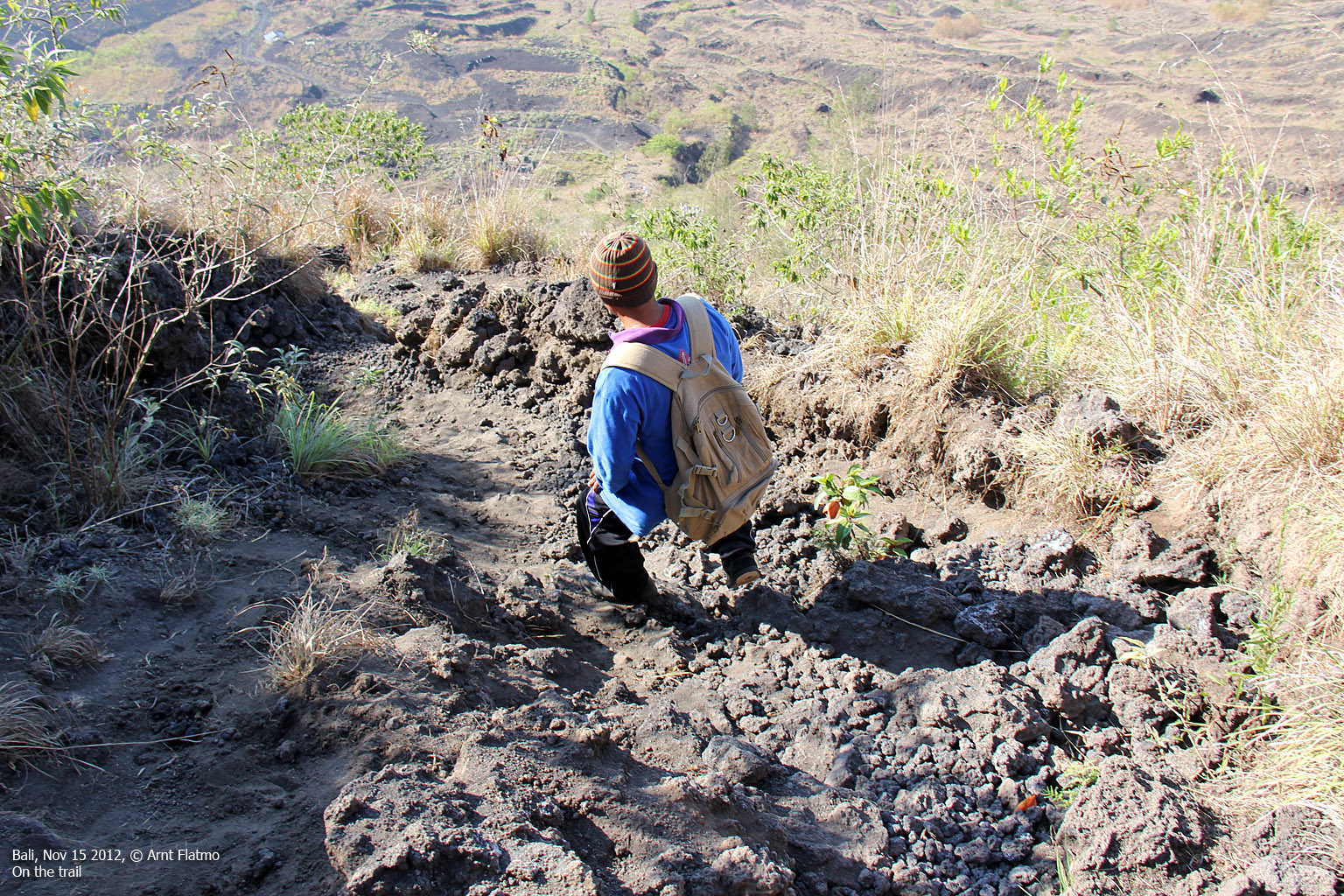
We headed out into the darkness at 3:50am and we could see numerous headlights ahead of us, on the way up the volcano. The GPS log shows we were constantly gaining elevation, but it felt as if the first kilometer went across fairly flat ground.

The route, as seen in Google Earth
(Click for larger image)
Ascending the volcano
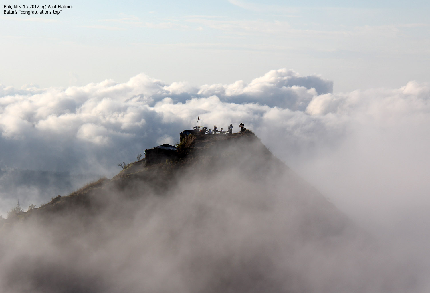
By the time the route got a bit steeper, we caught up with one group after the other. In the end, there was a long queue. Eventually, we reached the lower crater rim at approx. 1550m, and we passed a building where many stopped as the sunrise could also be seen from here. Nyoman, Anne and myself continued up to "Congratulation point" (my own expression) - the eastern top on the volcano. The time was 5:21am and we could see that the sunrise was in progress.

On the east top on Mt. Batur
(Click for larger image)
Summit?
Everybody congratulated each other, especially since the signpost on top said "Congratulation". But I could see another top to the northwest which definitely looked higher. I explained to Nyoman - through sign language, English, Norwegian and all that I could think of - that we wanted to go to the highest point on Mt. Batur. And eventually he understood.
The time was 5:33am when we reached the centre top on Mt. Batur and the sunrise was spectacular!

Bali sunrise
(Click for larger image)
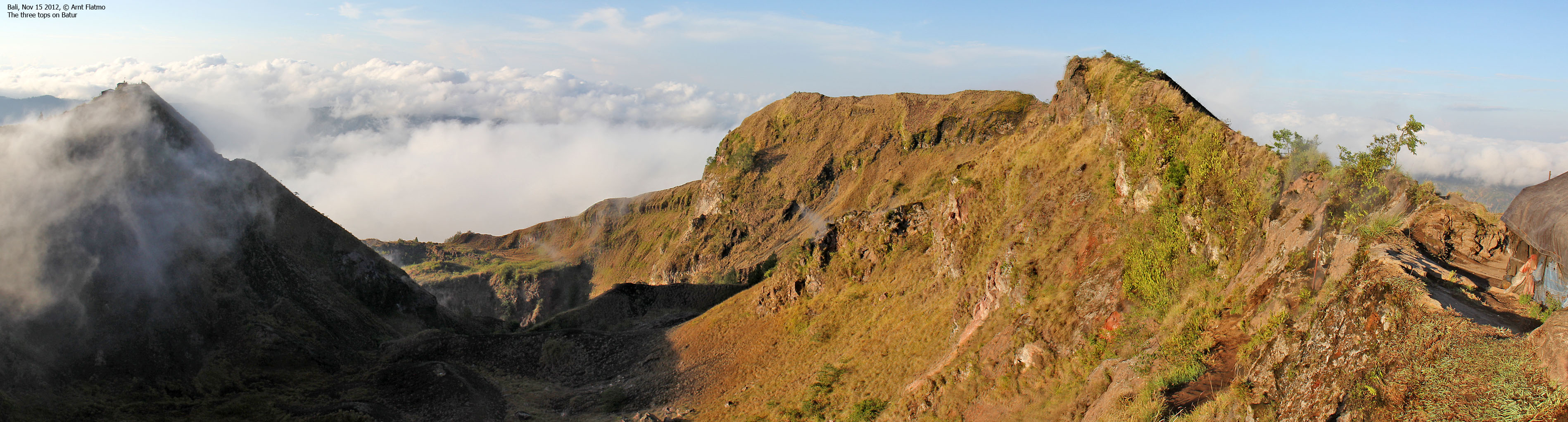
Nyoman was very eager to see my GPS. It read 1695m on the east top and now it read 1716m here on the centre top. That was exactly the summit height on the map, although I had a feeling that I should subtract 10 meters based on the readings on Mt. Agung.
I just wanted to make sure that the west top wasn't higher than the point we were on, and it didn't take us many minutes to conclude that the west top was 3-4 meters lower than the centre top - the summit.

On Mt. Batur summit
(Click for larger image)
After declaring the day for officially opened, we went down to the volcano kitchen to see Nyoman cook our eggs inside a furiously hot pocket. We then went over to the tent just below the summit point and had a warm eggs for breakfast. And Nyoman was still smiling...

Nyoman is cooking eggs for us
(Click for larger image)
Mt. Abang
7,5km southeast of Batur lies the summit of Mt. Abang. This mountain rises directly up from Batur Lake and is the 3rd highest peak on Bali. This was our goal for the next day, and we needed to start thinking about getting a guide. Nyoman told us that he was not guiding on Abang - which was a jungle hike and very different from Batur. But he also said that he would connect us with a guide if we could not find one.
At the tent, I met Mudi [ mudigoestothemountain@gmail.com, m: +62 (0) 81 338 153 991 ] who spoke very good English. He said he could take us to Abang, but not the day after. So we would have to find a different guide. I still leave his contact info on this page, in case someone needs a guide who speaks good English.
")
Mt. Abang and Agung (background)
(Click for larger image)
The grotto
We descended to the building at the lower crater rim and visited the nearby grotto in which the Balinese people have a temple for praying. We felt we were learning a lot about Balinese culture, tradition and religion, but we were merely scratching the surface of course. There is SO much to learn...
Many had traveled from near and far to visit the temple today, but the visitors had now left the grotto and we had it all to ourselves. It was a bit creepy to see the bats up in the grotto roof.

The grotto
(Click for larger image)
Upon descent, we passed a large group in which several walked barefooted. That is perhaps not such a crazy idea, but this was volcanic rock and not your normal mountain surface. It looked holy and painful at the same time...

Anne and one of the barefooted visitors
(Click for larger image)
We returned to the trailhead 08:51am (4 hours after heading out) after taking a slightly different route at the foothills of the mountain. Nyoman called up Yon Ariono who said he could take us to Mt. Abang the next day. Most excellent! Now we could set course to the Toya Bungkah hot springs and enjoy a lazy couple of hours.
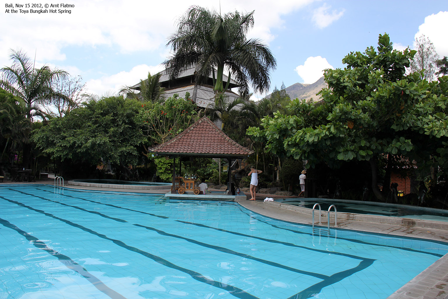
Toya Bungkah hot springs
I don't know what I was expecting to find - something between Blue Lagoon (Iceland) and a regular swimming pool? It turned out to be fairly close to a regular swimming pool, except for two minor additional pools with hot water coming out from the mouths of statues with scary faces. Bali has a lot of these statues...

Toya Bungkah hot springs
(Click for larger image)
We were getting hungry and we were happy when the hotel staff came to pick us up. What was not so good that the hotel - which had hardly any guests - had 40 people from some university for lunch. We waited 30 minutes just for our order to be taken. But it was OK to just sit and wait and think back on a very good day.
I was falling deeply in love with the Balinese cuisine and especially Nasi Campur and Nasi Goreng. And the Bintang beer wasn't bad either...
Afterwards, it was just a matter of waiting until the next morning and the ascent of Mt. Abang. The toilet only improved slightly on its performance and I decided to keep clear of it until we returned to Sanur Beach - late the next day.

Waiting for service at hotel Segara
(Click for larger image)


