
Norwegian Mountains, Møre og Romsdal
Bløkallen from Blø, Jan 13 2007
For Information, maps, trailhead and route descriptions, click HERE.

The routes to Bløkallen/Litlekulten
Why is it that I never, ever can ready a ferry schedule right? This was the question when I arrived Brattvåg 08:30AM this morning, when the first ferry to Dryna island left 10:45AM. The plan was to hike Bløkallen on foot, but I had no wish to wait MORE than one hour on this dark and rainy morning. So I decided to turn back around. Back at Eidet, I had to make a decision. Where would I go in these snowy mountains without skis or snowshoes? Especially if I wanted to visit a new mountain. There were some candidates in the Tresfjord region, but..
The time was now 08:50PM, which meant that it would be less than one hour before the ferry left. I decided to stick with Bløkallen and drove back to Brattvåg, and 09:15AM, I was once more waiting in line for the ferry to Dryna.
The weather wasn't as bad as I had expected. I had a full view of Hellandshornet (883m), and Bløkallen was only 522m. The ferry came - and left on-time, and I was in store for a very interesting drive on Midøya island. On a completely DRY road, I passed a car that was going 60 km/h in the 80-zone, and entered a BEAUTIFUL mix of ice and snow on the road, just I was about to get back into my lane. Oh... Norwegian roads...
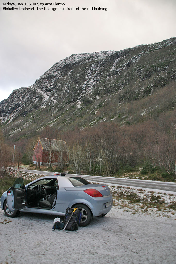
I found the trailhead straight away and I was on my way to Bløkallen 10:30AM. Being dependent on a ferry connection cause a certain stress. One ferry would leave Dryna 13:00PM. The next 15:20PM. With only a 500m ascent, I would (normally) reach the summit within the hour (11:30AM), and be back in less. As such, I decided to carry my little friend "Troll", instead of watching him unwillingly "drag his ass" up the forest. The hike up the forest offered a really good snowshower, and I was quite happy about it. If I was about to enter a snowshower, better here than on the top.
Above the "forest", I headed straight towards the north ridge, which looked interesting. Getting close, I ran into problems. It was just too icy. Without the dog, it would have been just challenging. With a dog, an ascent would have been risky. I spent 5 minutes chopping steps in the ice, but realised that this would be a time-consuming task.
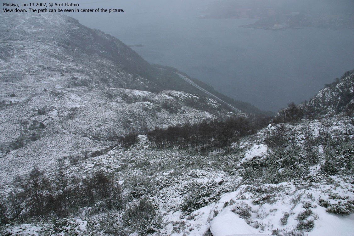
I cancelled the north ridge and continued southbound until I found a couloir (well, not really a couloir, but in lack of a better word...) which provided a convenient route up to the top. The summit had to be entered from the west, and by 11:35PM, I was standing on it.
The only sensible place to take pictures was on top of the summit cairn, which was very slippery. I did not succeed in taking a 360 deg. wide-angle panorama. Troll, located in the backpack at the bottom of the cairn, decided that the backpack was the best place for him, and I watched him "shiver" and feel sorry for himself inside it.
We left the summit 5 minutes later. Following my tracks back down allowed for a fast descent, and I let Troll descend most of the route. When the path turned into a stream, I put him in the backpack for practical reasons. We were back at the trailhead 12:12PM, and in GOOD shape for the 13:00PM ferry from Dryna.
It was good that we started out early. The weather turned really nasty, and we enjoyed a mix of snow and rain from Dryna to Ålesund.


