
Norwegian Mountains, Sogn og FjordaneVeten, 613m
|
| Fylke/Kommune : | Sogn og Fjordane/Vågsøy | ||
| Maps : | 1118-I Måløy (Statens Kartverk, Norge 1:50 000) | ||
| Primary factor : |
Veten: 613m Brurahornet: 179m Gottrøysa: 26m |
||
| Hiked : | Nov 2009 | ||
| See also : |
| ||
| See also : | Other Sogn og Fjordane mountains on westcoastpeaks.com |

Veten, Brurahornet and Gottrøysa
(Click for larger image)
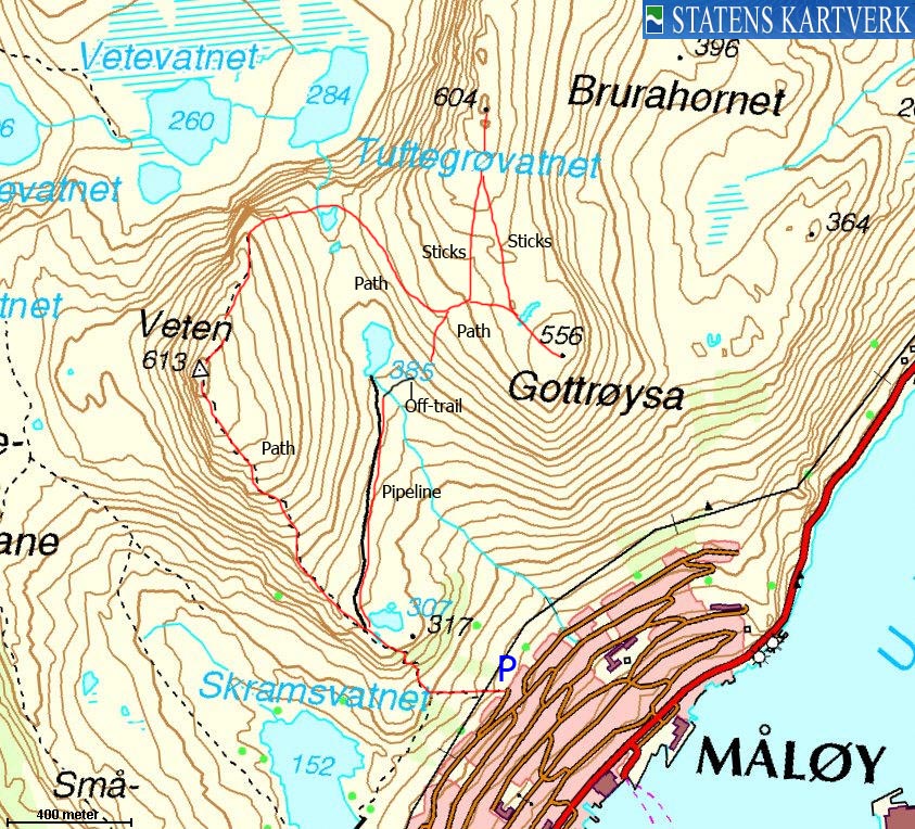
Veten and Brurahornet - Gottrøysa rise directly up from the town of Måløy - the administrative centre of the municipality of Vågsøy. There are a number of paths up to this mountain massif, but Skramsvatnet and Gate (street) 8A are perhaps the most popular starting points. This page will describe a round trip across all tops (along paths), starting from Gate 8A.
The name Veten implies it was home to one of the many coastal "vetter" (wooden cairns, set on fire under enemy attack) during the Viking era. The book Den Norske Leidangen refers to (under Selje) "Viten på fastlandet ved Måløy. Hanekammen?" (Viten on the mainland by Måløy). For the record - Hanekammen is located 4,5km east/southeast of Veten and seems less strategically located for being a "vette".
Brurahornet is located 1,2km northeast of Veten. Gottrøysa is a fine viewpoint on the south side of Brurahornet. Økonomisk Kartverk (interactive map on the net) refers to Gottrøysa as Brurahornet, while Norge 1:50,000 informs us that Brurahornet is point 395m - 650m east of point 604m. This page is based on that Brurahornet is point 604m and Gottrøysa is point 556m.

Måløy seen from Gottrøysa
(Click for larger image)
Veten (Norge 1:50,000: 613m, Økonomisk Kartverk: -, UTM 32 V 295038 6874667) has a primary factor of 613m being the highest point on Vågsøy isla
GPS measurement read 612m (on the ground), averaged over a 5-minute period (error margin +/- 2,9m).
Brurahornet (Norge 1:50,000: 604m, Økonomisk Kartverk: -, UTM 32 V 295940 6875500) has a primary factor of 179m towards the higher parent Veten. The defining saddle (approx. UTM 32 V 295470 6875070) is found in the lowest pass between these two mountains. Ref. Norge 1:50,000 (20m contours), the saddle is within the range 420-440, interpolated to 430m. However, the north/south 420m contours are only 40m apart, which makes a 10m interpolation less trustworthy. Thus, the saddle has been corrected to 425m.
GPS measurement read 603m (on the ground), averaged over a 5-minute period (error margin +/- 1,1m).
Gottrøysa (Norge 1:50,000: 556m, Økonomisk Kartverk: -, UTM 32 V 296148 6874704) has a primary factor of 26m towards the higher parent Brurahornet. The defining saddle (approx. UTM 32 V 296056 6874858) is found in the lowest pass between these two mountains. Ref. Norge 1:50,000 (20m contours), the saddle is within the range 520-540m, interpolated to 530m.
GPS measurement read 551m (on the ground), averaged over a 3-minute period (error margin +/- 4,2m).

Veten & Gottrøysa seen from the Måløy bridge
(Click for larger image)
Google's interactive map. You can zoom, pan and click on the markers.
|
|
|
|
Route 1: All tops - round trip (summer/autumn)
|
|
This route description is valid per Nov 2009
Access
(all distances are approx. distances)
The starting point is the town of Måløy. The nearest airports are Florø lufthavn and Sandane lufthamn Anda.
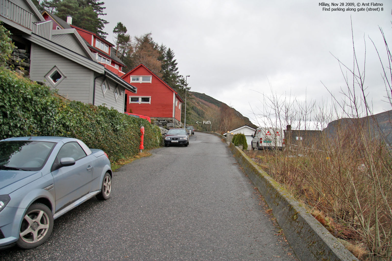
Locate Gate (street) 8A by using the street map above (Trailhead map). The first road upwards (up to Gate 2) begins 270m southwest of the road down to the ferry harbour. In Gate 8A, locate the Veten signpost. Find parking nearby.
The route

Part of the route
(Click for larger image)
Follow the forest path 300m upwards to a fork. Turn right (the path to the left leads to Skramsvatnet). Higher up, the path bears signs of erosion as it passes through steeper terrain. Pass a small lake at approx. 315m and at the upcoming fork (signposted), go straight ahead (left). If you do the round trip, you will be coming down from the right. Proceed up Veten's southeast ridge to Veten summit, marked by a small cairn.
From Veten, continue down the north ridge and descend into the valley between Veten and Brurahornet. The path - if you are still on it - heads southeast in the direction of Gottrøysa. Be aware of a path coming up from your right - as you will descend here later on. At 480m, the path forks and you can proceed north (the path is marked by sticks) towards Brurahornet - marked by a small cairn.
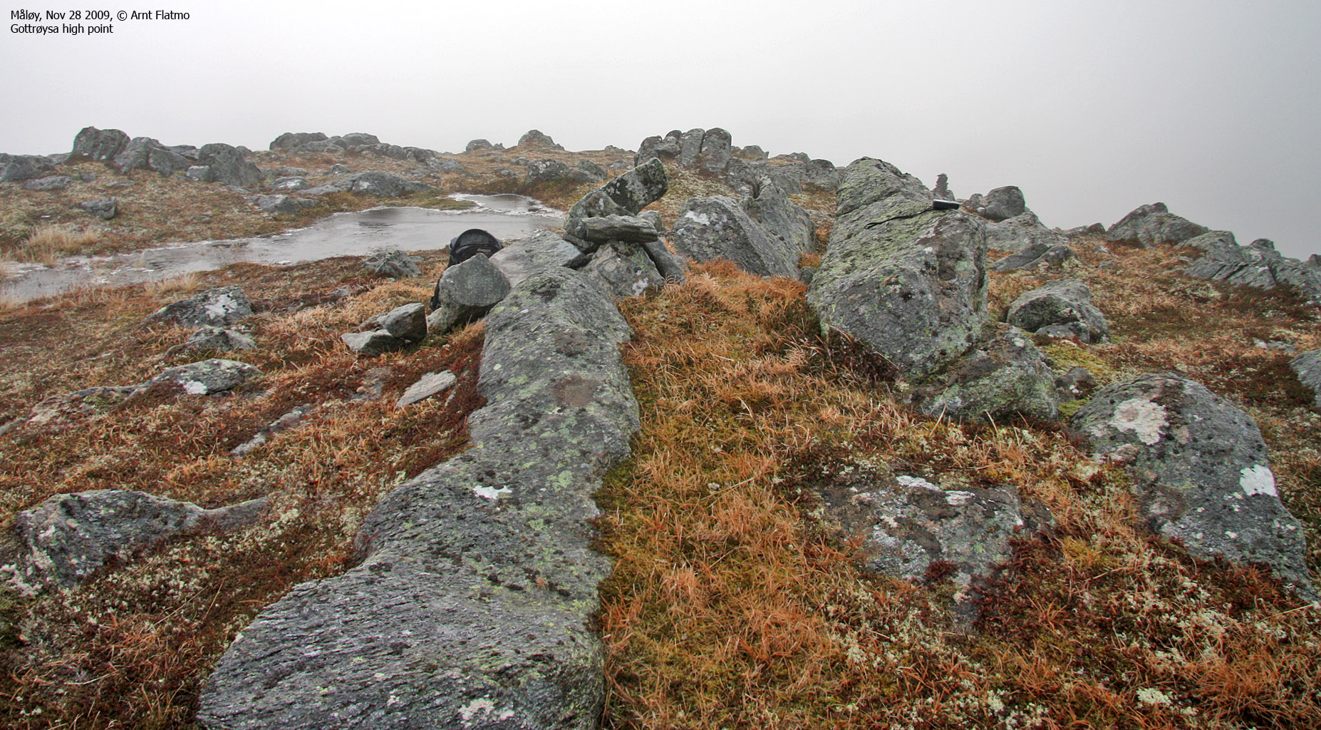
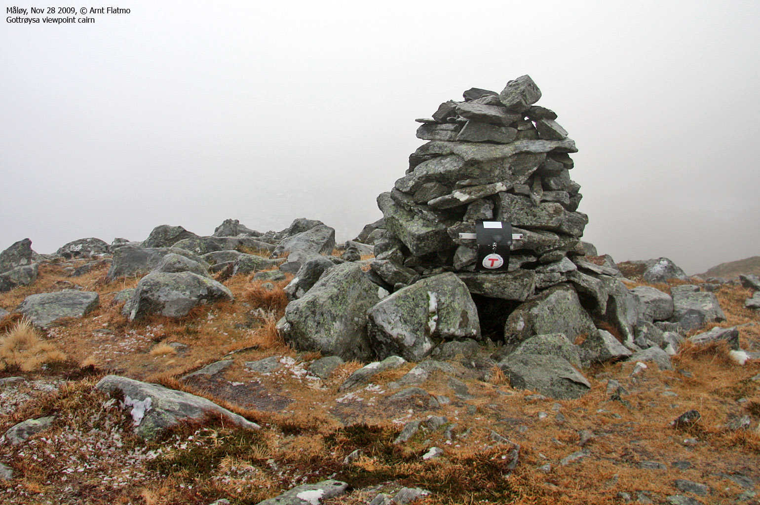
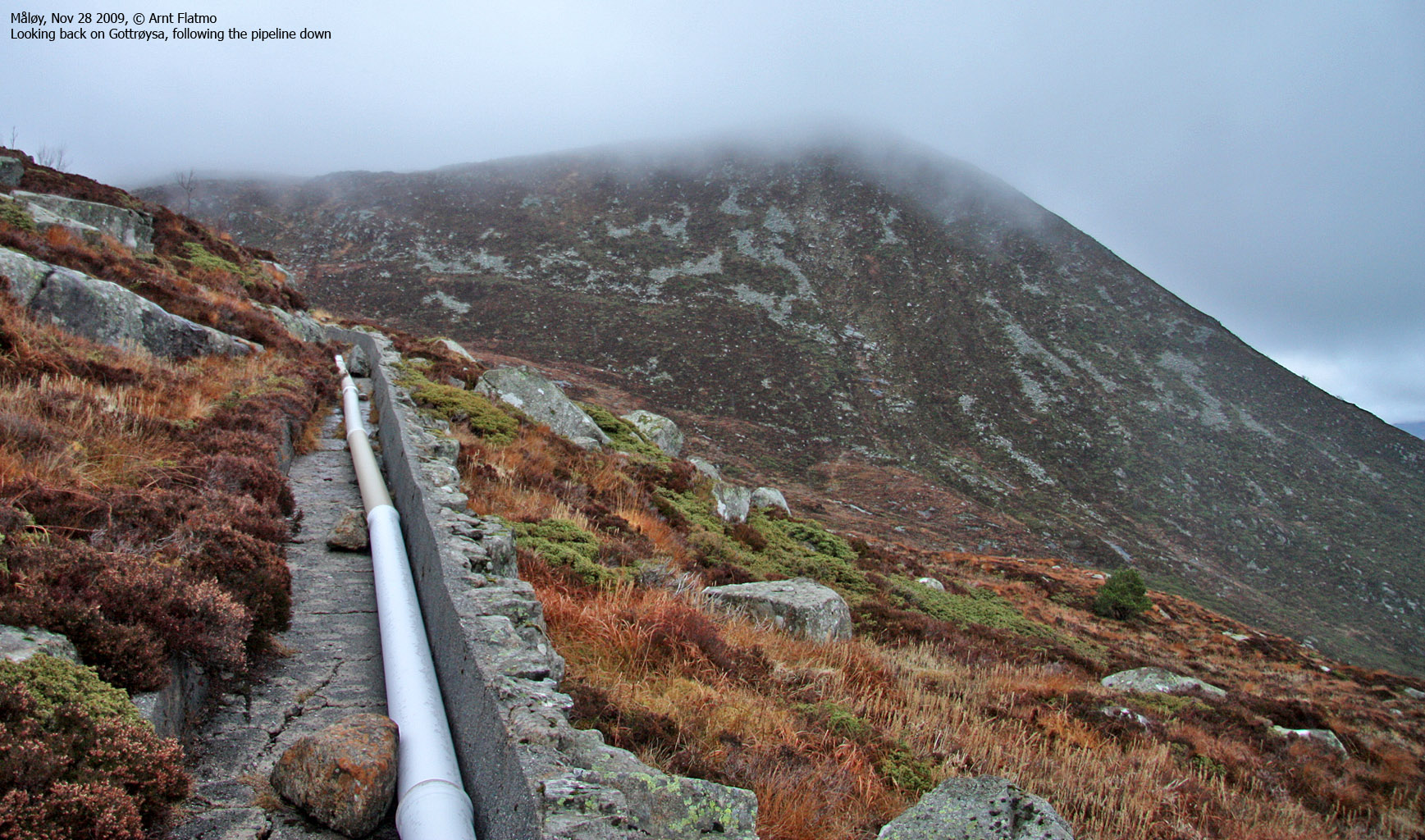
From Brurahornet, head south along a marked (sticks) path towards Gottrøysa. Gottrøysa's high point is not marked, but you will find a viewpoint cairn (UTM 32 V 296154 6874641) 60m south of the high point. Enjoy a fine Måløy view from here. From Gottrøysa, follow a path northwest until you join the path you came up. Follow the path south into the valley between Veten and Brurahornet. As you reach the valley, there may not be a path connecting the path you're on and the pipeline from lake 385m. Head off-trail over to the pipeline and follow it down to your Veten ascent route.
|
|


