
|

Budalshovden, highest point on the middle ridge(No Javascript) |
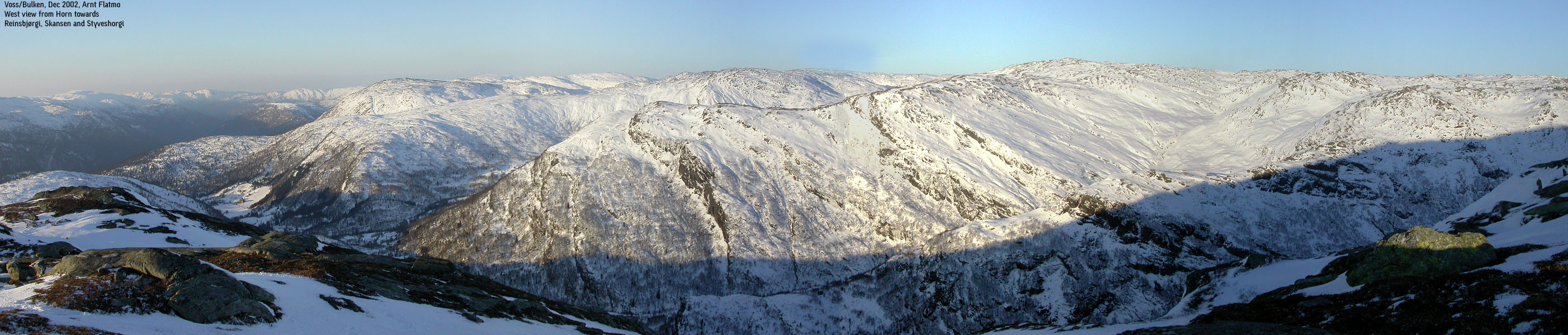
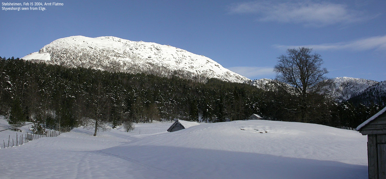
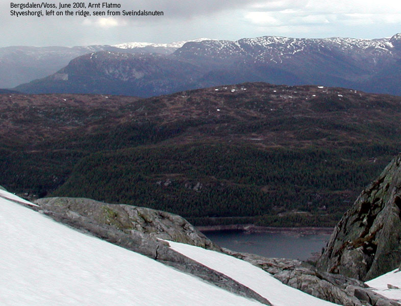
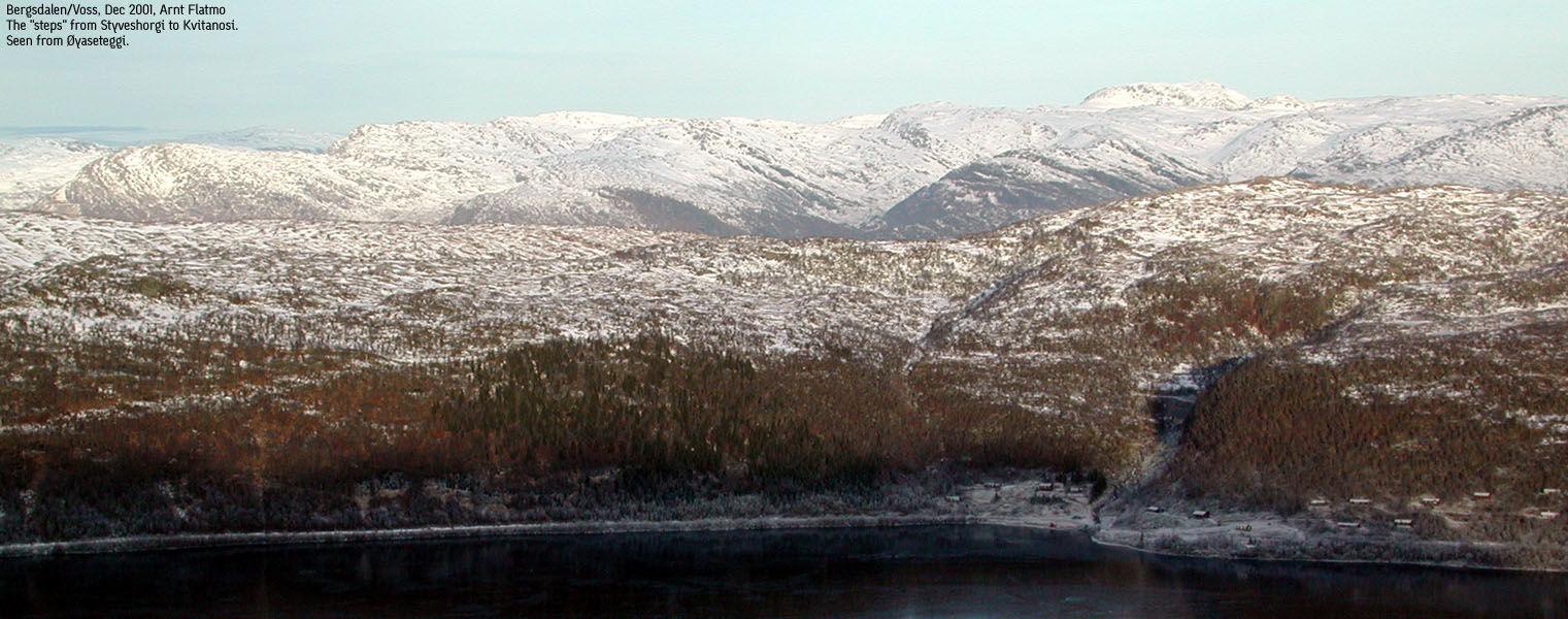
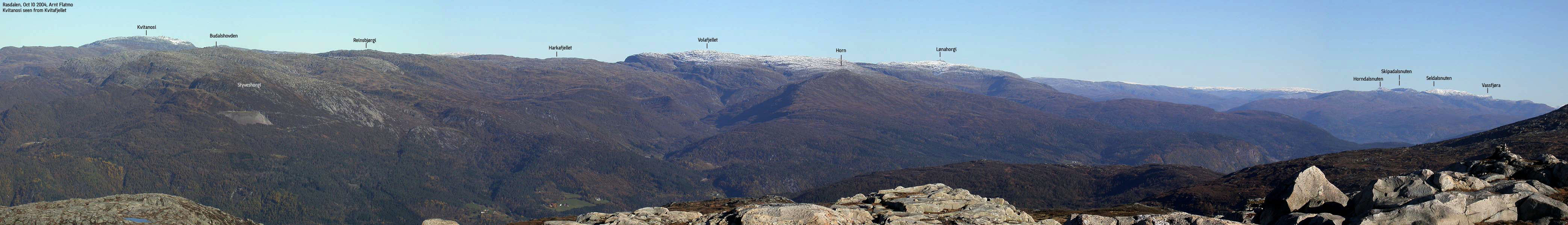
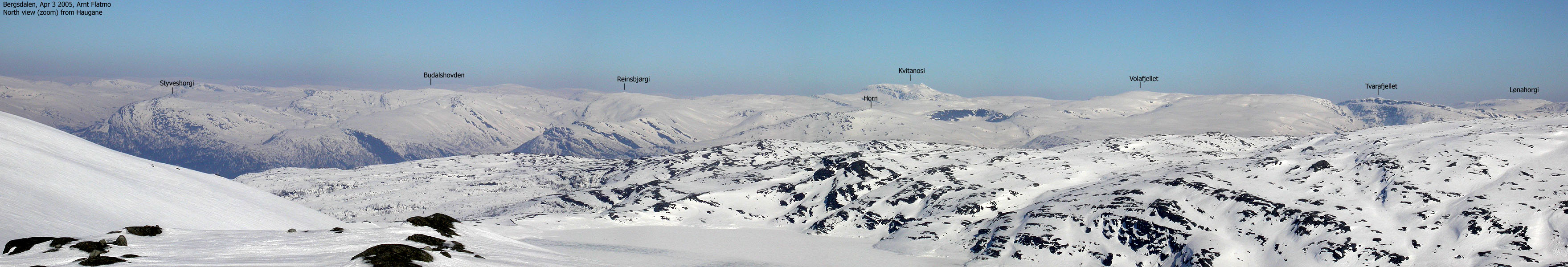
Budalshovden is a fairly anononymous high point, not easily seen from roads, and not a very prominent or distinct top when viewed from neighbouring mountains. But the views are excellent, just as from other high Stølsheimen mountains. Styveshorgi, on the other hand, is easily seen when you pass Evanger. Perhaps the most distinct feature is the stone quarry, which certainly does not enhances the beauty of the mountain.
The area seems quite popular in winter. A few cabins are found at the foot of Styveshorgi, but they don't take away the feeling of being quite a long way from civilization. A number of hiking trails also make access to the mountains quite easy.
Names and primary factor:
Budalshovden is the name of point 1140m. It is possible that the mountain plateau is named Auborrahorgi (also known as Åburdahorgi and Austborrahorgi), but from the map it seems that Auborrahorgi is a lower point further north.
Budalshovden's primary factor towards the higher Reinsbjørgi is 130m. The saddle is south of lake Ljosvatnet, and on the M711 (20m contours), the 1020m contours form the saddle. The saddle height is interpolated to 1010m.
Styveshorgi's primary factor towards the higher Budalshovden is 98m. The saddle is found on the ridge northbound towards Auborranipa. On the M711 (20m contours), the 900m contours form the saddle. The saddle height is interpolated to 890m. With only 2m away from having 100m primary factor, thus being an independent mountain, I have not bothered putting "not ranked" next to this mountain. Infact, since we don't know the saddle height, the saddle could actually be 881m, giving a primary factor of 107m. This extreme interpolation is known as "soft-rank", but I always apply a fair and average interpolation.
Note: Class ratings are in reference to YDS (Yosemite Decimal System).
Note: The trail described below is not necessarily the easiest trail to this mountain.
|
Elge - Budalshovden/Styveshorgi (winter)
|
|
Access
From Bergen, follow highway E16 towards Oslo. At Evanger, turn left towards "Eksingedalen". Drive 200m and turn right towards "Bjørgås 5". Follow this road for xxKm and stay right when you come to a fork. You are now at Elge. You should see a forest road going up to your left. Find parking nearby.
The route
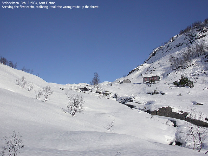
Follow the forest road upwards. This road runs all the way to 720m elevation on Styveshorgi's south side, but you will be taking a different route. After approx. 1Km, the forest road turns sharp to the left. Continue another 700m on the road and exit right into the forest just before the road crosses a creek. The direction towards the cabin in Bjørnagjelet is northeast. In summer, you will see a trail. In winter, you hopefully may see ski tracks. The trail/corridor is narrow and is not very suitable for downhill skiing.
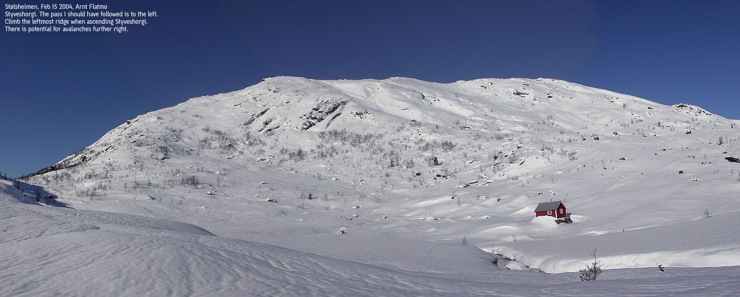
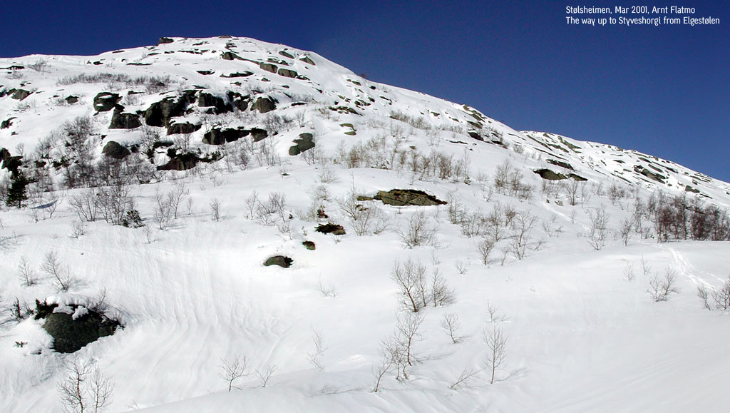
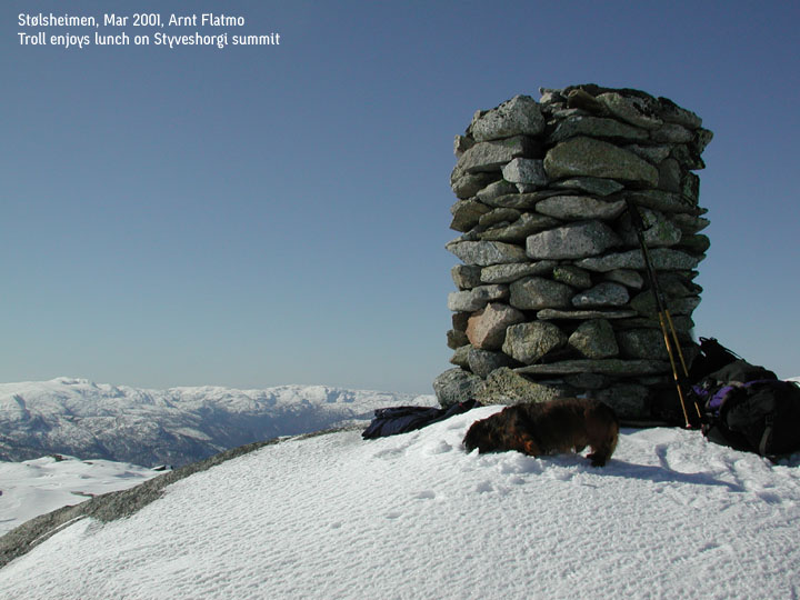
From Bjørnagjelet, continue north/northeast and go through a pass before you descend to Elgestølen cabins. If you aim to include Styveshorgi on your trip, then ascend Styveshorgi mid-way between the pass and the lake. It is only 1Km to Styveshorgi (overhead line) and a 370m climb in elevation. A proper cairn marks the Styveshorgi summit.
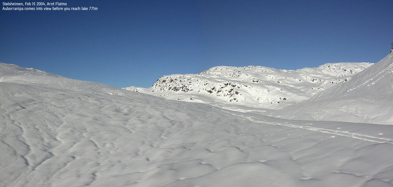
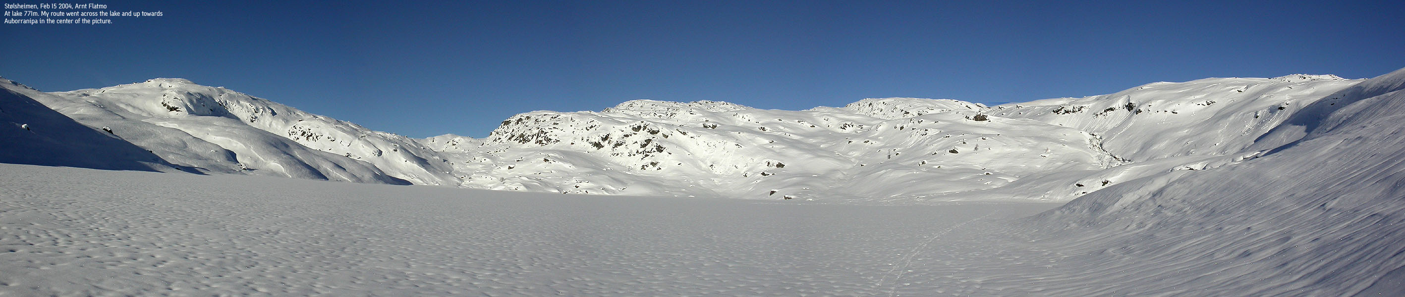
Back to the Budalshovden route; Maintain a northeast direction up towards lake Skorsetvatnet. Turn more east the higher you go, and arrive the lake where it drains southbound. During snowmelt, you need to find a suitable place to cross the stream. Normally, the stream can be crossed at the lake. If the ice is thick, head straight across the lake's east side and find a good north/nortwest route up to Auborranipa (approx. 1090m). There are quite a number of humps in the terrain, so you will need to switchback up the mountain.
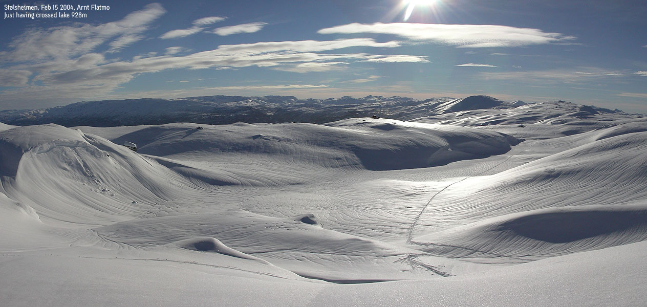
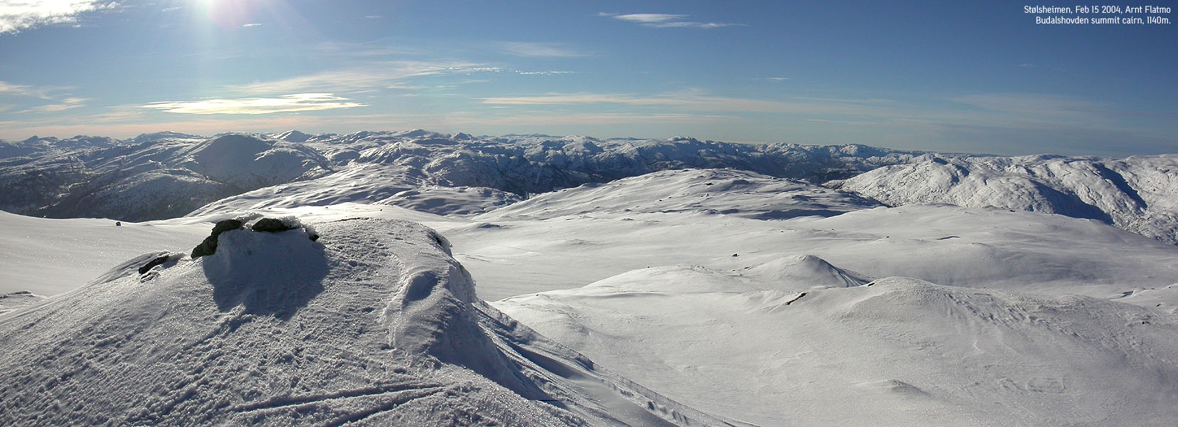
From Auborranipa, the direction to Budalshovden is northeast. I recommend you head eastbound to the small valley between Auborranipa and Budalshovden, and then set the course to northeast. A tiny cairn marks the Budalshovden summit.
|
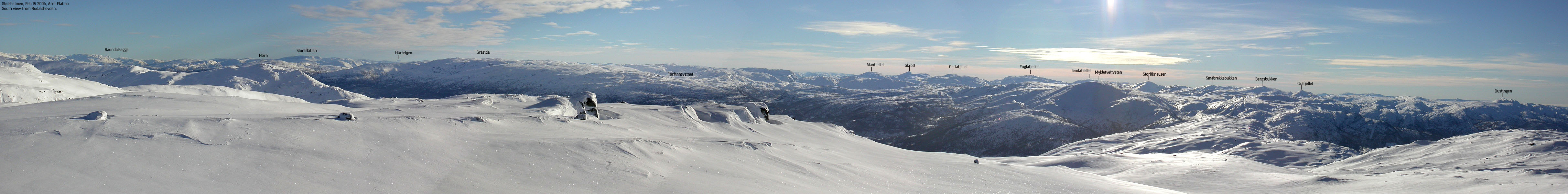
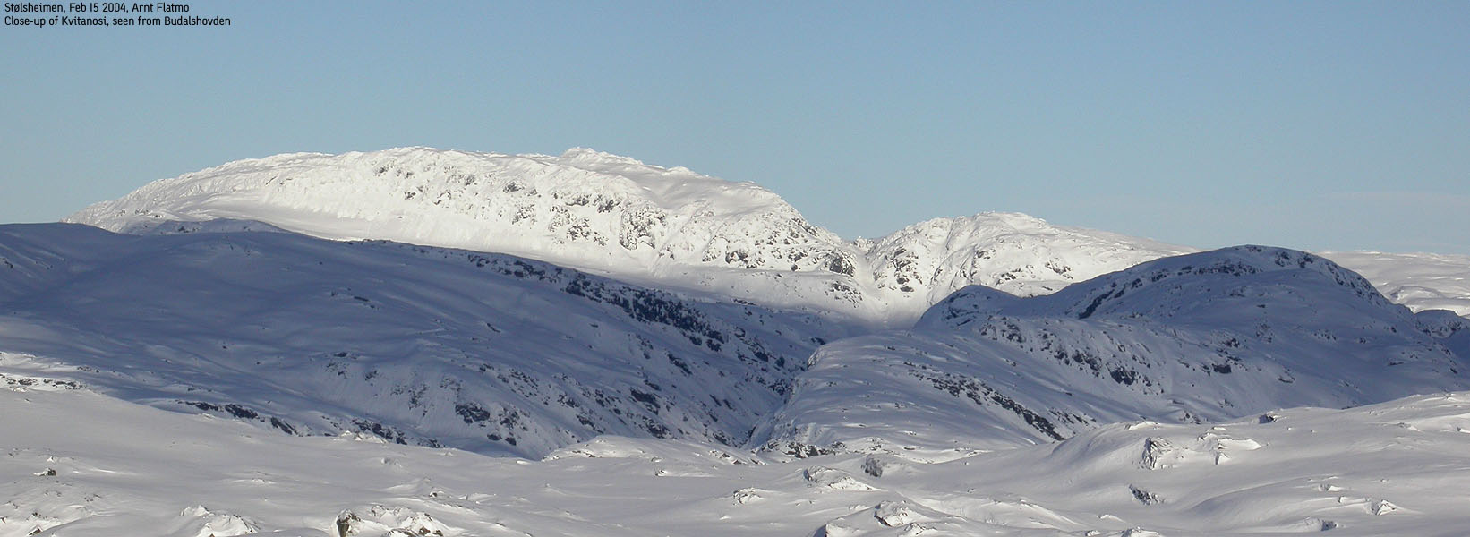
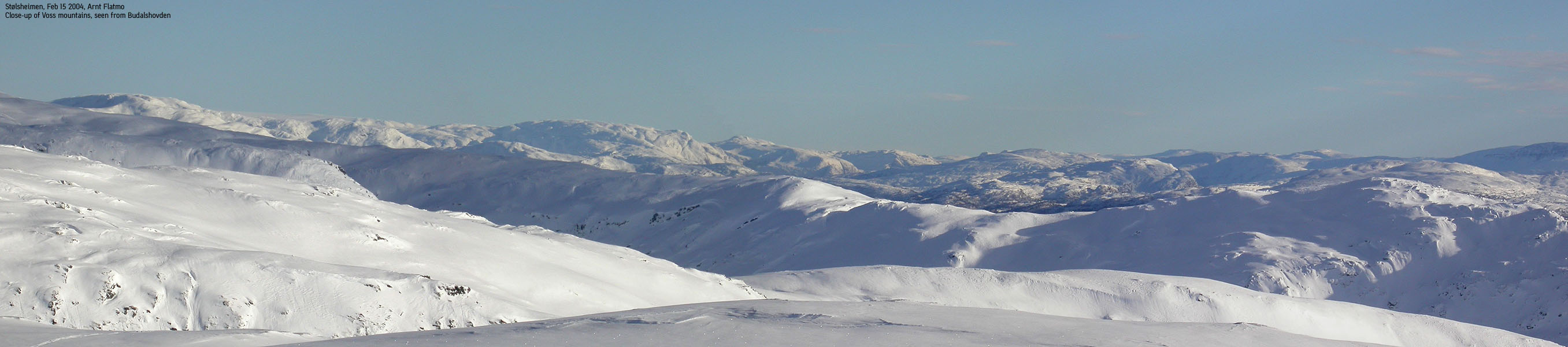
Trip Report Feb 15 2004After a great hike to Snerta the day before, I planned a longer ski trip for this Sunday. I expected the amazing weather to hold. Troll would be left home, and a neighbour would visit him now and then. Good concience was in place, as I would take him to Ulriken when I got back home. I didn't look forward to driving on the icy roads up to Elge, but was much less interested in walking from Evanger. I was on my way from Elge at 11:05PM and looked immensly forward to the ski trip. Last time I visited Styveshorgi, I followed the forest road all the way up to 700m, before I realized Styveshorgi couldn't be ascended from the south. I then followed the 700m contour until I reached Bjørnagjelet (this was quite a deep snow struggle). I found the right way down, but here and now I couldn't remember where I was supposed to leave the forest road. I ended up leaving it in the first curve and it became apparent within a few minutes that this was a bad call. It took me an hour to get up to the cabins, after messing around in the forest. Once above the forest, it struck me how incredible bad grip I had under the skis. Soft powder snow hidden under a thin layer of icy crust. No matter the color, it didn't hold. It struck me that vax wasn't the recipe for today. Not being totally foreign to struggle, I made my way (sideways) up to lake Skorsetvatnet. Just before a lake I came across some tracks, perhaps from the day before. The crust was broken, and a solid dose of red vax gave me some kind of grip. The rest of the ascent was quite uneventful, but nevertheless a pure pleasure in white snow and under a blue sky. I was thankful for the tracks in the snow, as they were obviously made by someone who knew the terrain well. I arrived the summit 14:00PM and took a well deserved break. The tracks disappeared into the neighbouring valley. I had been hoping they would run back down the ridge, parallel to the route I ascended. Since they didn't, I decided to take the same route back down. But after a good round of pictures. The higher Reinsbjørgi and Volafjellet blocked the view towards Voss. Besides that, the view in the rest of the directions was premium. A lot of familiar mountains in the horizon. The combination of wilderness, purity and beauty of the white landscape was overwhelming. I felt truly privileged to be able to make my way up to such a wonderful place on such a wonderful day. It doesn't get much better than this. The descent was initially a nightmare, as I wasn't able to make turns in the crusty snow, and the skis ran much faster than I cared for. My ascent route had followed narrow valleys and ridges where switchbacking was impossible. Running down in full speed was never an option. I fell once and felt the razor sharp crust cut my hands. Things got a bit better further down as the sun had melted some of the crust. I followed the normal route towards Bjørnagjelet, and was back at the car 1h:20m after leaving the summit. Troll was happy to see me again, but quickly put up the sorry face. After a little rest I took him to Ulriken (605m) and he was a happy dog again.
Pictures from the Feb 15 2004 hike:
Move cursor to read notes, and click on the images to see full version.
No Javascript: 1 2 3 4 5 6 7 8 9 10 11 12 13 14 15 16 17 18 19 20 21 22 23
|
|
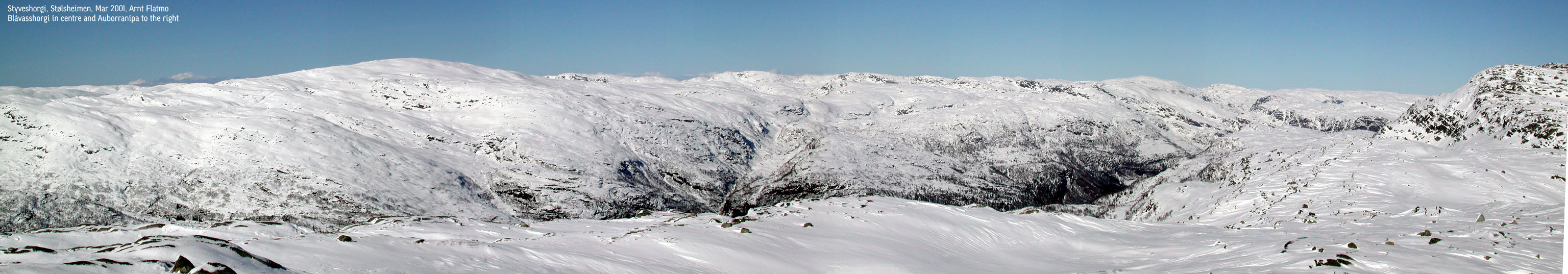
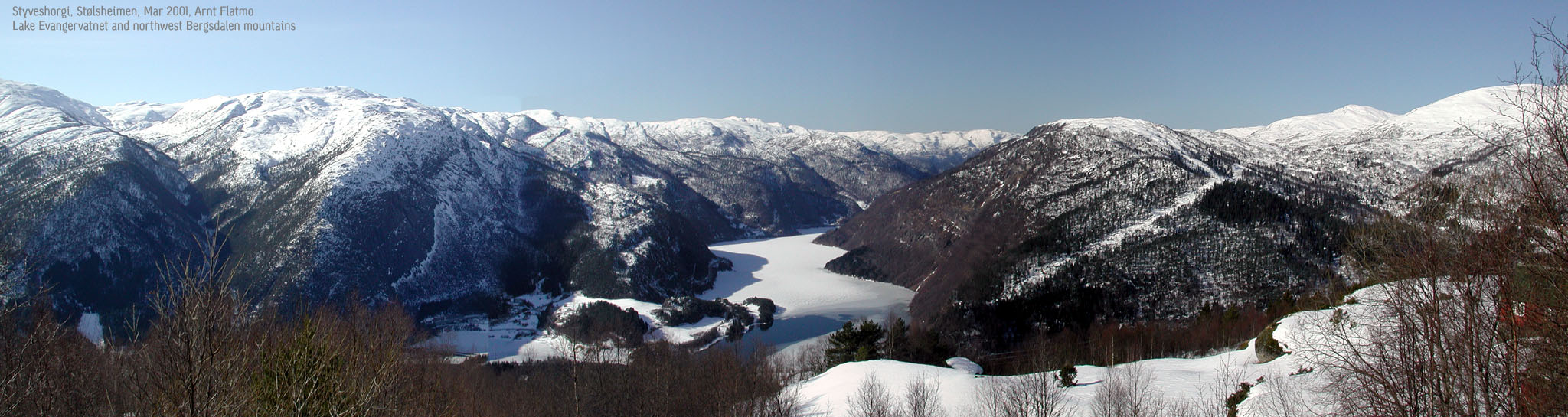
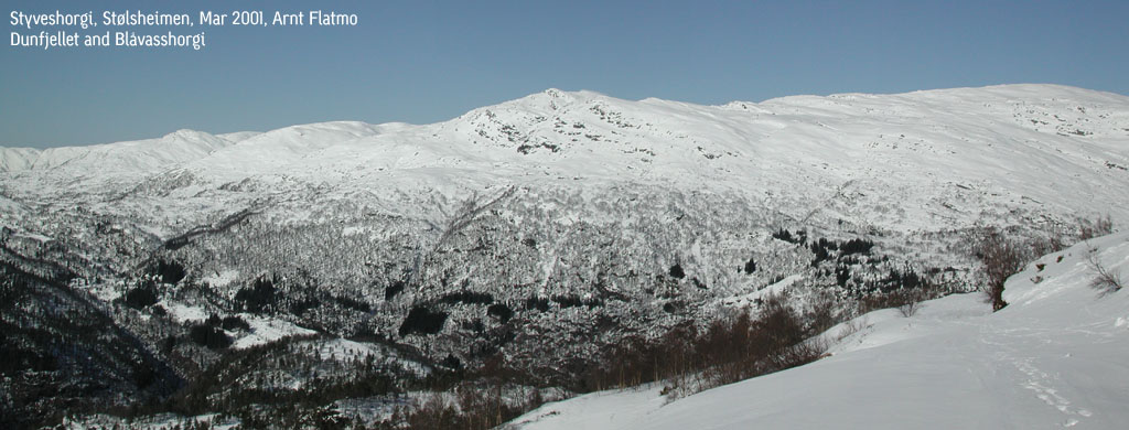
Styveshorgi Trip Notes Mar 2001I followed the forest road from Elge all the way to 700m elevation on the south side of Styveshorgi. I had plans to ascend Styveshorgi here, but abandoned the plans when I saw there was a potential for avalanche. Instead, I walked in deep snow and cumbersome terrain along the 700m contour and ascended Styveshorgi from southeast. I carried Troll in the backpack after leaving the forest road, and the weight combined with soft and deep snow made this a hard hike. The hike altogether took 3,5 hours in beautiful spring weather.
Styveshorgi Pictures Mar 2001
No Javascript: |


No Javascript:
 Other hordaland mountains
Other Voss K. mountains
westcoastpeaks.com
Other hordaland mountains
Other Voss K. mountains
westcoastpeaks.com


