
Norwegian Mountains, NordlandDalaunfjellet, 800m
|
| Fylke/Kommune : | Nordland/Brønnøy | ||||||
| Maps : |
1825-IV Velfjord (Statens Kartverk, Norge 1:50 000)
1725-I Brønnøysund (Statens Kartverk, Norge 1:50 000) |
||||||
| Primary factor : | 110m | ||||||
| Hiked : | July 2010 | ||||||
| See also : |
| ||||||
| See also : | Other Nordland mountains on westcoastpeaks.com |

Dalaunfjellet
(Click for larger image)
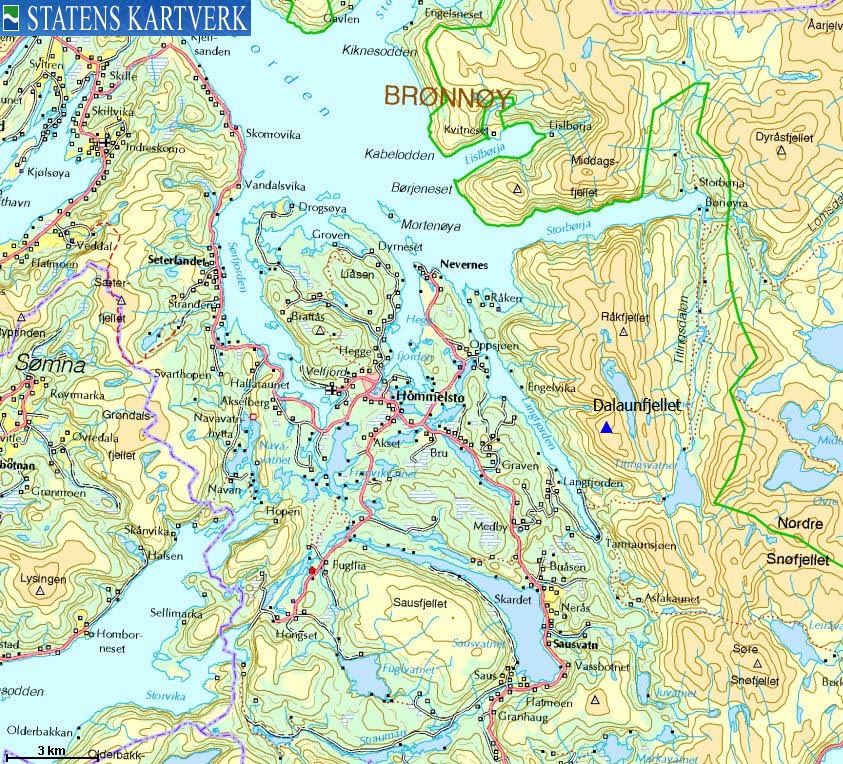
Dalaunfjellet is located above Langfjorden - one of Velfjorden's 7 fjord arms, and is part of a mountain region that is defined by Langfjorden to the west, the drains from Lake Tettingsvatnet to the south and east (Tettingdalen) and the Storbørja fjord arm to the north. Råkfjellet (884m) is the highest top in this region, and Råkfjellet, Engelvikfjellet (849m) and Dalaunfjellet form a horseshoe around Lake Storvatnet (aka. Langvatnet).
Dalaunfjellet is a fairly easy walk from the power plant by Langfjorden, but few people visit this mountain. Øyrtinden (3,8km to the southeast) receives numerous visitors, mainly because it is often part of Fjelltrimmen in Brønnøy. While the starting point and the hiking distance is almost the same for the two mountains, Øyrtinden and Dalaunfjellet are "worlds apart". While Øyrtinden offers a safe hike through the "T" marked path, Dalaunfjellet offers a touch of "the wild" - being located in the outskirts of the famous Lomsdalen wilderness.
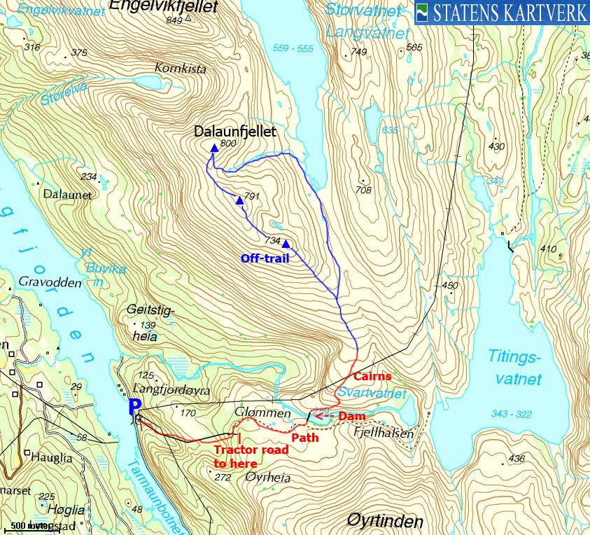
This page will describe a round trip route starting by Langfjorden. There are no very difficult or exposed sections, but the entire route above 400 meters is off-trail. A potential obstacle is a dam crossing. In July 2010, crossing the concrete offered no other challenges than getting down from it on the other side.

Dalaunfjellet
(Click for larger image)
Dalaunfjellet (Norge 1:50,000: 800m, Økonomisk Kartverk: -, UTM 33 W 393796 7254637) has a primary factor of 110m towards the higher parent Engelvikfjellet (849m). The defining saddle (approx. UTM 33 W 394067 7255237) is found between these two mountains. Ref. Norge 1:50,000 (20m contours), the saddle is within the range 680-700m, interpolated to 690m.
GPS measurement read 795m (on the ground), averaged over a 5-minute period (error margin +/- 1,6m).

Dam crossing
(Click for larger image)
Google's interactive map. You can zoom, pan and click on the markers.
|
|
|
|
Route 1: Langfjorden - Dalaunfjellet (summer/autumn)
|
|
This route description is valid per July 2010
Access
(all distances are approx. distances)
")
The road to Langfjorden (Øyrtinden route)
(Click for larger image)
The starting point is Brønnøysund. Follow highway RV17 towards Vennesund. At Skillvika (10 minutes outside Brønnøysund), turn left onto highway RV76. Drive 29,9km (passing Hommelstø along the way) and turn left towards Langfjord (signposted).
Follow this road 3,3km to Langfjord, then turn right at a junction. 300m later, turn right again. Continue 2,1km to the bridge across Tarmaunbotnet. Once across, drive 1,5km and park by the power plant (N65.37528 E12.70017). Per July 2010, the gate was open and there were no signposts about driving restrictions.
The route

Dalaunfjellet - upper ascent route
(Click for larger image)
From the power plant, follow the tractor road up along the power line. At 240m (N65.37433 E12.71830), the tractor road turns left and fades out on a meadow. Continue to the east and see if you can locate the path that runs to the dam. At the dam (N65.37549 E12.73368), cross the concrete and descend on the left-hand side once you're across. Getting off the concrete is the only technical move you need to do throughout the hike.
Look for cairns that take you across a small cleft and then up the ridge. Once you're on the ridge proper, forget about the cairns and follow the ridge up to point 734m (N65.38970 E12.72805). The ridge is somewhat complex below this point, so look for the easiest route. Continue across point 791m (N65.39293 E12.71911) before reaching Dalaunfjellet high point (800m, N65.39708 E12.71346), marked by a small cairn.
Descend your ascent route, or head back to the saddle between point 800m and point 791m. Then follow a valley and a small river down to Storvatnet/Langvatnet. Be careful across the slabs, especially if they're wet. Be also careful if there is snow above the river. At Storvatnet/Langvatnet, turn right and follow the valley down to 550m, where you turn gradually to the right and join your ascent route.
 westcoastpeaks.com
Other Nordland mountains
Other Norwegian mountains
westcoastpeaks.com
Other Nordland mountains
Other Norwegian mountains


