
Norwegian Mountains, Nordland
|
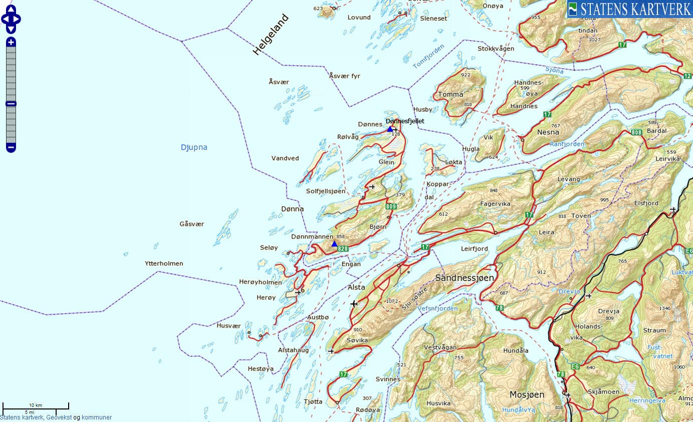
| Fylke/Kommune : | Nordland/Dønna | ||||
| Maps : | 1827-III Sandnessjøen (Statens Kartverk, Norge 1:50 000) | ||||
| Primary factor : |
Dønnmannen: 856m Dønnesfjellet: 115m |
||||
| Hiked : | Jul 2010 | ||||
| See also : |
| ||||
| See also : | Other Nordland mountains |

Dønnmannen
(Click for larger image)
Dønnmannen is guaranteed a place on "the list" of "distinct Nordland county coastal peaks", and from the summit, you can see most of the other tops on "this list", including Trænstaven, Rødøyløva, Lovund, Hestmannen, De Syv Søstre, the Vega tops and Torghatten - to name a few.
When seen from the north, the mountain resembles the face of a man (hence: Dønnmannen) sleeping on his back. The westernmost of the 4 Dønnmannen tops is called Nasen (the nose). Just search the internet for pictures of Dønnmannen or Dønnamannen, and you'll soon understand. And of course, the mountain takes part in the myths that also include most of the tops listed above.

Dønnmannen and Litltinden
(Click for larger image)
The normal starting point for Dønnmannen is Teistadvika. From here, a well marked path guides you up to Dønnmannen's east top (845m). From here, you follow the summit ridge 500 meters to the high point (856m). There is a steep section just before the east top that is secured by ropes. Seen from a distance, this section may seem intimidating, but it all gets simpler once you're up there. An experienced hiker will not feel a need to use the ropes.
You cannot (easily) reach Nasen from the Dønnmannen high point. If you want to visit both Nasen and the high point, then consider Breidvika as your starting point, and then ascend via Hagen. This page will describe the normal route from Teistadvika.

The rope section
(Click for larger image)
Dønnesfjellet
is the northernmost top on Dønna, and a car road brings you to the
Dønnesfjellstua restaurant on top. Dønnes Kirke (church) is found
close by, and so is Dønnes Gård - which offers accommodation.

Dønnesfjellet
(Click for larger image)
Dønnmannen (Norge 1:50,000: 858m, Økonomisk Kartverk: 856m, UTM 33 W 382030 7327623) has a primary factor of 856m, being the highest point on Dønna island.
GPS measurement read 859m (on the cairn - approx 1 meter high), averaged over a 5-minute period (error margin not recorded)
Dønnesfjellet (Norge 1:50,000: 128m, Økonomisk Kartverk: 127,60m, UTM 33 W 390527 7344664) has a primary factor of 115m towards the higher parent mountain Ørntuva (263m). There are at least two saddle candidates along the way. Picking the closest one, the defining saddle (approx. UTM 33 W 391693 7344301) is found just south of Dønnes, close to point 29m. Ref. Økonomisk Kartverk (5m contours), the saddle is within the range 10-15m, interpolated to 13m.
There is a top 200m west of Dønnesfjellet which has a 125m contour on Økonomisk Kartverk. In lack of a more precise height, Dønnesfjellet should be regarded as the highest point.

Dønnmannen east top
(Click for larger image)
Google's interactive map. You can zoom, pan and click on the markers.
|
|
|
The route descriptions are valid per
July
2010.
|
Route 1: Teistadvika - Dønnmannen summer/autumn)
|
|
Access
(all distances are approx. distances)
The starting point for this route description is Sandnessjøen, which has an airport. By car, you take the ferry from Sandnessjøen to Dønna. At the first junction (N66.08148 E12.58355), turn left. Drive 8,8km to the Dønnmannen trailhead at Teistadvika. Find parking here (N66.03836 E12.43324).
The route

The route from Teistadvika
(Click for larger image)
From the parking, the well marked path runs east for 400 meters, until it climbs northwest towards the drain from Teistadvatnet. You cross the drain below the lake, and continue west directly towards Dønnmannen. There are "T"'s marked with red paint all the way up, so it's difficult to get lost.
The path joins the southeast ridge at approx. 700m, and the route is much steeper from here. 60-80 meters above, you come to a fixed rope section. Once past the ropes, the walk up to the east top (845m - N66.04511 E12.40498) is easy. This point is marked by a medium-sized cairn, and there is a mailbox saying that you're at 858m. This is however not the case.
From the east top, continue west for 500 meters (first down, then ..) up to the high point (856m - N66.04721 E12.39537) - marked by a medium-sized cairn. Along the way, you have to scramble a small (and slightly airy) section, but if you were comfortable in the rope section, chances are good that you will be comfortable here too. You also pass a minor top (N66.04626 E12.39964) before reaching the high point.

The east top and the summit ridge
(Click for larger image)
 westcoastpeaks.com
Other Nordland mountains
Other Norwegian mountains
westcoastpeaks.com
Other Nordland mountains
Other Norwegian mountains


