
Norwegian Mountains, Møre og RomsdalDrynjahatten, Oct 21 2007Back to the main Drynjahatten page
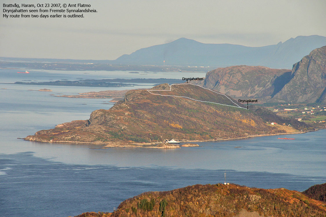
Drynjahatten and the route
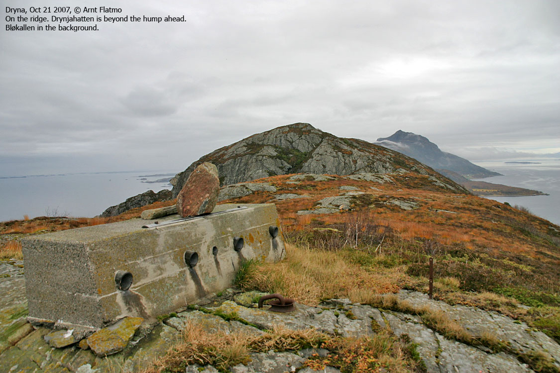
Time to kill I had just visited Klausethornet on Otrøya, and had a couple of hours to kill before the 17:25PM ferry from Dryna. I had absolutely no idea about this top, and where I should go. But how hard could it be? Should I hike from the ferry harbor or up the east ridge?. Soon after entering Dryna island (coming from Midøya), I noticed a road that led up to some houses. I decided to try my luck here. Then I discovered that the road continued to the north side of the island, and I decided to park in the pass. Whoaa, steep... In the pass, I looked at the (surprisingly) steep cliff below Drynjahatten and wondered HOW I was to get up here. Obviously, I would have to find a way around, and then I discovered a vague path heading into the forest. I expected this path to take me up to the top, but it didn't. Instead, I followed it well past the high point before I went up on the ridge. Nice ridge walk It was a nice walk across the ridge. The weather was OK (not good, but OK), and the wind wasn't terrible. Drynjahatten was perhaps not 1st choice on my mountain list, but it sure was better than waiting two hours in the car. I had left Drynaskaret 15:13PM and reached the high point 15:44PM. My dog "Troll" had his exercise on the Klausethornet roundtrip and was sleeping in the car. Descent From the top, I headed towards Drynaskaret before a cliff forced me to bypass the problem in somewhat steep terrain. It was getting late in the day and I hadn't eaten anything since breakfast. Suddenly I got very hungry and that's when the Drynjahatten exploration tour came to its end. I took a shortcut down through the juniper and was back on the forest path within a few minutes. The time was 16:00PM when I returned to the car. MAN, I was hungry when I got back home around 18:30PM... Pictures
Slideshow, all pics on this page:
To Drynjahatten
Wide-angle view from Drynjahatten
Descent
While waiting for the ferry..
No Javascript: 1 2 3 4 5 6 7 8 9 10 11 12 13 14 15 16
|


