
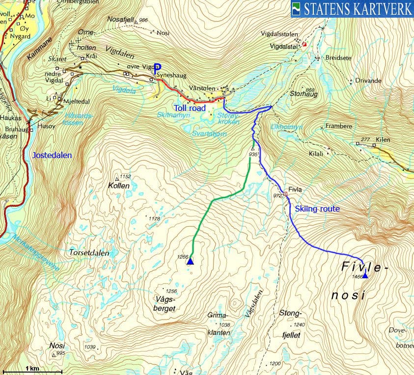
Norwegian Mountains, Sogn og FjordaneFivlenosi, 1466m
|
| Fylke/Kommune : | Sogn og Fjordane county/Luster municipality |
| Maps : |
1417-I Lustrafjorden (Statens Kartverk, Norge 1:50 000)
1417-IV Solvorn (Statens Kartverk, Norge 1:50 000) 1418-III Jostedalen (Statens Kartverk, Norge 1:50 000) |
| Primary factor : |
Fivlenosi: 728m Vågsberget: 156m |
| Hiked : | Apr 2010 |
| See also : | |
| See also : | Other Sogn og Fjordane mountains on westcoastpeaks.com |

Fivlenosi seen from Vorfjellet
(Click for larger image)
Fivlenosi is the highest peak in the mountain region defined by Lustrafjorden, Jostedalen, Vigdalen and Dalsdalen. Other peaks in this region are Vorjellet, Vågsberget and Grånosi. According to Petter Bjørstad's major mountain lists, Fivlenosi has the 22th highest primary factor in Sogn og Fjordane county.
Fivlenosi is also an easy mountain to ski or hike. The starting point is Vigdalen - a side valley of the more famous Jostedalen. In spring, you can drive up to 570m elevation, and in summer, the Vigdalen toll road continues all the way to 660m.
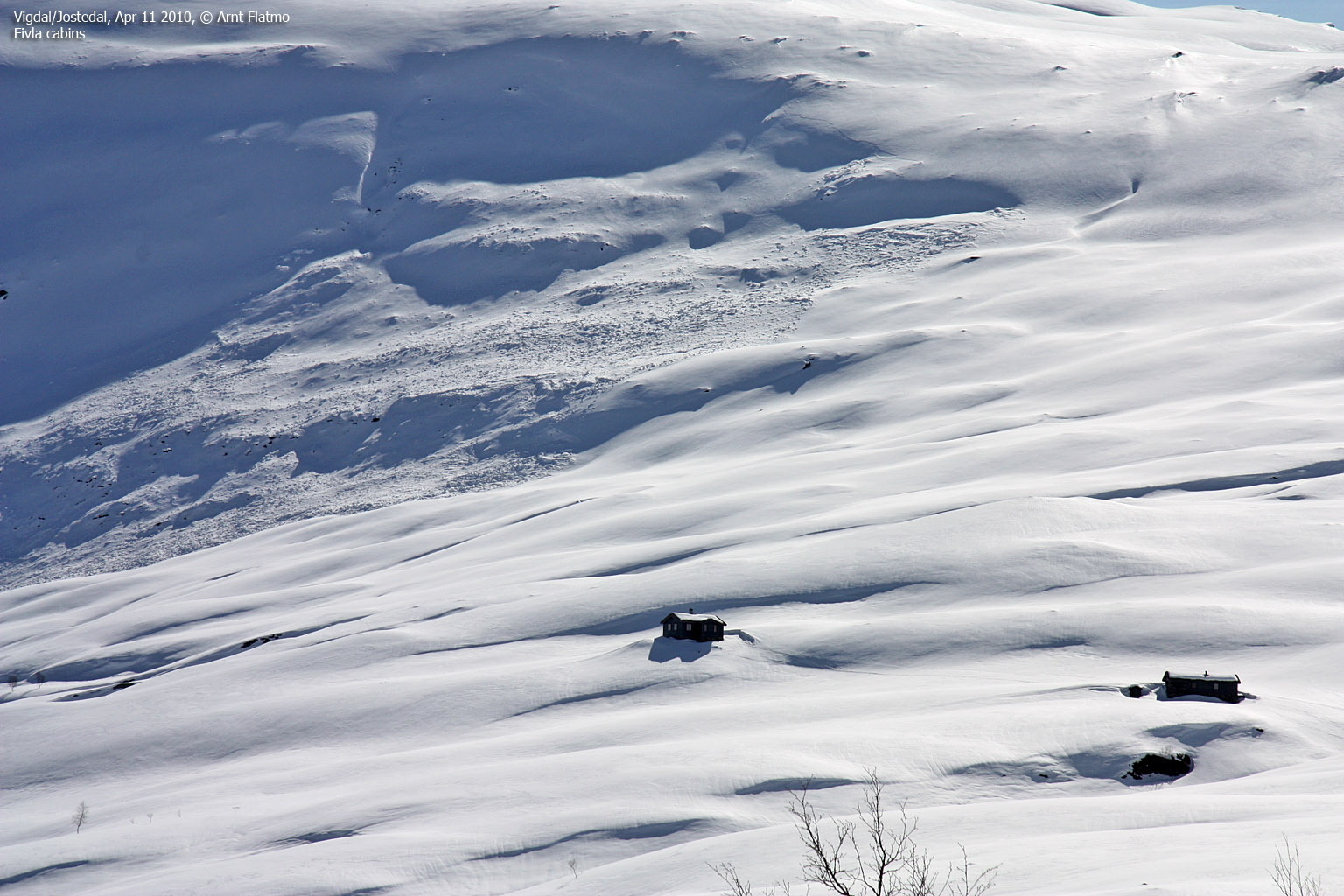
A marked trail runs up to Fivla (975m - external link)- two cabins owned by DNT - the Norwegian mountain touring association. From here, the route up to Fivlenosi is straightforward. The view from Fivlenosi is outstanding - especially the view towards Hurrungane and the peaks surrounding the Jostedalen valley.

Fivlenosi
(Click for larger image)
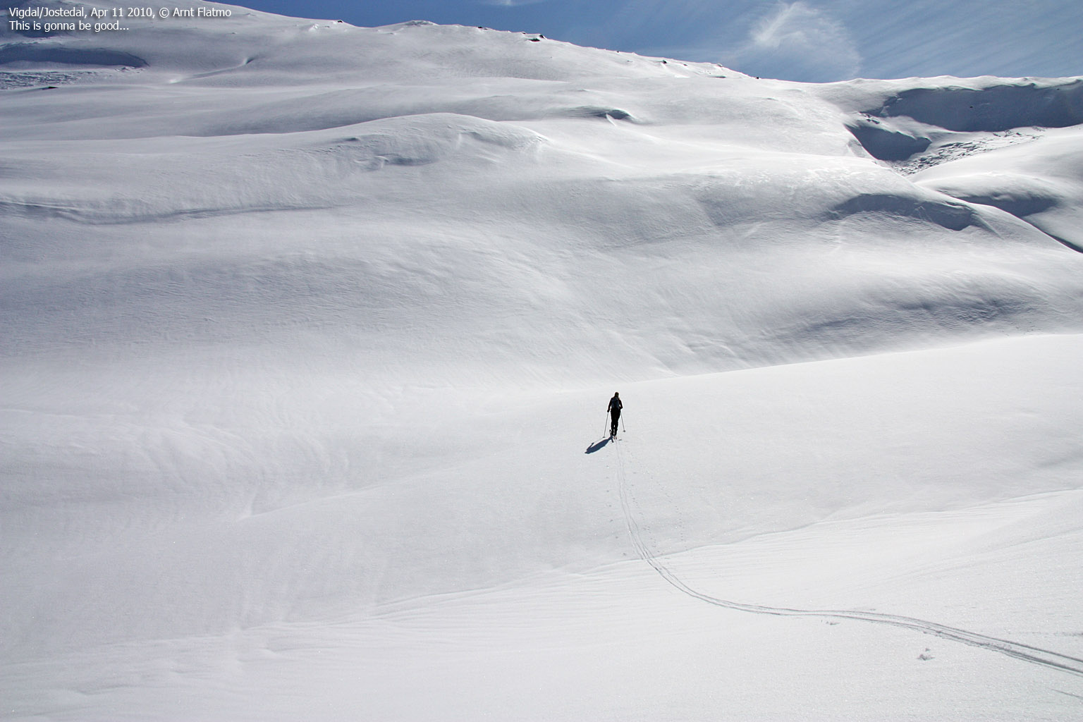
Providing the snow conditions are good, you are up for a treat upon descent...

Fivlenosi in spring
(Click for larger image)
Vågsberget is Fivlenosi's lower neighbour to the west. Follow the same route from Vigdalen. At point 935m, head southwest towards the summit. There is no established summer trail, but the mountain is easy to ski. There may be avalanche hazard zones, so pick the safest route.

Vågsberget
(Click for larger image)
Fivlenosi (Norge 1:50,000: 1466m, Økonomisk Kartverk: -, UTM 32 V 413885 6817761) has a primary factor of 728m towards the higher parent Hamrdalsnosi (1500m). The defining saddle (approx. 32 V 412233 6820615) is found in the pass between Fivlenosi and Storhaug. Ref. Økonomisk Kartverk (5m contours), the saddle is within the range 735-740m, interpolated to 738m.
Vågsberget (Norge 1:50,000: 1266m, Økonomisk Kartverk: -, UTM 32 V 410926 6818017) has a primary factor of 156m towards the higher parent Fivlenosi (1466m). The defining saddle (approx. 32 V 412026 6817951) is found between these two mountains. Ref. Økonomisk Kartverk (5m contours), the saddle is within the range 1100-1120m, interpolated to 1110m.

Fivlenosi summit cairn
(Click for larger image)
Google's interactive map. You can zoom, pan and click on the markers.
|
|
|
|
Route 1: Vigdalen - Fivlenosi (spring - on skis) + Vågsberget info
|
|
This route description is valid per Apr 2010
Access
(all distances are approx. distances)
The nearest town/village with an
airport is Sogndal. From Sogndal, follow higway RV55 towards the
northeast - in direction of Sognefjellet. At Gaupne, turn left towards
Jostedalen. Follow the Jostedalen road 14km to the north, then turn
right towards Vigdalen. Follow the Vigdalen road 4,2km up to
Syneshaug, where the toll road towards Vigdalsstølen begins.
Park
here (unless the road is open...)
The route
Follow the Vigdalsstølen road towards Vårstølen (1,4km), then turn right at the Fivla signpost. The route crosses the river Vigdøla, where you need to rely on snow to get across (if there is a bridge, we didn't see it). Continue to the Fivlenosi - Storhaug pass, and stay left of a cliff along the way (see the below picture).
From the Fivlenosi - Storhaug pass, turn right (south) and head up a forest (birch) ridge. Once above the forest, head southeast towards the Fivla cabins (970m) and continue southeast->east up Fivlenosi and to the summit - marked by a medium-sized cairn. Look forward to the descent!

The route from Vigdalen
(Click for larger image)
Vågsberget
At point 935m - above the forest and with view towards both Fivlenosi and Vågsberget, head southwest towards Vågsberget. In case of avalanche danger, avoid the steepest slopes.
|
|


