
|

Some of Voss kommune's highest mountains are found along the Hordaland/Sogn og Fjordane county border, from Nærøydalen to RV13 across Vikafjellet. Fyresnipa is the 8th highest mountain in Voss kommune, while Uraskarfjellet is the 10th highest. Øyastølsfjellet is merely a point on Fyresnipa's south ridge, and is not considered an independent mountain on this web-site.
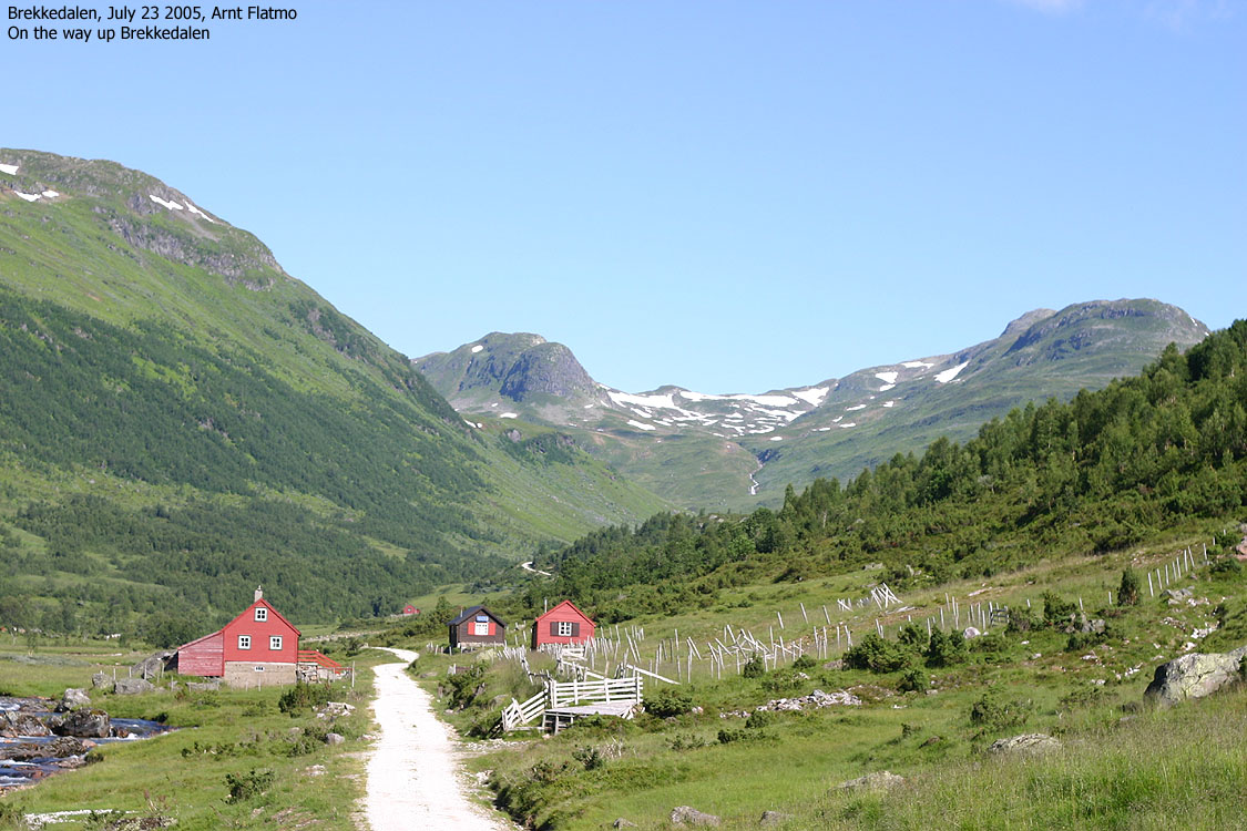
This web-page will describe a round trip across all tops. The start point is high in Brekkedalen valley, providing that the (toll) road is open. Contact Stalheim hotel for information about the road. The good thing about this round trip is that you have many route options. Those who want to extend this already long hike can easily do so, while those who want a shorter have several options along the way. The drive up Brekkedalen itself is very scenic, and attracts tourists that already have discovered Stalheim. Cattle and sheep walk free in this valley, so drive carefully.
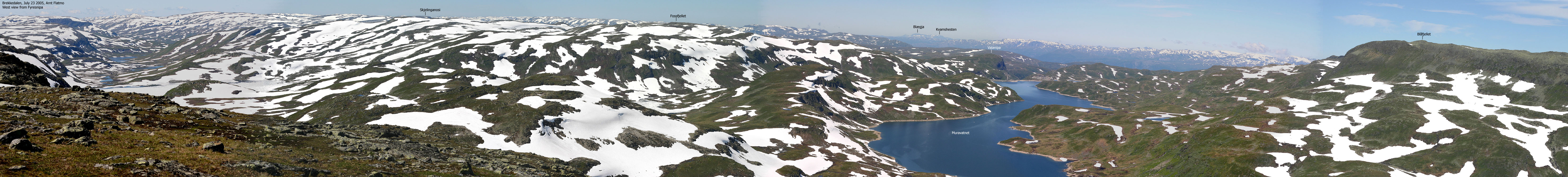
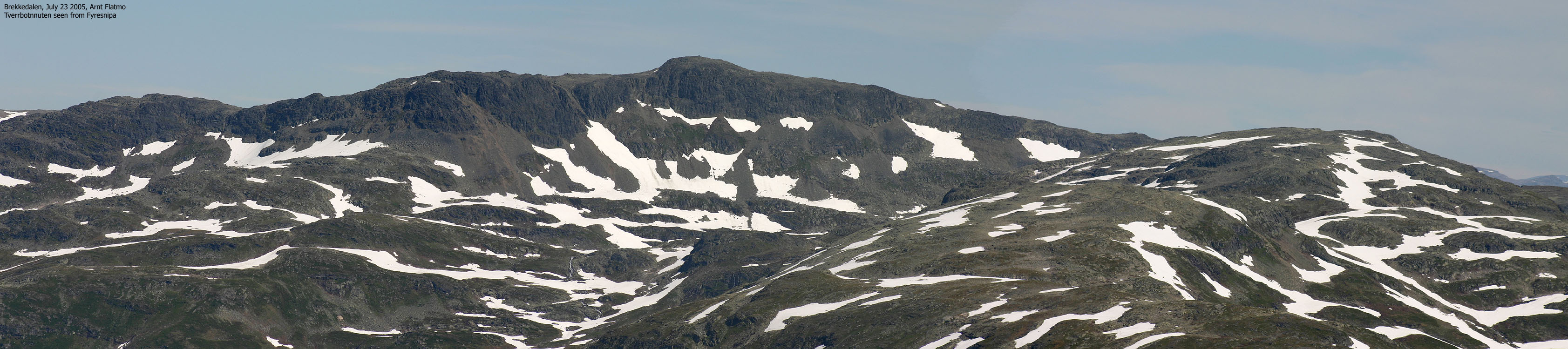
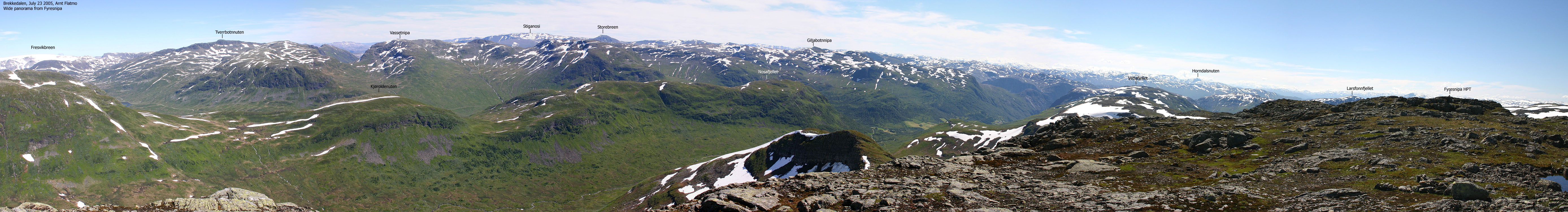
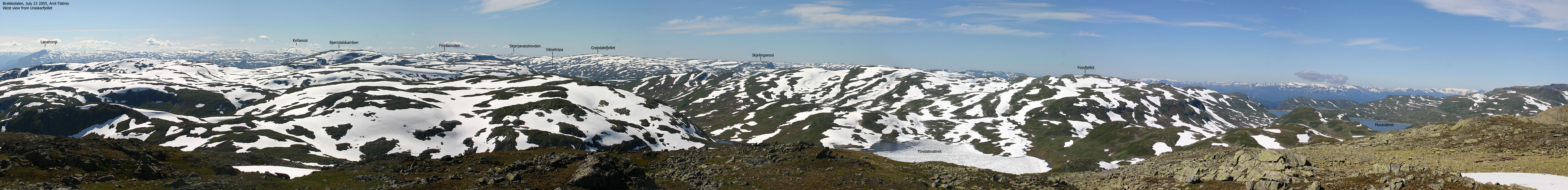
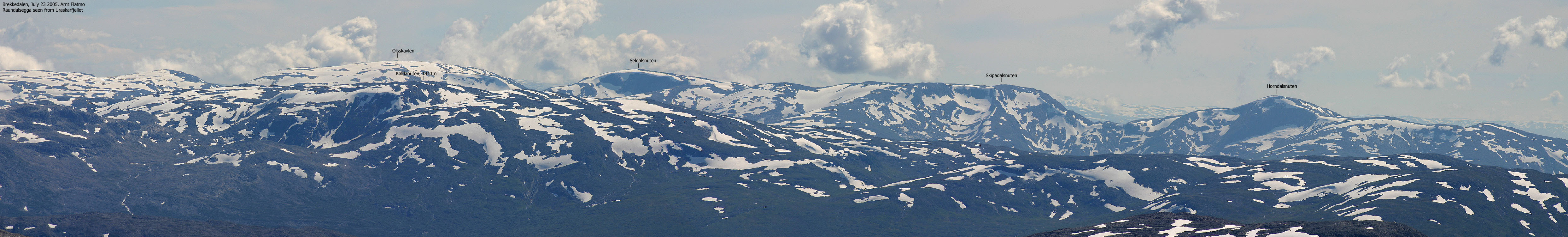
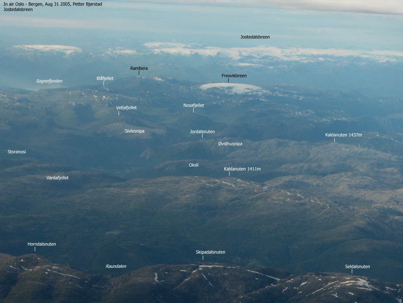
The views from Fyresnipa are extensive. A long, unbroken chain of peaks is seen to the north of
Sognefjorden. Fyresnipa is perhaps also one of the best viewpoints towards the Fresvikbreen glacier,
and all other high Voss mountains (Kvitanosi, Olsskavlen, Seldalsnuten) can be seen from this top.
Unfortunately, the mountains surrounding Fresvikbreen (Tverrbotnnuten, Rambera, a.o.) block the
views towards Jostedalsbreen glacier and the Jotunheimen peaks.
Primary factor:
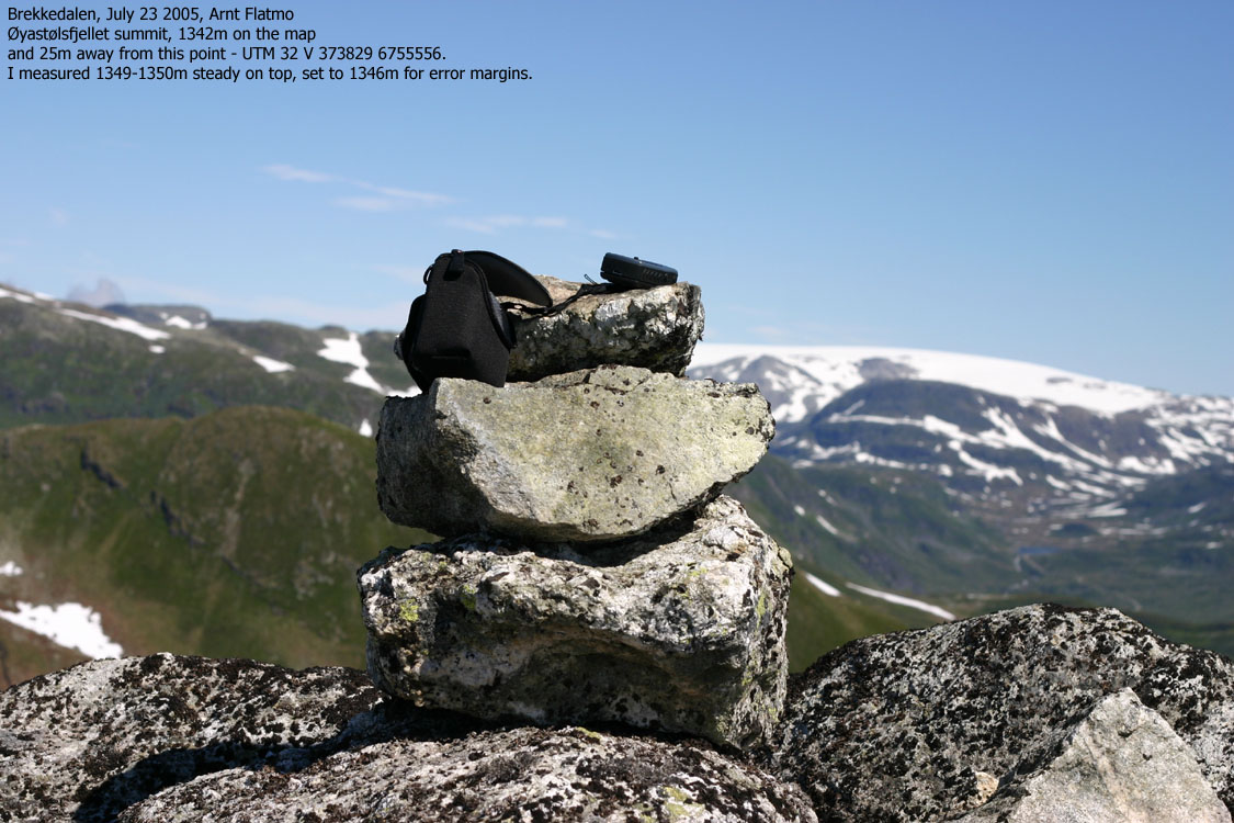
Øyastølsfjellet (M711: 1342m, Ø.K: -, GPS: 1346m) has a primary factor of 68m towards the higher Fyresnipa (1465m). The saddle is found on the ridge between the two tops Ref. the 1316-I map (20m contours), you cross the 1280m contours on the high route, but not 1260m. The saddle height has been set to 1278m based on GPS reading.
Comments:
Ref. my Garmin GPS map, the high point is 34m NW of the map point, which may explain why my GPS reported a steady number of 1349m on the high point. I have subtracted 3m for error margins and set the height to 1346m.
Fyresnipa (M711: 1455m, Ø.K: -, GPS: 1465m) has a primary factor of 275m towards the higher Blåfjellet (1548m). The saddle is found on the ridge between the two tops. Ref. the 1316-I map (20m contours), you cross the 1200m contours on the high route, but not 1180m. The saddle height has been interpolated to 1190m.
Comments:
On the 1316-I map, you see two 1460m contours on top, which makes it impossible to understand why the height has been set to 1455m. The southernmost of these contours are the high point, marked by two rocks. This point reads 1461m on my GPS map. Unfortunately, I did not do thorough measurements on this point. However, on the northernmost point, which is only 1-2m lower, my GPS reported 1469m over 25 minutes. I eventually decided to define the height to be 1465m.
Uraskarfjellet (M711: 1435m, Ø.K: -, GPS: 1437m) has a primary factor of 187m towards the higher Fyresnipa (1465m). The saddle is found in Uraskaret pass, between the two mountains. Ref. the M711 map (20m contours), you cross the 1260m contours on the high route, but not 1240m. The saddle height has been interpolated to 1250m, because I have less faith in GPS readings in saddles. The GPS indicated that the saddle heigth could be in the range 1243m-1247m.
Comments
On the 1977 edition of the 1316-I map, Uraskarfjellet's height was set to 1337m. This is the height that I have continued to use as I measured the high point to be 1340m over 15 minutes. I have subtracted 3m for error margins. It seems hard to understand why the height has been set to 1435m in the latest edition of the map.
Viksetnipa (M711: 1348m, Ø.K: -, GPS: 1350m) has a primary factor of 120m towards the higher Uraskarfjellet (1347m). The saddle is found between the two tops. Ref. the M711 map (20m contours), you cross the 1240m contours on the high route, but not 1220m. The saddle height has been interpolated to 1230m. My GPS indicated that the saddle height was in the range of 1225-1228m, but as already mentioned, my faith in saddle readings is lower than for the tops.
Comments
I measured the height of Viksetnipa to be 1353-1354m over 10 minutes. I have subtracted a few meters for error margin and set the height to 1350m.
Notes: Class ratings are in reference to YDS. Click here for more information.
The trails described below are not necessarily the *easiest* trails to this mountain.
|
Brekkedalen - all tops round trip (summer/autumn)
|
|
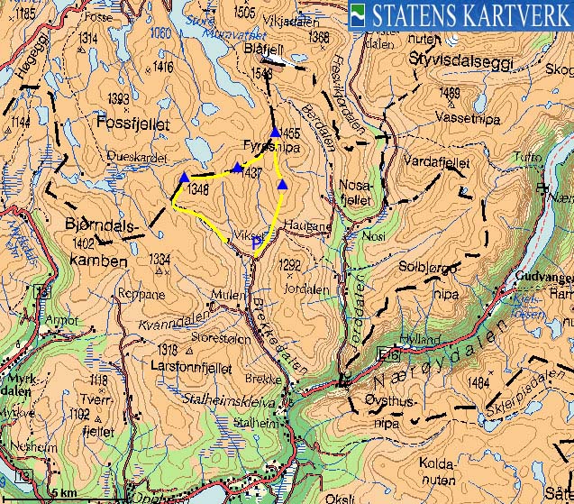
From Bergen, follow highway E16 towards Voss. From the traffic light in Voss, follow E16 up to the RV13/E16 junction (1,3Km). Turn left towards Oslo and follow E16 31,9Km. Turn left towards "Stalheim". Drive 1,4Km and just after having passed Stalheim hotel, turn onto the road up Brekkedalen. Follow this road 6,4Km and park neat the Vikset/Tverraldskaret junction. Do not block for tractors.
Fyresnipa
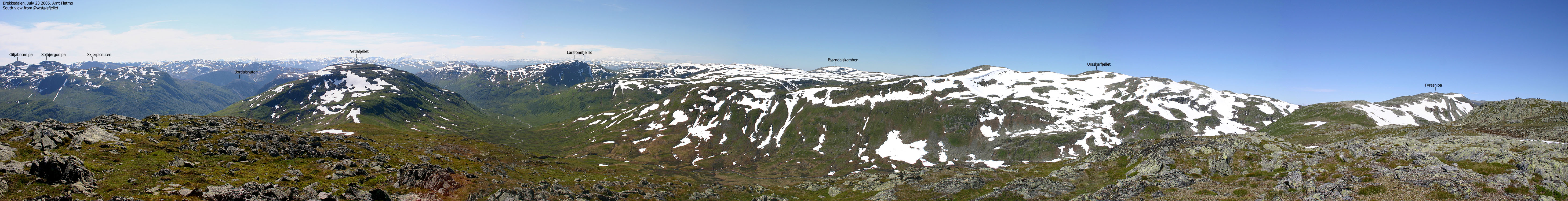
It might have been tempting to drive all the way to Tverraldskaret (approx. 950m elevation) and hike up Øyastølsfjellet south ridge from there. But you'd be glad you parked down at 760m when you return from your long hike. Instead of walking on road towards Tverraldskaret, follow a path that runs along the Armotselvi river. Keep the same bearing (NE) all the way to the top of Øyastølsfjellet summit. At 1030m elevation, you will cross the path from Tverraldskaret to Uraskaret. Continue off-trail up to Øyastølsfjellet. The summit area is a large plateau with several humps and cairns. The high point (closest to Fyresnipa) is easy to identify in good weather. A small cairn denotes the high point.
Follow the main ridge up to Fyresnipa, which consists of two high points. The high point is marked by two rocks, 80m SW of the cairn. The cairn is located 1-2m lower than the high point.
To Uraskarfjellet
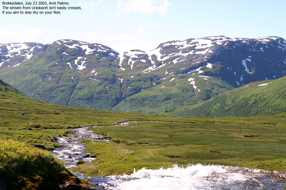
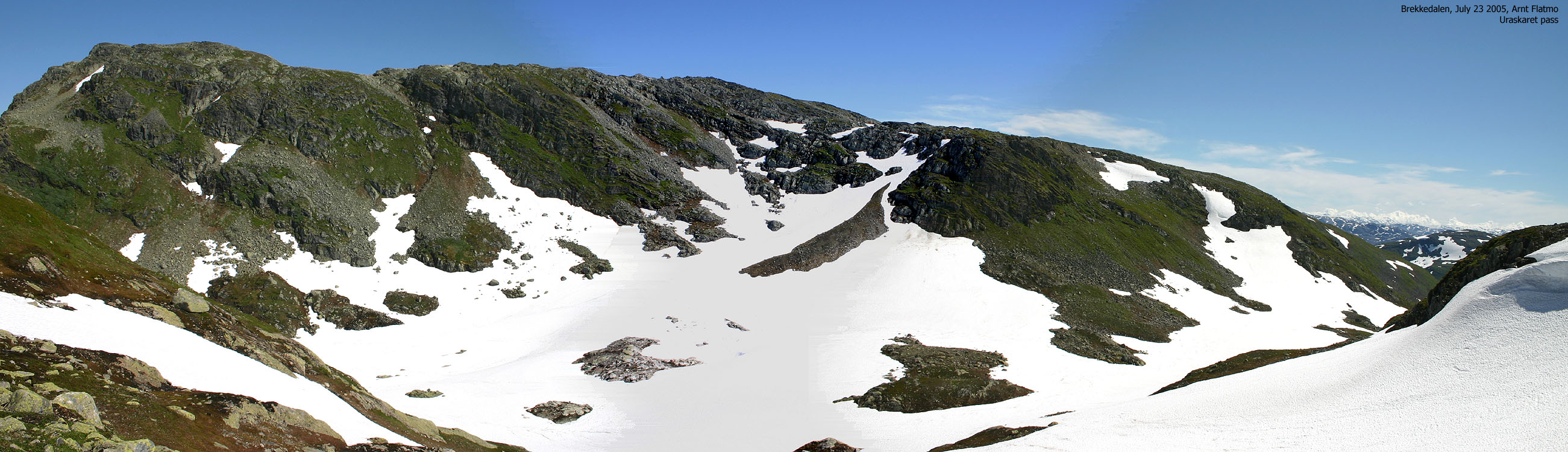
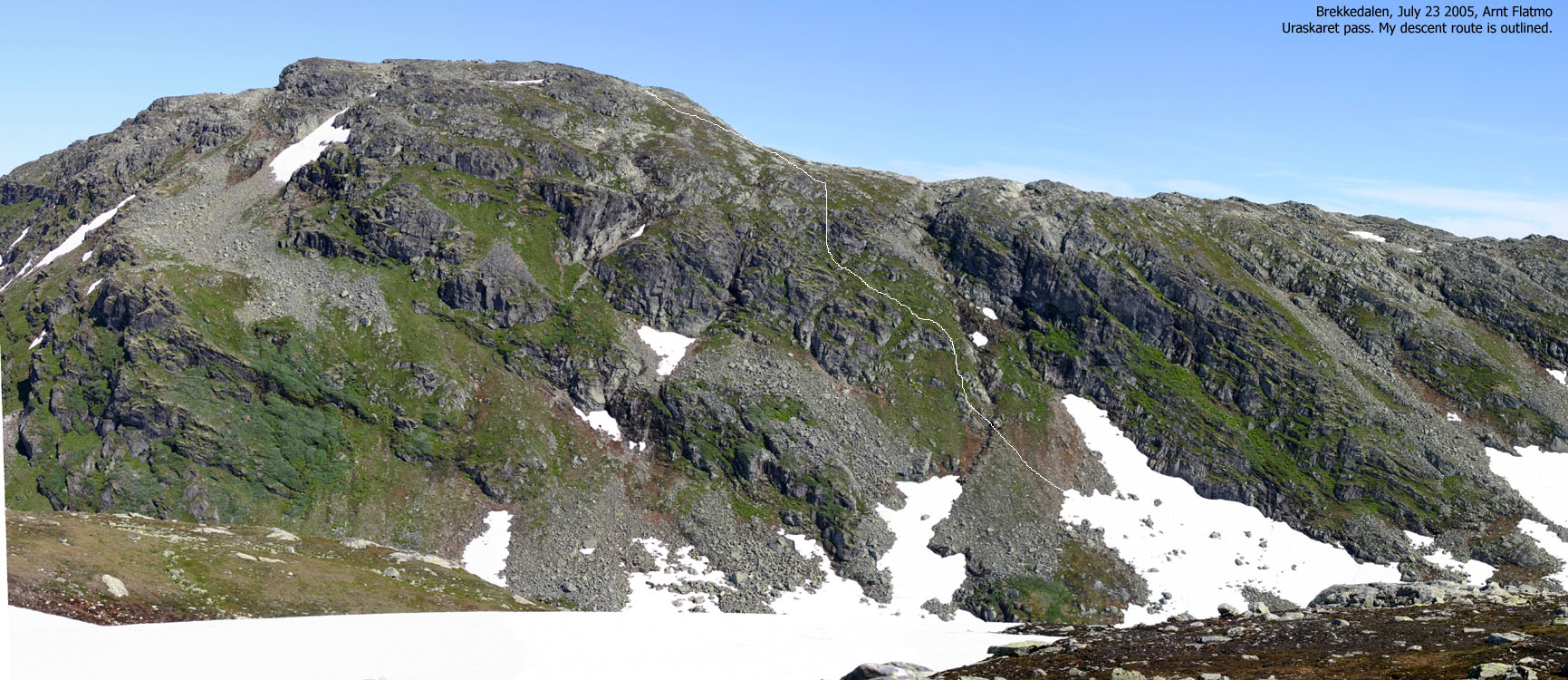
From Fyresnipa, head SW towards the cliffs facing Uraskaret. You need to find a route that runs directly down to Uraskaret pass, and in dry conditions, the best route is the first one you encounter. Seek towards the small creek that runs down and more or less follow it down to the pass. If the slopes are wet, or if there is snow and ice, consider descending down boulder fields further south. If the terrain makes you altogether uncomfortable, head back down to the Fyresnipa - Øyastølsfjellet saddle and descend from there. If you want to head back home, then simply follow the path from Uraskaret.
The hike up to Uraskarfjellet is quite unproblematic. Ascend directly from Uraskaret. Initially, northwest is better than west. Once on the ridge, the terrain is trivial. The summit is marked by a cairn.
To Viksetnipa
From Uraskarfjellet, head west-to-southwest to gain the broad ridge leading to Viksetnipa. If you want to head back home, follow the valley down from the Uraskarfjellet - Viksetnipa pass. If you want to continue; from the Uraskarfjellet - Viksetnipa pass, head up between two 1300m contours and proceed northwest to the Viksetnipa summit cairn, which is the largest cairn on all the above mountains.
Descent
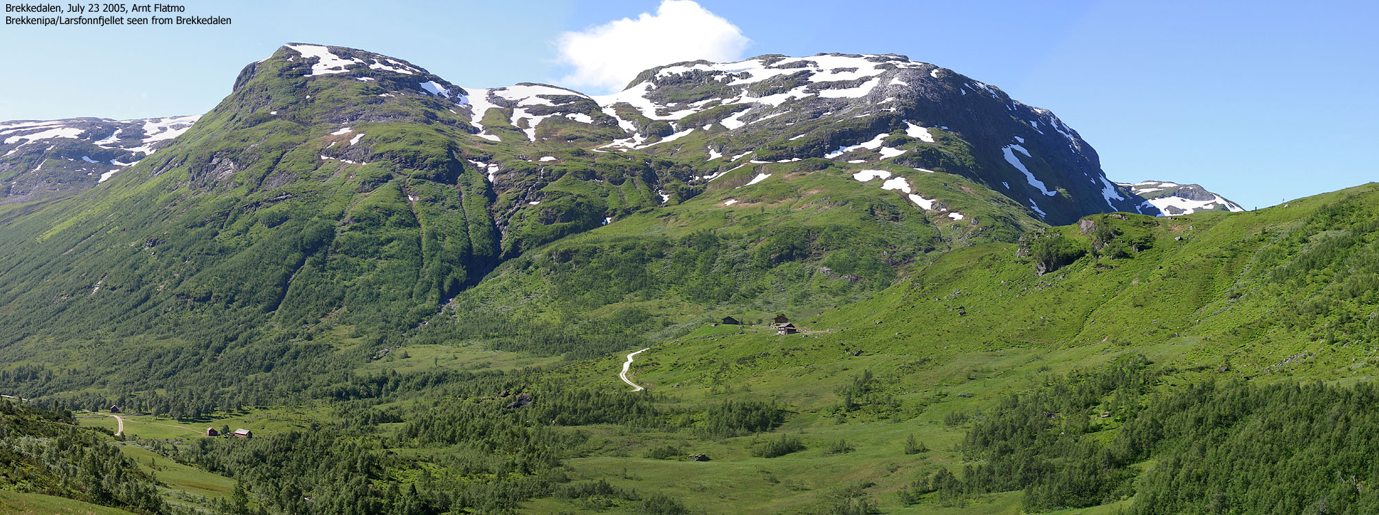
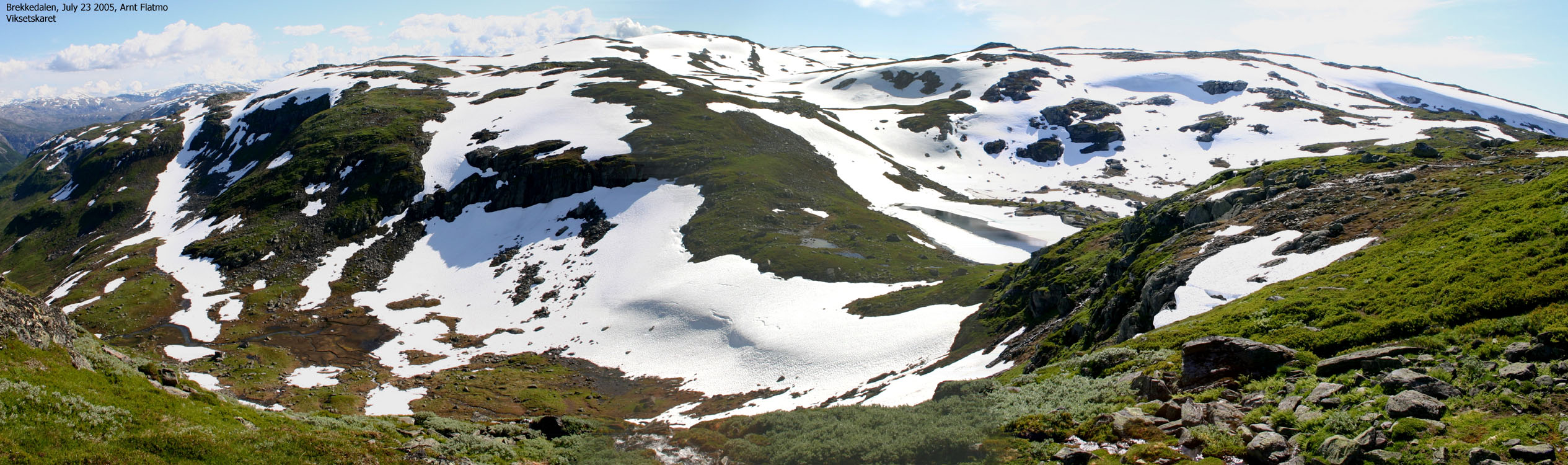
From Viksetnipa, follow the southwest ridge down. The terrain is steep above Viksetnipa, but the ridge leading directly down to Viksetskaret pass is quite easy to follow. If you're in luck, you will be able to follow a path that takes you down to the pass. From Viksetskaret, follow a path all the way back to the trailhead. If you don't find it initially, don't worry. It will present itself. In any case, stay left (north) of the river.
Choices
I'm (almost) never able to plan my week-end hiking on Friday afternoon. This week-end was no exception. I had a good hike to Liatårnet on Sotra with my friend David on Friday afternoon, and when I woke up on Saturday morning, I didn't know where I wanted to go.
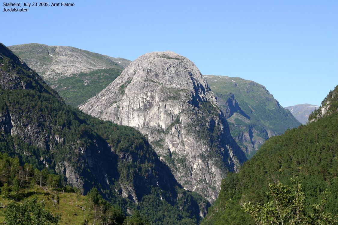
Clouds were covering the local mountains, but the temperature suggested that the fog would burn off. My first thought was to go to Folgefonnhalvøya and hike Torsnuten, but I'm not too keen on ferries during the summer holidays. Instead, I chose to collect more high Voss mountains. One week earlier, I visited the ridge from Jordalsnuten to Giljabotnnipa. Why not continue where I left off? I chose to go for Fyresnipa, Uraskarfjellet and Viksetnipa. Provided the fog would burn off.
While passing Voss, Lønahorgi (1410m) looked almost the same as it did one week earlier. The fog was burning off, and the top was only minutes away from being revealed. I continued towards Stalheim, confident that the hike was about to happen.
Fyresnipa
I knew little about the road up Brekkedalen. I talked to the reception people at Stalheim hotel. They told me the road was open, but that it was a toll road. I continued up the valley, paid the toll and passed a couple of gates. After chatting with a local farmer, I was ready to go by 11:00AM. 10 minutes ahead of schedule, compared to last week. I had been tempted by driving up to Tverraldskaret, but knew I would be happy to avoid these 190m vertical meters when I returned from the mountains. I parked in the Tverraldskaret - Vikset road junction and followed a path along the river.
My dachshund "Troll" was (as always) quite unwilling to walk, and I carried him all the way to the base of Øyastølsfjellet. He then had enough of the backpack and gave me the "I want out" sign. It was a very hot day, but he seemed happy to walk the slopes up to Øyastølsfjellet. For the rest of the hike, I carried him downhill from one mountain to the next, and then he walked all the uphills. From Viksetskaret, he walked all the way back to the trailhead. No wonder he slept for the rest of the day. After all, he's turning 12 years later this year.
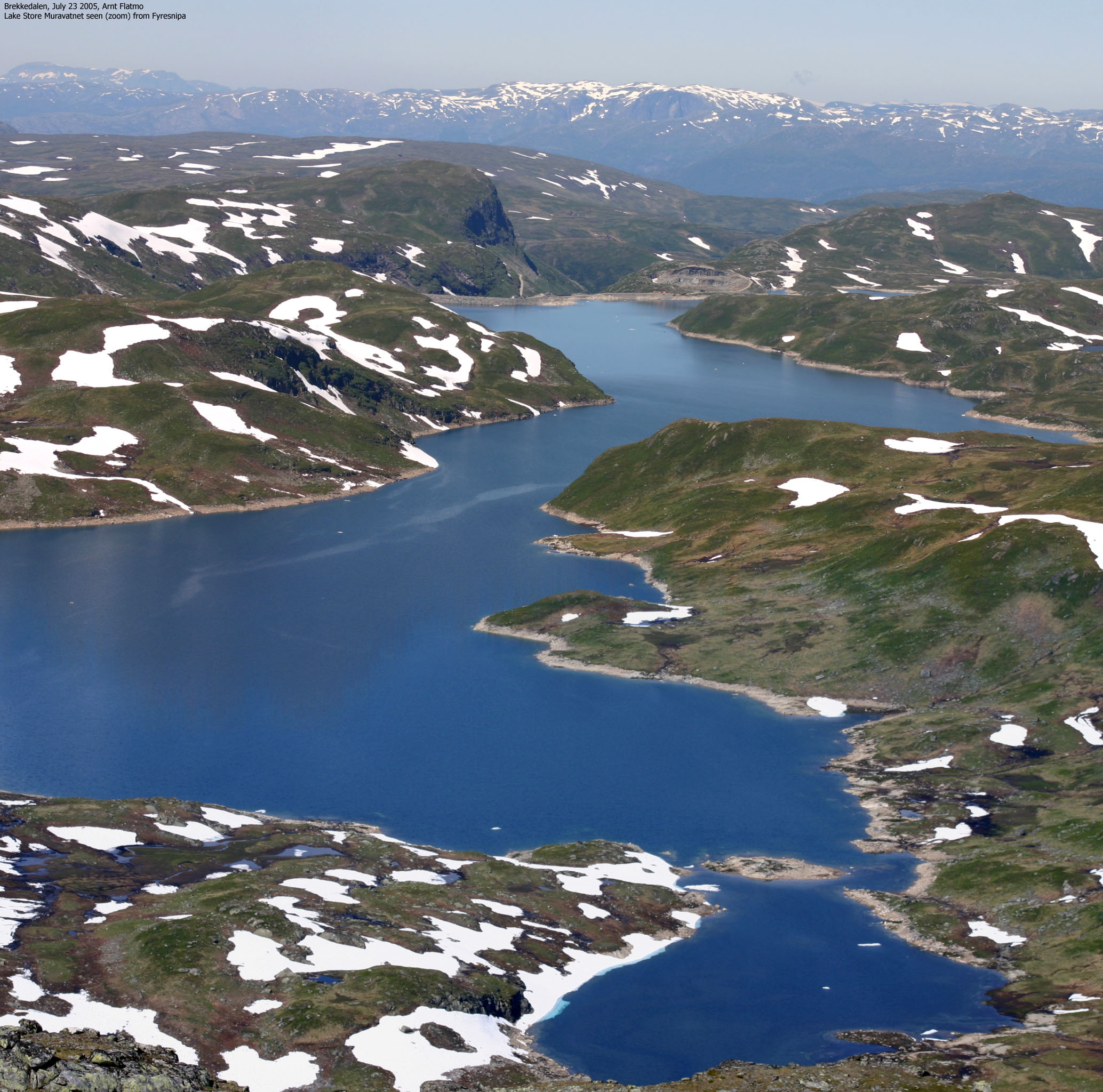
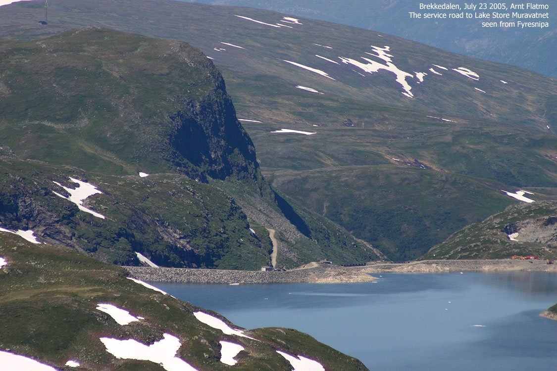
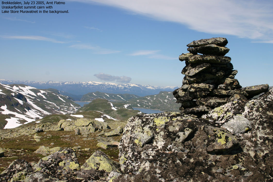
We reached Øyastølsfjellet 12:20PM and Fyresnipa 13:05PM. The views! Fresvikbreen laid in front of us. All white and tempting. Lake Store Muravatnet has never been more blue, and white mountains were seen all around. Was it really the end of July? After checking my GPS on Fyresnipa, I concluded that the map heights for the mountains in this region were questionable.
We spent half an hour on top. It was a gorgeous day. I could see that the mountains south of Voss were partly covered by clouds. I felt I had taken the right decision. Torsnuten was probably wrapped in clouds. Troll went to sleep after finishing his lunch box. I had (yet again) made poor food planning and had only one small sandwich with cheese and ham. No bisquits or bananas. I finished the sandwich quickly and told myself to improve on the food thing.
Uraskarfjellet and Viksetnipa
I was afraid I would have to take a long detour in order to get down to Uraskaret pass. But I was in luck and found a good route right away. It was a lot of snow on the way up to Uraskarfjellet, which Troll had positive and negative feelings about. True, it was heaven to roll around on the cold snow, but on the long snowfields, things were harder. Still, he never gave up and stuck with me, like faithful friends do.
We reached the top of Uraskarfjellet 14:55PM, and I was hungry. Abandoning the trip was however not an option, and after a short stay on top, we continued towards Viksetnipa.
We reached the top of Viksetnipa 16:00PM. We had been on "the road" for 5 hours, and I *seriously* considered continuing towards Solheimsfjellet, a 200m vertical meter climb from Viksetskaret. I knew I would get a headache from not having anything to eat (water was never a problem on this hike), but when I realized there was yet another mountain beyond Solheimsfjellet, I decided to come back for these two mountains. On my next visit, I could also include Vetlafjellet, located just south of Tverraldskaret pass. Yeah, that was a plan I felt good about. Now I wanted to a) get back to the car and b) get a hot-dog back in Voss.
The descent
While descending from Viksetskaret, a sheep screamed out to the others; "This guy is *packed* with salt, and look at this weird four-legged creature walking next to him!". Suddenly, I was surrounded by sheep. I find this odd. I scare the living daylights out of some sheep just by my presence, while others try to chew me up. The locals just *hate* hikers who bring the sheep down from the mountain, so I had to take some serious action. "Hooosh, hooosh" didn't produce results, and neither did acting like a madman with waving arms. The sheep were like zombies, walking slowly towards me, while mumbling "salt..salt..salt..".
A clever plan had to be made. I turned around and headed back up the valley, with the herd screaming behind my back. Troll was of course in the backpack now, most likely terrified. I promised myself that if anyone, further down in the valley, commented that I had the dog unleashed, I would go bananas. I led the sheep up to the stream and jumped across. Sheep seem to think slow (unless under panic) and had to dwell on my move. I quickly descended through a long and steep slide on snow. That did the trick. The sheep were outmanoeuvered, and I could get back to the preferred side of the stream again.
Next, a "fjellvåk" (eagle family) tried to scare me away from the valley. As the bird was alone, I didn't feel threatened. Had they been two, I would have been on the alert, as I have been attacted three times in the past. When they have a nest nearby, they show no mercy.
17.40PM, the hike was over. When I returned to the car, one of the side-mirrors was found next to the car, and the windows had ugly lick-marks all over. I looked up towards the nearby cows, and they looked guilty as hell to me. 5 minutes earlier, I had passed three sheep that yelled "it's the SALT guy", and followed my tail. The anti-mosquito spray had worn off a long time ago, and I had a swarm of flies above my head. I grabbed the side-mirror and got the engine running just as the sheep arrived the car. I drove one kilometer before I was out of reach from sheep and flies, and managed to get the side-mirror back in place.
And the hot-dog back in Voss tasted like heaven...
Move cursor to read notes, and click on the images to see full version.
Some of the thumbnails may have been cropped to fit the format.
To Brekkedalen and Øyastølsfjellet


To Fyresnipa:


To Uraskarfjellet


Viksetnipa and descent


No Javascript:
1 2 3 4 5 6 7 8 9 10 11/a> 12 13 14 15 16 17 18 19 20 21 22 23 24 25 26 27 28 29 30 31 32 33 34 35 36 37 38 39 40 41 42 43 44 45 46 47 48 49 50 51 52 53 54


No Javascript:
Other hordaland mountains
 Other Voss K. mountains
westcoastpeaks.com
Other Voss K. mountains
westcoastpeaks.com

