European mountains
La Gomera, Canary Islands, Spain
Garajonay (1489m), Fortaleza de Chipude (1240m)
Mirador El Santo & waves, Dec 29 2009
To the main Garajonay/Fortaleza page (maps, route descriptions, other trip reports, etc.)
To the La Gomera introduction page.
Garajonay, 1489m

The route - as seen in Google Earth

(Click for larger image)
This was our (Anne Rudsengen and me) second day on the island of La Gomera, and our first with a rental car available to us. The day before, we had a very enjoyable traverse across La Merica, and the plan for the second day was to visit Garajonay - the island high point, as well as Fortaleza de Chipude - a very characteristic mountain that I noticed early on during my pre-trip Google Earth studies.
On the way from our hotel in Valle Gran Rey, we could see that the higher mountains were fogged in. But it wasn't raining, and besides, it could be fun to see the humid subtropical national park forest in the fog that it's famous for. The trailhead wasn't difficult to find, and by 11:45am, we were on our way to Garajonay.
After following a paved (brick) road for a little while, we turned onto a forest path that run across Pajarito - a minor top 400m northeast of Garajonay. We reached Garajonay 12:02pm, and although we didn't see anything of the island, it felt good to have the island high point in the bag. First things first, so to speak...

It was already apparent to me that my GPS consistently reported elevations 10-13m higher than the hiking maps, and I was curious about the elevation of the mountain. The Garmin map height was 1489m, and as such, would the GPS elevation exceed 1500m? Not that this was very important, but at least I could discuss with Petter Bj°rstad whether the mountain should appear on one of his Prominent peaks lists (on some which 1500m is a key elevation). Bu the GPS measured only 1496m, and I also had to subtract 2m for the manmade brick wall.
A group of hikers arrived on the summit, and we found it best to move on. We stopped by a cool tree (a water fountain) that was producing raindrops. We then followed the normal route (along the paved brick road) and were back at the trailhead 12:30pm - 45 minutes after heading out.
Fortaleza de Chipude, 1240m

The route - as seen in Google Earth

(Click for larger image)
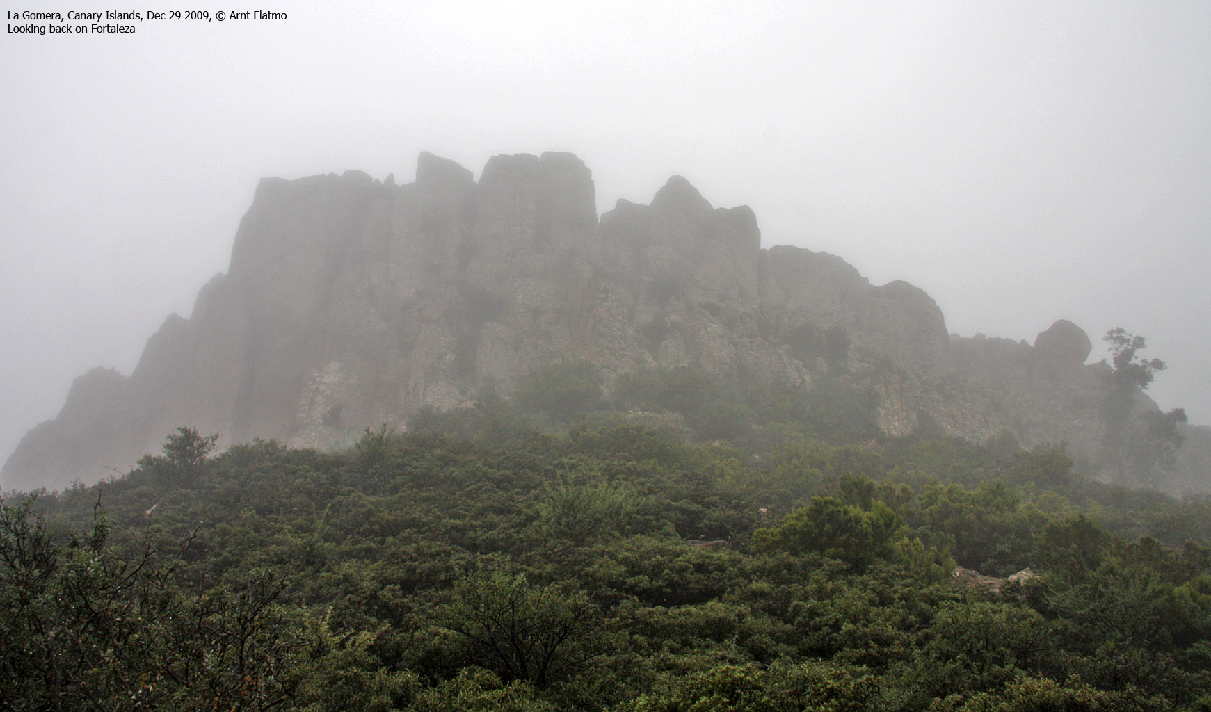
Next stop was Fortaleza de Chipude. We located the Pavˇn trailhead easily, even though the mountain was completely fogged in. We left the trailhead 12:58pm, and 10 minutes later we got confirmation (thanks to a signpost) that we were on the right way. After a few minutes along the mountain trail, a mountain from Doom rose in front of us. What on earth was awaiting up there?

The route runs up here .. somewhere

(Click for larger image)
The mountain trail up the cliffs turned out to be easy enough, although caution was required in places. In not too long, we arrived on the summit plateau and located the high point, marked by a pile of rocks. The time was now 1:26pm, less than 30 minutes after leaving the trailhead. 2 days and 3 tops was an excellent start of our Canary vacation, and I decided to celebrate with my interpretation of the Uga Chaka dance. Because of the fog, there was no reason to linger around on the mountain, and we were back at the trailhead 2:20pm.

Uga Chaka

(Click for larger image)
Mirador El Santo +++

The route - as seen in Google Earth

(Click for larger image)
On our way back to Valle Gran Rey, we decided to stop at Arure and walk the 600m of the Arure - La Merica - Valle Gran Rey trail that we skipped the day before. But just after heading out, we discovered a vague path that we just had to follow. This path took us along a steep face and towards a spectacular building (mostly because of its location). If I am not mistaken, the chapel Ermita de Santo is found inside this building - also known as Mirador (view) El Santo.

After scrambling onto the Mirador (we were obviously not following the public route), we noticed that access to the upper level was blocked, and we had to scramble to get to the Mirador road. We were now on the public route from Arure and below an arch. We hiked (off-trail) upwards to a point where we could see directly down on the Mirador, the Taguluche valley and the Tejeleche mountain range further north (visited two days later).
Parallel to the trail towards La Merica and Valle Gran Rey was a rugged ridge that seemed far more interesting than the trail...

After a fun traverse across the (above) ridge, we (eventually) reached the trail towards La Merica and Valle Gran Rey. We followed until we (almost) reached the point we turned around the day before. We were now directly below a pointy rock feature that we named "El Dedo" (The Finger) - climbed the day before. From here, we tried to get to another (adjacent) rock feature but had to give up on due to serious fencing. Along the way, we scared the living daylights out of "Jack Rabbit" which got caught between us and cliffs. We named this rock "El Privado" - sensing the true meaning of the word trespassing.

Waves
Back at our hotel in La Puntilla, Valle Gran Rey, we took a walk to enjoy the magnificent waves that continuously hit the shore. I've seen cool waves before, but none as beautiful as these..

Next day: Los Roques


