
Click here for the main Grøtshornet page.
Ever since I moved to Ålesund, I had wondered why Grøtshornet had earned the "proud" suffix "hornet" (horn). The mountain resembled a big hill more than a horn. But when I "discovered" the north side on a trip to Rekdalshesten, I was sold. The mountain was simply beautiful, rising gracefully up from the sea, narrowing in towards the top.
On this Monday afternoon, there was opportunity to visit the mountain again. This time from the north. My neighbour Pål came along for the hike, including his dog "Chico", and my dog "Troll". We left the trailhead 17:00PM. The weather was nice, but I had a feeling this could change during the afteroon.
Once we gained the ridge, we were blessed with a spectacular scene. An eagle came gliding in from the sea, graciously and mighty. What a sight. The eagle was gliding above us in circles, carefully evaluating potential candidates for dinner. Without any particular knowledge about eagles in general, I felt that the dogs were quite safe. I couldn't picture an eagle attacking when there were two humans present. I put the zoom lens on in a hurry, and althoug the pictures are not of the finest quality, they are indeed some of the most memorable pictures I've ever taken.
After a while, the eagle got bored and "sailed away". We took a break at 300m elevation, before continuing up the ridge. Pål enjoyed this characteristic ridge, and so did I. We arrived the top 17:50PM, and both dogs obviously understood that a "reward" was within reach. My old faithful fellow doesn't have perfect vision anymore, and I had to TELL HIM that the cairn was near. Then, he took off.
This should hardly come as any surprise, but Grøtshornet is (also) a splendid viewpoint. The view was however obscured by rainclouds above Ørstahalvøya, and they were heading our way. After a long and good break on top, we descended our ascent route and were back at the trailhead 20:05PM. And *then* it started to rain.
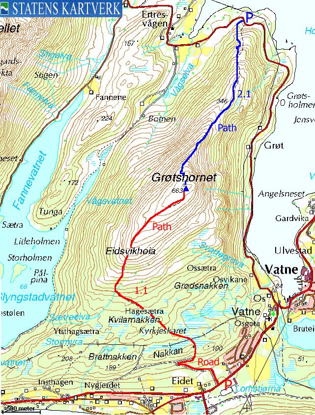
Map: I followed route 2.1 on this trip

To Grøtshornet


The eagle


Continuing upwards...


360 deg. wide-angle panorama

50mm panoramas, 2 parts


Zoom views


Descent


No Javascript:
0 1 2 3 4 5 6 7 8 9 10 11 12 13 14 15 16 17 18 19 20 21 22 23 24 25 26 27 28 29 30 31 32 33 34
 westcoastpeaks.com
Other Møre & Romsdal mountains
Other Norwegian mountains
westcoastpeaks.com
Other Møre & Romsdal mountains
Other Norwegian mountains