
Norwegian Mountains, NordlandHardangsfjellet, 787m
|
| Fylke/Kommune : | Nordland/Brønnøy & Bindal | ||||||||
| Maps : | 1825-IV Velfjord (Statens Kartverk, Norge 1:50 000) | ||||||||
| Primary factor : | 739m | ||||||||
| Hiked : | July 2009 | ||||||||
| See also : |
| ||||||||
| See also : | Other Nordland mountains on westcoastpeaks.com |

Hardangsfjellet
(Click for larger image)
Hardangsfjellet is found on the Brønnøy/Bindal border, approx. 25km south of the town of Brønnøysund. Compared to other mountains in this region, Hardangsfjellet is quite prominent. Even if the closest trailhead is only 5-6km east of the summit, this mountain may seem remote. There are no established trails, and there is a good chance that you get a feeling of wilderness after a while.
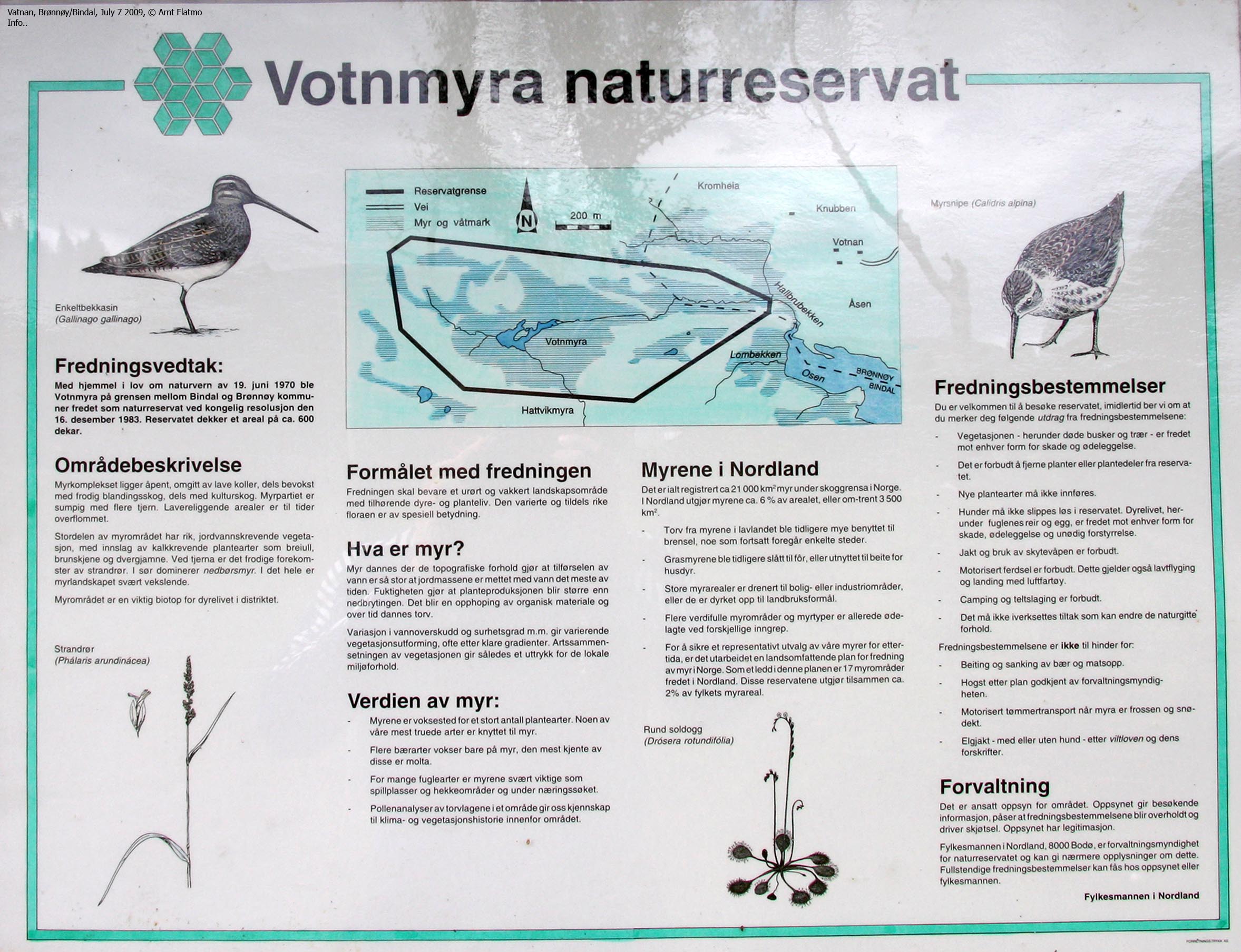
On the wildlife note - (per 2009) you can experience the deer breeding farm at Vatnan, as well as the Votnmyra preserve just west of Vatnan (Votnan on some maps).
The normal starting points are Sausheia (via Strauman), Godvasslia and Vatnan. This page will describe the route from Vatnan, which is the only route that does not involve any major river crossings. Another possibility is to paddle between Kaldbekkvika and Fjellbukta in a canoe or kayak. See the Hardangsfjellet page on kjiver.no for inspiration. The mountain can also be reached from the west - via Hardangsfjorden in a boat. Of those who head out from Sausheia, many travel Strauman lakes by boat, and ascend Hardangsfjellet along its northeast ridge.

Hardangsfjellet seen from Gravtinden
(Click for larger image)
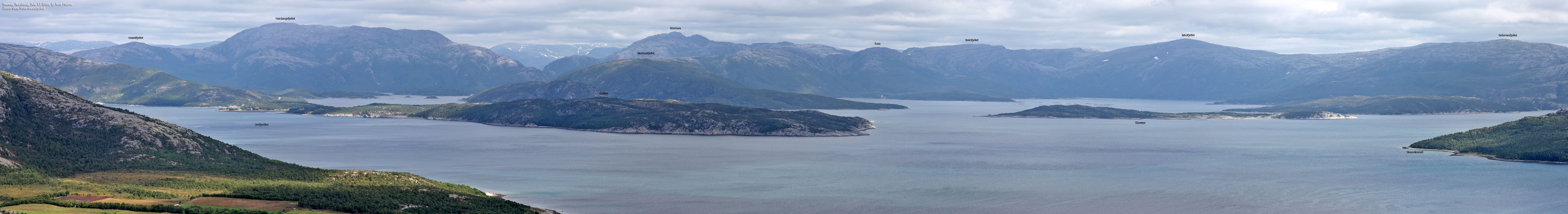
The view from Hardangsfjellet is extensive, and you'll easily recognize distinct peaks such as de Syv Søstre, Anddalshatten, Snøfjelltinden, Breidvasstinden, Visttindan, and Heilhornet - to name a few. You can see nearly all of the Sømna and Brønnøy mountains from up here. To the east, mountain ranges blend into one another, and highest of them all is the Børgefjell range.
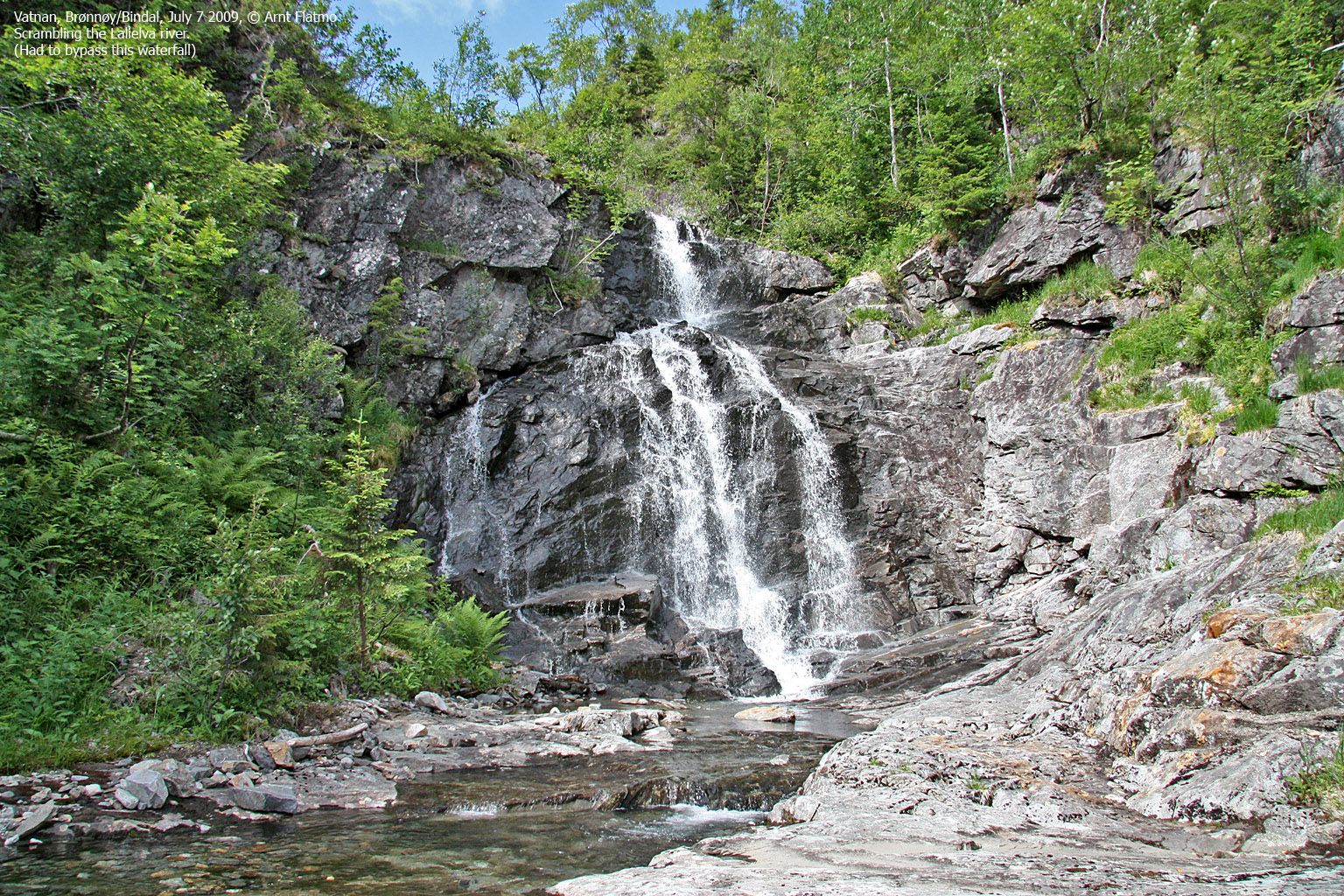
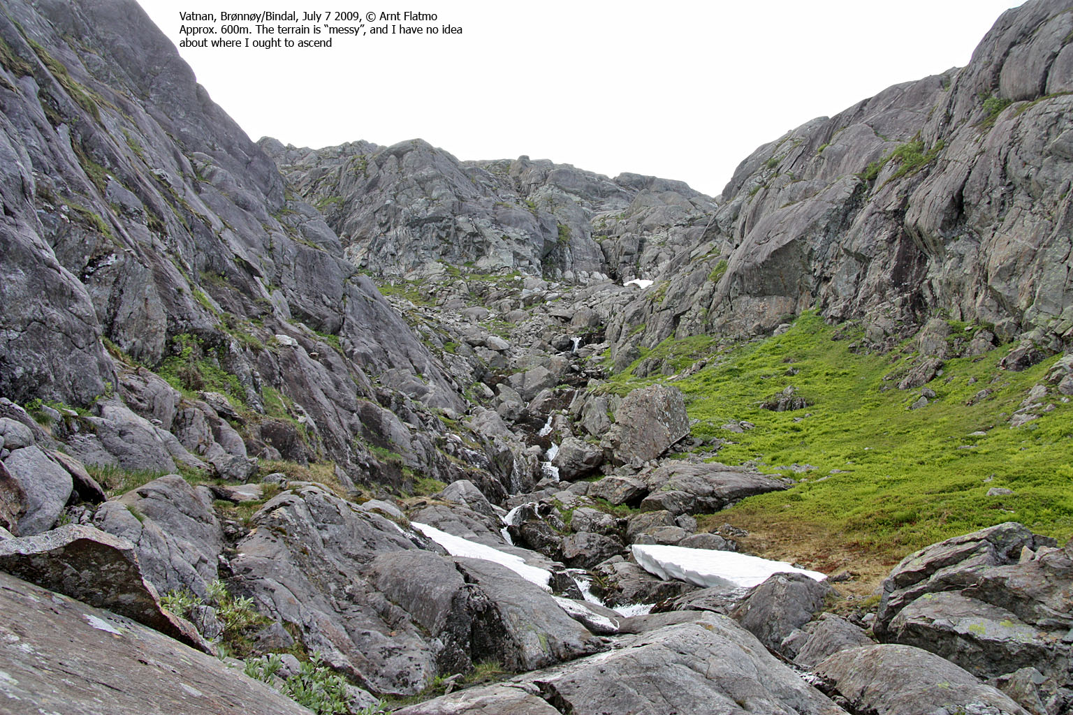
The route described on this page runs from Vatnan, via Langdalsrabban, Stormyra, Fjellbukta and up Lalielva river. If there is not too much water, you can stick to the river and find ways around the waterfalls. Whether you scramble the river or walk through the forest alongside it, you're in for a strenuous walk even if the distance to the top is only 7km. There are no difficult sections on the easiest route, but if you stick to the river, you can enjoy the full range of walking, careful balancing, scrambling and climbing. The lower part of the river is beautiful!

In Lalielva river
(Click for larger image)
Hardangsfjellet (Norge 1:50,000: 787m, Økonomisk Kartverk: -, UTM 33 W 383445 7241797) has a primary factor of 739m towards the higher parent Stortuva (804m). The high route towards Stortuva is long and complex, but the defining saddle (approx. UTM 33 W 386182 7240963) is found on Stormyra, between lakes Godvatnet and Fjellvatnet. Ref. Økonomisk Kartverk (5m contours), the saddle is within the range 45-50m, interpolated to 48m.
GPS measurement read 781m (on the small cairn, <0,5m high), averaged over a 5-minute period (error margin +/- 2,5m). This was an unexpectedly low elevation. The highest point in the track log shows 785m. It is very seldom that my GPS reports a height lower than the one found on the map.
You will find two other cairns on Hardangsfjellet. The tallest cairn is found at UTM 33 W 383481 7241864, GPS: 778m on top of the cairn. The second cairn is found at UTM 33 W 383508 7241794, GPS: 773m on top of the cairn. Both cairns are within a 780m contour. All the more reason to ask questions about the map. In addition, there are two other 780m contours on the summit plateau.
Google's interactive map. You can zoom, pan and click on the markers.
|
|
|
|
Route 1: Vatnan - Hardangsfjellet (summer/autumn)
|
|
This route description is valid per July 2009
Access
(all distances are approx. distances)
The starting point is Brønnøysund. Follow highway RV17 towards Vennesund. At Skillvika (10 minutes outside Brønnøysund), turn left onto highway RV76. Drive 43,6km and turn right towards Vassbygda (signposted). You are now on a gravel road. Drive 1km, then turn left. Drive 1,5km to the Godvassli/Vatnan junction (signposted) and turn left again. Drive 1,6km to the Deer Farm at Vatnan (per 2009!). Either find parking nearby, or turn left at the junction near the farm and drive 100m and find a rough parking on the left-hand side of the road.
The route

The route up Lalielva
(Click for larger image)
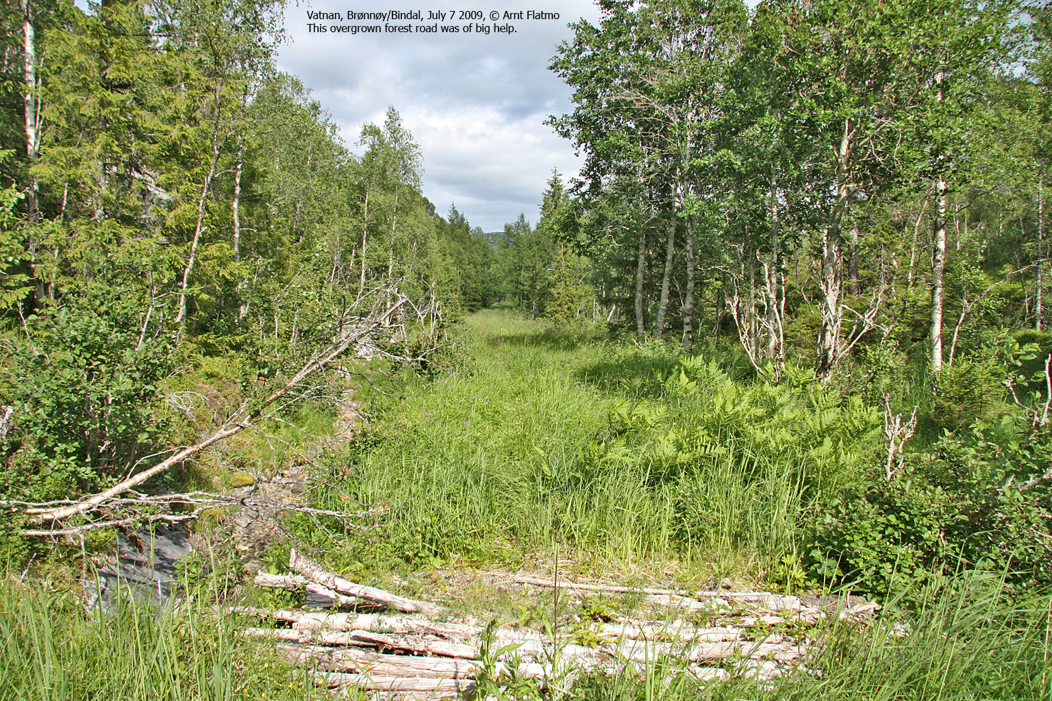
Walk to the west/northwest along the fence until it turns north. In summer, the grass is high. If it is also wet, you'll be too. Keep going west/northwest, cross a forest ridge and join an old, overgrown forest road. Follow this road approx. 500m until it forks (pay attention - it's easy to miss). The left branch takes you down to Fiskbekken (which is not where you want to go). Turn right and within minutes you'll be standing in front of the Stormyra meadows.
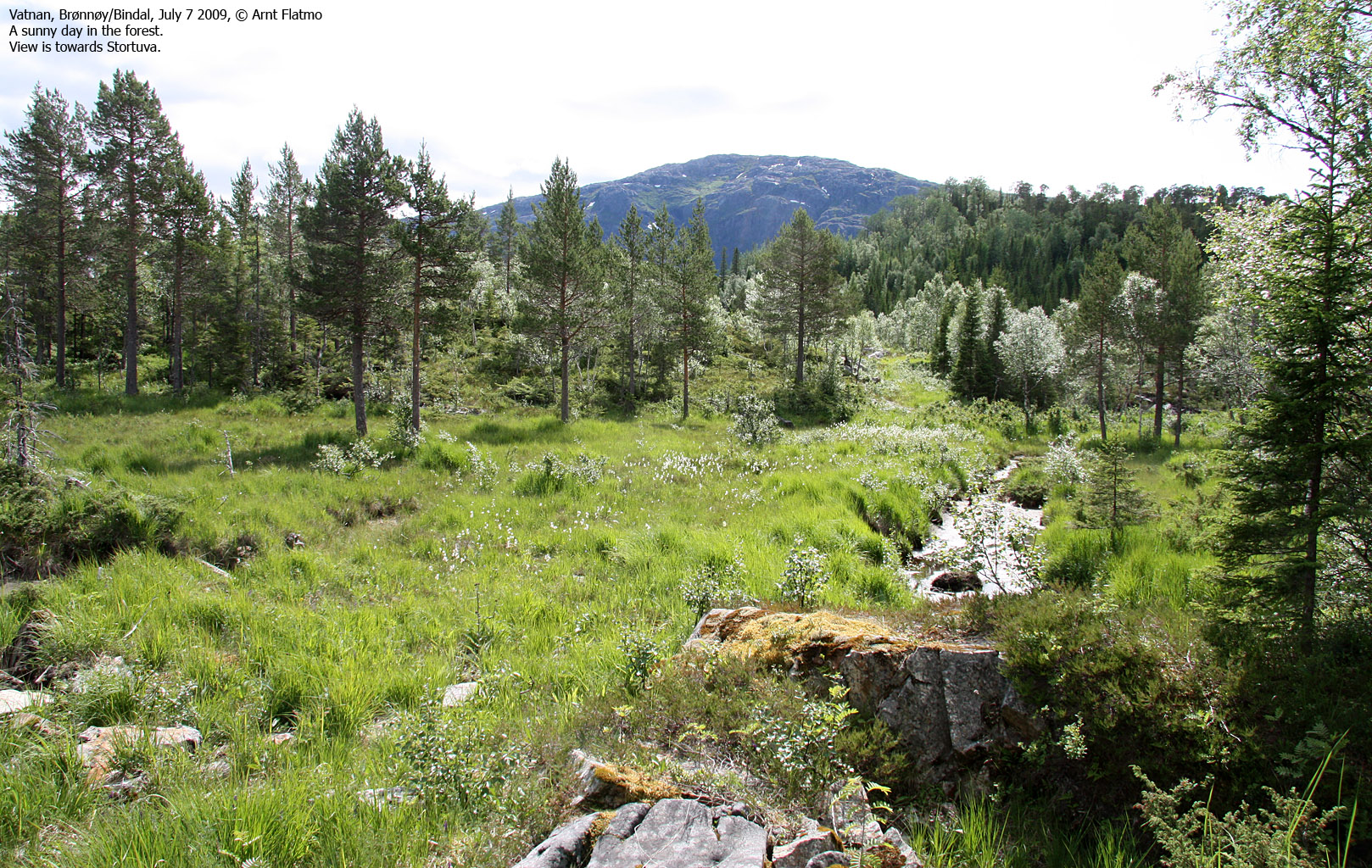
Another old (and vague) forest road runs across Stormyra and down to Fjellbukta. As you arrive at Lake Fjellvatnet, there are no more paths. Follow the shore 500m until you reach the drain from Lalielva river. Follow this river almost to the top of the mountain. Either scramble the river and bypass steep waterfalls, or hike the forest just west of the river. Both routes are strenuous.
Halfway up the river, pass a slab section on the left-hand side. You will need to look for the best route.
When you are below point 596, you can either go left (and later - right) or right of this point. Again, you will need to find the best route in order to avoid smaller slab sections. Keep heading northwest until you reach Hardangsfjellet's northeast ridge. Then head west towards the high point, marked by a few rocks. You will see two other cairns nearby (one is prominent in comparison). These cairns do not mark the high point. Descend your ascent route.


No Javascript:
 westcoastpeaks.com
Other Nordland mountains
Other Norwegian mountains
westcoastpeaks.com
Other Nordland mountains
Other Norwegian mountains


