
Norwegian Mountains, Nordland
Hardangsfjellet from Vatnan, July 7 2009
To the main Hardangsfjellet page (maps, route descriptions, other trip reports, etc.)

The route up Lalielva
(Click for larger image)
I've always considered Hardangsfjellet to be a very remote mountain. Partly because of the distance to it, but also based on the boating and camping stories in Strauman and Vatnan that I heard over the years. Add to this that I had never been to Vatnan (except from when I was a kid, perhaps), so I was a complete stranger to this area.
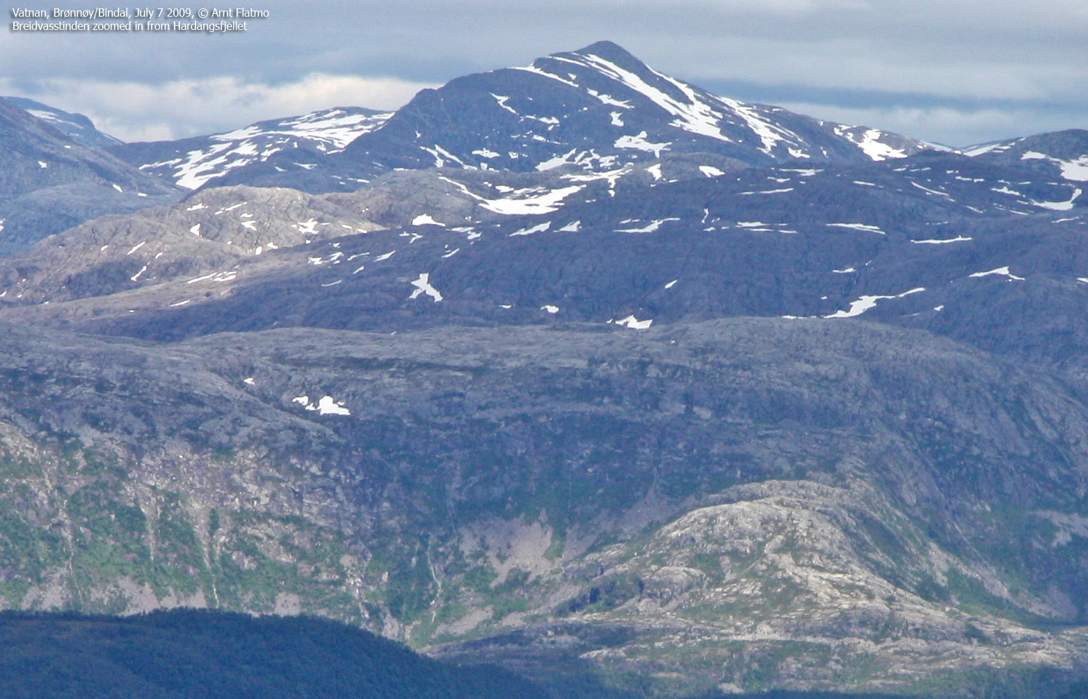
Hardangsfjellet looks huge, regardless from where you look at it. After all, it ranks as #90 amongst the most prominent mountains in Nordland county. I decided to scrap the "myths" I had built up, and looked at the map as if it was any ordinary mountain. The distance - as well as the height, was modest. 3 hours to the top. Max! And the route would be along the Lalielva river. In this dry period, it might be possible to scramble the river.
It was yet another fine day in northern Norway when I arrived at Vatnan. More cloudy than on yesterday's hike to Gullsvågfjellet, but the temperature was outstanding. I was in for a suprise when I "discovered" the Vatnan deer farm. To be honest, I never heard about a deer farm before. And as I was in need of some information about the mountain, I decided to pay them a visit and learn a thing or two about the farm.
This became a most interesting visit. I was wholeheartedly received, and got some good info about the route towards Hardangsfjellet. And as courtesy to the visitor, they said they would call in the animals so I could get a good look at them. Two small girls went to get a bell and a bucket of goodies. The deer gathered by the fence long before the girls came with the food. Behaviour recognition at its best...

Feeding goodies to the deer
(Click for larger image)
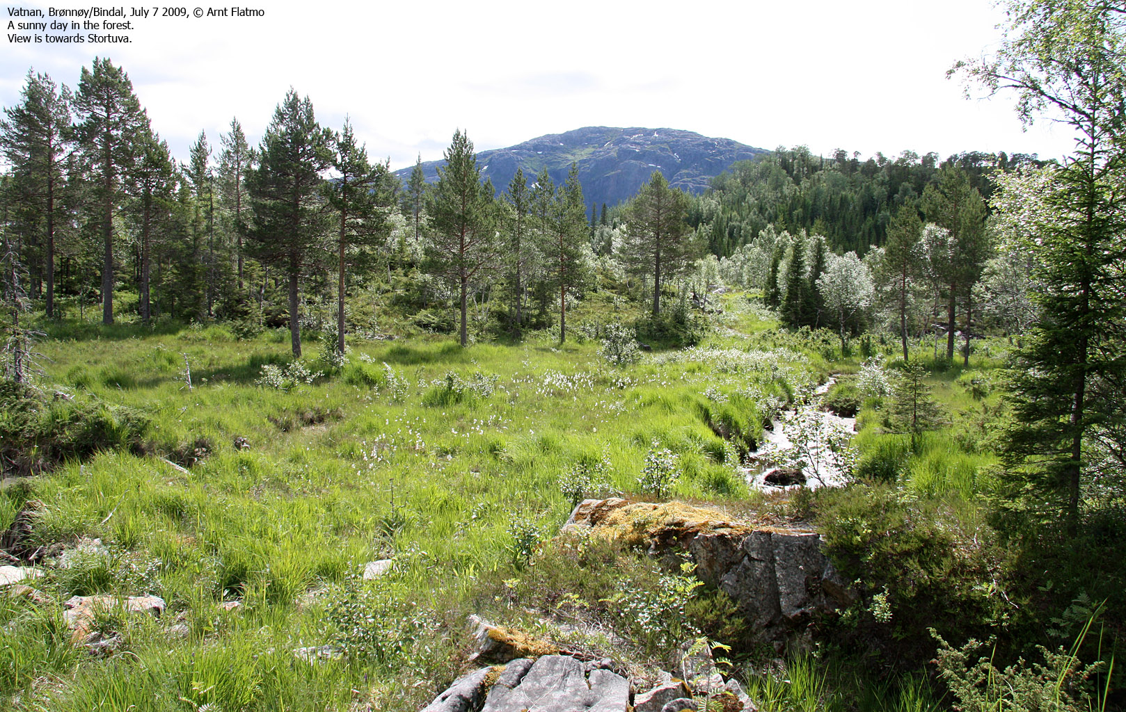
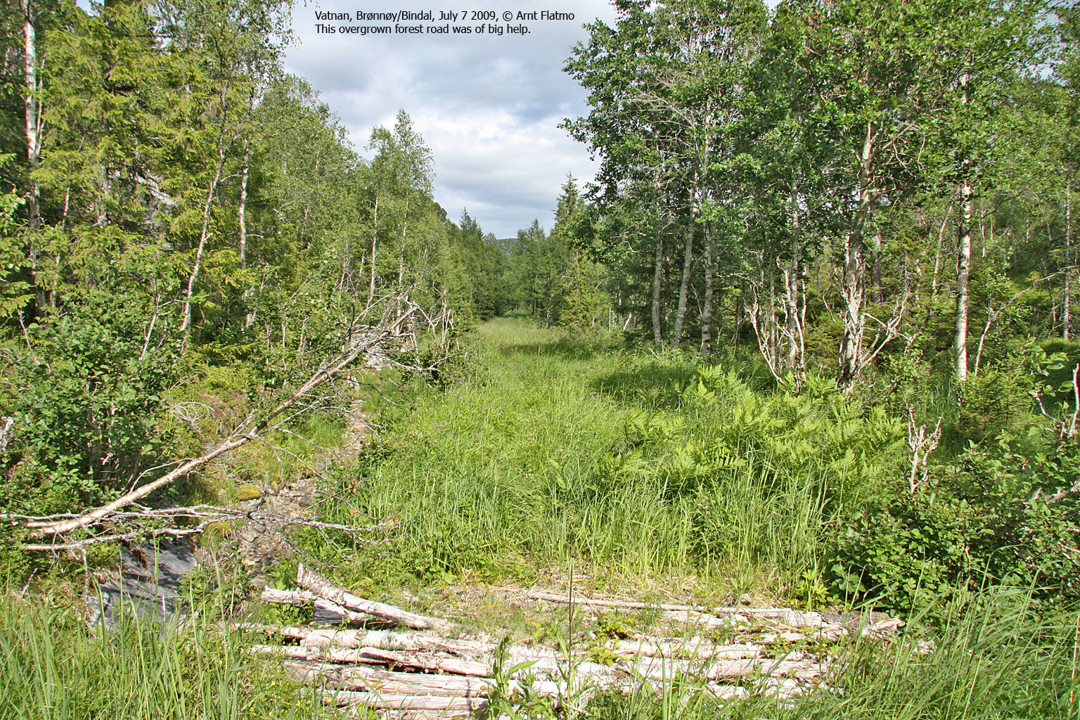
It was time to hike the mountain. I followed the advice I got, and stuck to the fence until I had the forest in front of me. I crossed a forest ridge and found an old, overgrown forest road. I had grass up my chest! But I knew that the ground below was solid, so the road was clearly an advantage. I would just have to deal with the ticks - if any - when I'd get back home.
I was able to follow old forest roads and paths all the way to Lake Fjellvatnet. The walk took approx. 55 minutes. The lake was a small paradise, and if it hadn't been for the flies, it would have been very tempting to take a nap on the slabs by the water.

Lake Fjellvatnet
(Click for larger image)
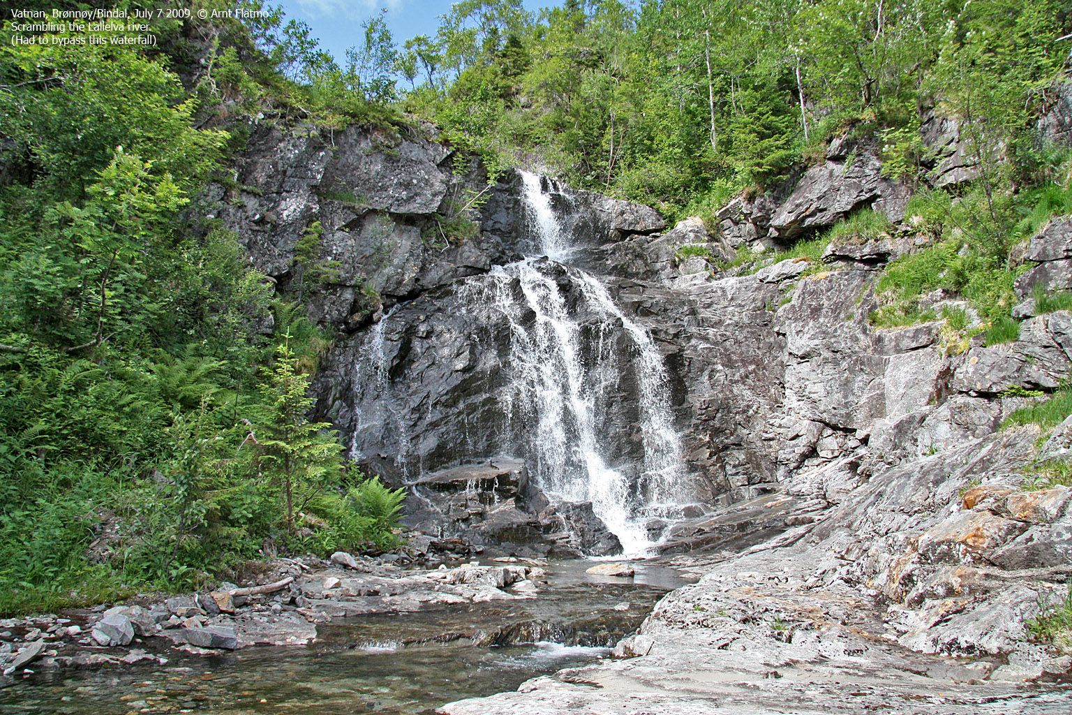
The nap is just a figure of speech, of course. The scenery was awesome, but I had a mountain to visit. I walked the 500m to the Lalielva drain, and was very, very curious about the river route ahead. The lower part wasn't particularly fun - an "untidy" river with lots of boulder and gravel. But very soon, the river turned into a fairy tale. It was like being inside a marble castle. Overjoyed as I was, it felt that way. Hundreds of colours radiated from the polished rock. Superb for scrambling, and just phenomenal for the heart and mind.

Up Lalielva river
(Click for larger image)
The scrambling was big, big fun. But after a while, I ran into waterfalls that did not offer any guarantees about successful ascents. They were however easy to bypass. The walk to the mountain, plus all the scrambling took energy, and after having done only 400 vertical meters, I needed a pause. I took my boots off, put my feet into the cold water, and enjoyed a couple of tasty chocolate biscuits. What a day so far!

Pause
(Click for larger image)
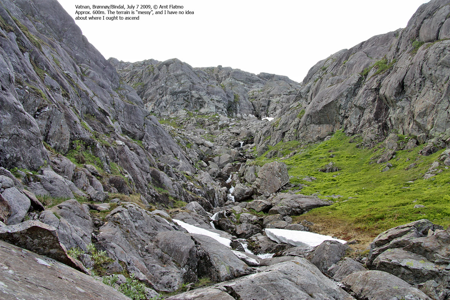
The upper part of the mountain was also interesting; I almost got myself into trouble while short-cutting a slab section, and below point 596 there was just no telling what the mountain had in store. The cliffs above were horrendously steep. But it all sorted itself out along the way. 2h:50m after leaving the trailhead, I was on top of Hardangsfjellet.
And the view - the view - only the rain clouds on the horizon put a limit on it. Mom called and reported thunder in the Brønnøy region. That did not seem likely to become a concern here, so I took it nice and easy. There were a couple of cairns nearby, and I visited them both for the extra views. This was indeed a big mountain - the terrain above 700m covered 2000 metres in the north-south direction. Many familiar mountain tops could be seen in the distance. I paid extra attention to Anddalshatten - one of my goals for the summer. And one week later, I stood on top of it.

Anddalshatten
(Click for larger image)
I chose to descend my ascent route. That is, I traded some of the river scrambling for easier sections in the forest next to it. I began my descent 3:05pm and arrived at the trailhead just before 5pm. A natural ascent vs. descent ratio - considering the long flat section. I felt tremendously good after having done this mountain. It's been a dream for quite a while. And now I've done it. The "myths" have been buried once and for all.
Next report: Sæterfjellet & Grøndalsfjellet


