Norwegian Mountains, Sogn og Fjordane
Heidane (530m) & Høgegga (414m), Mar 17 2012
To the main Heidane & Høgegga page (maps, pictures, other trip reports)

Yet another trip to the Stadlandet/Selje region, and this time with my girlfriend Anne. It was not raining and we had a wonderful drive from Gurskøya (with the roof down!). It was almost as if it was too good to be true, based on the weather so far this year...
A nice morning

(Click for larger image)
Because of Anne's bad shoulder, we had chosen an easy hike from Liset outside Selje. The primary goal was Heidane, with the option of hiking via Høgegga upon return. Thanks to my new local contact in Selje (Sølvi), we learned that Liset would be the best starting point for Heidane. The alternative would have been to hike from Flødevatnet - which I recently visited on my hike to Geitahornet.

Høgegga and Heidane seen from Selje

(Click for larger image)
We found the Liset trailhead and headed upwards 11:50pm. We passed stone fences, stone cabins and stone cairns. We also passed a company-seeking sheep that we felt a bit sorry for - alone as he was. And the weather was changing from good to gorgeous. It was time for a small celebration...

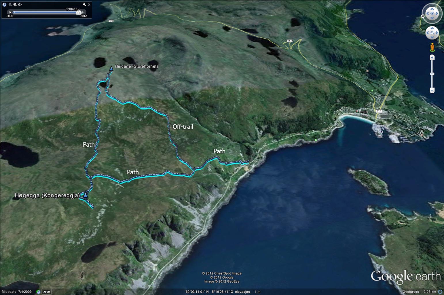
At Løkane, it was clear that the path we were on would not take us to Heidane. We left the path and headed east, aiming for Heidane's southeast ridge. Going off-trail on Stadlandet is seldom fun, and today was certainly no exception. But the aggravation decreased proportionally to the elevation gain, and when we reached the top of Heidane (1:17pm), the turfs and bog were all forgotten about...
Flying high on Heidane

(Click for larger image)
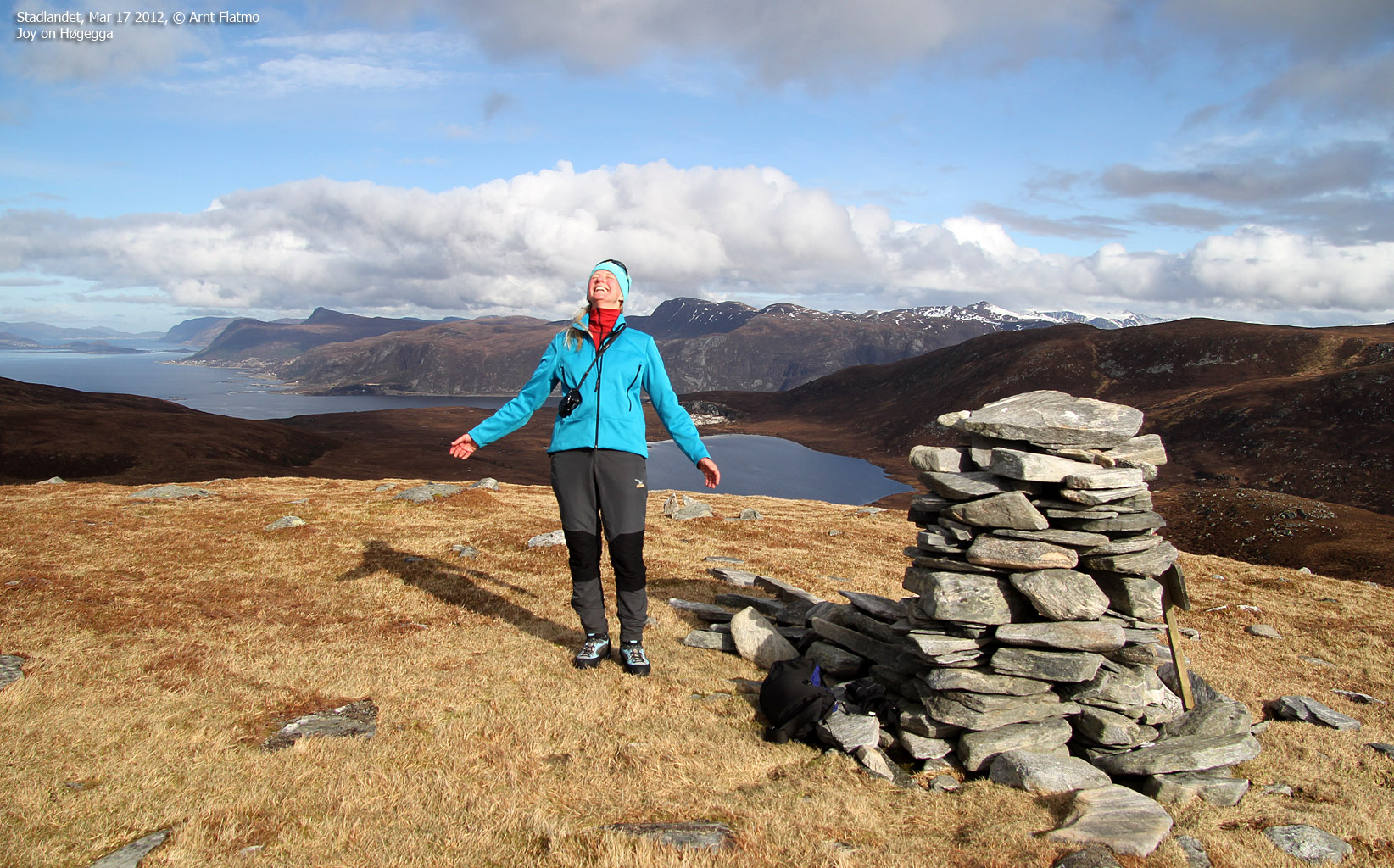
After a nice break on Heidane, we decided to return via Høgegga. We followed a vague path down Heidane's west ridge and a more pronounced path up Høgegga's east ridge. We reached the top of Høgegga 2:04pm.
On Høgegga

(Click for larger image)
We returned to Liset via the marked path and returned to the trailhead 2:55pm - close to 3 hours after heading out. More sheep appeared and we understood that the lonely one had been physically separated from his herd by accident. He desperately tried to overcome a fence, with no avail. As such, we went to the nearest house and reported the situation. Action was immediately taken...
After the hike, we went down to the shore and enjoyed watching waves before returning home...
Watching waves

(Click for larger image)
On the way home, we stopped by Tusentrinnstrappa below Gorgeneshornet (Kjødspollen). Without really exploring the limitations of the human body, I reached the top in 10m:20s (counting from the first step). Anne came in 1m:40s later. Very good! And if you wonder - yes it's exactly 1000 steps!
Tusentrinnstrappa

(Click for larger image)


