
Norwegian Mountains, Møre og RomsdalHildrehesten, 740m
|
| Fylke/Kommune : | Møre og Romsdal/Haram | ||||||||
| Maps : | 1220-III Brattvåg (Statens Kartverk, Norge 1:50 000) | ||||||||
| Primary factor : |
Hildrehesten: 486m Hestehaudet: 82m Hesteraua: 37m |
||||||||
| Hiked : | Feb 2006 - Oct 2008 | ||||||||
| See also : |
| ||||||||
| See also : | Other Haram mountains |

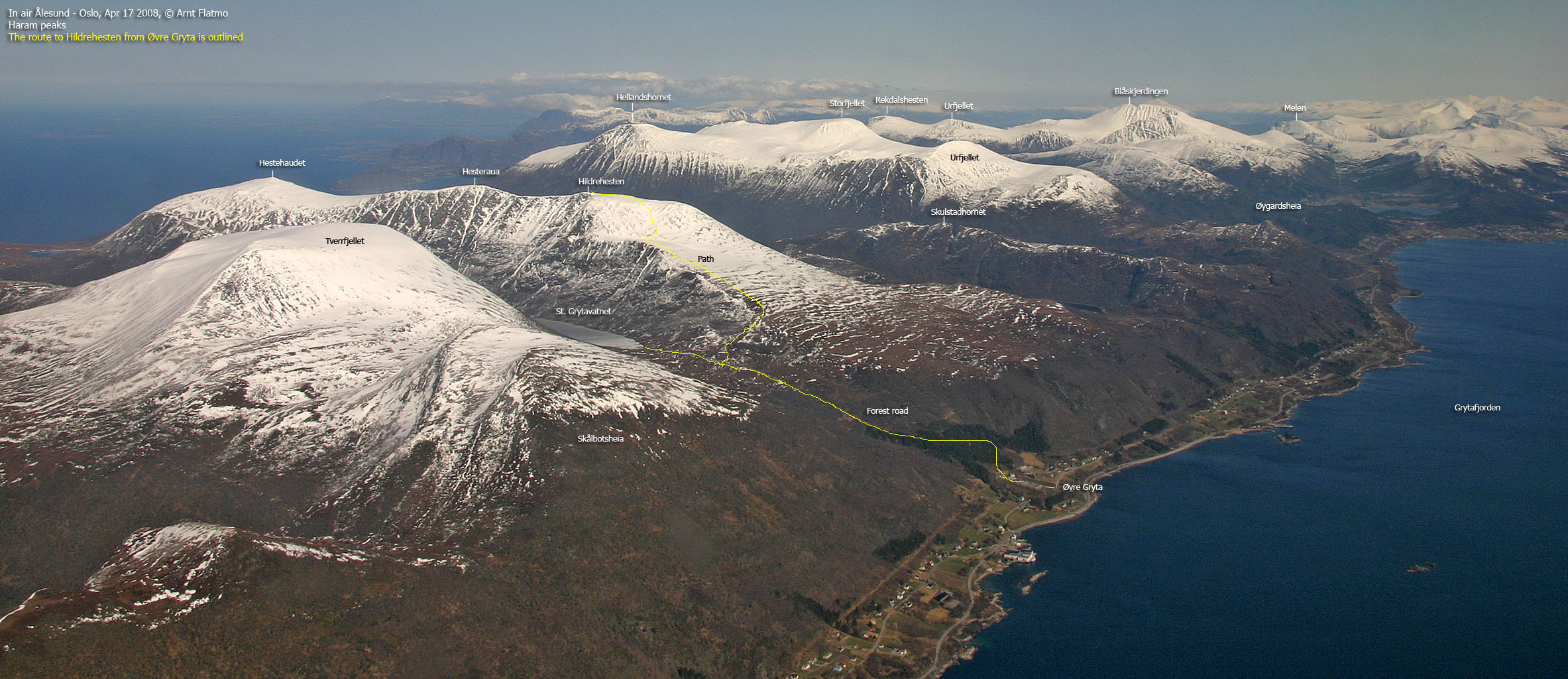
Hildrehesten
(Click for larger image)
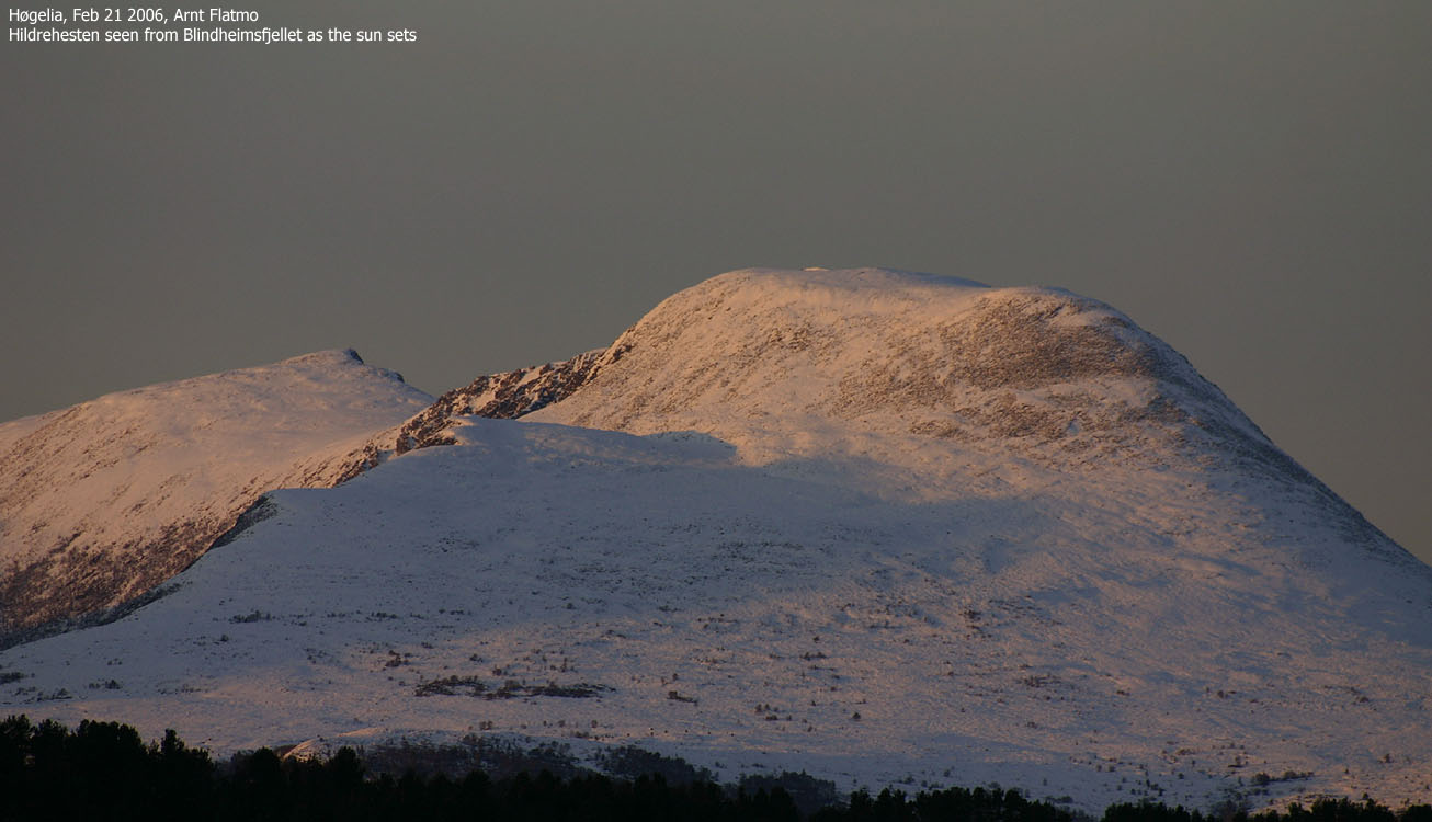
Hildrehesten (The Hildre Horse) is a characteristic Haram mountain, easily identified through its broad south flank and the long ridge with steep sides. There are three humps on the ridge; the southernmost being the highest. The northernmost is called Hestehaudet (dialect) - the Horse's head. The middle top is called Hesteraua - the horse's ass. The high point has not earned a distinctive nickname...
The high point is normally approached from the southwest (via Store Grytavatnet) or southeast (via Gjersetvatnet). These routes are roughly equally long and involves the same vertical gain. Both routes are described on this web page. The lack of snow in the coastal region seldom permits skiing on this mountain. In summer, a traverse of the mountain is highly recommended.
Those who live in Brattvåg normally ascend the mountain from the north side. An approach via Hestehaudet (the northern top) is also described on this page. Hildrehesten has also numerous steep gullies to be explored by those who like to step outside the beaten paths.
The view towards the Romsdalen - Sunnmørsalpene mountain region is quite spectacular, with mountains as far as your eyes can see.

Hildrehesten
(Click for larger image)
Hildrehesten (Norge 1:50,000: 740m, Økonomisk Kartverk: 740m, UTM 32 V 366317 6939480) has a primary factor of 486m towards the higher parent mountain Tverrbotshornet (749m). The defining saddle (approx. UTM 32 V 365193 6938225) is found at the south end of lake Store Grytavatnet (between the two mountains). Ref. Økonomisk Kartverk (5m contours), the saddle is defined by a fixed point at 254m elevation.
GPS measurement on the summit cairn (approx. 1m high) read 742m, averaged over a 5-minute period (error margin +/- 3,1m).
Hestraua (Norge 1:50,000: 732m, Økonomisk Kartverk: highest contour is 735m, UTM 32 V 366358 6940191) has a primary factor of 37m towards the higher parent mountain Hildrehesten (740m). The defining saddle (approx. UTM 32 V 366356 6939939) is found between the two tops. Ref. Økonomisk Kartverk (5m contours), the saddle is within the range 695-700m, interpolated to 698m.
GPS measurement on the summit read 735m, averaged over a 3-minute period (error margin +/- 4,4m).
Hestehaudet (Norge 1:50,000: 735m, Økonomisk Kartverk: highest contour is 735m, UTM 32 V 366049 6941387) has a primary factor of 82m towards the higher parent mountain Hildrehesten (740m). The defining saddle (approx. UTM 32 V 366151 6940985) is found between Hestehaudet and Hesteraua. Ref. Økonomisk Kartverk (5m contours), the saddle is within the range 650-655m, interpolated to 653m.
GPS measurement on the summit cairn (less than 1m high) read 736m, averaged over a 10-minute period (error margin not recorded).
Google's interactive map. You can zoom, pan and click on the markers.
|
|
|
Notes: Class ratings are in reference to YDS. Click here for more information.
The trails described below are not necessarily the *easiest* trails to this mountain.
|
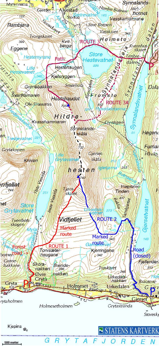
Route 1: Øvre Gryta -
Hildrehesten (winter)
|
|
Access
(all distances are approx. distances)
From Ålesund, follow highway E136->E39 towards Åndalsnes. From the E136/E39/Olsvika roundabout near Breivka, follow E39 approx. 13,3Km. Turn left onto highway RV661 (Skodje/Brattvåg/Vatne). After 1,5Km, pay toll at an unmanned toll booth (coins + credit cards + AutoPass). Approx. 9,7Km after you left E39, you reach the RV659 (Brattvåg)/661(Vatne) junction. Turn left here. Follow RV659 4,3Km and turn left towards "Søvik/Grytastranda".
Drive 7,2Km along this road and then turn right onto an higher road. Drive 450m in the direction you came from, and you will see a narrow road that leads up to a farm on your left-hand side. You will also see a sign pointing to Hildrehesten here. Look for parking nearby. There is room for one small car next to the mailboxes, 100m ahead.
An alternative route from Ålesund is to drive via Ellingsøya. The Ellingsøytunnelen toll is (per Jan 2006) NOK 60,- (passenger cars, one person) thus, NOK 30,- more expensive than by driving RV661.
The route
The route from Øvre Gryta
(Click for larger image)
Head up the road leading to the farm, and follow the forest road that continues from the farm. Follow the forest road up to 240m elevation, where you see the "Hesten" trail sign. Don't turn right quite just yet! Continue another 350m along the forest road, then turn right on a trail towards a cabin. Turn left by the cabin, then follow a path up the nearest ridge until you get on the southwest flank.
Once on the southwest flank, follow the path along the edge of the flank. When you get to the boulder fields, head towards the longest grassy slope you see, and you'll find a marked path upwards. Higher up in the rocky section, follow tall, standing rocks that will lead you to the summit.
Pictures from this route can be seen
here.
Route 2: Gjerset - Hildrehesten (summer/autumn)
|
|

Hildrehesten
Access
(all distances are approx. distances)
From Ålesund, follow highway E136->E39 towards Åndalsnes. From the E136/E39/Olsvika roundabout near Breivka, follow E39 approx. 13,3Km. Turn left onto highway RV661 (Skodje/Brattvåg/Vatne). Pay toll at an unmanned toll booth (coins + credit cards). 1,5Km later. 8,7Km after you left E39, you reach the 659(Brattvåg)/661(Vatne) junction. Turn left here. Follow RV659 4,3Km and turn left towards "Søvik/Grytastranda".
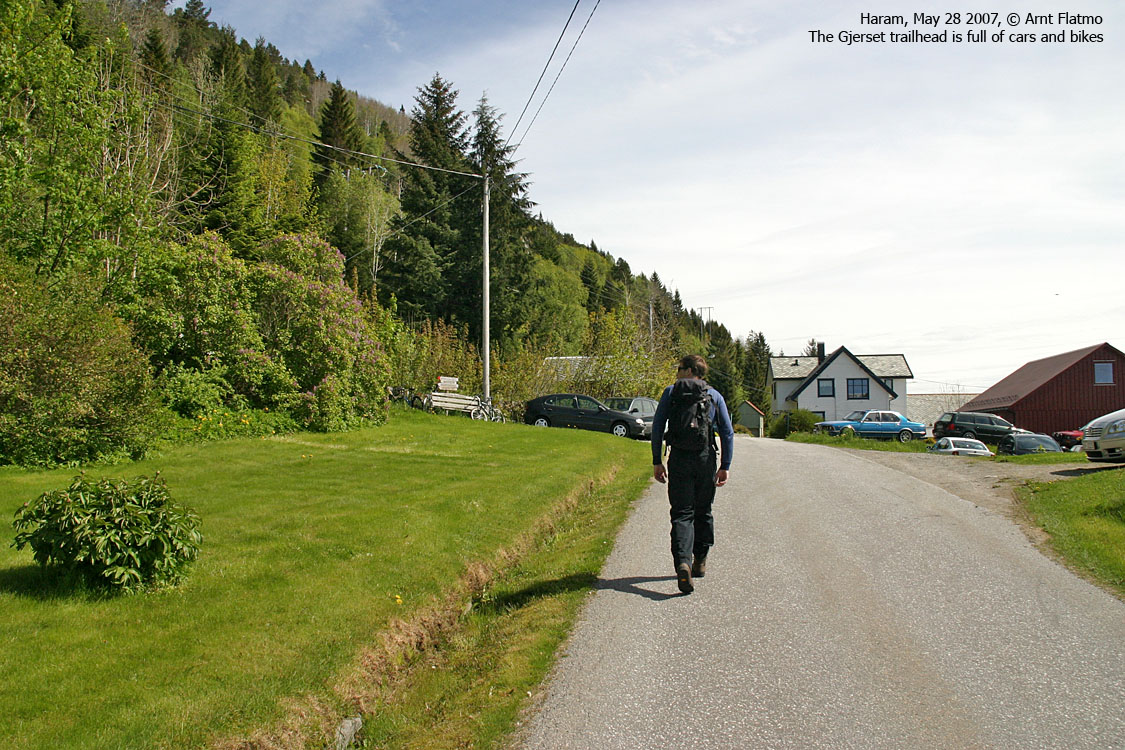
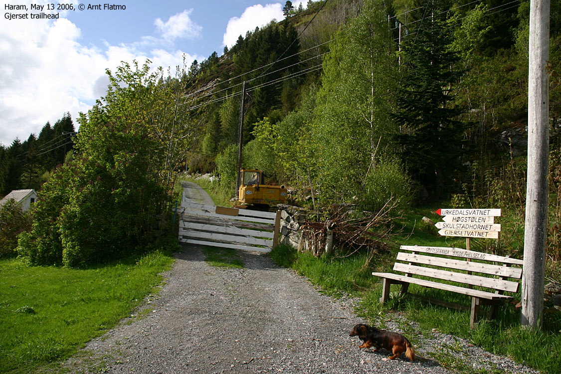
Drive 1,9Km on the road towards Søvik, and turn right onto a side road that runs in parallel to the main road. Drive 1,7Km on this parallel road until you reach Gjerset. You see the service/forest road on your right-hand side and trailsigns towards Tinden, Gjersetvatnet and Skulstadhornet. Park here.
An alternative route from Ålesund is to drive via Ellingsøya. The Ellingsøytunnelen toll is (per May 2006) NOK 60,- (passenger cars, one person) thus, NOK 30,- more expensive than by driving RV661 (one way).
The route
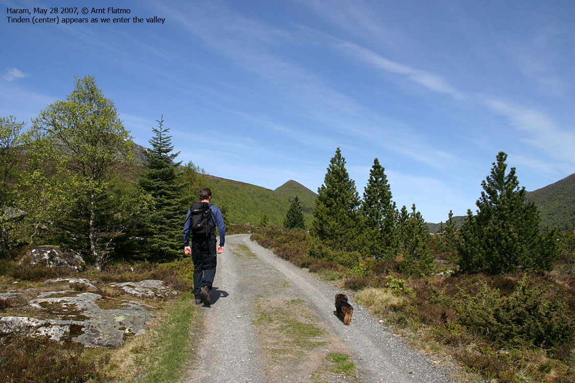
Follow the service/forest road up to Lake Gjersetvatnet (you pass the Skulstadhornet trailsign on your way) and continue along until you see the "Urkedalsvatnet" trailsign on your left-hand side. A forest path runs up to the lake, where you turn right (north) towards Tinden, or south->west to gain Hildrehesten's south flank. The route to Hildrehesten is marked from the lake, and we assume it's marked all the way to the top (this route has not been walked).
Click here for Tinden pictures.
Route 3: Brattvåg - Hestehaudet (summer/autumn)
|
|

Hestehaudet

Access
(all distances are approx. distances)
From Ålesund, follow highway E136->E39 towards Åndalsnes. From the E136/E39/Olsvika roundabout near Breivka, follow E39 13,3Km. Turn left onto highway RV661 (Skodje/Brattvåg/Vatne). Pay toll at an unmanned toll booth (coins + credit cards + AutoPass) 1,5Km later. 8,7Km after you left E39, you reach the 659(Brattvåg)/661(Vatne) junction. Turn left towards Brattvåg.
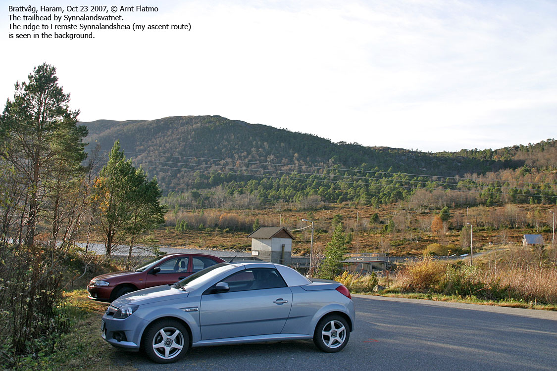
13,2Km later (from this junction), you are now in a junction in Brattvåg. (this is 2,4Km after you passed the "Brattvåg" village sign) You have a store to your left ("Coop" per Mar. 2006) and a road to your left. Turn left here. Drive 250m and turn left (just before a bridge) onto a road that has many signs. "Brattvåg Ungdomsskule" is one of them. Drive this road (Dalavegen) 1,1Km until you reach the "Vassenden" junction. Turn right and drive to the road end. You will find parking there.
The route
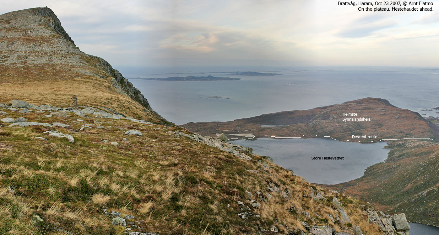
Cross the Synnalandsvatnet dam and turn right when you're on the road to Synnalandsdalen. After a few meters, turn left onto a forest road (passing a large building). After 130m, this road forks. Get on a forest path heading westbound. This path takes you all the way to Lake Store Hestevatnet (follow sign to Hesten).
Pass Store Hestevatnet on the north side (on path) and continue southwest - slightly north of the powerline. Pass Lake Litle Hestevatnet on the south side and follow the path up Hestehaudet's northwest ridge (Grønebakken). Hestehaudet summit is marked by a trigonometric point and a tall cairn.
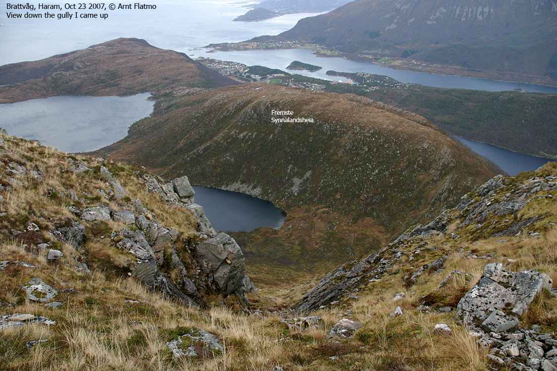
Descent (ROUTE 3A):
Descend your ascent route - or head southbound until you reach a tall cairn (approx. UTM 32 V 366214 6940924) - 500m S/SE of Hestehaudet. Proceed 50m S/SE and locate a distinct gully that takes you steep down towards the Fremste Synnalandsheia - Hestehaudet saddle (south of Ryssdalstjørna). Optionally, move to the right (south) and join a more distinct route - easily recognized after a landslide.
Head across Fremste Synnalandsheia and proceed on path until you join your ascent route.
Pictures from this route can be seen here.
 westcoastpeaks.com
Other Møre & Romsdal mountains
Other Norwegian mountains
westcoastpeaks.com
Other Møre & Romsdal mountains
Other Norwegian mountains


