
Norwegian Mountains, Sogn og Fjordane
Svarstadveten (591m) and Hogden (601m), Oct 8 2011
+ Lodalen bike trip
To the main Hogden page (maps, route descriptions, other trip reports, etc.)

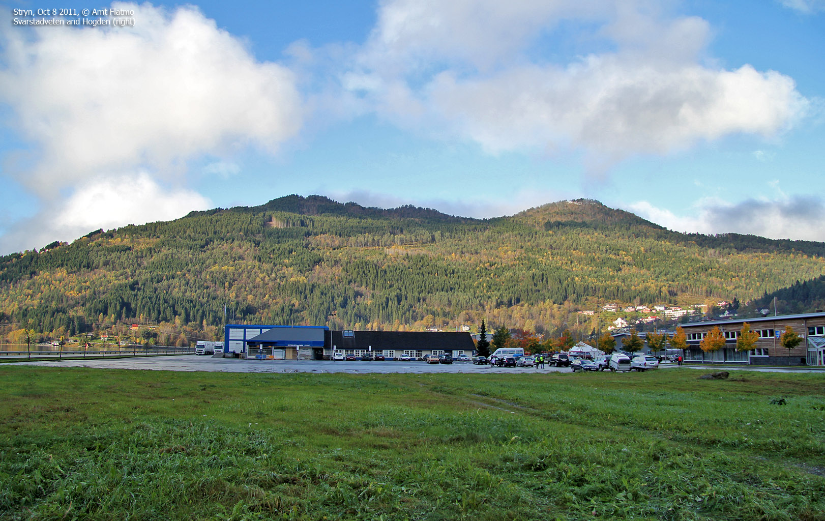
Svarstadveten and Hogden
(Click for larger image)
Svarstadveten & Hogden:
This weekend was spent in the Stryn - Loen region. Anne worked on SNO's stand on the Strynemessa exhibition, but had the Saturday off. Our base-camp was the Loenfjord hotel in Loen. After days and days of rain (and snow in the mountains), the weather was improving - allowing us to do something nice outdoors. We agreed to spend Saturday a) hiking Hogden in Stryn and b) biking the beautiful Lodalen valley afterwards.
Hogden was a natural choice, being the only mountain in the Stryn region that was not buried in snow. Moreover, we had not been to the top before. We didn't know anything about any routes up the mountain, but I suddenly remembered that my friend Arngeir had visited this top earlier in the year. I went to his most excellent website haramfjell.com and found a good description of a round trip route across Svarstadveten and Hogden.

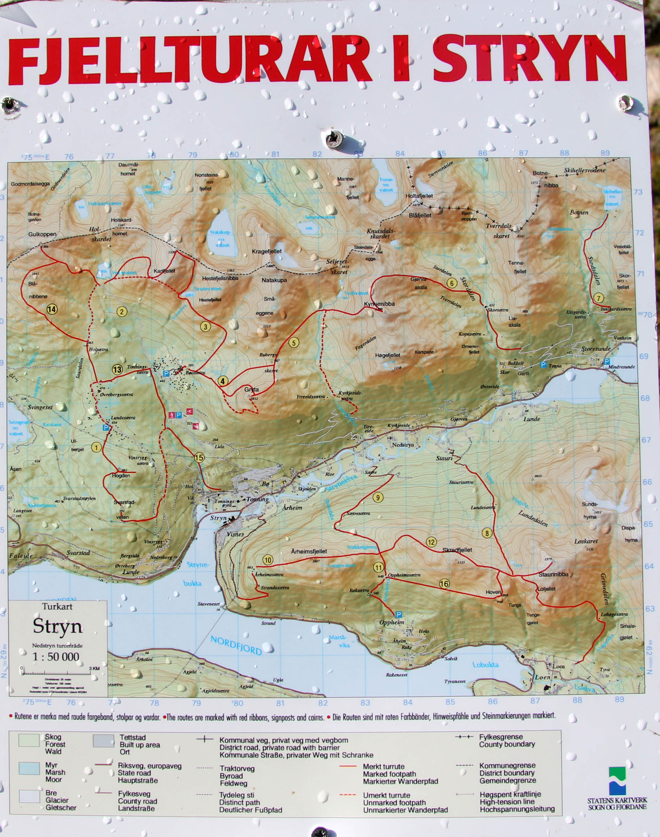
The route, as seen in Google Earth
(Click for larger image)
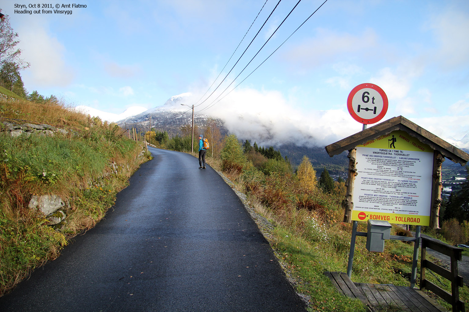
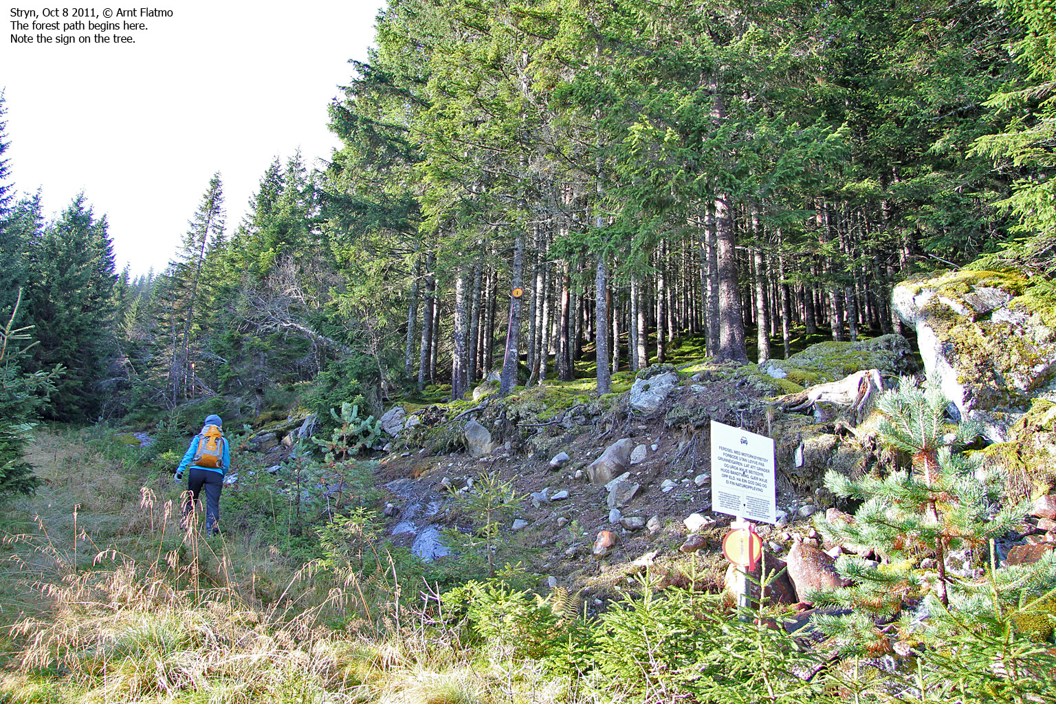
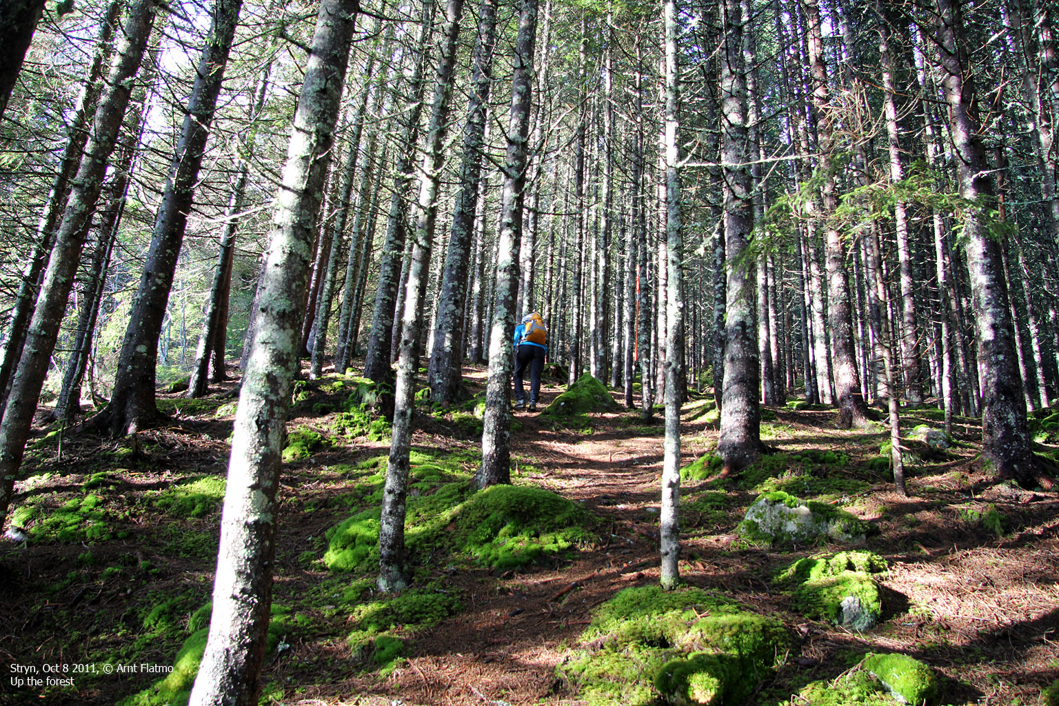
We drove to Vinsrygg (just outside Stryn) and parked there. After 1,1km on the toll road to Lundasætra, we found the forest path that took us up to Svarstadveten. We ran into some snow above 500 meters, but snow would definitely not be an issue on this hike. Had we headed up to Gryta, then things would have been different. It looked like skiing conditions up there.
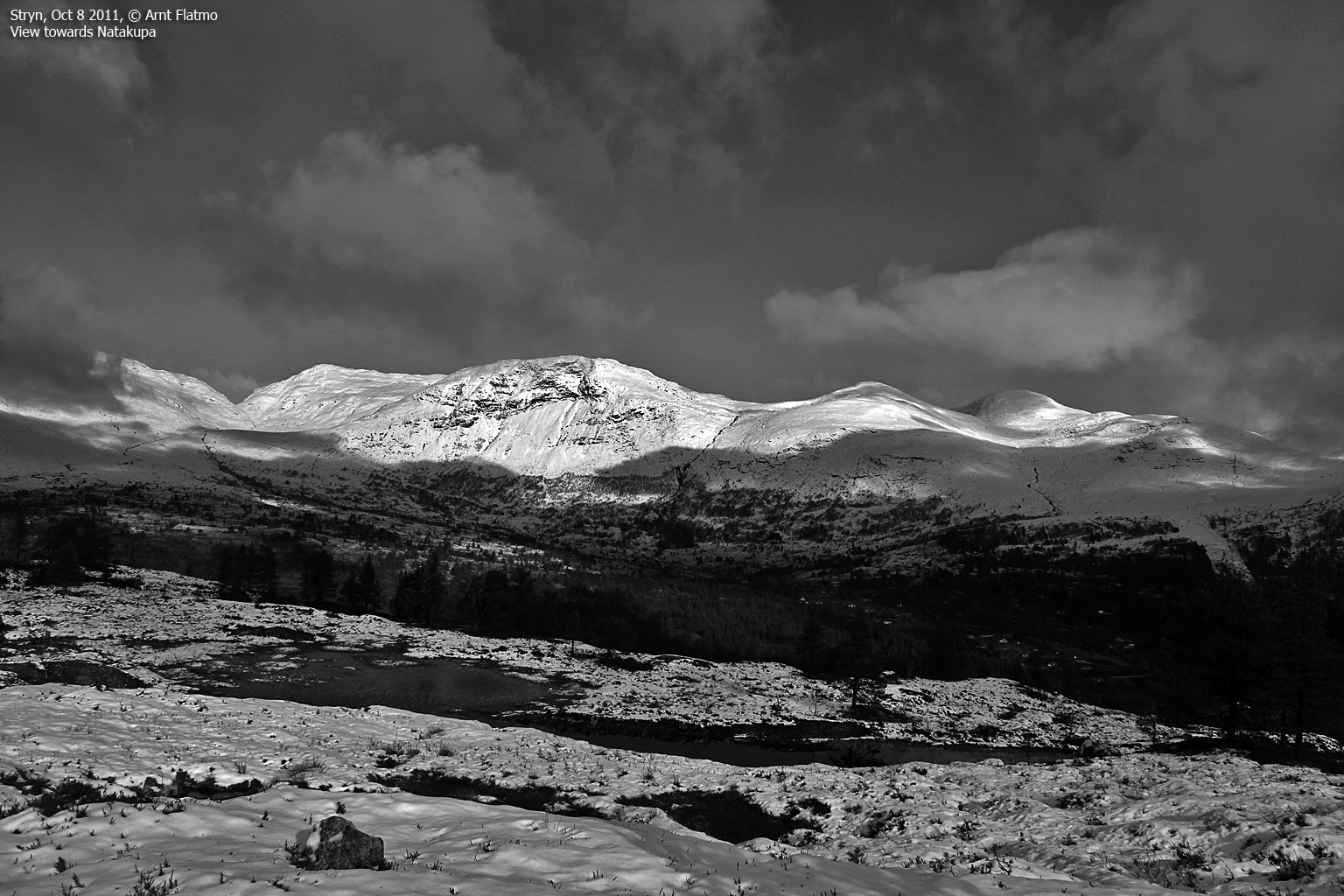
We reached Svarstadveten 12:05pm - 50 minutes after leaving Vinsrygg. It was very nice to be up here. The combination of the sun (which we had missed for quite a while), the snowy mountains, the blue fjord and the drifting fog was just awesome. And then I went nuts with black and white pictures. Go figure...

On Svarstadveten
(Click for larger image)
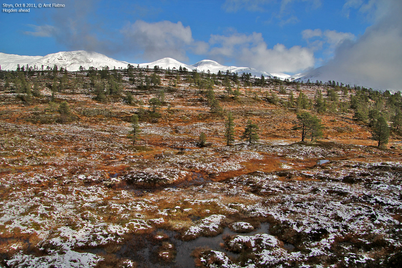
We moved on and followed the marked path towards Hogden. After 0,7km, we reached a lake and felt that the path was now going in the wrong direction. As such, we decided to continue off-trail directly towards Hogden. After crossing some real boggy terrain, we joined a path - probably the same we had been on earlier - just before reaching the top of Hogden. And seconds later - 12:40pm - we "celebrated" Hogden summit.

On top of Hogden
(Click for larger image)
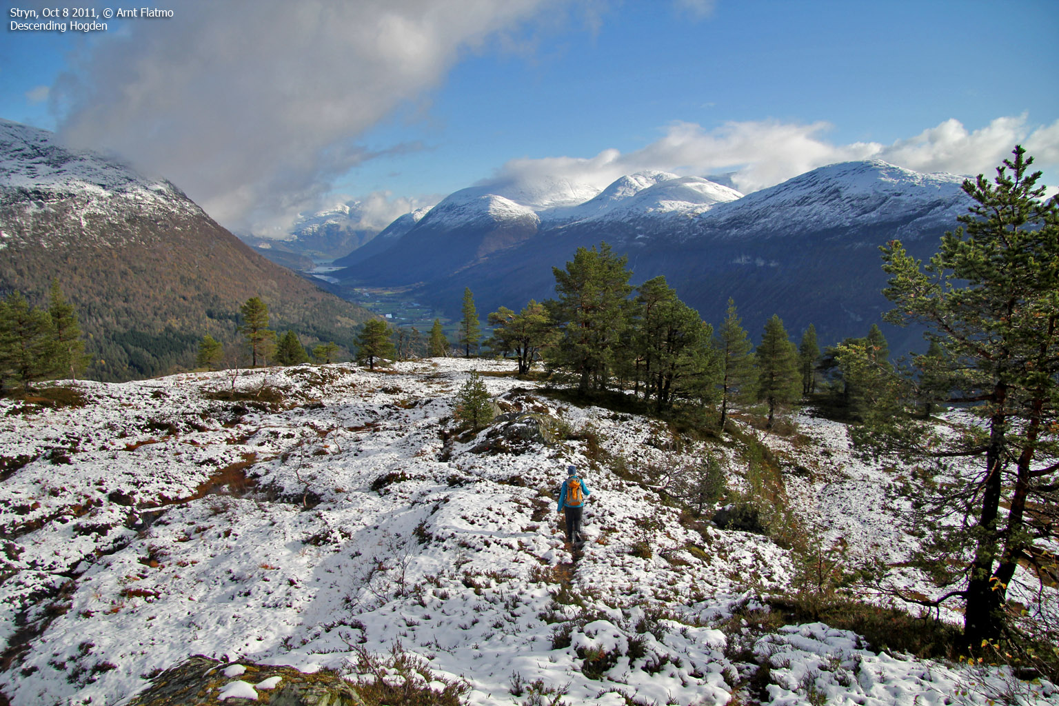
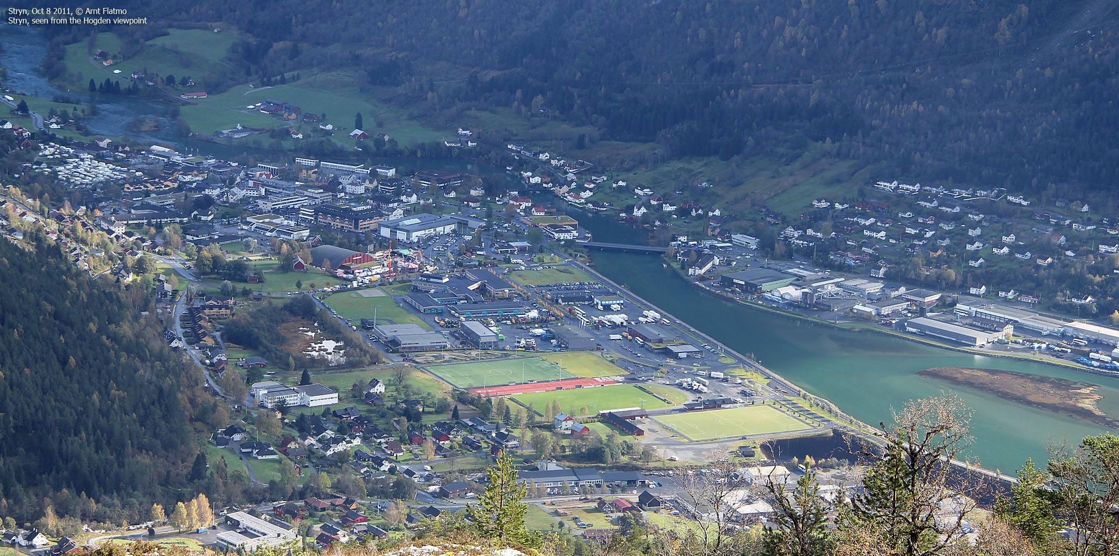
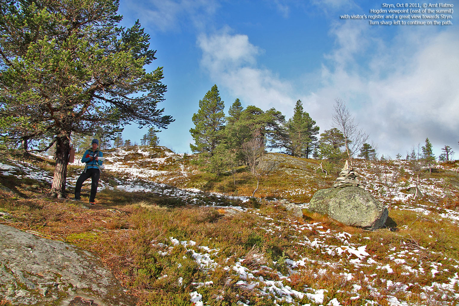
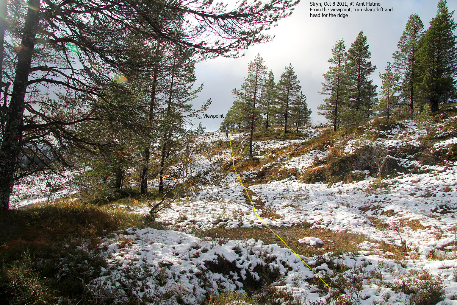
As Arngeir had described, there was a path going east, and we followed it. 0,5km later, we arrived at a viewpoint, where we had first class view towards Stryn. The path seemed to end here, but I remembered that Arngeir wrote "go left" here. So we did, and located the forest path again. We followed the path until we reached the Lundasætra road, and were back at the Vinsrygg trailhead 1:30pm - 2h:15m after heading out.

Stryn
(Click for larger image)
Lodalen bike trip:
We returned to our hotel in Loen and pulled our bikes out of the car. Our destination was the road end in Lodalen - with high and mighty mountains towering above. I had been to Bødalsætra a couple of times, but never really paid attention to the valley itself. A bike trip would be the perfect opportunity to do just that.

On the way to Lodalen
(Click for larger image)
"Road end" was a 21km bike trip away from the Loenfjord hotel, and I was really looking forward to every inch of it. One captures so many more details on a bike. As we reached Lovatnet, we were surrounded by Hellsetefjellet, Høgrenningsnibba, Meleinsnibba and Ramnefjellet - all new acquaintances to me. And "up the road" was Kjenndalskruna and Nonsnibba. This was great! Just great! Anne felt right at home, of course. This is her "backyard"...

Along Lovatnet
(Click for larger image)
To my surprise, there was a bit of traffic along the road, but I soon learned that the Ramnefjellet landslide (1905) is still a significant tourist attraction. We overheard someone mentioning that they couldn't see the boat that the tsunami washed on shore (understatement). Then, Anne took charge...

Anne, explaining things
(Click for larger image)
Approaching road end, Anne showed me the new Kjenndalsbreen glacier access road, which got re-constructed under her supervision. The old road got washed away during a heavy rainfall. This part of the valley was just crazy - with Kjenndalskruna towering above like a monster.

Approaching Kjenndalsbreen
(Click for larger image)
What a fantastic bike trip! And yet another 21km was awaiting - in the opposite direction. I'll never forget the Kjenndalskruna view. I posted the below picture on Facebook, and someone mentioned the north wall of Eiger. Not a bad comparison?

Kjenndalskruna

(Click for larger image)


")


