
Norwegian Mountains, Sogn og Fjordane
Hornelen & Svartevassegga from Hunskår, June 28 2009
To the main Hornelen/Svartevassegga page (maps, route descriptions, other trip reports, etc.)

Hornelen and Svartevassegga
(Click for larger image)
Hornelen had been on my "VIM list" (Very Important ... drum roll... Mountains) for a long time. Still, the perception of a long drive had been keeppaing me away from it. But on this fine day, late June, I decided to finally visit this mountain. The weather was forecasted to be beautiful, which is a must when I visit a brand new mountain region. I left Gurskøya early morning, and learned that Måløy was much closer than I had imagined it to be.
The town of Måløy was absolutely dead when I got there - still quite early on this Sunday morning. The ferry wouldn't arrive for yet another hour, but fortunately - a couple from Johannesburg pulled up behind me, and all of a sudden, I had company for the next hour...

In Måløy - waiting for the ferry
(Click for larger image)
I had chosen Hundskår (instead of Berle) as the starting point. A small group of people were also about to head out, so I decided to walk fast to avoid being "stuck" in the middle. I left the trailhead 10:24am and had successfully passed the entire group 10 minutes later. Now I just had to pace it a little, to get some distance in-between. This wasn't exactly the easy start I had in mind, but twenty minutes later, I was completely alone on the trail (just like I like to be alone on the road..). I could now fully relax, enjoy the scenery, stop for pictures before being overtaken by the group again. A compulsive disorder, perhaps, but it keeps me calm..

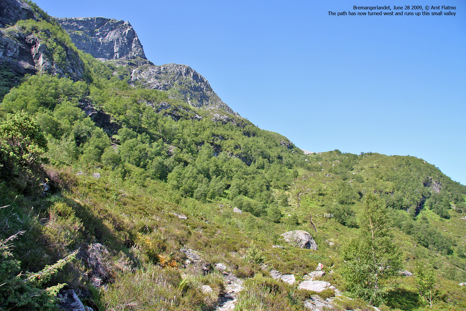
The view above
(Click for larger image)
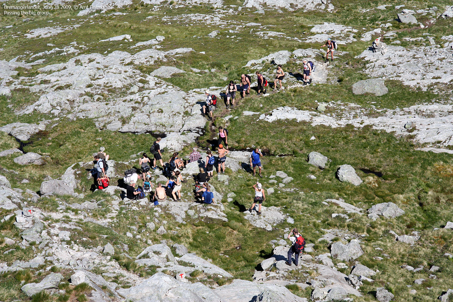
This calm state of mind lasted 5 minutes - until I discovered that another group (more than 20 people) was ahead of me on the trail.

Oh-no!
(Click for larger image)
There was only one thing to do - pace it some more. It was a notable effort to pass everyone on the outside. By the time I passed the leader of the group, talking without making a whining noise wasn't easy. I slowed down a bit, the pulse got back to normal, the whining noise went away. It turned out that Flora Turlag had organized this trip, and that they were (obviously) headed for Hornelen.
I decided to go back to solitude, still covering ground quickly, and when everyone stopped for a break at 540m elevation, I was alone again. By the time I reached the lake at 630m, I was thirsty, thirsty, more thirsty and exhausted. I threw my top half into the lake, let the cold water work on my sick brain and mumbled something. I stopped mumbling when it dawned on me that I hadn't checked if this lake was draining. I normally try to avoid drinking still water. The time was now 11:15am, and I had ascended 600 vertical meters in 50 minutes. Which is not bad - given that this trail isn't particularly steep. A few minutes later, I found running water, and gradually, energy came back.

Running water
(Click for larger image)
Half an hour later, I topped out on the mountain plateau. The plan was to visit Svartevassegga first. I was convinced that this top was up to my right. I had a look around. Yup - there was a mountain up to my right, and a slightly characteristic top up to my left that just had to be Hornelen. Easy job! Those tops would be done in less than one hour!
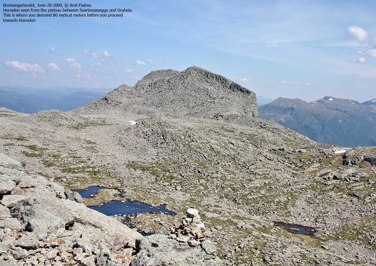
Once on top of "Svartevassegga", I was very surprised when I saw that the elevation was only 842m. I could have sworn it should be closer to 900m! I checked the GPS, and the GPS said I was on Svartevassegga. Well then! I took a good look towards "Hornelen". The group leader I had spoken to earlier said Hornelen had two tops. And I was looking at two tops. So I decided to visit the lower first.
The plateau was so rocky that walking was difficult. I was better off jumping the rocks. When I reached the smaller top, the picture became clearer. In the distance - 1,5km to the northeast - was Hornelen. I looked at my GPS again, and it told me that I now was on Uraheia. After a closer look, I saw that the Svartevassegga map name had been put on the wrong top. But OK - now that there was no more confusion, I would just have to continue on. First stop would be the real Svartvassegga.

Hornelen - first view
(Click for larger image)
Svartevassegga was reached 12:30pm - after a 650 metre walk from Uraheia. I then headed towards Hornelen, and had a steep and rocky descent into the valley between the two tops. With Hornelen now in front of me, I took the shortest route possible and reached the summit 1:03pm. There were only 6-7 people on top, which was a bit strange. I had expected to find the 20+ group up here by now.
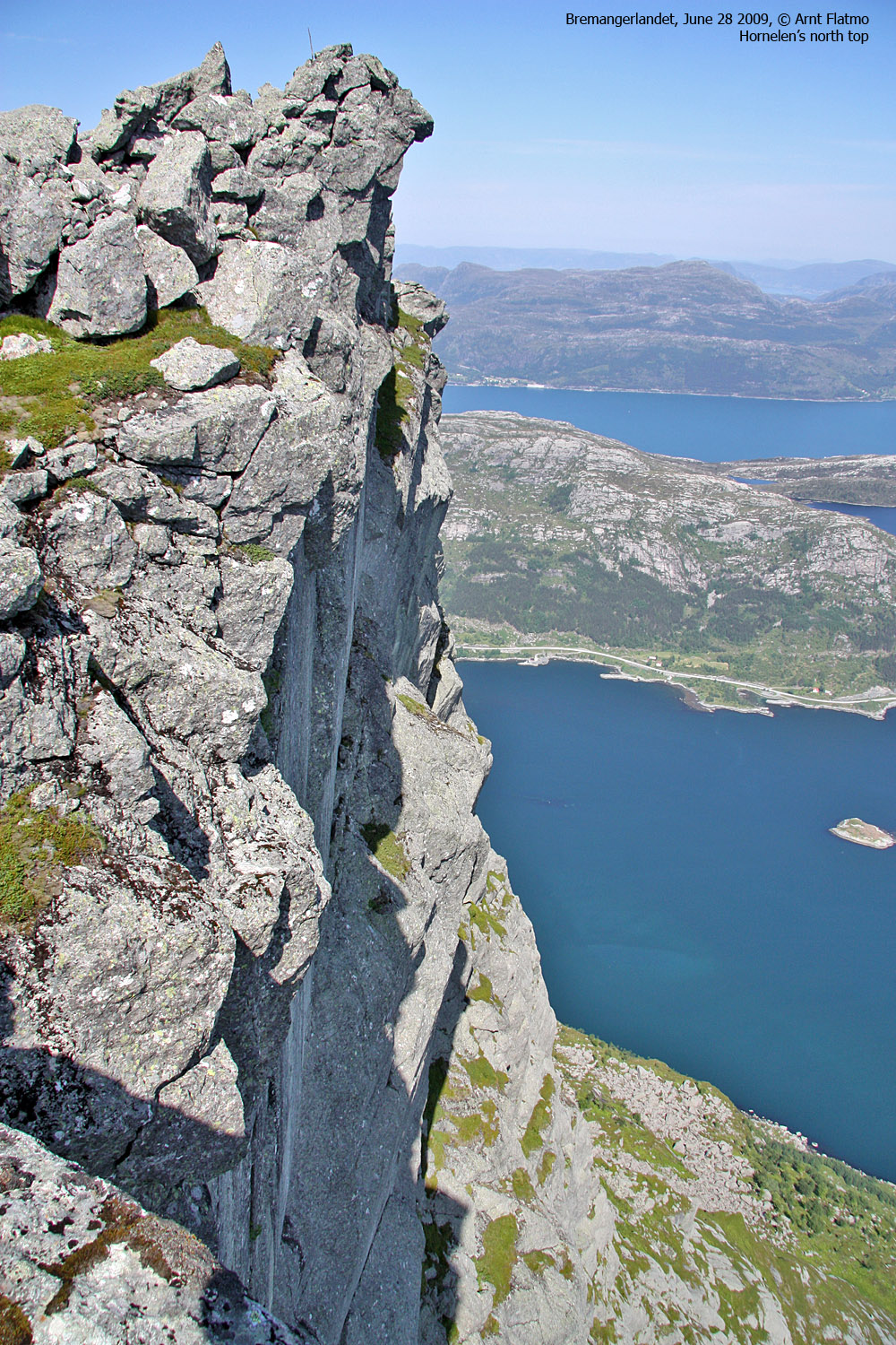
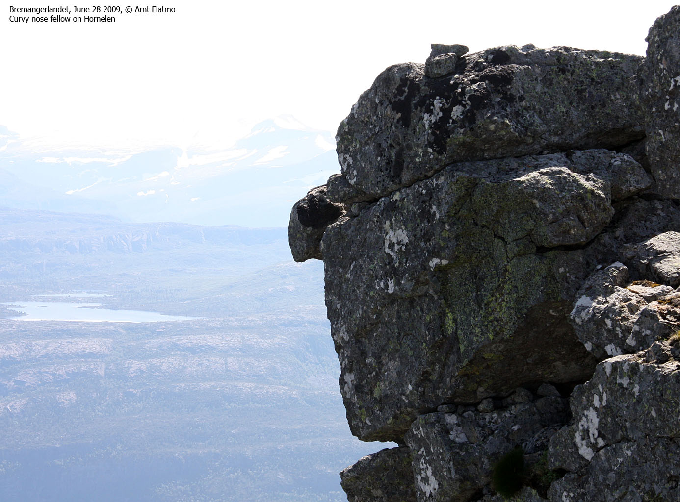
I moved over to the north top, where the interesting views were. And after a little while, the first people from the big group arrived. Soon, everyone was up here, just as fascinated by the awesome drop down to the fjord as I was. Some were more fascinated than others...

That old desire of wanting to FLY
(Click for larger image)
I went back up to the main summit to check if the group leader knew the names of the local tops. He told me that the top I had first visited was known as Slettheia. This was useful, and I thanked him for the information. On my down from the main summit, I passed three people - just sitting down for a chat. "Aren't you staying for the Service?", one of them asked. "What Service?", I replied. "The Sunday Service". "Really", I said - "so that's what's going on here!"
The priests were already in place, but the men's choir hadn't arrived yet - so the service was a bit delayed. I asked them where they were from. And soon I learned that one of them was the aunt of one of my colleagues! Small world..
It was time to move on. I decided to follow the marked route, and passed the men's choir after a little while. I was back at the trailhead 3:36pm. The descent took 1h:45m, which gave me about an hour to kill at Oldeide, before the ferry to Måløy arrived. On the ferry, I chatted with a guy with a very charming dog, and all of a sudden - I was back in Måløy. And the drive back to Gurskøya was just nice!

View from the north top
(Click for larger image)


